
On the heels of what was a rain and ice storm for the state Friday, another system will impact the region Sunday. Everything from plain rain, to freezing rain and sleet, to a few inches of snow are expected across the commonwealth late this weekend. Precipitation will move in from southwest to northeast Sunday morning, continue through the afternoon, and by the evening will be exiting northeast PA. There may be a lull in precipitation for a few hours during the event while the primary low transfers to the coastal low.
Precipitation will be mostly light to moderate during this storm, as the system will just be starting to intensify off the coast while hitting us. Road conditions may become deteriorated in nearly all of central PA, as well as in eastern PA, primarily north of Reading and Allentown on Sunday afternoon and evening due to any icy/snowy slush. Winter Weather Advisories are likely to soon be issued for much of the area due to this event.
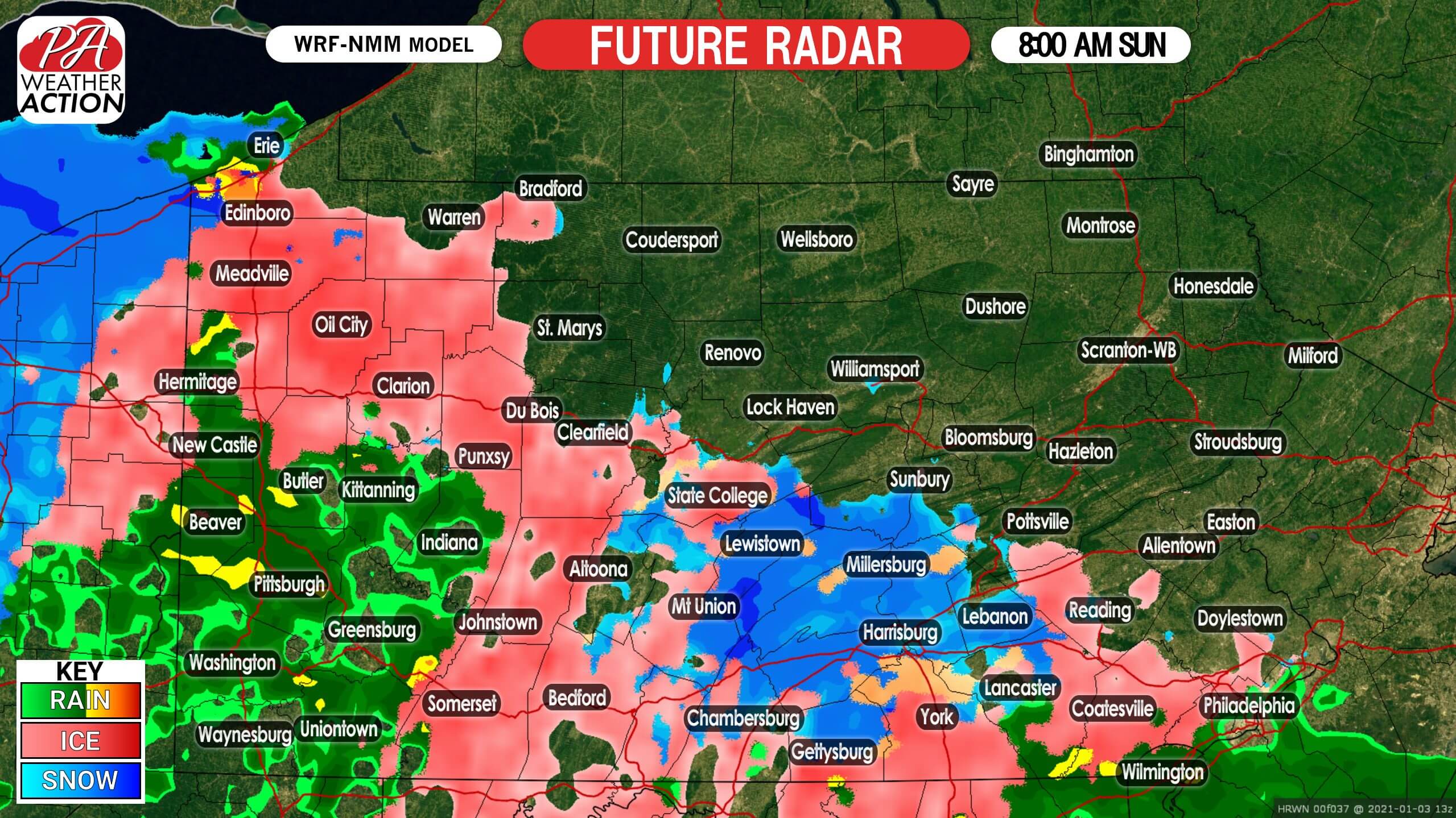
FUTURE RADAR TIMING
A wintry mix will move into western and central PA just after sunrise on Sunday. Mainly rain is likely in southwest PA, with freezing rain, sleet, and snow expected in south-central PA, the Laurel Highlands, and northwest PA. A three to five hour period of freezing rain in south-central PA and the Laurel Highlands may result in moderate icing. Below is future radar for 8:00 AM Sunday.
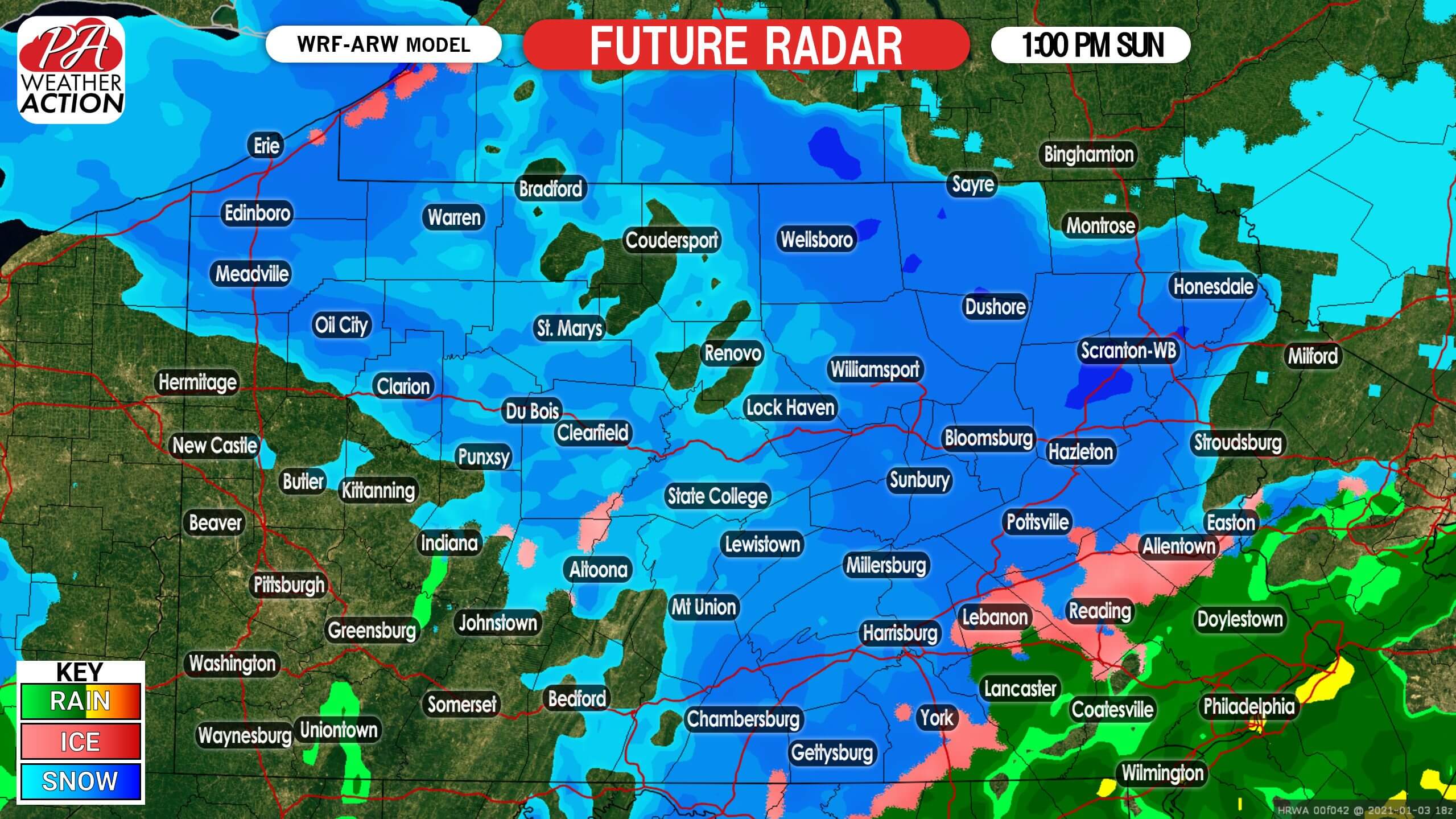
By early Sunday afternoon, the coastal low will take control and precipitation in western PA will end. Meanwhile, snow is expected to be falling north and west of I-81 and I-78 in central and eastern Pennsylvania. Rain is likely in southeast PA. Temperatures are expected to be near freezing, so roads may become slushy especially above 1000′ elevation. Here is future radar for 1:00 PM Sunday.
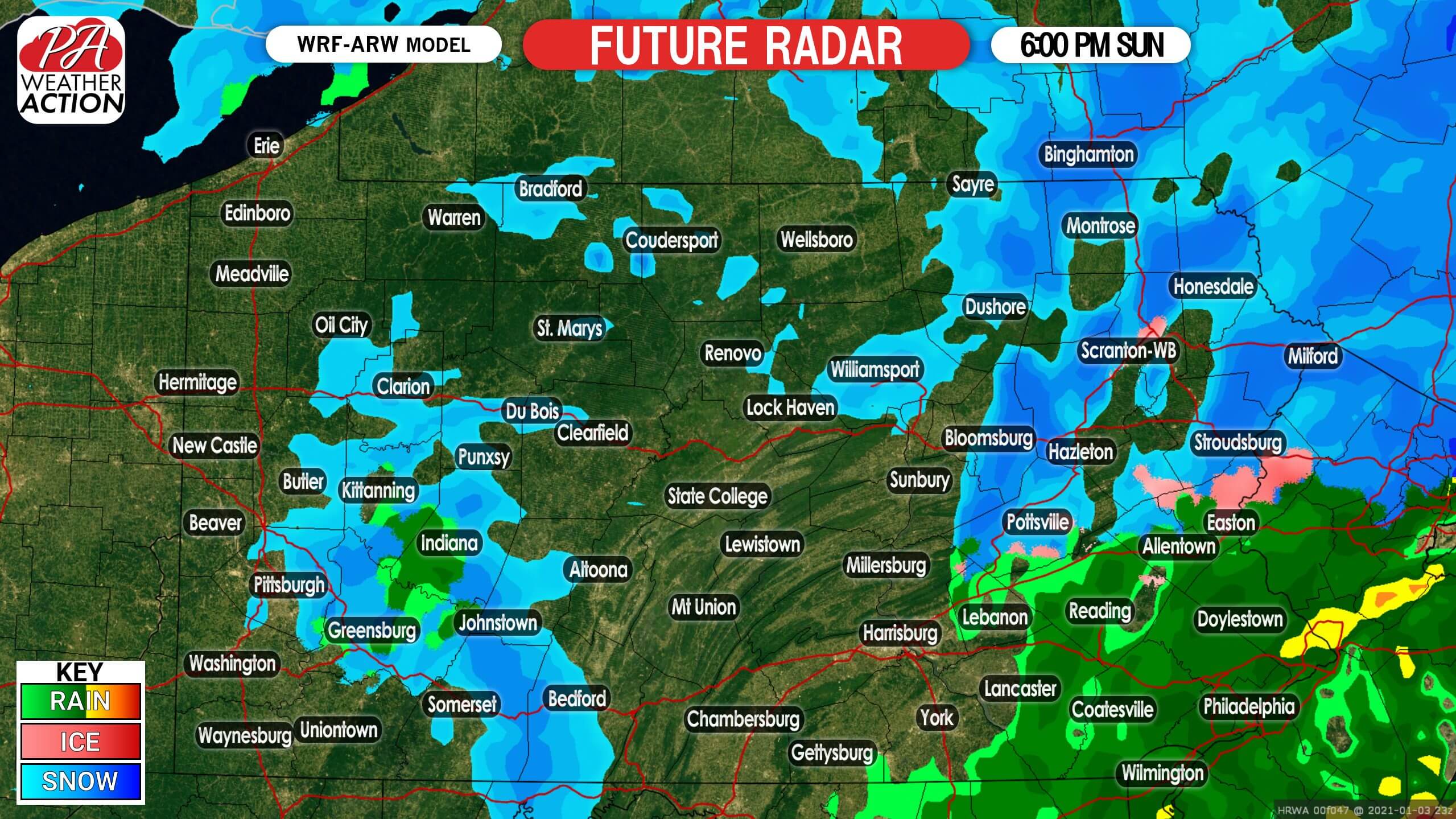
Precipitation will progress northeast, and by dinnertime, snow and rain is likely to be exiting eastern PA. Below is future radar for 7:00 PM Sunday.
FIRST CALL SNOW & ICE FORECAST FOR SUNDAY
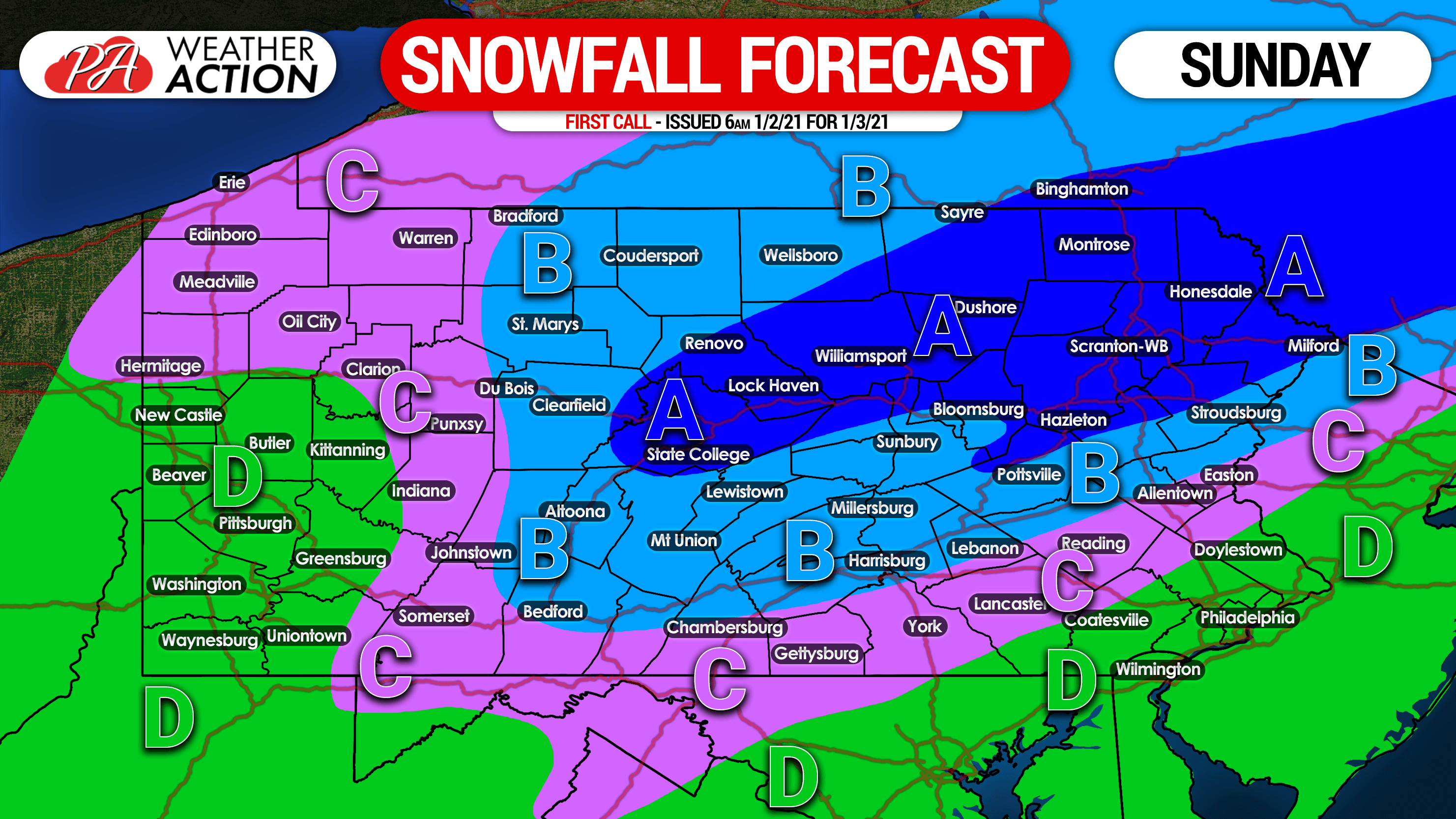
Area A: All snow is expected. Snowfall accumulation of 2 – 4″ likely. Slushy roadways are anticipated, and reduced speeds are recommended.
Area B: A mix of freezing, sleet and snow are expected south of I-80, with all snow likely north of I-80. Snow and sleet accumulation of 1 – 2″ expected, with a trace of ice also expected south of I-80. Roads may become slippery or slushy, especially above 1200′ elevation.
Area C: A period of freezing rain and/or sleet is expected, and an hour or two of snow is possible as well. Snow and sleet accumulation of less than 1″ expected. with a trace of ice likely. Up to a tenth-inch of ice is possible in south-central PA and the Laurel Highlands Sunday morning.
Area D: Plain rain expected.
This forecast may be revised Saturday evening if needed. Stay tuned for any updates and get all of our forecasts, radar, and more with our app! Get it on Apple & Android here >>> Weather Action App
Share this forecast with family and friends who may be on the roads Sunday using the blue button below. Stay safe!

You must be logged in to post a comment.