A series of storms systems will drag and push a frontal zone back and forth across our area through the weekend, resulting in plenty of showers. There will be timing issues with the front which could affect the temperature forecast. Total precipitation through the weekend could exceed an inch of much-needed rainfall.
A powerful storm system responsible for an extensive severe weather outbreak over the Mississippi River Valley dragged a warm front northward through our area last night, delivering warm humid air today. Temperatures soared into the upper 60s and lower 70s! That storm system tracked well north into eastern Canada and will push that frontal zone back southward through our area as a cold front tonight. This will bring an extensive area of showers to our area tonight, with amounts between a quarter inch to as much as an inch possible.
FRIDAY
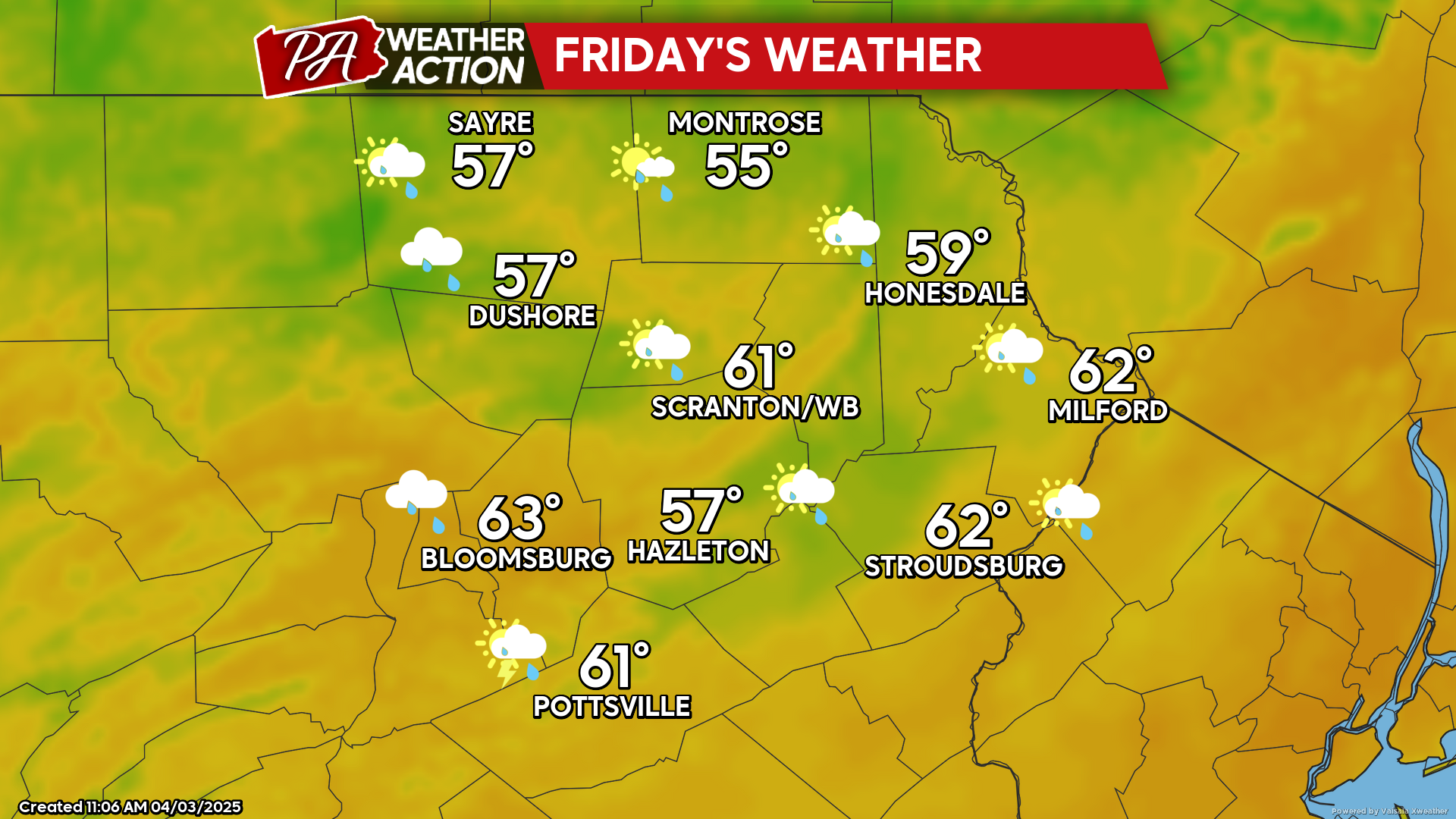
The frontal zone and its associated showers will shift south of our area by midday. Clouds and scattered showers are possible through midday, with drying conditions during the afternoon. Most areas will remain cloudy, although some peeks of sunshine could grace our northern counties.
SATURDAY
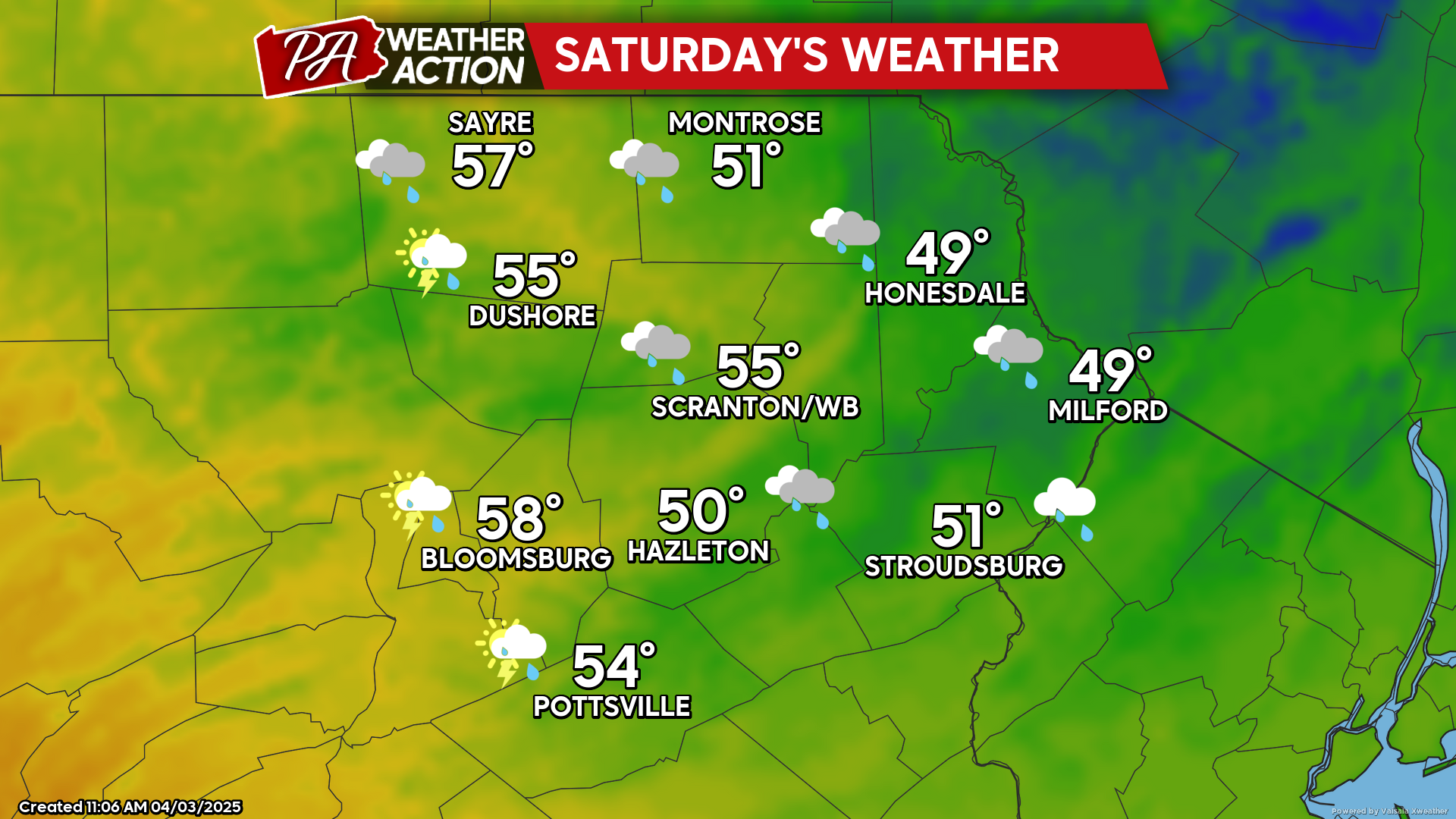
Another strong storm system will move northward through Ohio and along the St Lawrence Seaway on Saturday, dragging that front back northward to bring another day of showers and isolated thunderstorms. Here at the surface, the wind will blow from the east-southeast, which will draw cool damp maritime air into our area, keeping temperatures below normal and damp, especially in the eastern counties.
SUNDAY
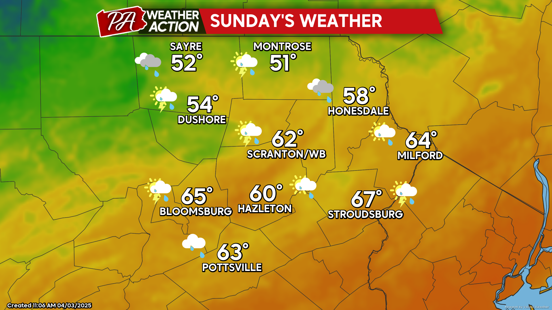
The storm system will drive that frontal zone back southeastward across our area as a cold front. Ahead of that front, the wind will shift to the southwest. However, it will have to scour away the low-level maritime air out of our southeastern counties which could delay or even thwart the warmth. There will be some showers and thunderstorms along the front, which will push eastward during the daytime. There is uncertainty with the timing of this frontal passage as well as whether the maritime air will be scoured out before the front, so temperatures could verify cooler. A band of chilly post-frontal rain is also possible behind the frontal passage later Sunday and Sunday night.


You must be logged in to post a comment.