
After a much needed break in the rain the past few weeks due to high pressure keeping the action to our south, it looks to return in a big way starting Sunday. The risk of severe thunderstorms accompanying this abundant rain will be relatively low at least early this upcoming week, with only a few isolated strong storms possible Sunday and Monday.
Temperatures will also be cooler than what we’re used to seeing this time of year, with highs only in the 60s and 70s for the most part starting Tuesday.
Unsettled weather will begin Sunday, lasting through about Thursday before we should get a break just in time for next weekend. Each day will feature the chance for heavy rain and thunderstorms. Highest rainfall totals are currently expected to occur in western PA and northern PA.
RAINFALL FORECAST TOTALS MAP
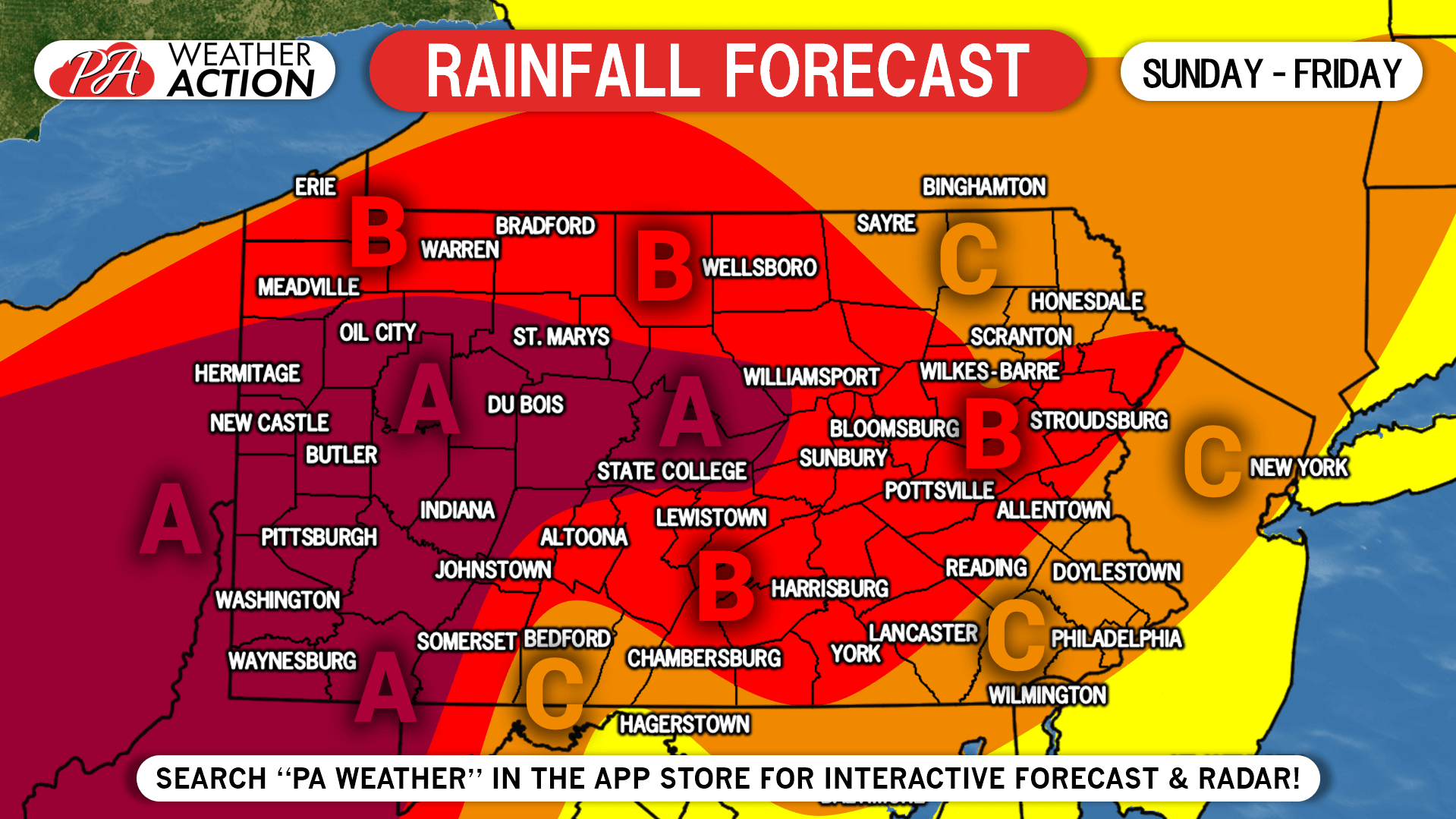
Area A: Rainfall totals of 4-5″ expected. Localized flash flooding is possible especially in areas with poor drainage.
Area B: Rainfall totals of 3-4″ expected. Localized flash flooding is possible especially in areas with poor drainage.
Area C: Rainfall totals of 2-3″ expected. Isolated flash flooding possible.
Monitor the radar and hourly forecast in your area with our app on Apple & Android. Tap the banner below to download in your phone’s app store!
You must be logged in to post a comment.