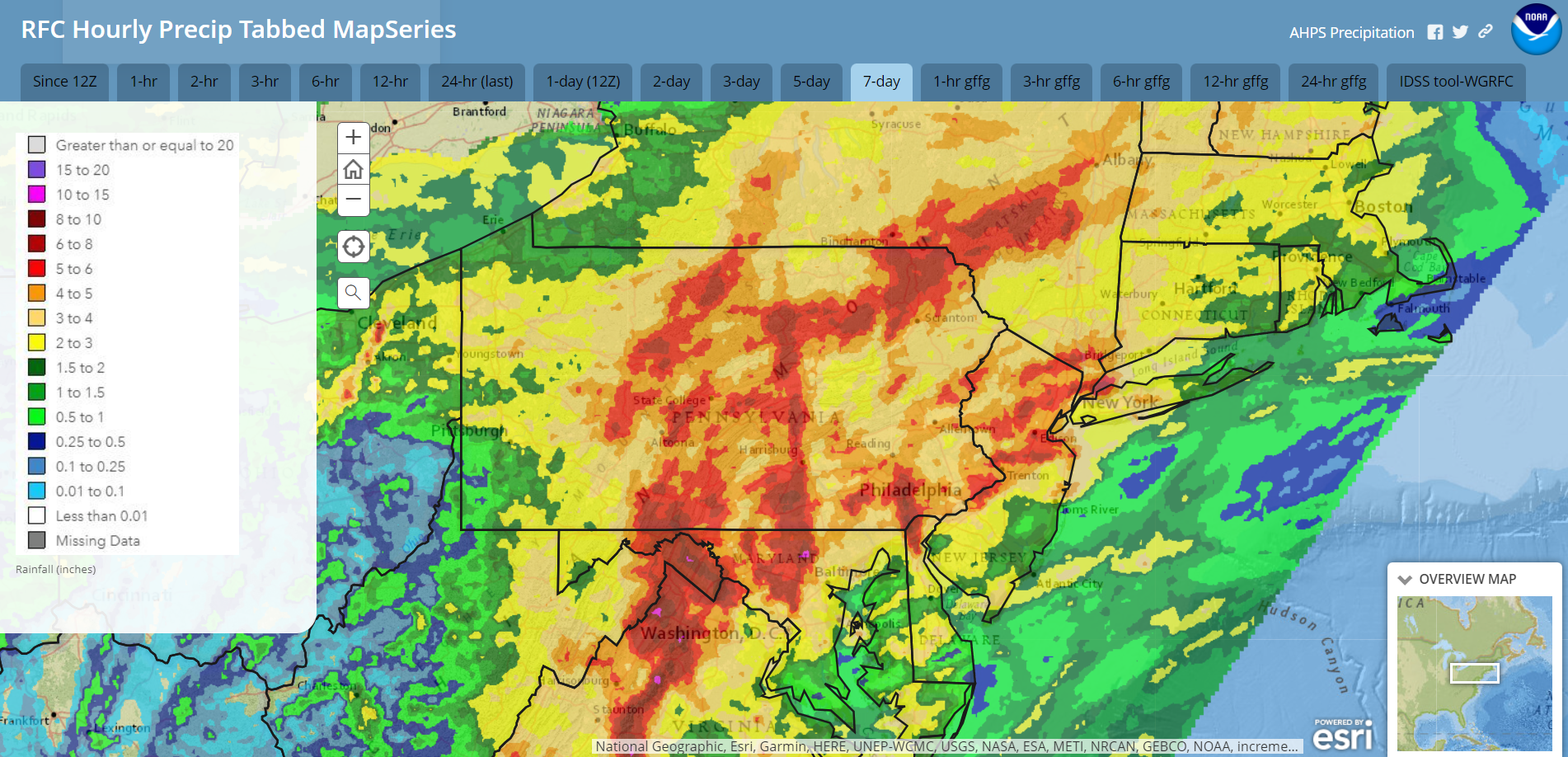
The remnants of Debby unleashed 1-4″ rain upon our region Friday, with areas receiving over 5″! The week leading up to Debby’s arrival featured ample antecedent rainfall which created significant flooding as some areas received over 6″ for the week!. Wind gusts of 30-40 mph resulted in widespread power outages.
7-day rainfall ending 8am Saturday Aug 10:
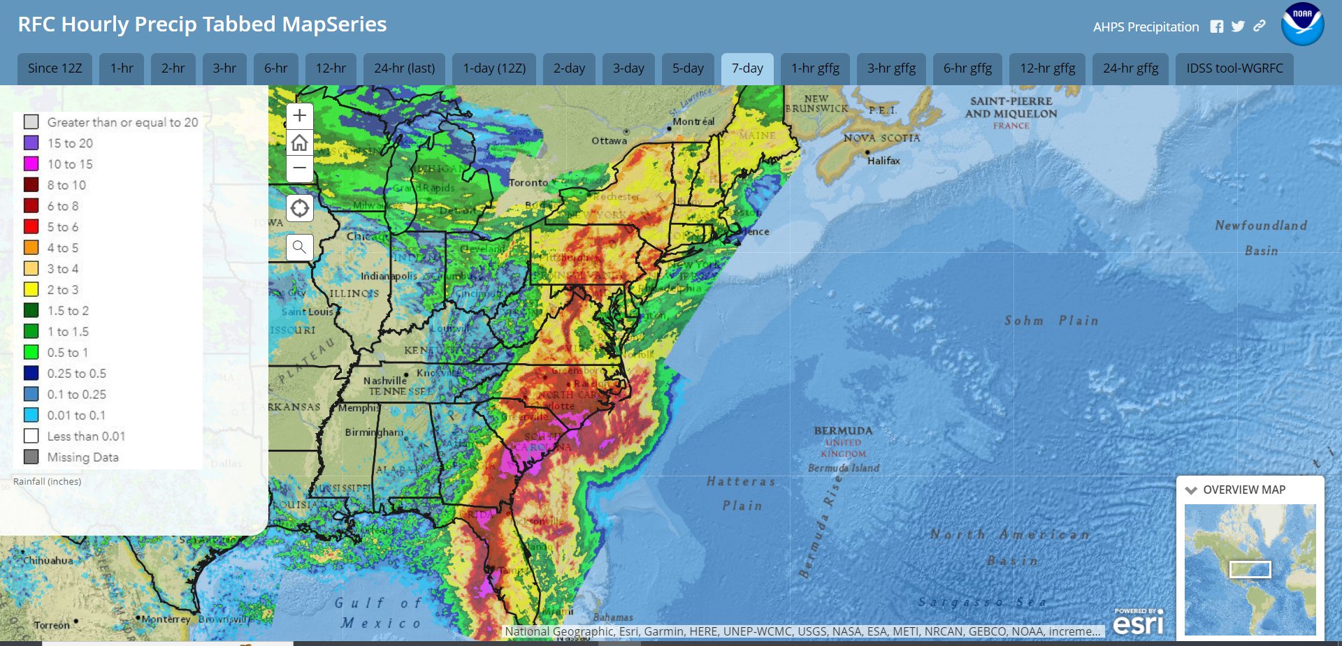
Meanwhile, other areas of the East Coast were inundated with over 15″ rain from Debby!
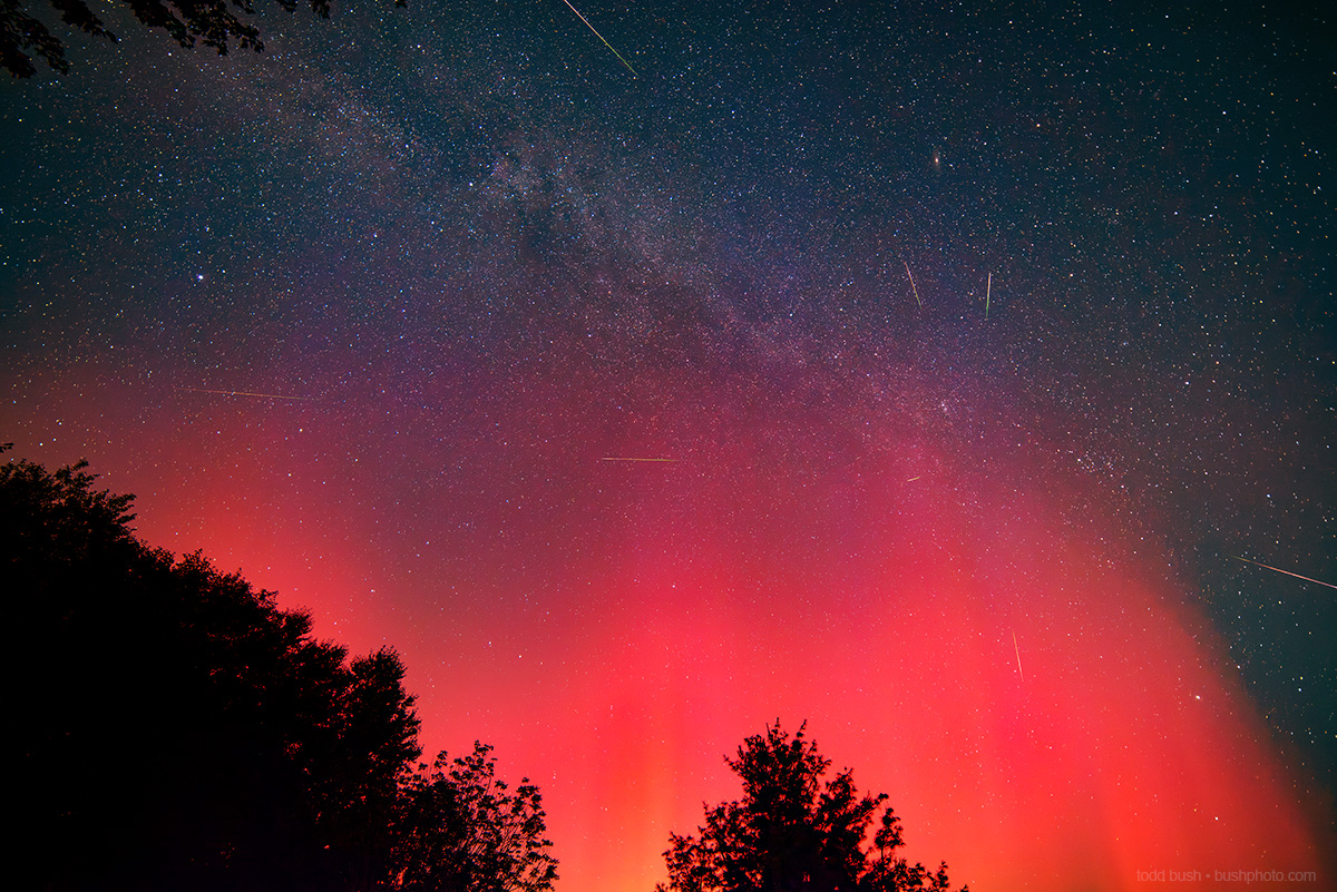
September-like air was drawn into our area behind Debby, with overnight lows dropping to near 50 last night! Along with the peak of the Perseid meteor shower, a strong geomagnetic storm sparked an aurora that was visible from Pennsylvania.
The geomagnetic storm peaked today and is currently subsiding, so unfortunately the chance of seeing northern lights tonight are slim. Here is a photo of last night’s aurora with some of the Perseids taken by Todd Bush in Banner Elk, NC:
Meanwhile, an upper-level trough over the Northeast inspired numerous but spotty showers to pop over the Northeast this afternoon. These showers will quickly collapse after we lose the heating of the sun.
Incidentally, last night’s air temperature flowing over the Great Lakes was low-enough to generate some lake-effect rain showers off Lake Erie! With the heating of the day, the opposite effect is happening this afternon where there is an area of clear sky downwind of the lake.

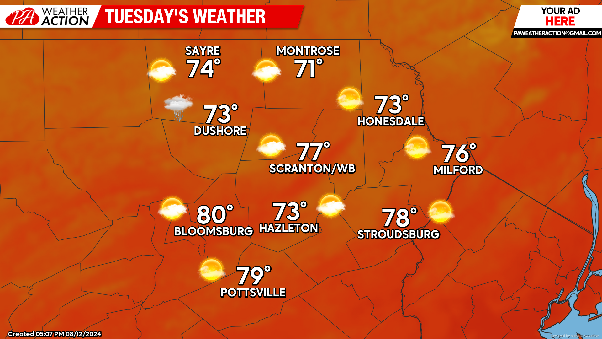
TUESDAY
After another cool clear morning, once again there will be scattered cumulus clouds and spotty showers that pop during the heating of the day, courtesy of an upper-level trough still influencing the Northeastern US. Temperatures and humidity will continue to be more like early September than early August.
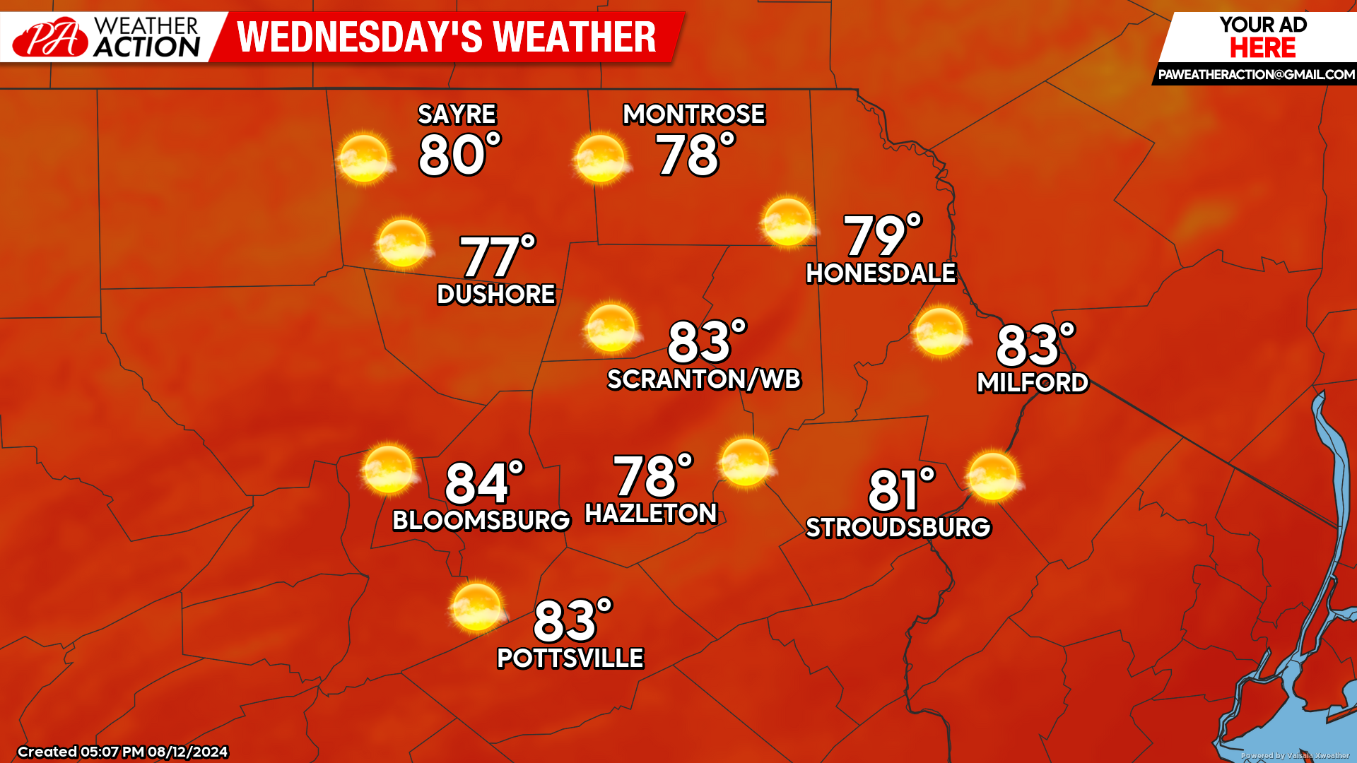
WEDNESDAY
The surface high will be over our region, and the upper-level trough will have relinquished its influence. Temperatures will be near normal, with a continuation of the low humidity.
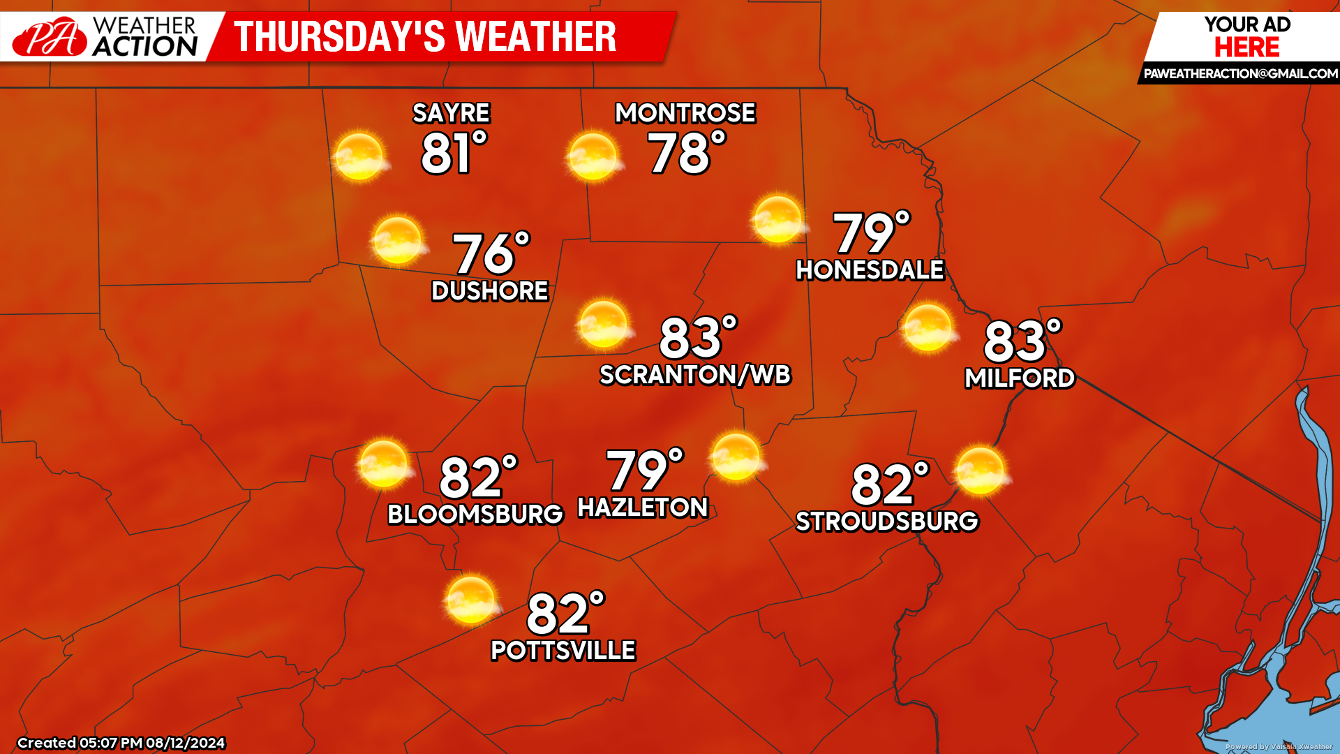
THURSDAY
The surface high will remain over our area, with Thursday also featuring plenty of sunshine, near-normal temperatures, and low humidity.
BEYOND THURSDAY (Friday-Sunday Aug 14-16)
Low pressure will impact our region during this time frame, bringing increasing clouds and the potential for rain later on Friday. The opportunity for rain will continue through the weekend. Meanwhile, Ernesto will be moving northward through the Atlantic as a hurricane, but should remain offshore until he impacts the Canadian Maritimes on Monday.

You must be logged in to post a comment.