
We are tracking a potent coastal storm that is taking aim at our area late Friday into Saturday. A low pressure system is expected to develop over the south on Thursday and will then tap into Gulf of Mexico moisture. This will allow for the low pressure system to get its act together by early Friday.
By Friday the low pressure system will be transferring most of its energy into a coastal storm right off the North Carolina coast. While the track is officially not locked in at this point, most model guidance suggest that the coastal storm will take a north-northeastward track. This will put our area under the threat for a cold heavy rainfall with gusty winds. There is the potential for the rain to change to wet snowflakes for the highest elevations in Pennsylvania Saturday, but that is currently on the less likely side.
Light to moderate rainfall will begin to develop Friday evening, likely around dinner time or shortly after. Below is a look at the future radar for 8:00 PM Friday:
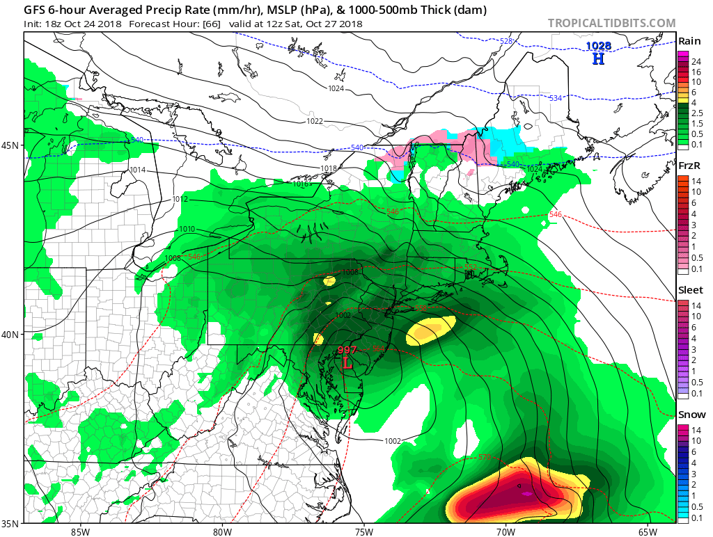
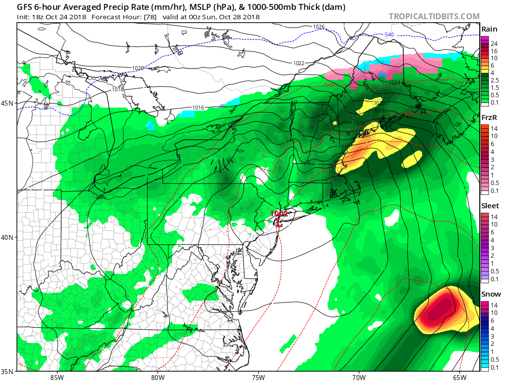
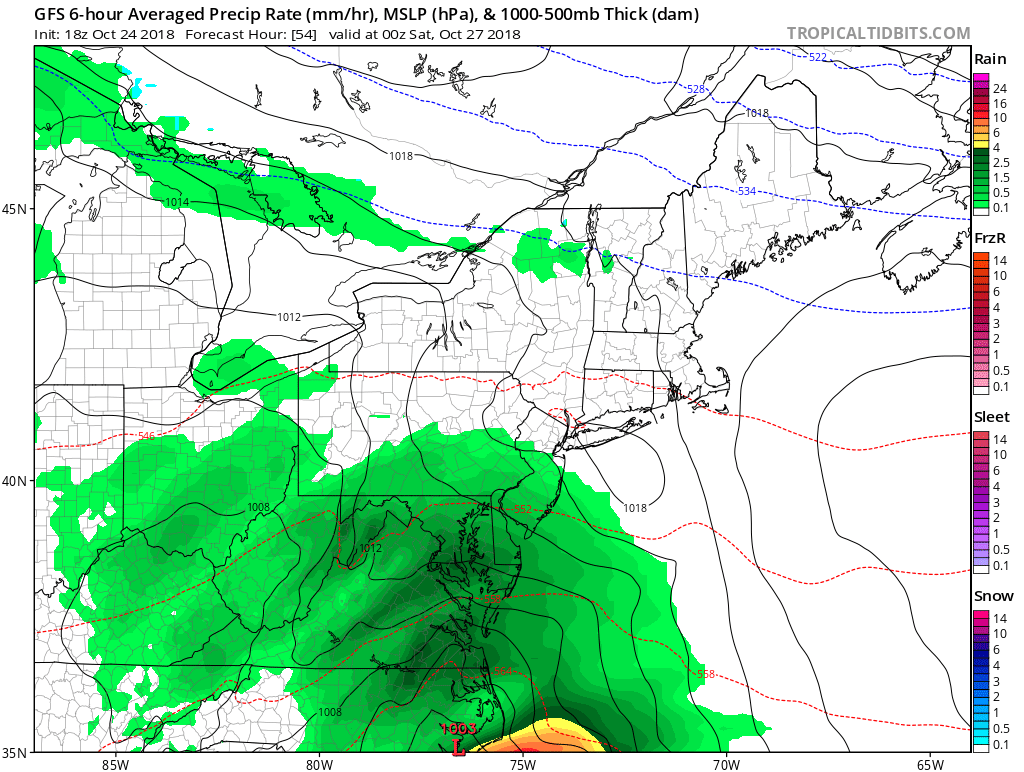 As the coastal storm begins to strengthen and edge northward, moderate to heavy bands of rain will make it into the region. Most of Saturday will be a washout, state-wide. Below is a look at 8:00 AM Saturday morning:
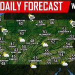
 During the day Saturday, winds will be gusting 20 to 30 MPH. This will be a very cold rainfall like we stated before. Checkout the expected high temperatures for the state. Most areas will be stuck in the 30s and 40s!
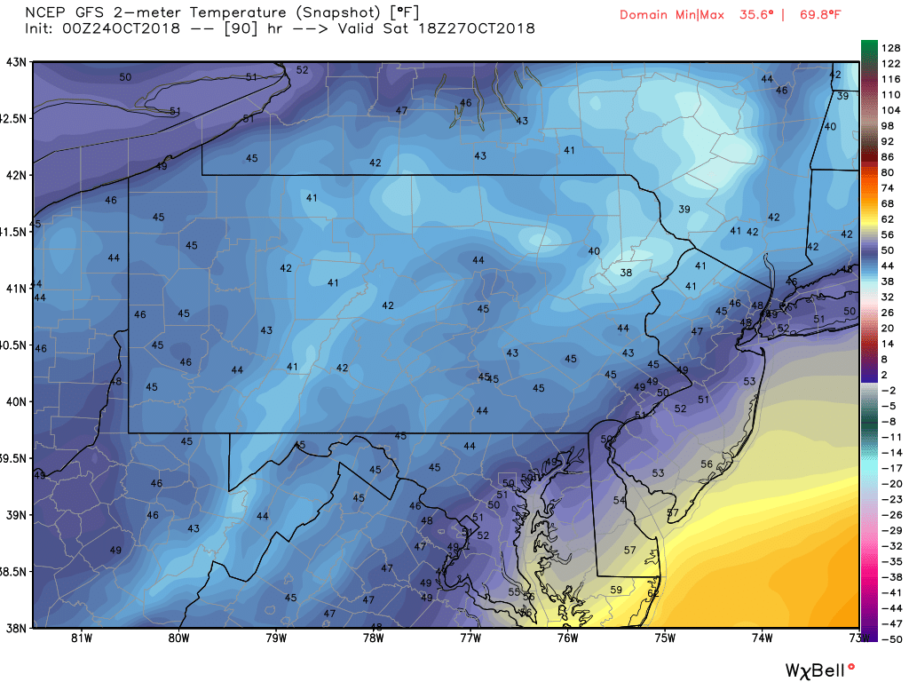
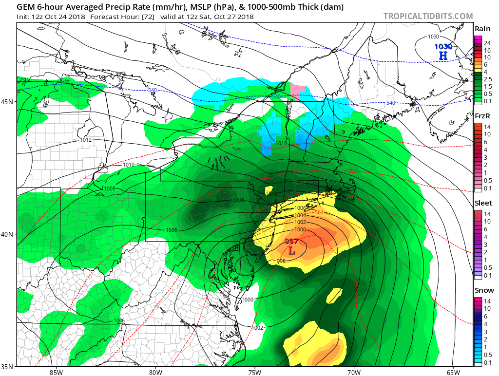
We do expect the moderate to heavy rain to taper off to a lighter rainfall by Saturday evening. Below is a look at 8:00 PM Saturday evening:
 In general, we are anticipating between a half inch to at least two inches of rainfall from Friday evening through Saturday for our area. As we mentioned, we are keeping an eye out for the highest elevations in Pennsylvania in the Laurel Highlands and along the NY/PA border for a potential switch from rain to wet snowflakes. At this time, the odds on this happening are slim. If there was a change over to wet snowflakes for these areas, it would be Saturday evening as wraparound bands will be accompanied by a northwest breeze allowing for colder air from Canada to be mixed in with the system. We will keep you updated over the next several days.
Help Hurricane Michael recovery efforts in the Florida Panhandle by purchasing a Fleece Jacket! A third of your purchase will go directly to our selected charity. Click here to view the Fleece Jacket!
Be sure to have liked our Facebook page, if you have not already for the latest updates>>>Pennsylvania Weather Action’s Facebook page
Download our free app today before Saturday’s coastal storm, click here: Pennsylvania Weather Action’s App
Share the news with your family and friends using our icon below!
You must be logged in to post a comment.