


Before we get into Saturday’s forecast, I want to briefly discuss the rainfall overnight Tonight and into the first half of your Wednesday. A cold front will be pushing across the state from the West overnight delivering with it shower activity. Like we mentioned previously, Western PA remains the area for the best chance to see higher rainfall totals. The rainfall will likely breakup as it hits the Mountains across Central PA, but there is the potential that the rain restrengthens a tad by the time it reaches Eastern PA.
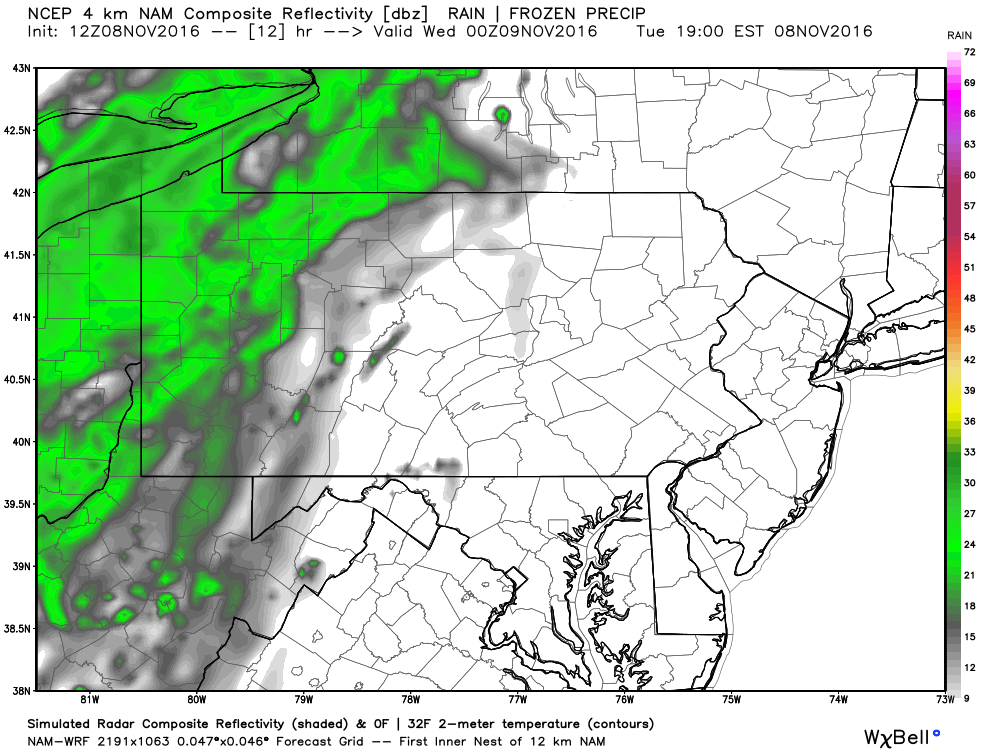
Below is the Hi-Res NAM model showing the rain arriving in Western PA later this evening. Expect showers to arrive over these parts between 6 PM and 8 PM this evening.
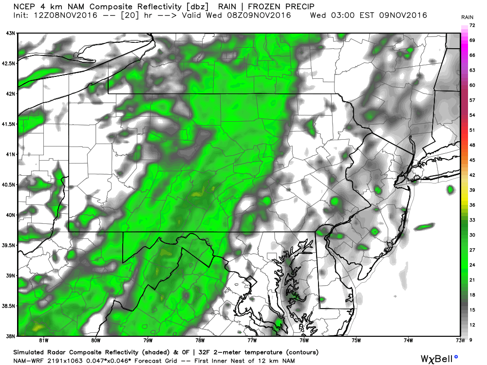
The shower activity will continue to push East and arrive for Central PA during the overnight hours, likely between 8 PM and Midnight.
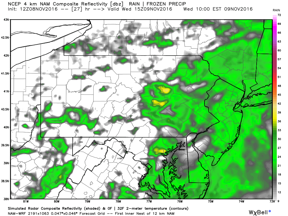
For Eastern PA, don’t expect showers to start until after 3 AM and the threat for showers will continue throughout all morning. Below is valid at 10 AM. There is the potential for pockets of downpours indicated by the yellows, but these will be very isolated.
Rainfall totals: 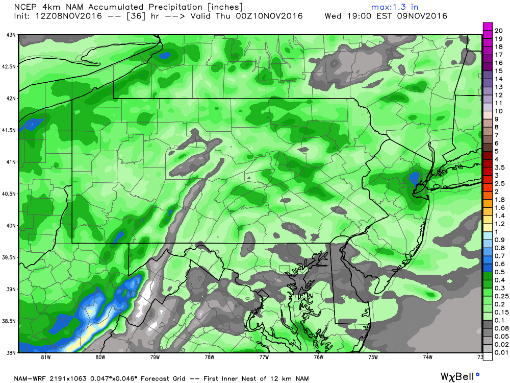
Rainfall totals will likely range between a tenth and a third of an inch with isolated higher amounts possible.
Now onto the bigger story of the week..THE COLD. Saturday will feature the coldest air of the season, so if you have not yet taken your Winter gear out of the closet yet, you may have to Saturday! Our first true cold shot of the season will be arriving from Canada late Friday Night and will hang around through Saturday.
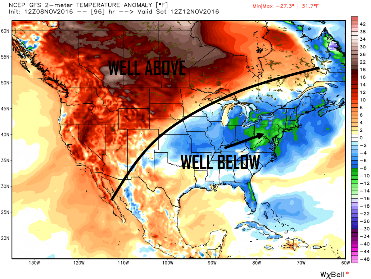
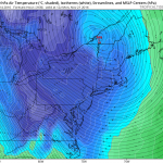
Looking at the temperature anomalies for this Saturday, Pennsylvania looks to run an impressive 8 to 15 degrees below normal for most areas. Another thing to note here, is the above average temperatures across central Canada. Persistent ridging over this area is leading to warmer than average temperatures with little to no snowfall across these parts of Central Canada. As long as this area is warmer than average, any cold shots our area receives, will likely be short lived. At least for the next couple of weeks.
So how cold are we talking? Take a look below at our temperature map to find out: 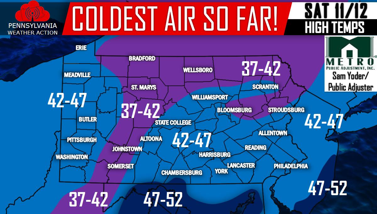
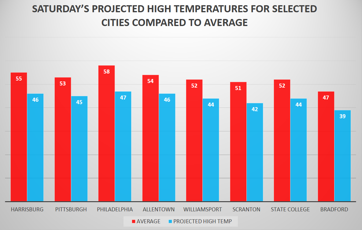
And for a closer look at how these temperatures compare to normal for this time of year: The numbers in the red represent the average high temps, while the numbers in the blue represent the projected high temps. Again most locations will fall 8 to 15 degrees below average for this time of year.
Northwestern and North-central areas of Pennsylvania do stand the chance for some Lake Effect Snow Showers Saturday, but at this point, the threat looks minimal at best.
The good news for all of you that do not like the cold, temperature swings will be a common theme for the next 2 to even 3 weeks. No real sustained cold or warmth is in sight.
Be sure to “like” us on Facebook if you haven’t already to receive the latest Pennsylvania Weather updates>>>>PA Weather Action on Facebook!
You must be logged in to post a comment.