
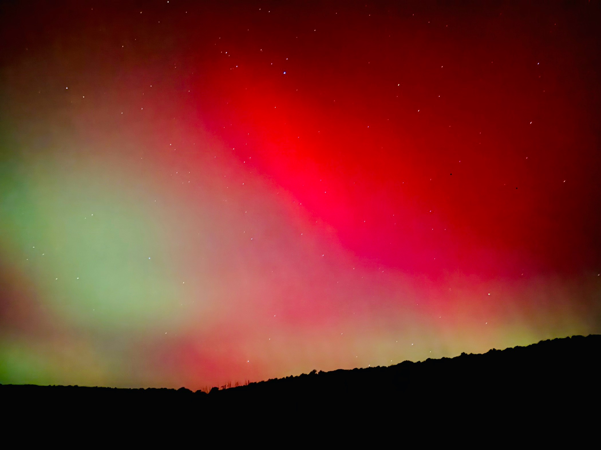
Hopefully everyone enjoyed Thursday evening’s spectacular aurora and the first frosts of the season.
After a mild weekend, a cold front delivered gusty wind and below-normal temperatures to our area for today. Behind that front, an upper-level trough over our area along with daytime sun is helping to generate random showers across New England and New York, some of which are entering our northern counties. Some of the higher elevations near the NY border could enjoy their first snowflakes of the season mixing in with the rain showers tonight through Wednesday morning!
Meanwhile, comet Comet C/2023 A3 Tsuchinshan-ATLAS is now visible near the western horizon for about an hour after the sun sets. It is bright-enough to be seen with the unaided eye, and has a tail that stretches about 10-degrees across the sky. Unfortunately clouds and showers will plague our northern counties through Wednesday and impede on the comet’s viewability. However, our southern counties might be more fortuitist and have enough clear skies to enjoy!
By Thursday and through the weekend, the comet will be higher in the western sky and visible longer after the sun sets, and we should have clear skies to partake in the spectacle! Unfortunately, the comet will also be moving farther away from Earth and thus will gradually become smaller in our sky.
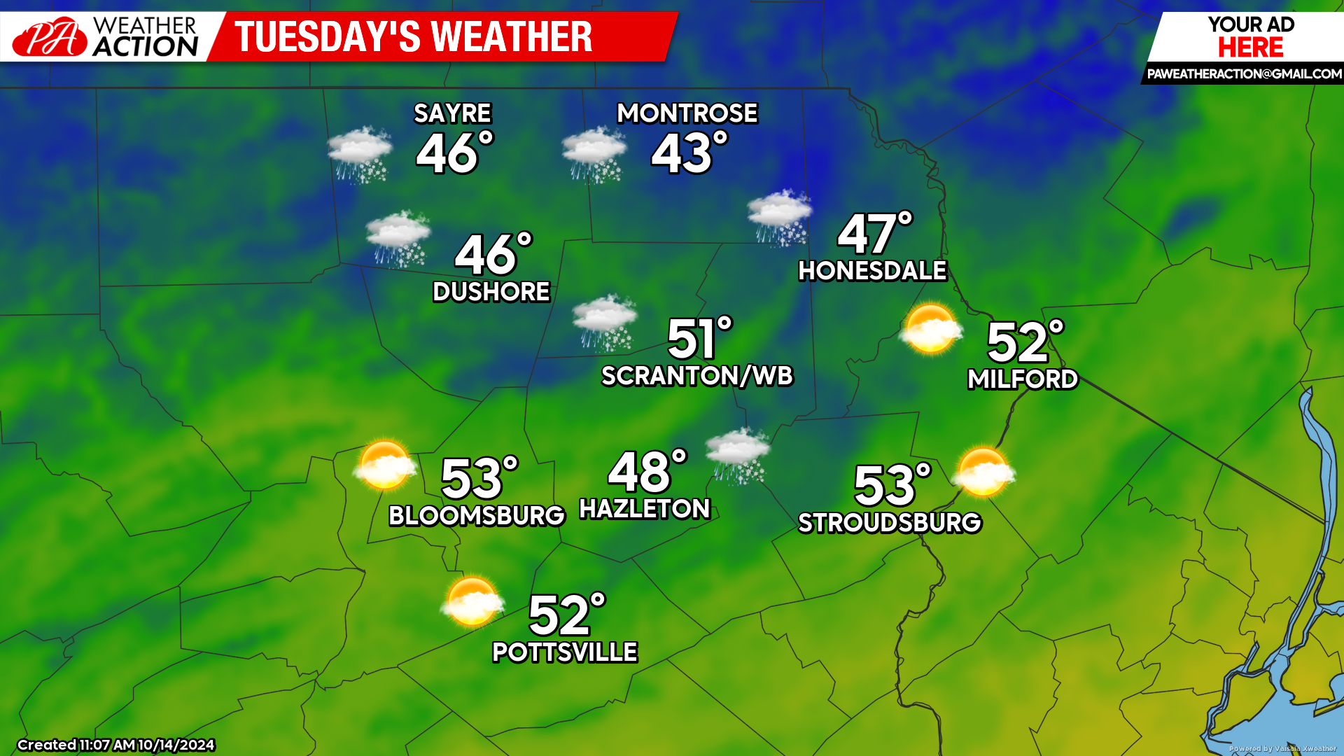
TUESDAY
An upper-level disturbance will rotate around the upper-level trough and spawn numerous rain and snow showers throughout the day and into the night, mainly across our northern counties. The warm waters of Lake Ontario will also contribute to these showers. You might be able to see the transition of the random daytime showers from the sun’s heating, to the banding streaming off the lakes overnight. There could even be a light coating of snow for the highest elevations near the NY border Tuesday night! Meanwhile, the valleys of our southern counties should remain dry. Temperatures across northeastern Pennsylvania will start the day in the 30s, and fall back into the 30s Tuesday night. Breezy conditions will also continue.
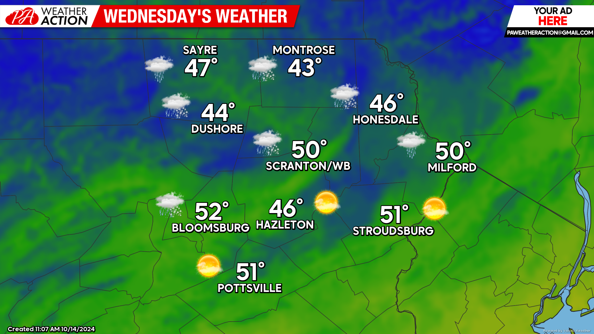
WEDNESDAY
Rain and snow showers will continue through midday across the northern Counties. Temperatures will start the day in the low-mid 0s. During afternoon, a surface high will move into our area, bringing clearing conditions and diminishing the opportunity for those rain and snow showers. That surface high will provide clear skies for comet viewing at sunset. Most locations will have frost, and temperatures falling into the low 30s.
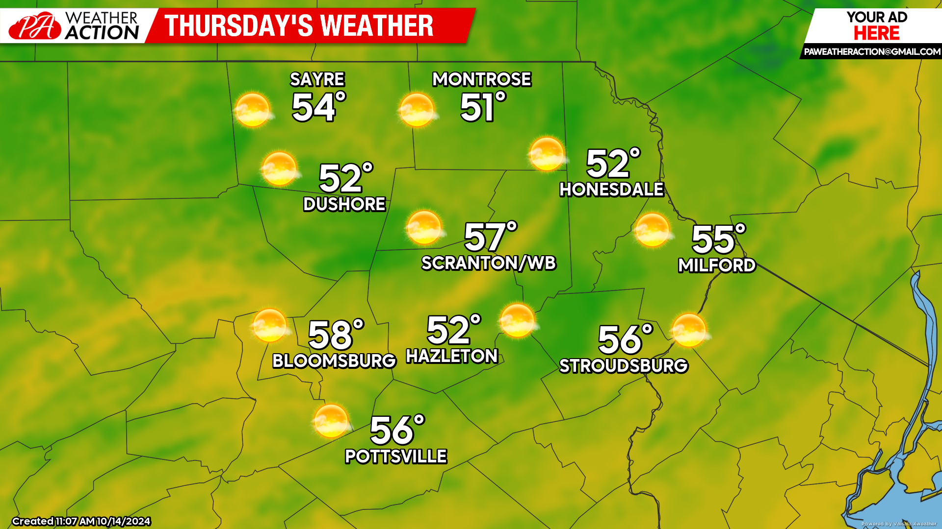
THURSDAY
The aforementioned surface high will provide sunshine and milder temperatures across the area. I highly recommend spending the first hour after sunset looking for the comet near the western horizon! That surface high will move to our east for the weekend, allowing above-normal temperatures and sunshine to dominate our weather Friday through Sunday!
You must be logged in to post a comment.