
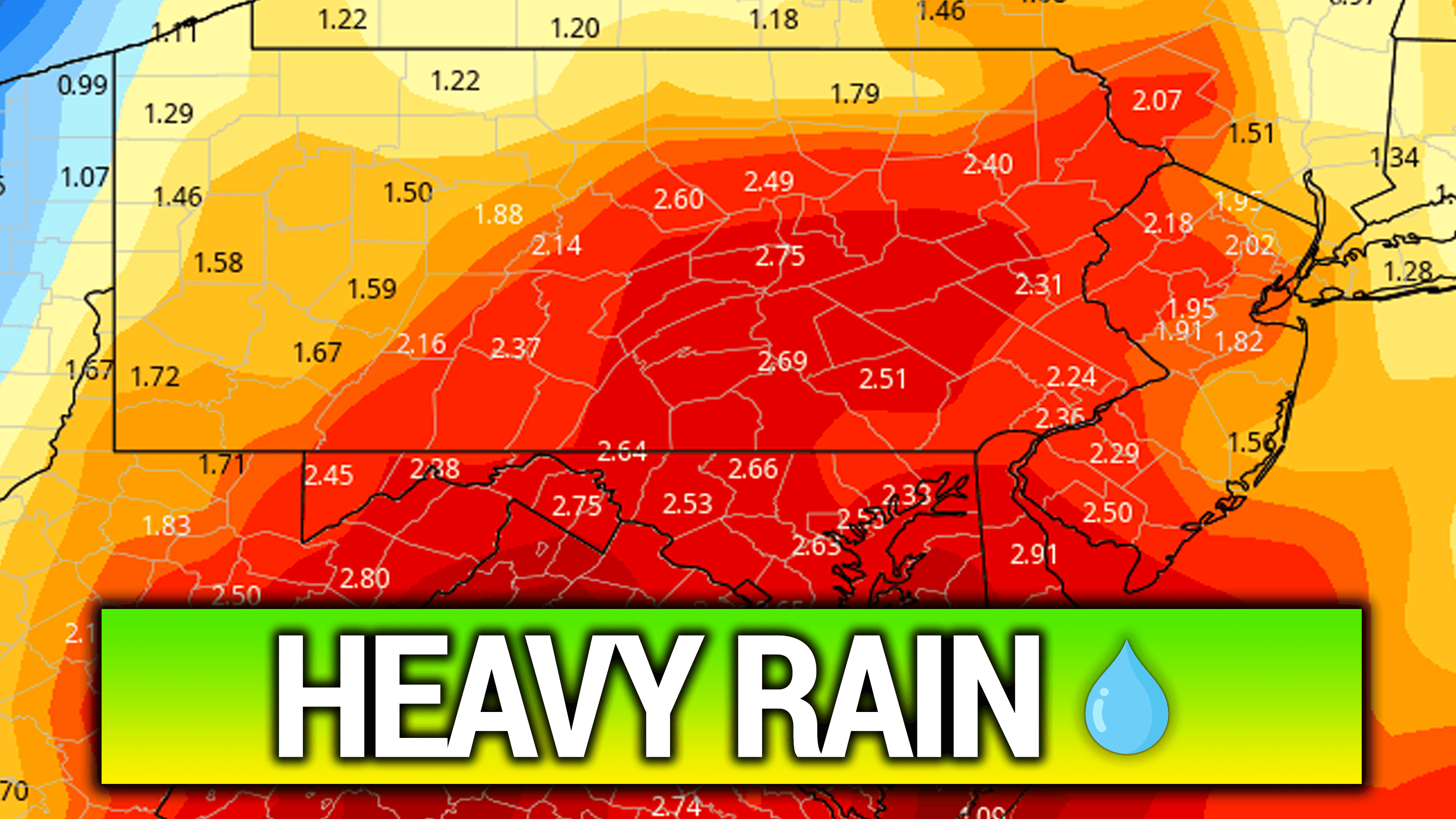
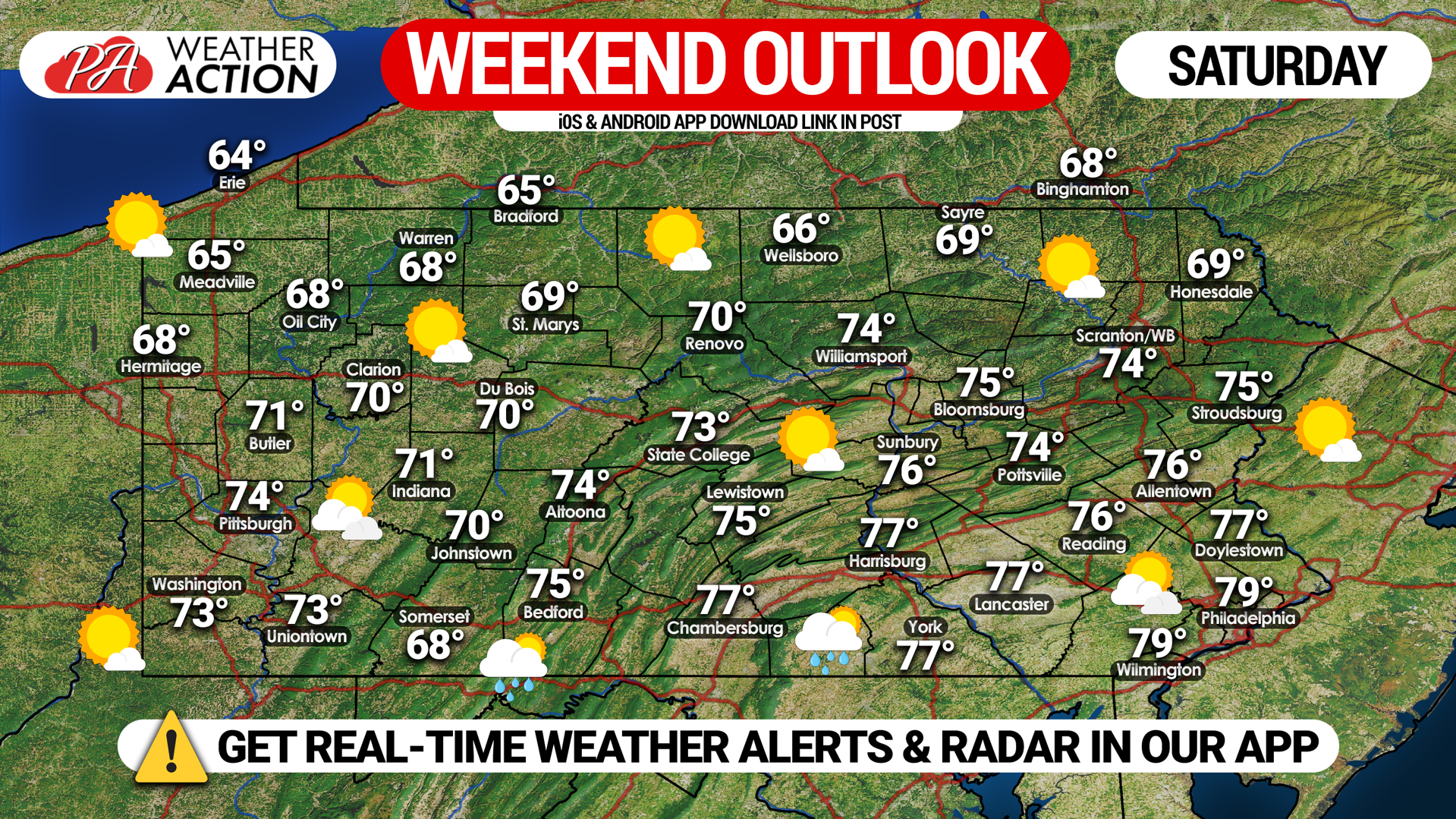
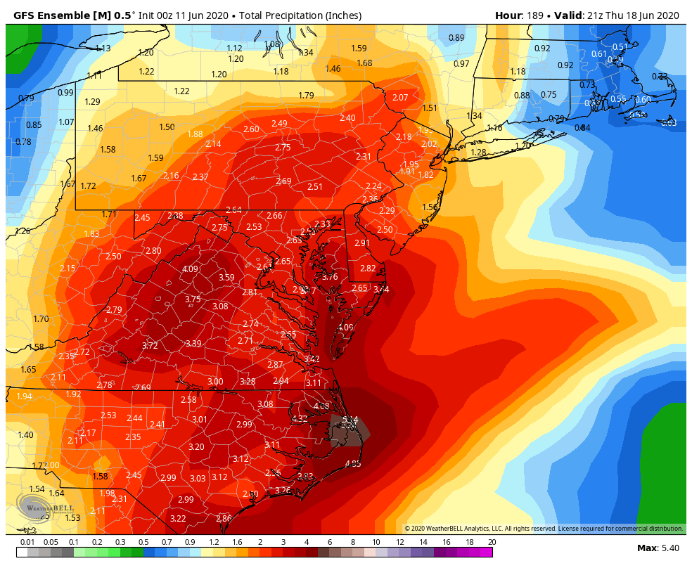
After heat indexes in the 90s to near 100° this week, below average temperatures will flow into the area for the weekend. Highs in the 60s and 70s are expected both Saturday and Sunday, with a chance of showers in southern and eastern PA Sunday. Unfortunately for those wanting to spend time outside, Sunday’s shower potential looks to be only the beginning of a streak of wet weather in the Mid-Atlantic. But first, we should see a dry and comfortable start to the weekend. Here is Saturday’s statewide forecast.
Severe weather will be held to a minimum in the coming week. However, temperatures will gradually begin to increase next week and a ridge looks to build in the week of the 21st, which may lead to a few days with a severe weather potential during that week.
You can track the forecast and much more on our app! Get it on iOS & Android here >>> Weather Action App
Don’t forget to share this forecast with family and friends who may have outdoor plans in the coming week!
You must be logged in to post a comment.