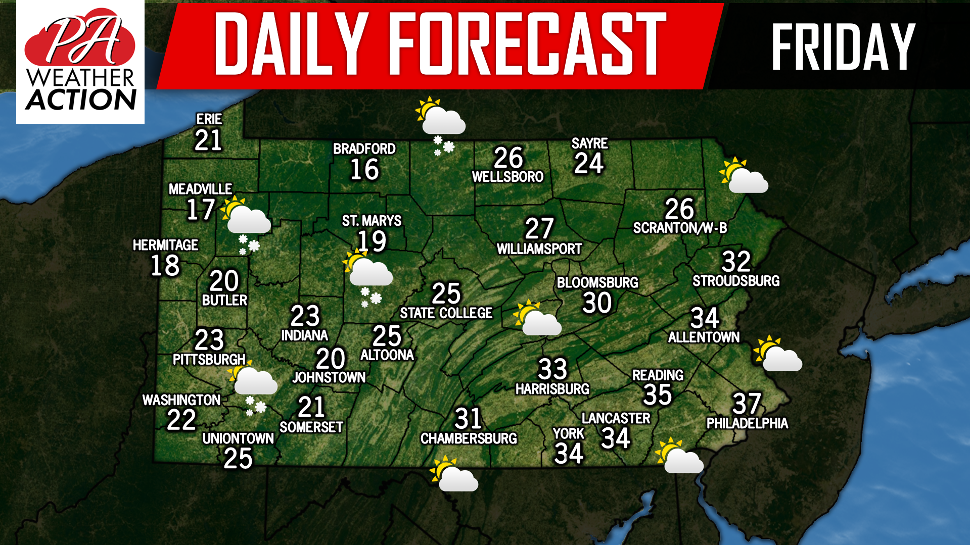
After yesterday’s brief warm up for some areas, temperatures are back to below average across the state. Some flurries are possible across Western and Northern Pennsylvania today, but little to no accumulations are expected. The next chance for widespread accumulating snow appears to be during the Monday/Tuesday time period. Expect updates on that system soon. Have a great Friday!
Josh has been passionate about weather as long as his memory dates! From watching the Weather Channel at age 7, to making hand-drawn hurricane maps at age 11, starting his first weather site at 13, and founding PWA at 15 and forecasting for the state for the past 9 years, Josh's interest in weather has never dwindled! As difficult as it is, he greatly enjoys forecasting for Pennsylvania due to its countless microclimates. The state is an East Coast severe weather hotspot and nearly always home to the rain/snow line during winter storms!
Post navigation
Previous Post
Daily Forecast for Thursday, January 24th, 2019
You must be logged in to post a comment.