
Today will be a picture perfect 10 out of 10 kind of day with temperatures above average for this time of year and plenty of sun!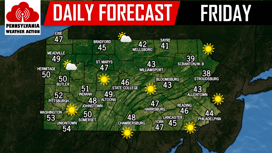
Temperatures will continue to be warmer than average this weekend with the only threat of precipitation arriving late Saturday night and will linger into the early morning hours on Sunday. This will not be a washout by any means, and will occur while most of us are sleeping. Below is a look at the GFS valid for 1:00 AM Sunday morning: 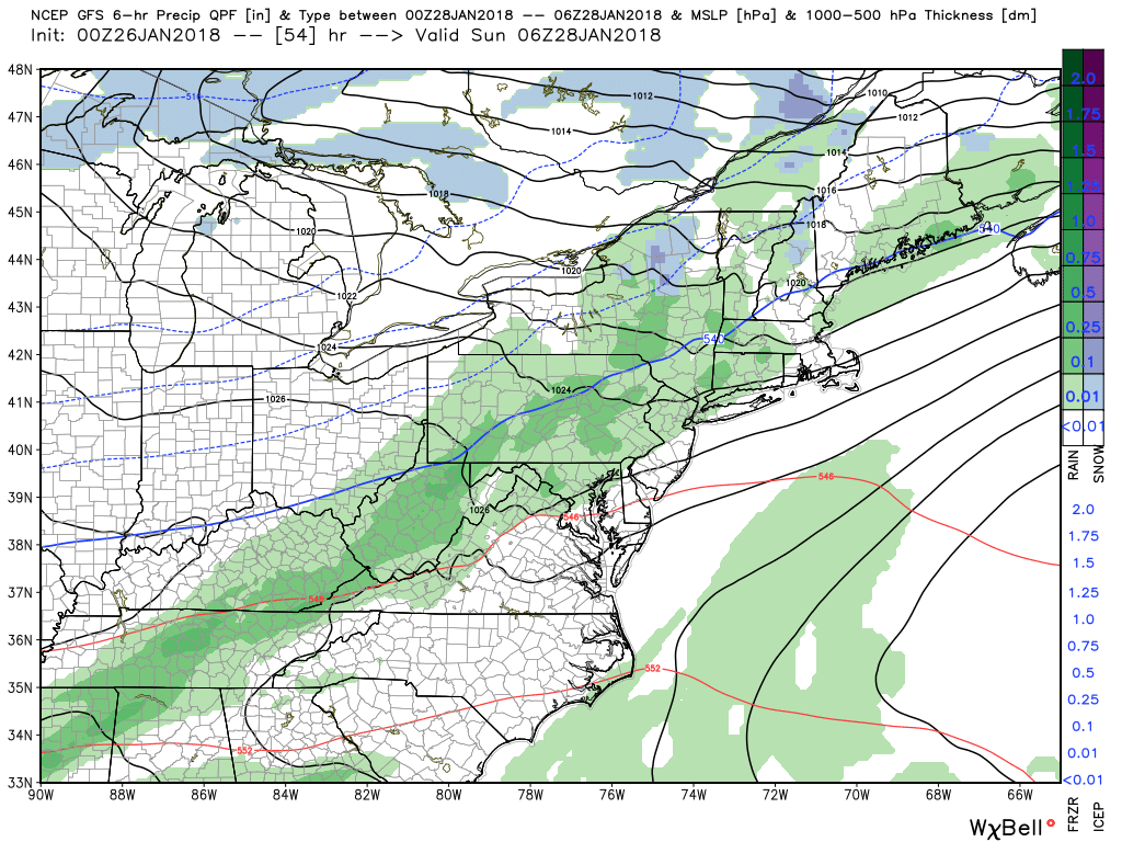
The coastal that we mentioned yesterday possible for Monday is still expected to remain far enough out to sea that it will have no impacts to the area. Again, we expect this to be the solution. Our next storm threat is still focused around February 2nd and 3rd.
You must be logged in to post a comment.