
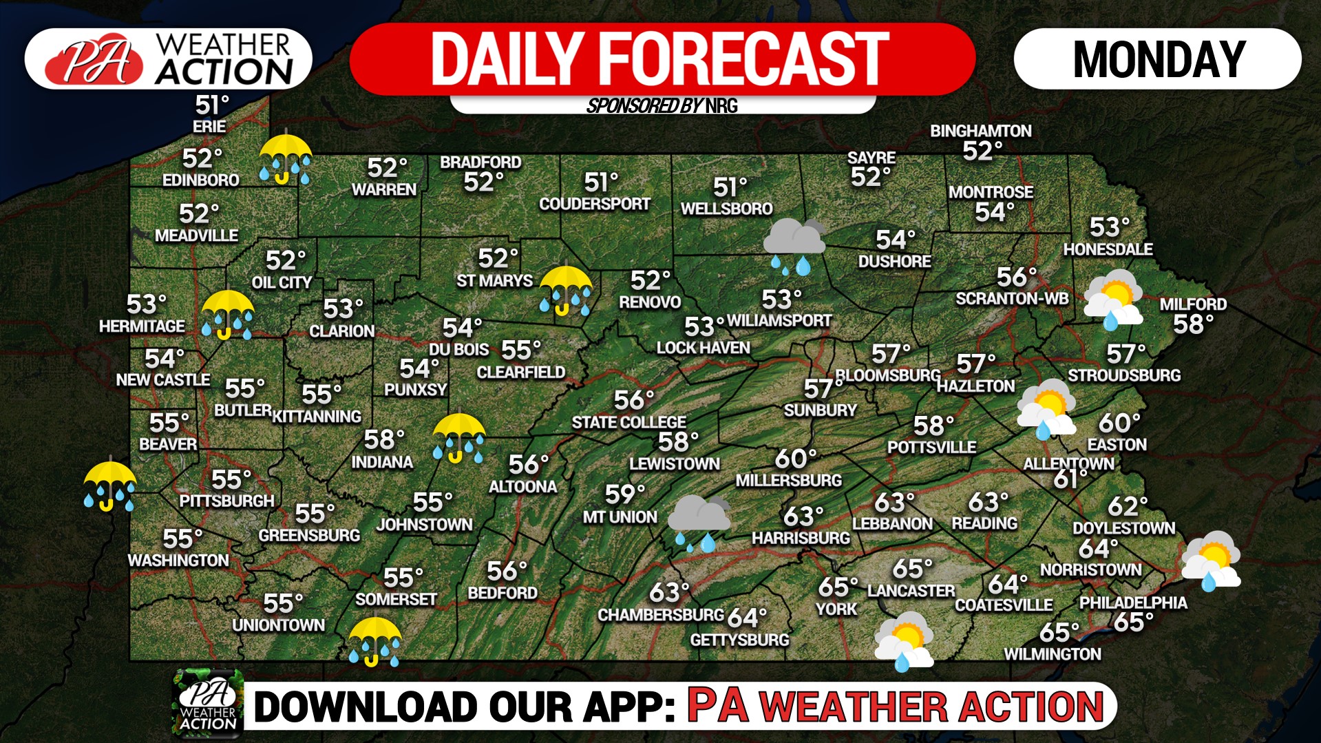
A cold front will move across the state this afternoon with gusty winds up to 40 mph. Locally heavy rain across Western Pennsylvania this morning will gradually slide east during the afternoon. This map shows maximum high temperatures, but don’t let the 50s and 60s fool you, because it won’t last for long! Falling temperatures are expected as soon as the front moves across the region. Our western counties will likely drop from the mid-50s this morning into the mid-30s by late this afternoon. Across Southeastern Pennsylvania, temperatures will reach the low to mid-60s with some breaks in the clouds and rain holding off until late in the day.


You must be logged in to post a comment.