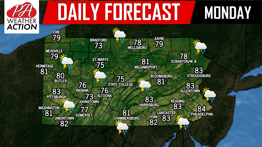
A chance for scattered showers and thunderstorms are possible today state-wide with temperatures in the 70s and 80s.

The best chance for storms will be across Western and Central Pennsylvania later this afternoon. Below is a look at the future radar valid for 5:00 PM Monday: 

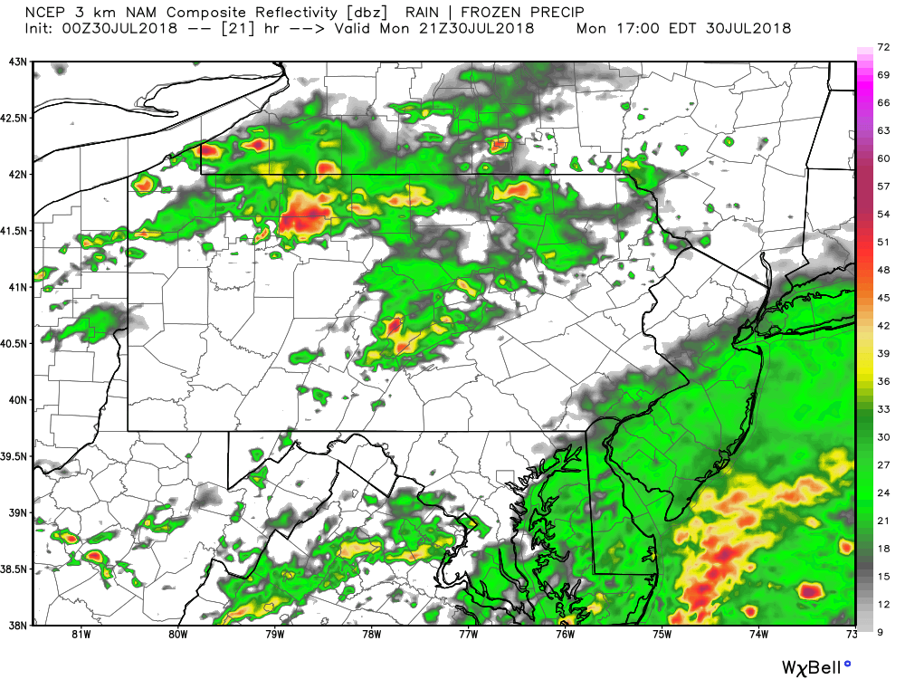
Stay tuned to our Facebook page for the latest!


Josh has been passionate about weather as long as his memory dates! From watching the Weather Channel at age 7, to making hand-drawn hurricane maps at age 11, starting his first weather site at 13, and founding PWA at 15 and forecasting for the state for the past 9 years, Josh's interest in weather has never dwindled! As difficult as it is, he greatly enjoys forecasting for Pennsylvania due to its countless microclimates. The state is an East Coast severe weather hotspot and nearly always home to the rain/snow line during winter storms!