


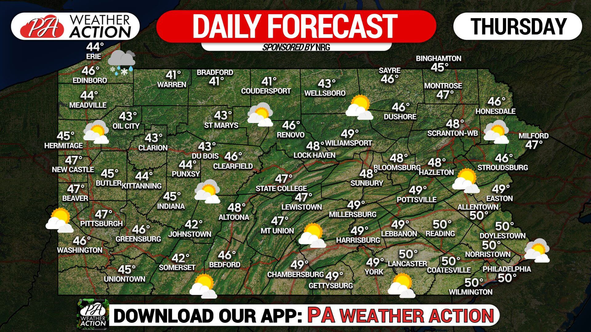
Skies will range partly to mostly cloudy today. There is a slight chance for an isolated Lake Effect rain or snow shower across Northwest Pennsylvania. High temperatures this afternoon will range from the low to mid 40’s across the northwest portion of the state to the upper 40s across central and southeastern Pennsylvania. Winds will remain light from out of the north-northwest.
Another cold and frosty night is expected with lows ranging from the low to mid-20s across Western and Central Pennsylvania, to the upper 20’s across Eastern Pennsylvania. A warming trend is in the forecast beginning Friday and we will add roughly five degrees each afternoon through the weekend and into early next week!

You must be logged in to post a comment.