
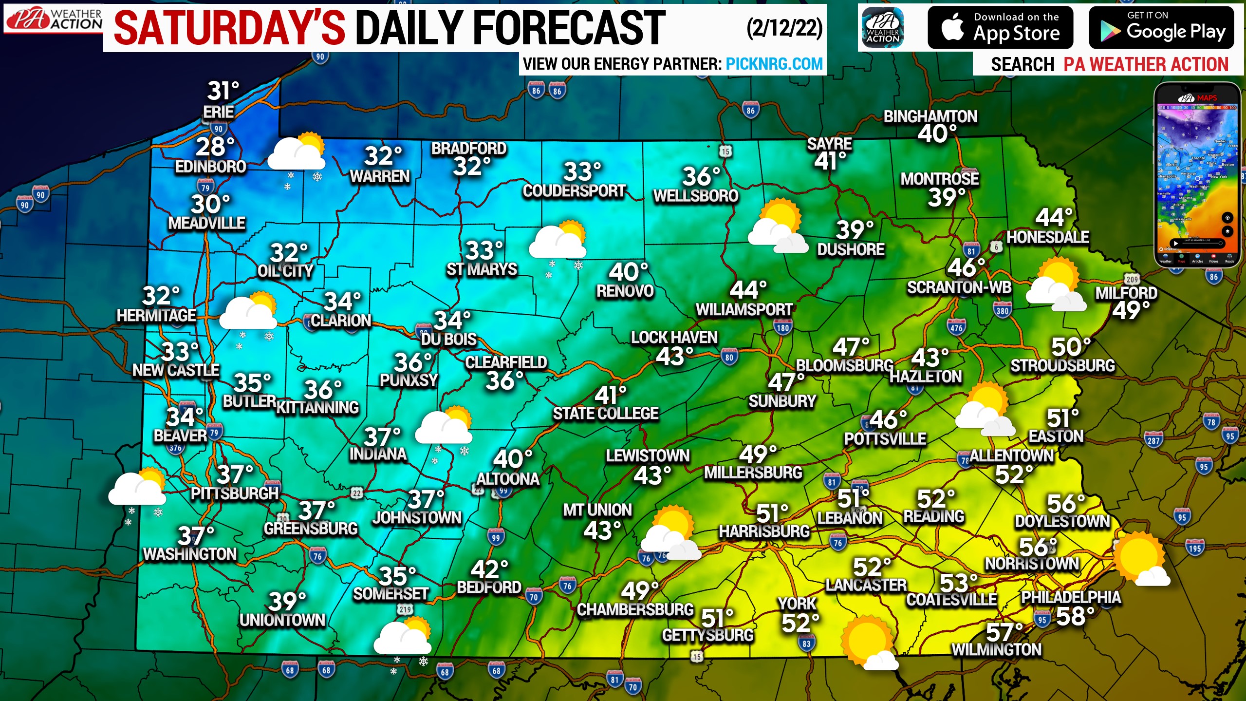
A much colder day is on tap across much of the state as the cold front makes its way through, but Southeast PA will still have an unseasonably warm day. West winds between 10-20mph likely, with a few higher gusts. Mostly cloudy skies are expected in the western half of Pennsylvania, with a few flurries possible. Partly to mostly sunny skies are likely in the eastern half of PA.
We are monitoring a light snowfall event Sunday morning for Southern PA, generally south of I-76 east of Breezewood, and south of I-78 in Eastern PA. Widespread accumulations of 1″ likely, with up to 3″ in some areas possible. We’ll have a map out early this evening. For now, have a great Saturday!
You must be logged in to post a comment.