
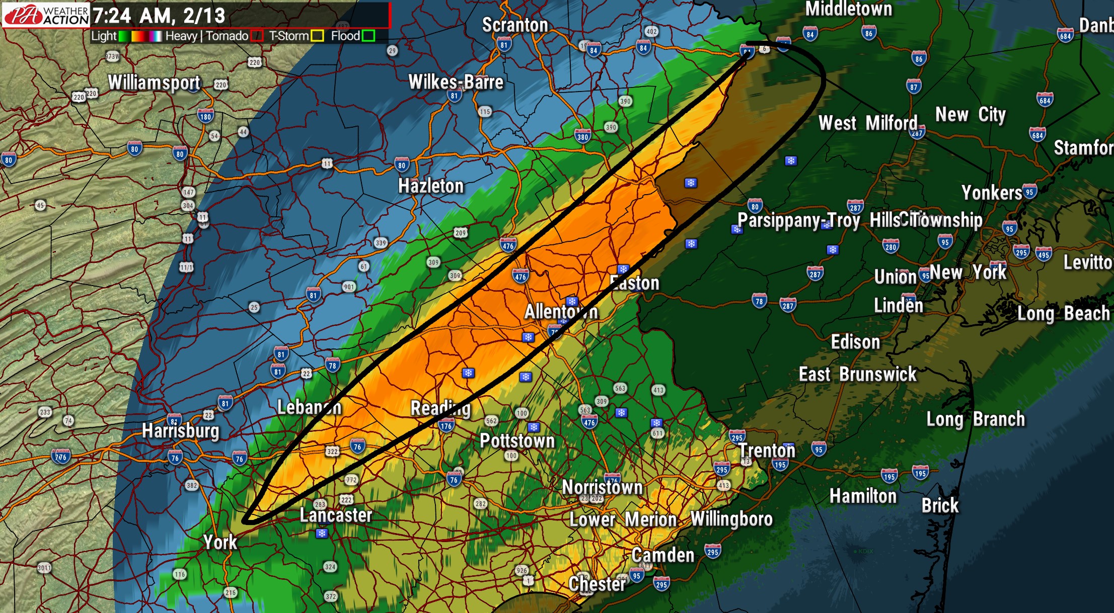
The overnight snow event is wrapping up from west to east this morning, but the heavy snow is over. It was an overachiever from Berks County, through the Lehigh Valley and Southern Poconos. Most main roads are just wet, but some secondary roads may have a layer of snow on them. Below gives you an idea of what locations bullseyed with 3 – 5″. The rest of Southeast PA, as well as the I-81 corridor received around 1 – 2″ of snow.
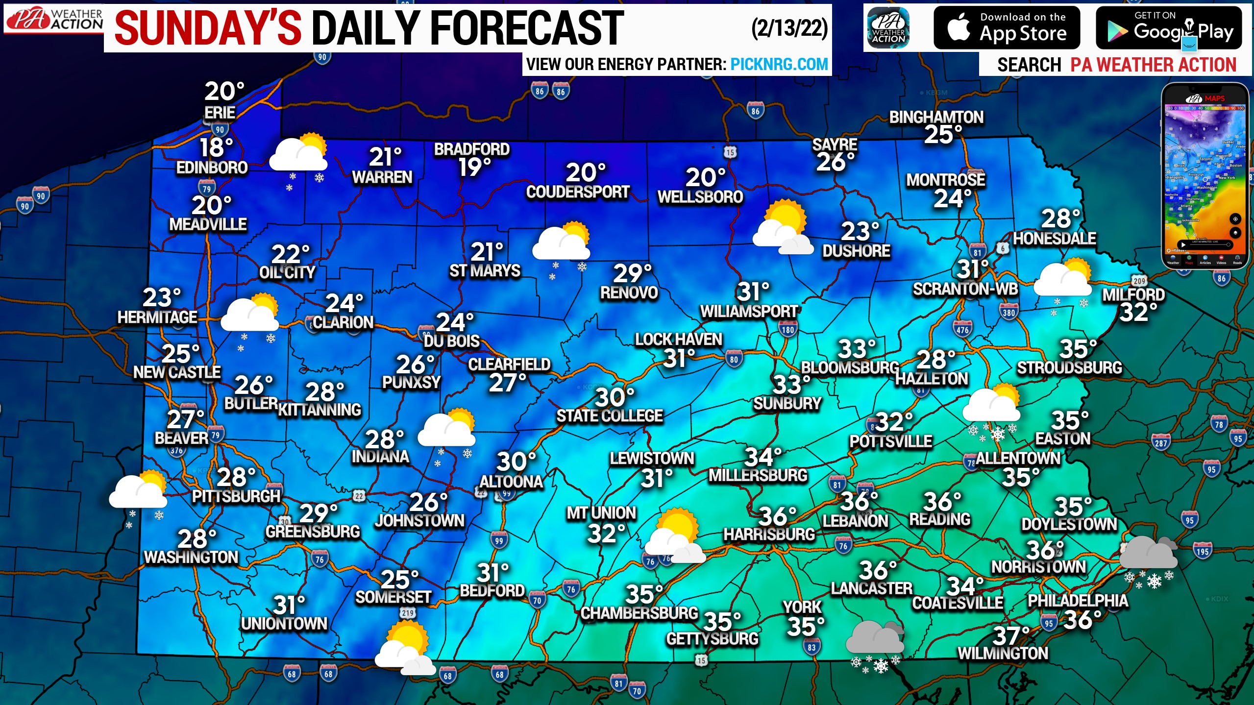
Today will feature high temperatures much colder in the 20s and 30s, with a few locations in NWPA only reaching the upper teens. Most areas will be cloudy, with snow showers exiting Eastern PA, and a few snow showers around Western PA. Isolated snow squalls are possible late this evening generally south of Butler and west of Chambersburg. Reduced visibility and a quick coating of snow will be possible within those squalls.
You must be logged in to post a comment.