
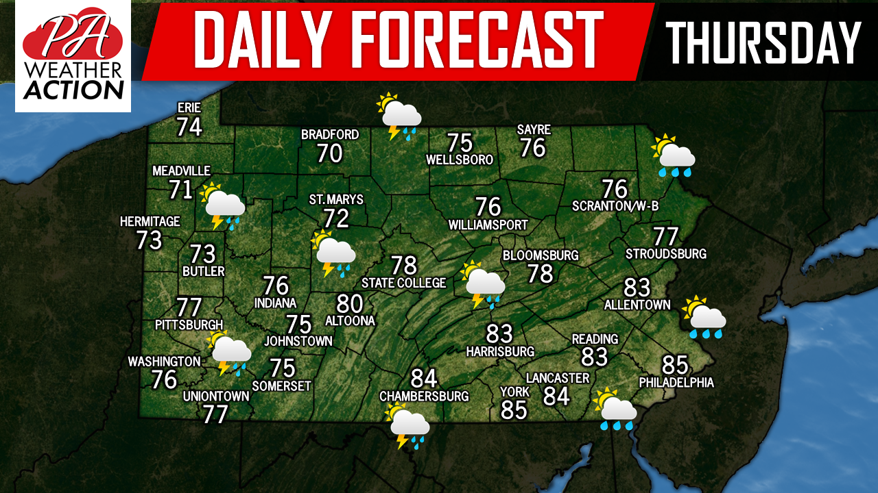
Although it is the first week of October, temperatures today will feel more like early September with most areas warming well into the 70s, if not 80s for high temperatures. A cold front is expected to cross the state this evening delivering with it the chance for scattered thunderstorms. While the storms could go severe, we are not anticipating anything close to what our area experienced on Tuesday.
With that being said, the greatest chance for thunderstorms will be across Central and Western Pennsylvania this afternoon and evening. By the time the cold front arrives in Eastern Pennsylvania, the threat will just be limited to scattered showers.
Below is a look at the future radar for 7:00 PM showing the broken line of thunderstorms as the cold front passes through: 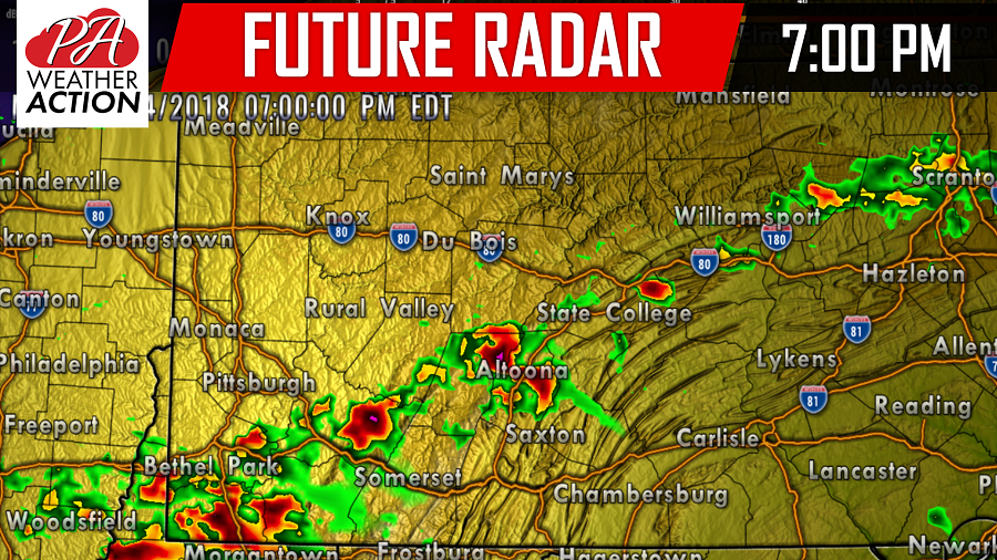
You must be logged in to post a comment.