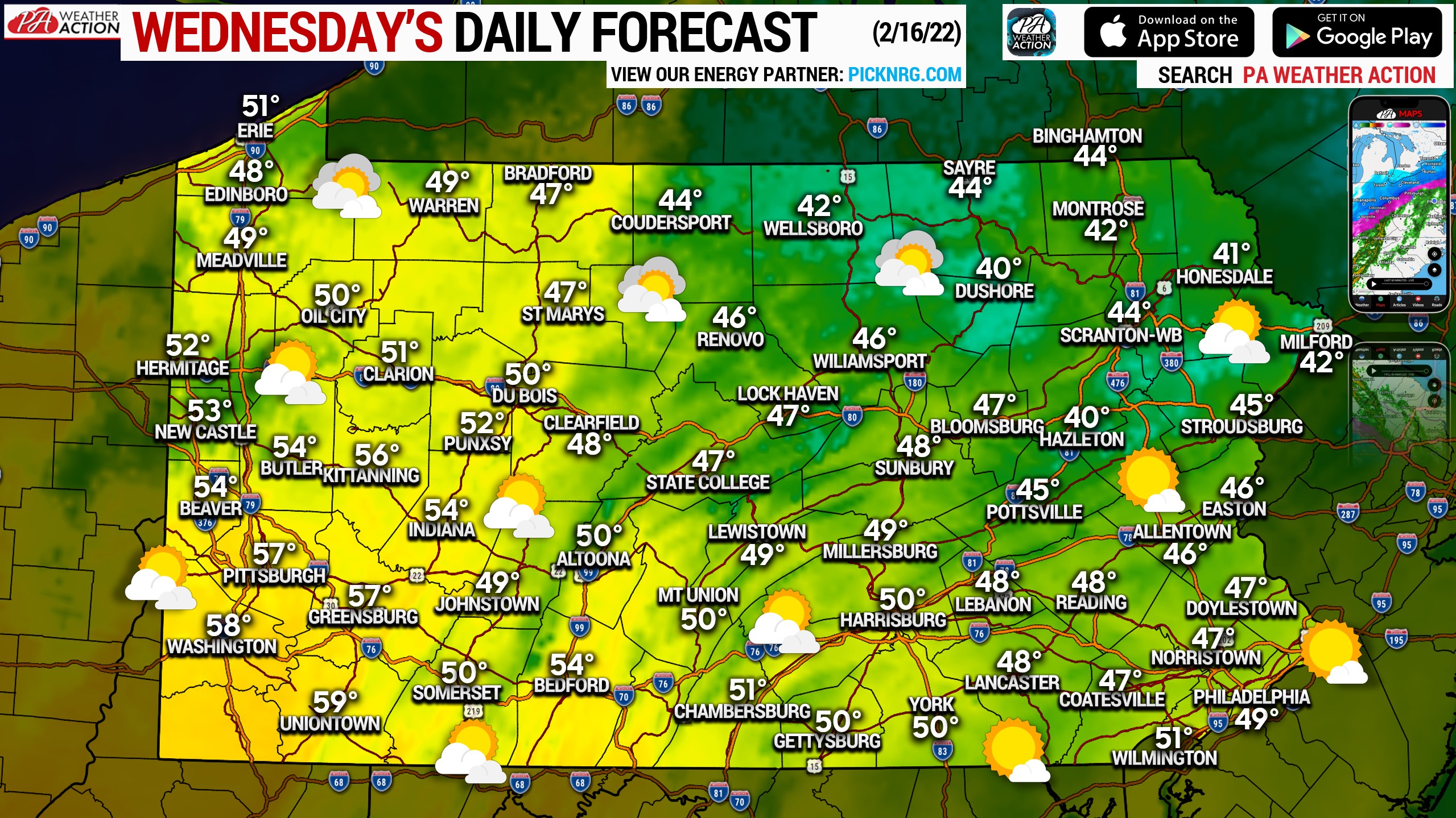
Temperatures are on the increase today ahead of a rainstorm coming tomorrow night. This will also be the first of several days that winds become a factor, with a few gusts to 30mph. Varying amounts of clouds and sunshine today, with generally the most sun southeast and most clouds northwest. Highs will range from the low 40s in NEPA to the high 50s in SWPA. Tomorrow will be the warmest day of the week, with most of Southern PA expected to break the 60 degree mark!
Posted inDaily Forecast
Daily Forecast for Wednesday, February 16th, 2022: Warming, Winds Increasing
Posted by
By
Lead Forecaster Josh Adams

Josh Adams is the founder and lead forecaster of Pennsylvania Weather Action, a regional forecasting site he launched in 2015. With over a decade of experience analyzing weather patterns across Pennsylvania, his forecasts have reached millions of readers throughout the state.
Josh specializes in Pennsylvania’s complex microclimates and terrain-driven weather patterns, providing detailed coverage of severe thunderstorms, winter storms, and flooding events. His forecasting focuses on delivering precise, timely information to help Pennsylvanians stay informed and prepared during impactful weather.
Last Updated: March 10, 2026

You must be logged in to post a comment.