
Mother Nature heard your complaints about the lack of summer weather, and took them to heart. We are about to get more than we asked for, with a very strong ridge parking itself over the East Coast. This will create a strong “heat dome” for many days.
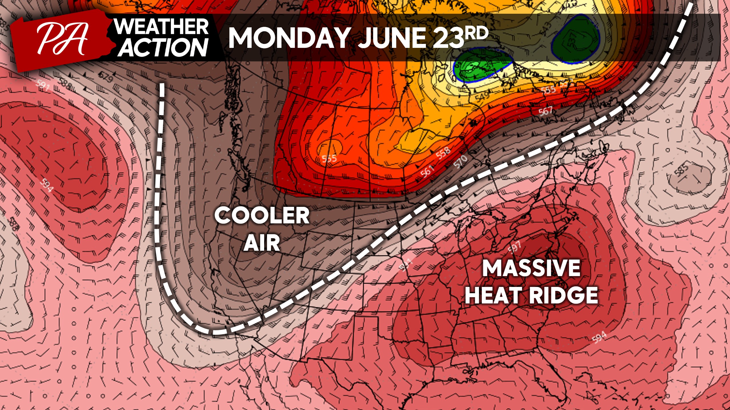
A heat wave is defined by three consecutive days with high temperatures at or above 90°. But this heat wave will last 7-10 days, with temperatures nearing 100° some days in the urban corridors.
Below are the European Model’s daily high temperatures starting Sunday June 22nd, and continuing through Wednesday July 2nd. Sometimes models overdo heat in the longer range, but the bottom line is next week’s heat wave is all but guaranteed.
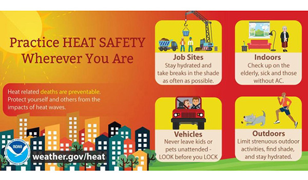
This is the type of heat that will wear you down regardless of what age or physical shape you’re in. Yes, it’s summer and we all want to be outside typically. But in this case, limit your time outdoors to short increments and stay hydrated and in a cooled environment.
Do not leave humans or animals in a car for any amount of time. The interior of your car will reach 125° in just 20 minutes, leading to potential heat fatigue and possibly heat stroke.
FIRST CALL HEAT INDEX FORECAST FOR MONDAY – WEDNESDAY (6/23-25)
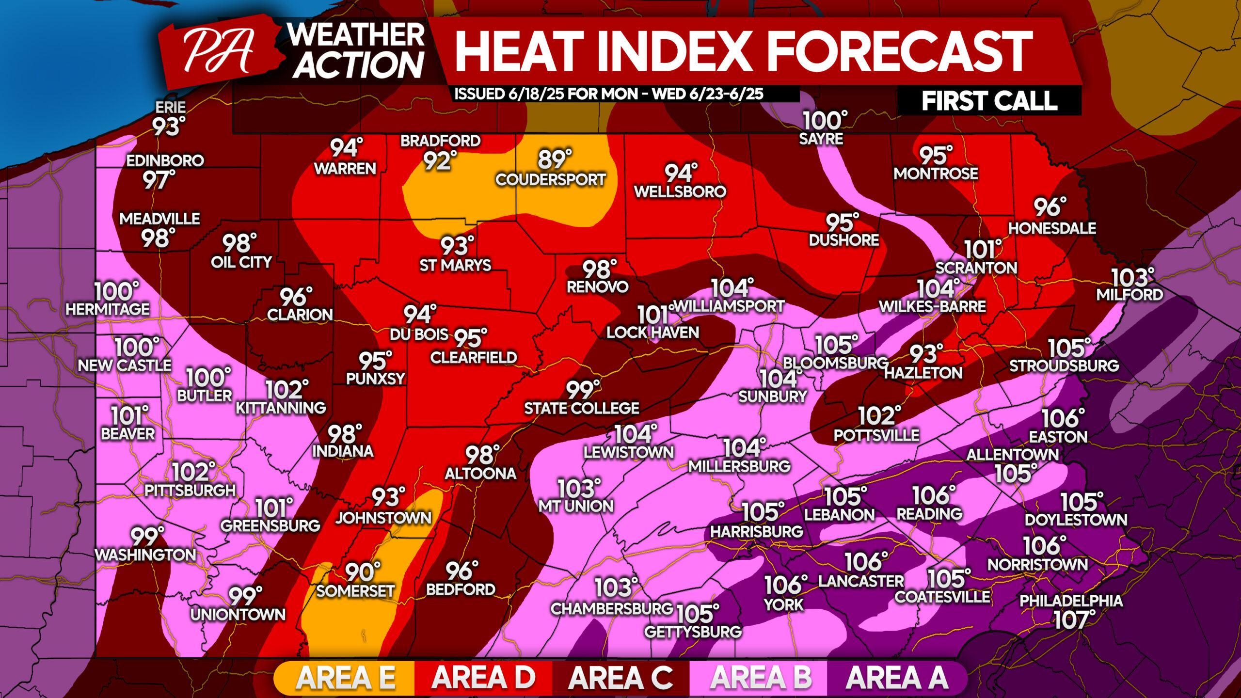
Area A: Temperatures of 97 – 102° with high dew points will make it feel like 105-110° during the afternoons of Monday, Tuesday, and Wednesday. Heat cramps or heat exhaustion likely, and heat stroke possible with prolonged exposure and/or physical activity.
Area B: Temperatures of 93 – 97° with high dew points will make it feel like 100-105° during the afternoons of Monday, Tuesday, and Wednesday. Heat cramps or heat exhaustion likely, and heat stroke possible with prolonged exposure and/or physical activity.
Area C: Temperatures of 90 – 93° and high dew points will make it feel like 95-100° during the afternoons of Monday, Tuesday, and Wednesday. Heat stroke, heat cramps, or heat exhaustion possible with prolonged exposure and/or physical activity.
Area D: Temperatures of 87 – 90° combined with high dew points will make it feel like 90-95° during the afternoons of Monday, Tuesday, and Wednesday. Heat stroke, heat cramps, or heat exhaustion possible with prolonged exposure and/or physical activity.
Area E: Temperatures of 85-87° and high dew points may cause fatigue after prolonged exposure. These high elevations will avoid the worst of the heat.
Share this important forecast & information with family and friends below!


You must be logged in to post a comment.