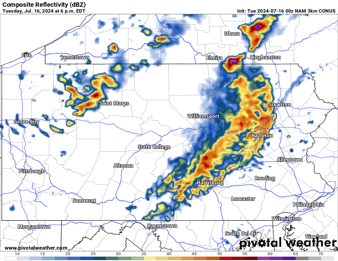
The Summer of 2024 is on pace to go down as one of the hottest summers ever recorded and today will arguably be the hottest day of the season so far. Severe weather is also likely today across parts of Pennsylvania. Below is a look at the latest radar imagery:
Today’s Weather Forecast: 4/10
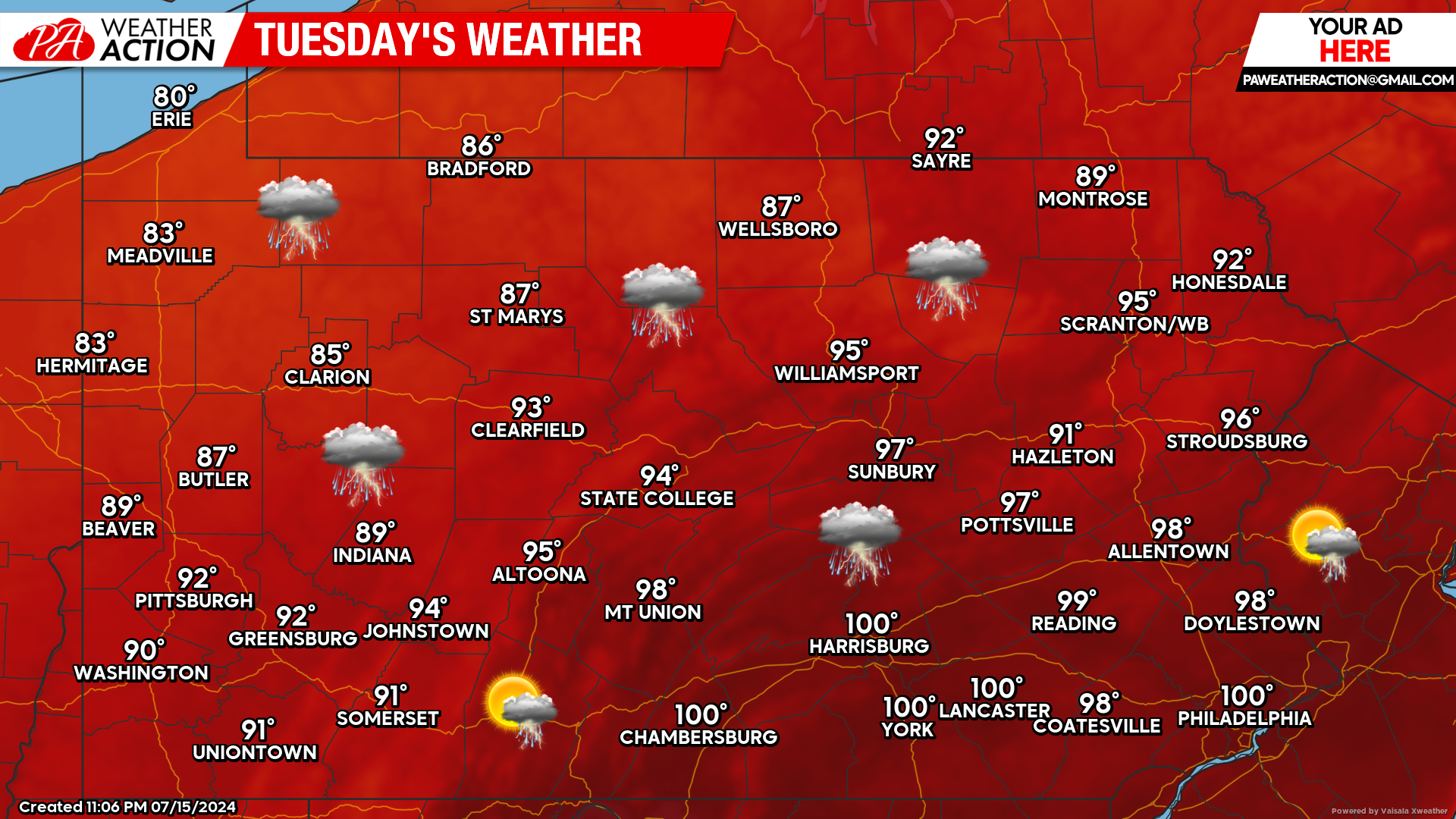
Today will be the hottest day of the year so far for many areas as temperatures will reach the triple digits across southern and eastern Pennsylvania. Real feel temperatures will be anywhere from 5 to 10 degrees hotter than that. Scattered strong to severe thunderstorms capable of producing damaging winds and large hail are likely during the afternoon and evening hours today.
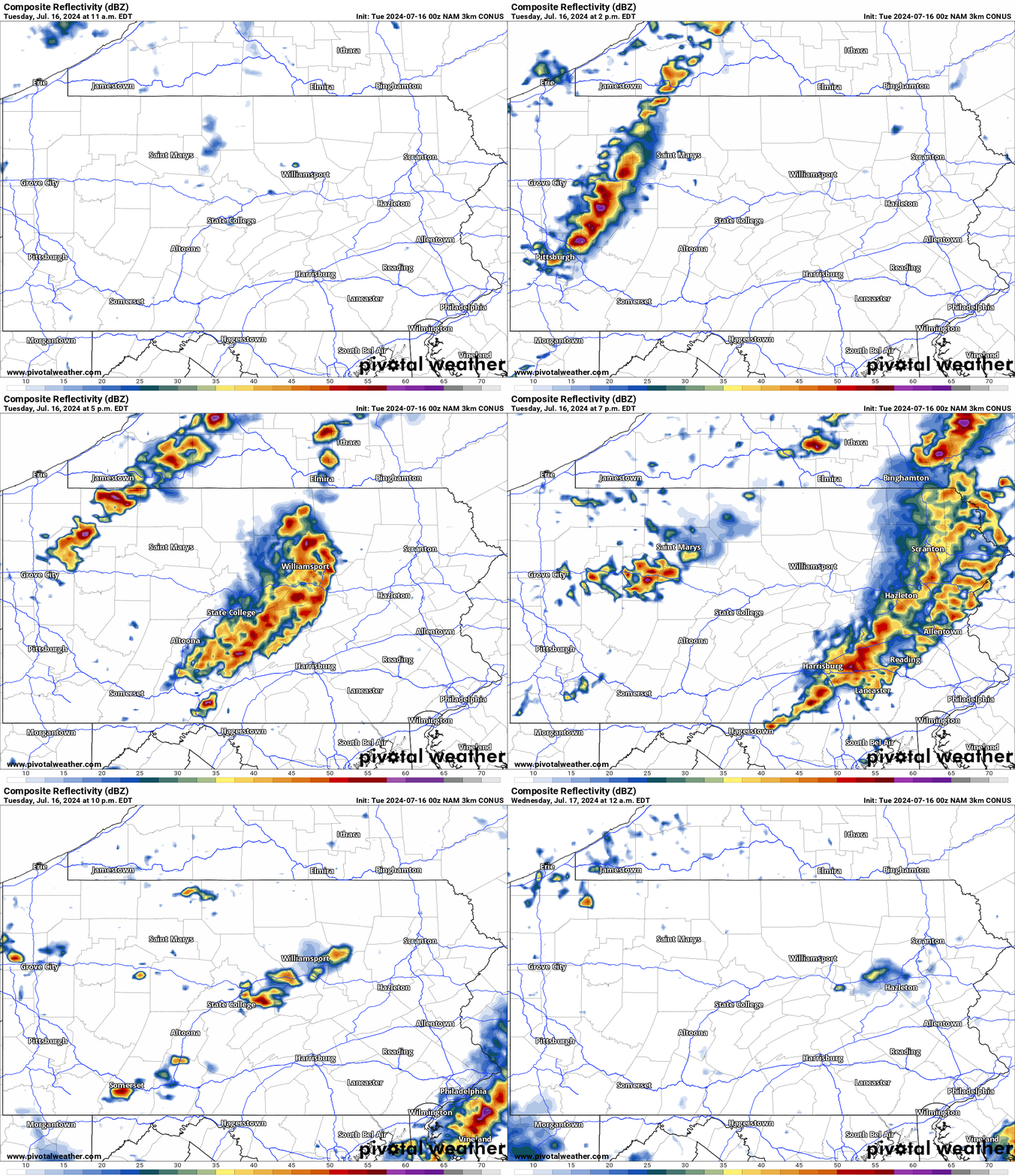
Hi-Res NAM Future Radar Valid through Tonight:
The Hi-Res NAM illustrates today’s severe weather potential very well. These storms today will have the potential to produce damaging winds and large hail. Stay hydrated today and keep an extra eye to the radar. You do not want to be caught driving in these storms.
Wednesday’s Weather Forecast: 8/10
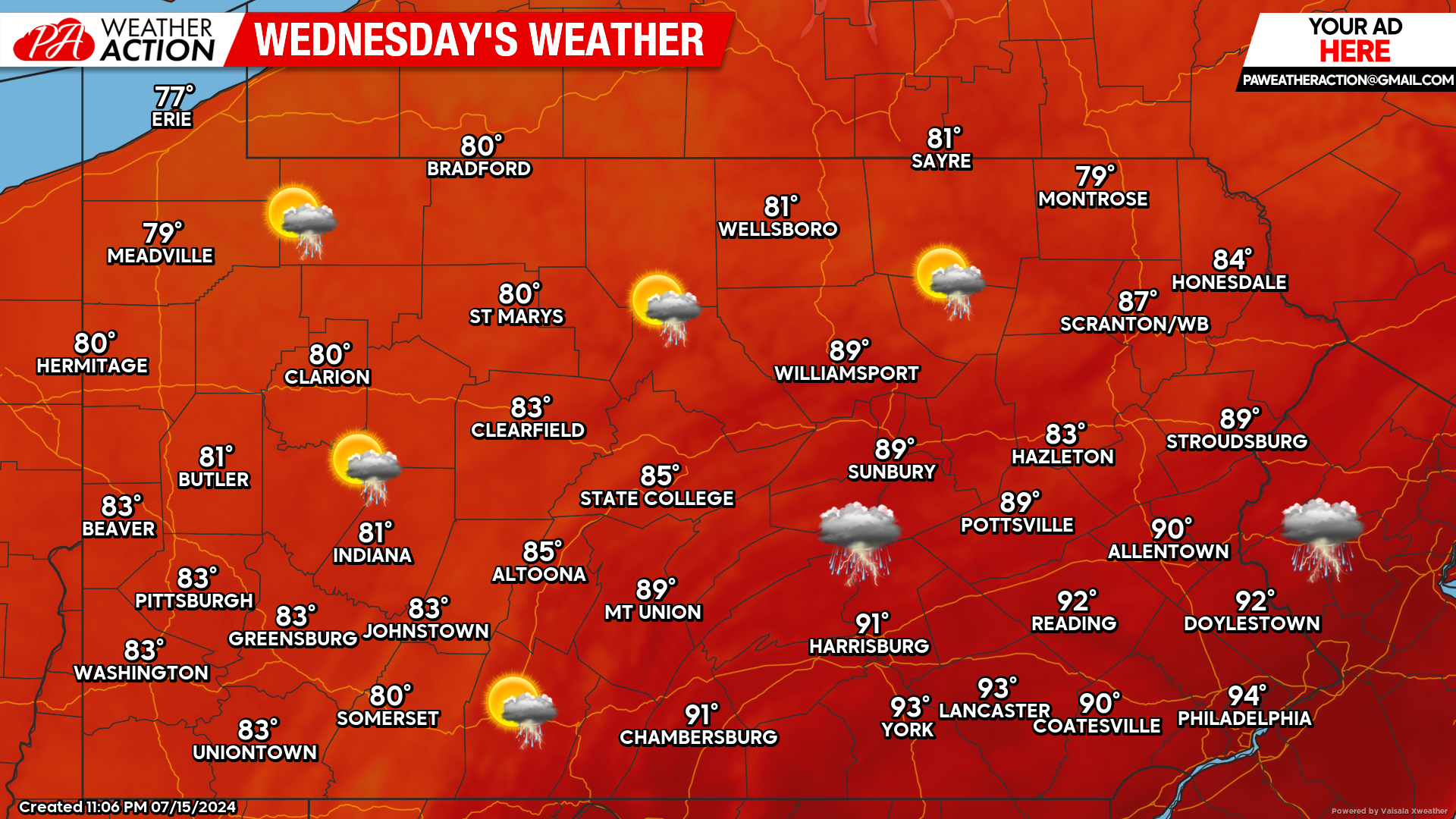
While Wednesday will still be hot across southeastern Pennsylvania, many locations will begin to feel a relief from the extreme heat. Isolated thunderstorms are possible.
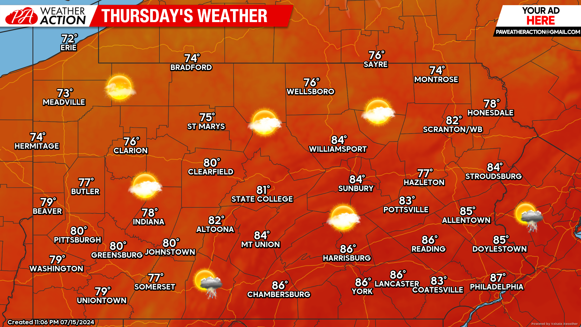
Thursday’s Weather Forecast: 9/10
Thursday will feel absolutely phenomenal across the board. An isolated thunderstorm is possible. The bigger story will be the relief from the extreme heat!


You must be logged in to post a comment.