Good morning everyone, after two straight days of severe weather including large hail, tornadoes, and damaging winds, we now focus on this active weather pattern starting Sunday.
A moderate risk of severe weather today for the Southern Plains. A slight risk for severe weather in Florida.
Large hail, damaging winds up to 80 mph, and tornadoes today in the Southern Plains. Also damaging winds and hail in Florida. Please see SPC threat map below. 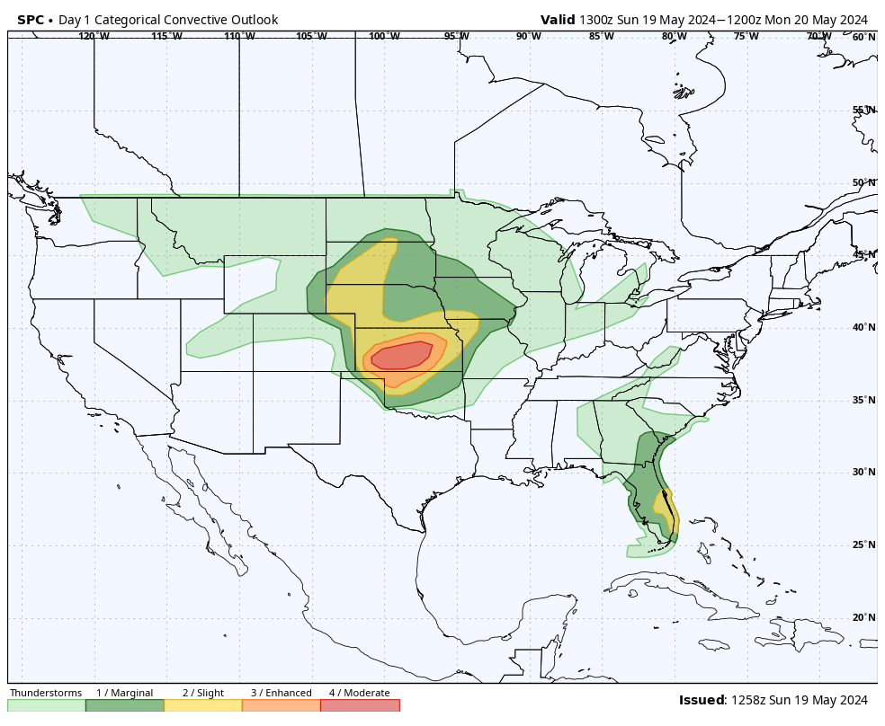
HRRR helicity track for today.
The helicity track highlights the damaging winds, hail and possible tornadoes for today in Kansas and Northern Oklahoma. Damaging winds up to 80 mph. 
HRRR future radar for today for the Southern Plains
A large weather system will move through the Southern Plains today with severe winds up to 80 mph, large hail, and tornadoes in Western and Central KS/Northern OK.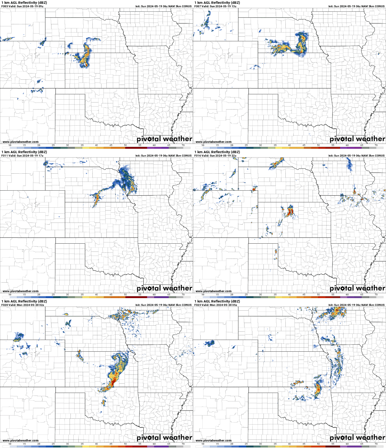
HRRR bulk shear for today
A swath of damaging winds with a potential derecho forming tonight in Western Kansas then moving East towards Central KS/Northern OK.
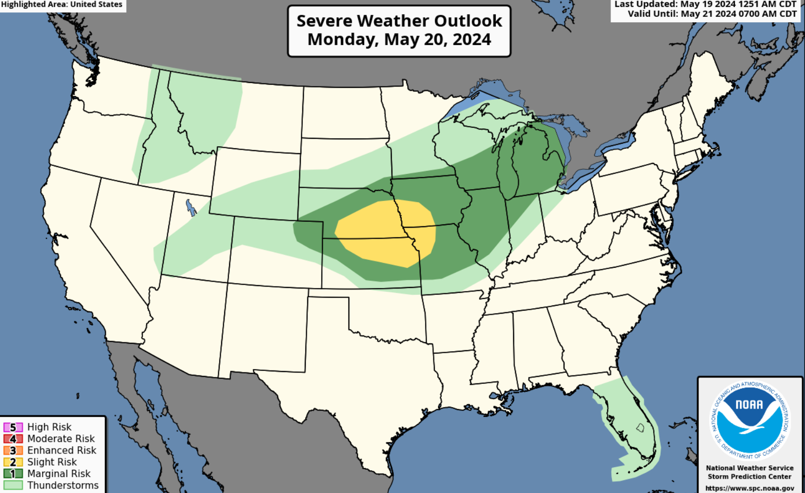
A slight risk for the Central Plains on Monday.
Large hail, damaging winds and tornadoes for the Central Plains on Monday. Please see the SPC threat map below.
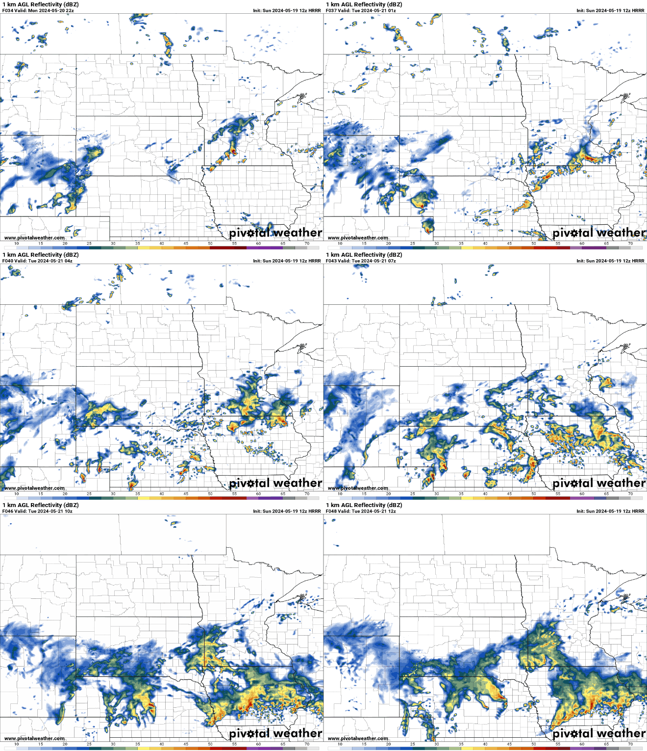
 HRRR future radar for Monday
The future radar highlights a system moving through on Monday with large hail, damaging winds and tornadoes. A storm system moves through the Central Plains from NE, Northern KS, IA and Northern MO.
A enhanced risk for severe weather on Tuesday for the plains to the upper Midwest.
Large hail, damaging winds, and tornadoes for Tuesday from Kansas to Wisconsin. Please see the SPC threat map. 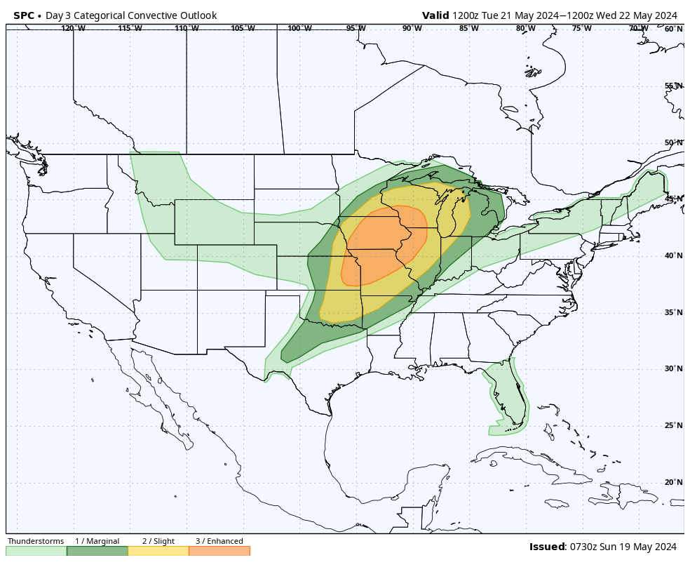
Stay tuned for updates on next week’s active weather pattern.


You must be logged in to post a comment.