
UPDATE POSTED: First Call Forecast for Significant Winter Storm Thursday AM – Friday AM
All of the ingredients are coming together for a significant Winter Storm system to impact the area Thursday into Friday. The coldest temperatures of the season are expected to line up perfectly with a coastal low pressure system that will deliver snow, ice, and rain to the area. The big “wild card” then will be an Upper Level Low system that will be trailing the coastal. The Upper Level Low will likely generate an additional round of snow, ice and rain to the area Friday morning. The areas that do receive snow from the upper level low could receive a significant amount.
With that being said, the most disruptive part of this particular storm will likely not be the accumulating snow, instead, the amount of freezing rain and sleet expected. Here is a look at the future radar using the GFS valid for 1:00 PM Thursday: 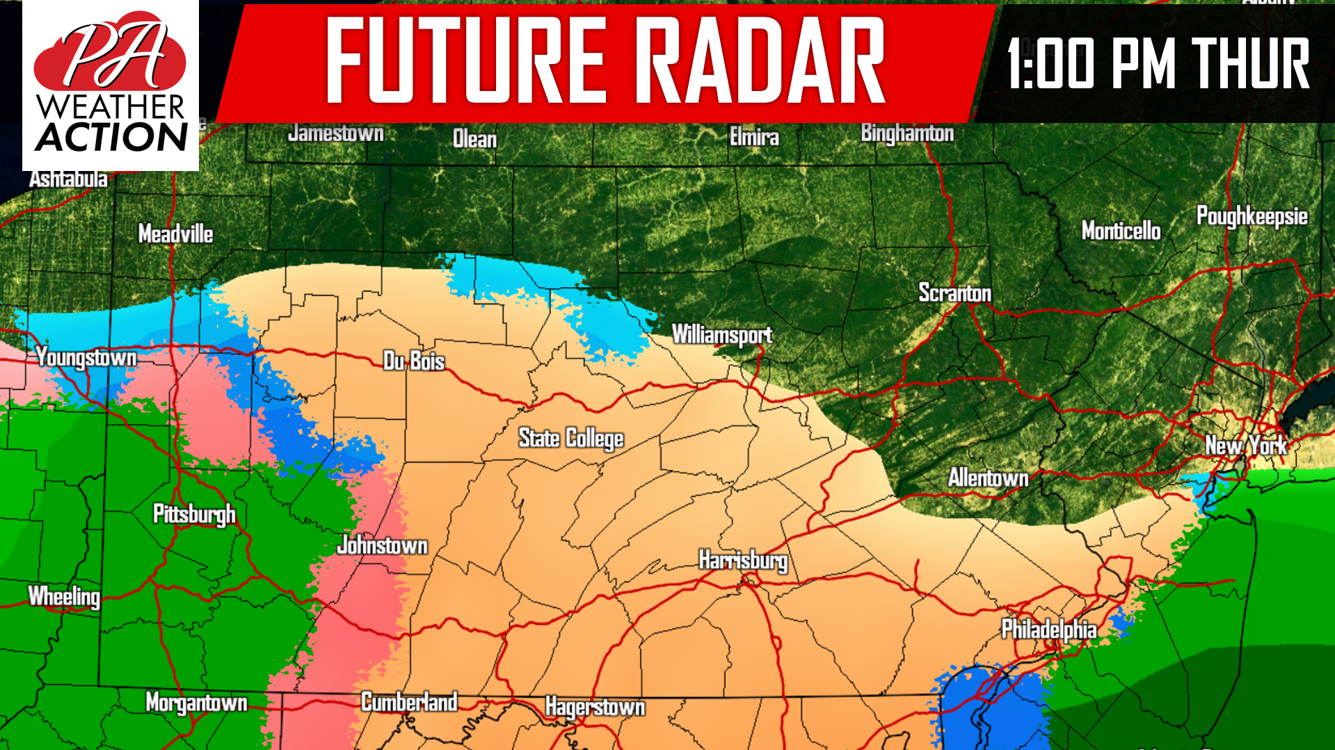
The storm may begin as a brief period of snow for many of us, changing over to a wintry mix. The GFS is in agreement with other model data suggesting a prolonged period of sleet and freezing rain for a widespread area Thursday and Thursday night. High temperatures Thursday will struggle to reach the middle 30s in most locations with the exception being extreme Southwest PA and Southeast PA.
As we take the future radar out to 7:00 PM Thursday night, sleet and freezing rain will begin change to snow in Western PA as upper levels begin to cool off and the precipitation begins to intensify for some areas, while other areas hang onto the sleet and freezing rain: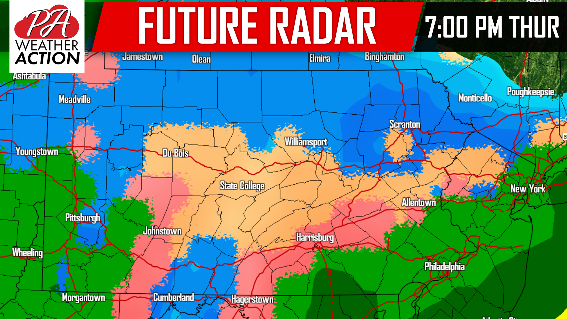
By early Friday Morning, the Upper Level Low we previously mentioned will begin to take over. This will help cool the column and turn many areas back over to snow for a prolonged period Friday Morning: 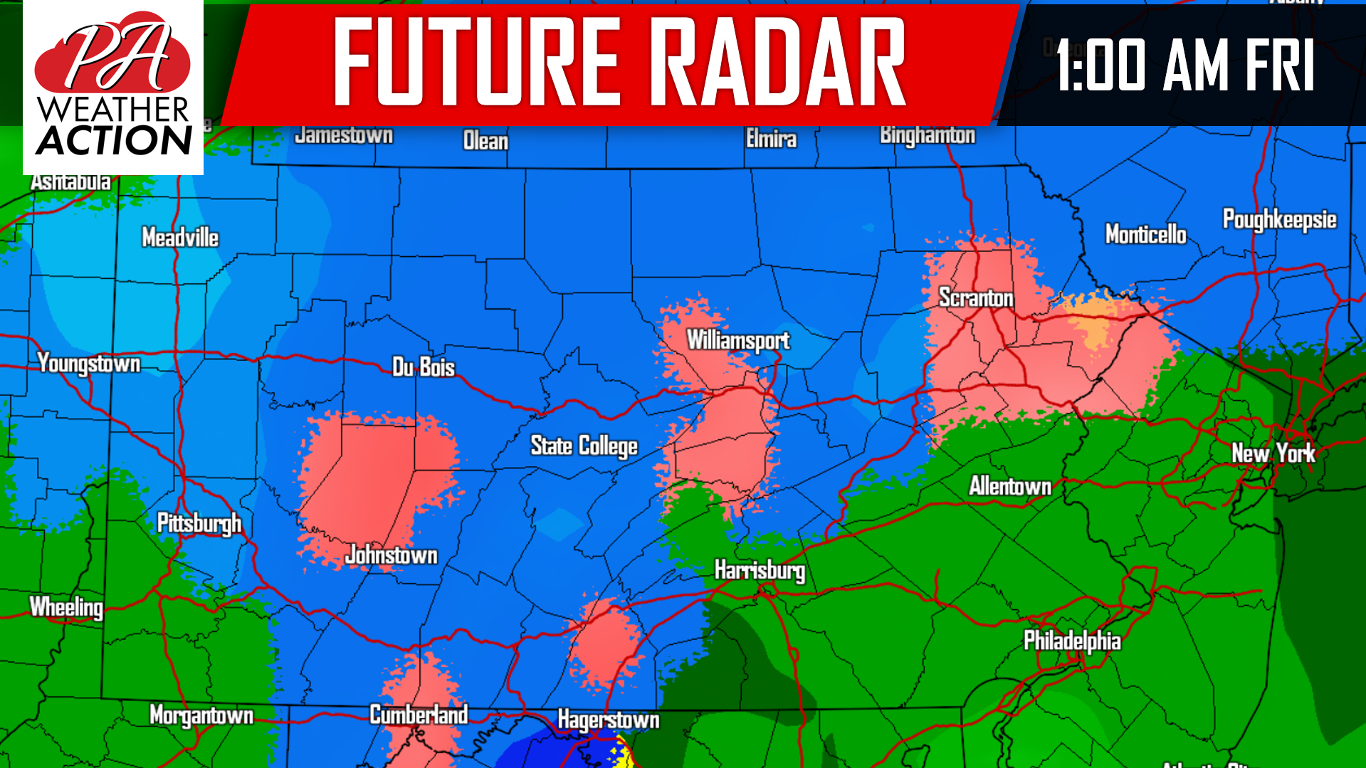
We do anticipate that the precipitation will begin to taper off after the mid-morning hours Friday. Because we are still three days away from impact, we are going to hold off until tomorrow for specific snow, sleet, and freezing rain amounts.
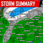
FIRST LOOK AT THURSDAY INTO FRIDAY’S WINTRY MIX:
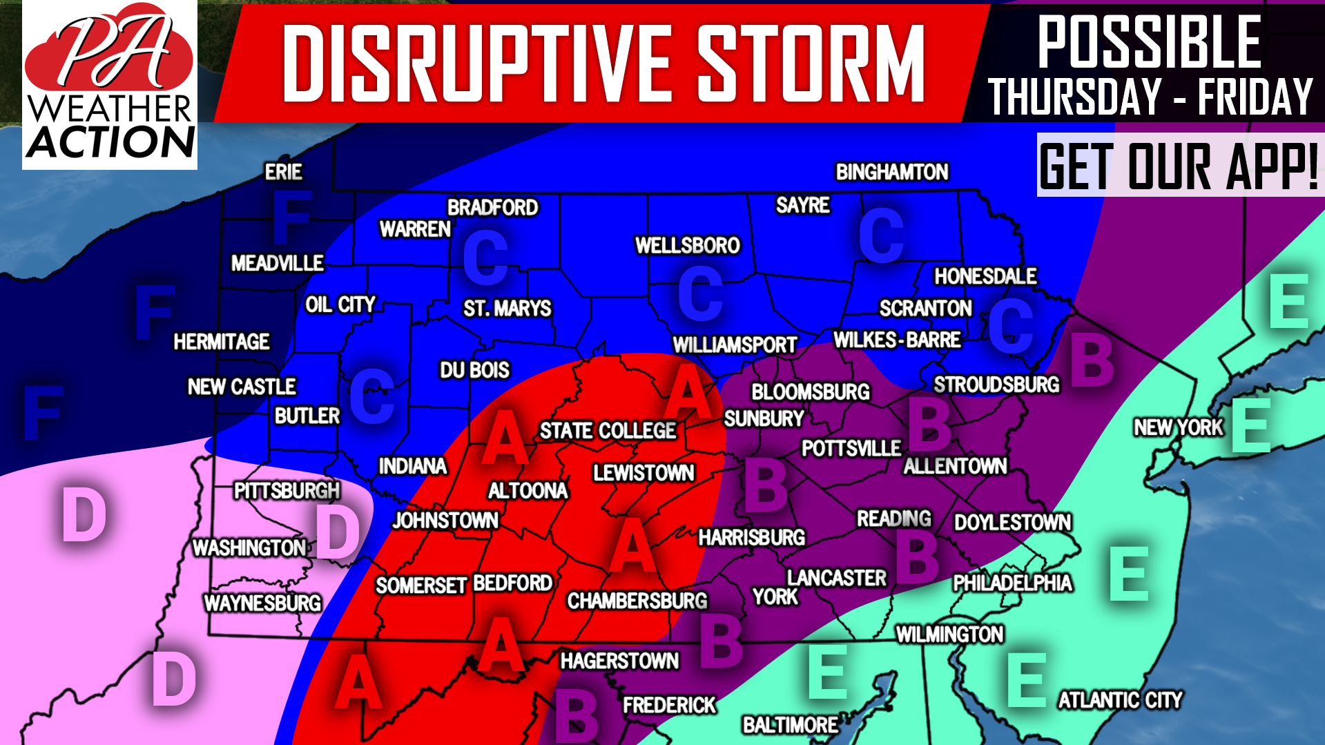
Keep in mind we are still three days out, so timing and precipitation types stated below may changed.
Area A: Snow late Thursday Morning and early afternoon will change to sleet, then freezing rain by mid-late afternoon. This area may stay below 32 degrees the entire day Thursday, potentially leading to significant ice accumulations. Freezing rain will then change back over to snow after 12 AM Friday. Snow will continue into Friday morning before ending by around noon Friday. Travel disruptions are looking likely, stay tuned.
Area B: A brief period of snow late Thursday Morning and early-mid afternoon will change over to sleet and freezing rain for a few hours, until likely changing to plain rain by around 8-10 PM Thursday. This area may then change back over to snow between 3-5 AM Friday, continuing until around noon Friday. Travel disruptions are likely when frozen precipitation is falling.
Area C: Snow Thursday Afternoon may switch to sleet or freezing rain by late evening. This wintry mix will then likely change back over to snow from west to east early Friday Morning. We are expecting this area to stay below 32 degrees for the entire duration of the storm, potentially leading to significant travel impacts.
Area D: A brief period of snow late Thursday Morning-early afternoon will likely change to freezing rain late Thursday afternoon, then plain rain by the evening. However, locations on the northern edge of this area may stay below 32 degrees the entire day, leading to a potentially long period of freezing rain. This area will then likely change back over to snow by 2 AM Friday, continuing into the mid-morning Friday. Travel disruptions are certainly possible, stay tuned.
Area E: A brief period of snow late Thursday Morning-early afternoon will likely change to sleet, then plain rain by late afternoon or early evening. Rain is then expected until early Friday Afternoon.
Area F: Freezing rain is likely to begin in this area by late afternoon or early Thursday Evening. Freezing rain will continue until about 1-3 AM Friday, before changing to snow which should continue until just after sunrise.
As you may be able to tell, this storm is complicated to say the least. Be sure to stay tuned for our First Call Forecast on Tuesday by liking our facebook page (Click Here), and downloading our app (Click Here).
Share this article with your friends and family using the button below, a storm like this does not happen often here in PA in November!
Consider supporting us and FL Hurricane Relief by viewing our brand new shop! >>> PA Weather Action Shop Link
You must be logged in to post a comment.