
An area of low pressure along the coast will bring showers and thunderstorms mainly across eastern Pennsylvania as we head into the afternoon and evening hours. We will begin to notice an increase in cloud coverage from the south as the low pressure system approaches the area:

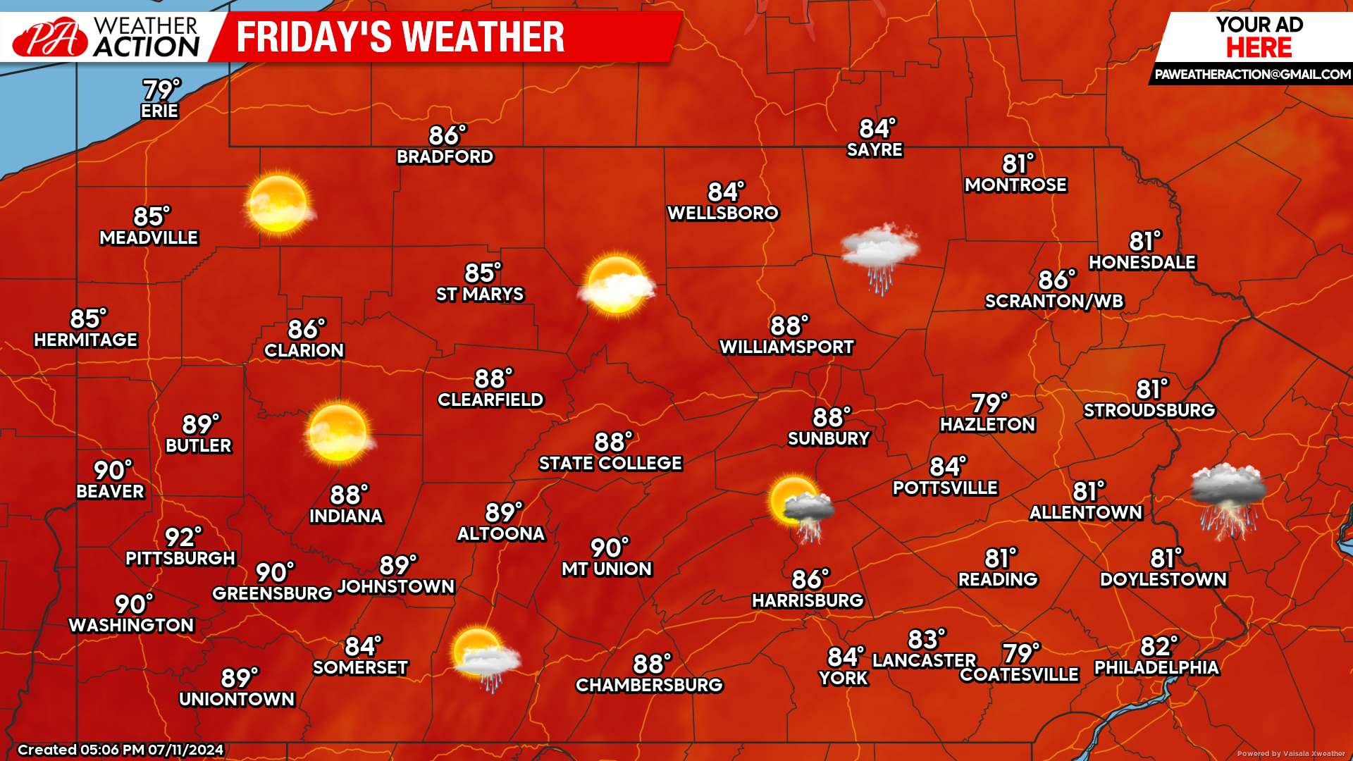
Today’s Weather Forecast: 6/10
Today’s weather rating will be strongly decided where you live. Across the western half of the state, beautiful sunny skies are expected with temperatures generally in the 80s, with some locations reaching the lower 90s. The eastern half of the state will have to deal with showers and thunderstorms approaching from the south as an area of low pressure moves up the coast.
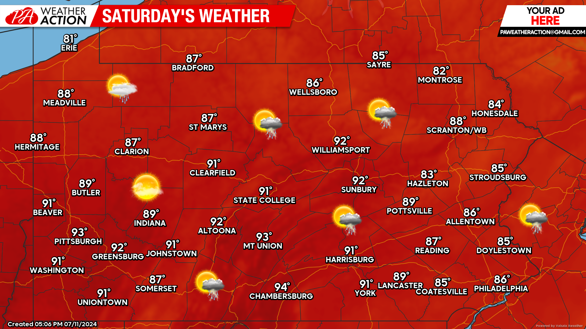
Saturday’s Weather Forecast: 8/10
Saturday will feature a chance for an isolated shower or thunderstorm. The bigger story will once again be the heat, with many towns and cities soaring into the lower 90s.
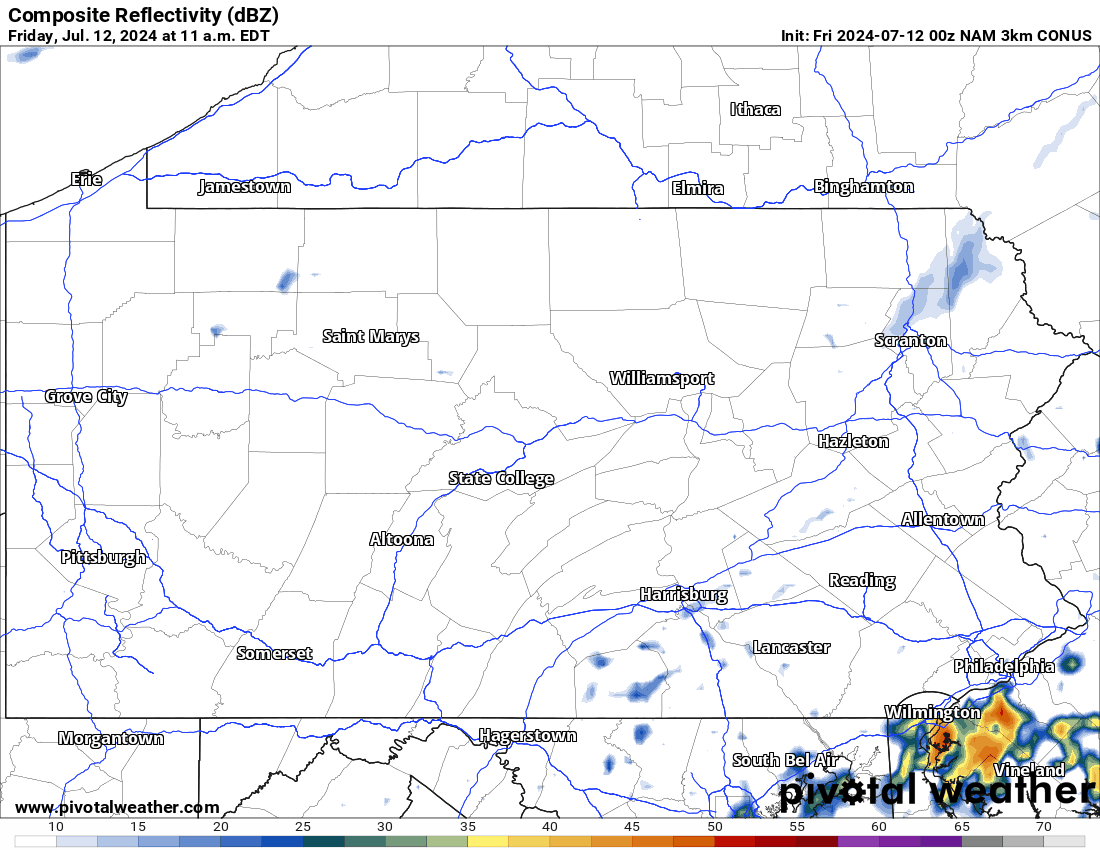
Hi-Res NAM Future Radar Valid Through 2:00 PM Saturday:
Below is a look at the latest Hi-Res NAM future radar valid through early Saturday afternoon. This model does a phenomenal job illustrating that the bulk of the rain we are expecting will be concentrated over eastern Pennsylvania. Showers and thunderstorms will linger into the morning hours Saturday. Use the top left of the graphic below for time reference:
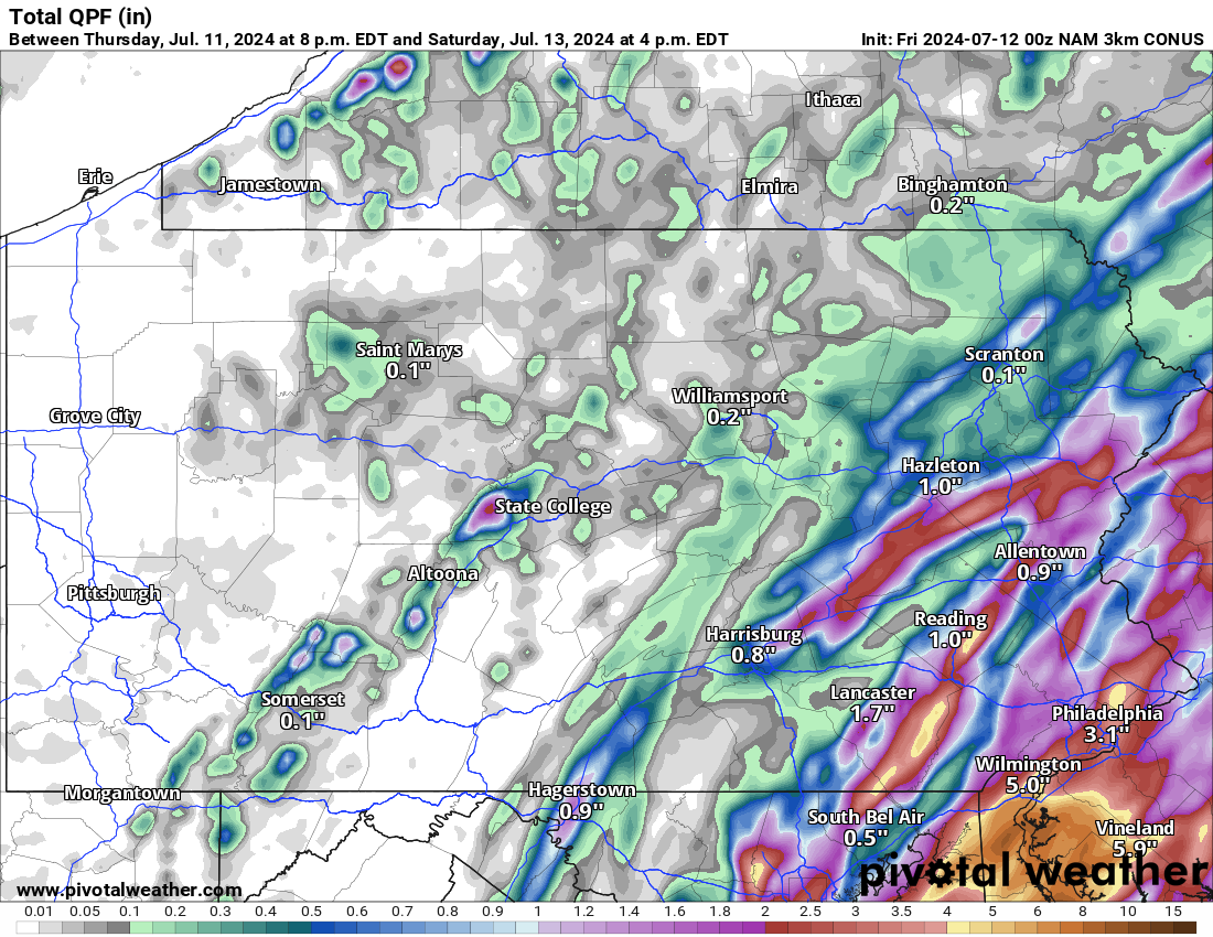
Hi-Res NAM Projected Rainfall Totals Through Saturday Afternoon:
Please note this is not an official forecast. However, below is a look at the Hi-Res NAM projected rainfall totals through early Saturday afternoon. Generally speaking, the farther east you live, the more rain you are likely to see. Isolated locations will have the potential to pick up over an inch of rainfall.
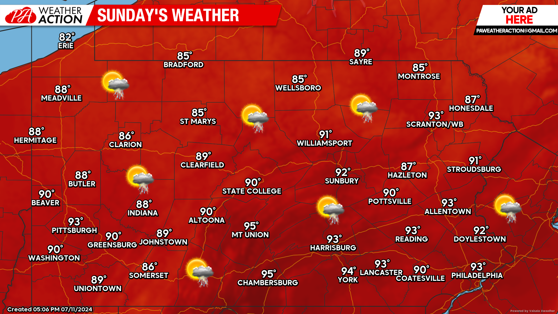
Sunday’s Weather Forecast: 7/10
Sunday will be the hottest of the next three days. Many areas will reach the lower to middle 90s with the chance for a scattered thunderstorm or two.

You must be logged in to post a comment.