Please view the article linked below for our updated forecast for this storm, which includes revised snowfall totals.
Final Call Snowfall Forecast for Thursday Evening – Friday’s Early Winter Storm in PA
Just weeks ago we were wondering where true fall weather was, as temperatures were in the 80s and it seemed like we were on tap for another lackluster winter. But as we know here in Pennsylvania, seasons can flip on a dime in November. And in fact, temperatures in November have no bearing on how the following winter will go.
Any precipitation will be very beneficial with drought conditions worsening over the last few months. Rain will push in from west to east late Wednesday into Thursday morning, followed by precipitation from an upper level low that will be nearly stationary Thursday night into Friday.
The Start of a More Active Pattern
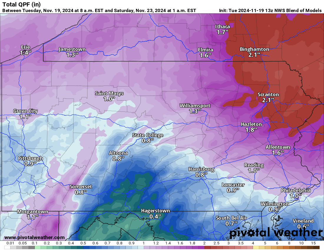
That second low pressure will be responsible for the snowfall potential. Total precipitation through Saturday looks to be at least half-inch in South Central PA to over 2″ in Northeast PA.
This will finally mark the beginning of a wetter and colder pattern heading into Thanksgiving and early December. Below is a look at the total precipitation forecast through Saturday. This is not the snowfall forecast.
Potential Winter Storm Timing
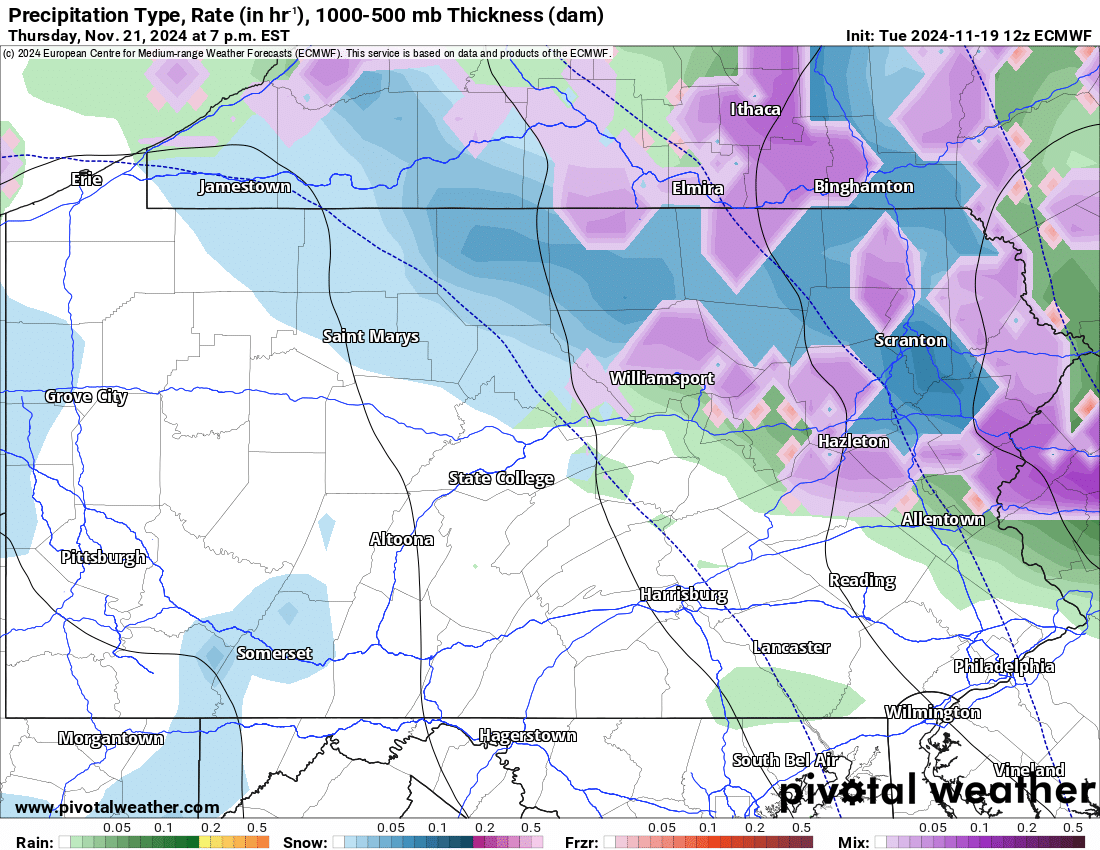
This type of early season storm with an upper level low is notoriously difficult to predict, so be aware of changes to the forecast in the coming days. Rain may begin changing to snow above 2000′ elevation in the Laurel Highlands and Northeast PA just before dinnertime Thursday. As we head into the evening around 7-10 PM Thursday, rain should begin changing to snow down to 1000′ elevation.
Note that the Wyoming Valley and Susquehanna Valley are both under 1000′ elevation, and will probably not changeover until early Friday morning. Here is a look at the European Model future radar for 7:00 PM Thursday evening.
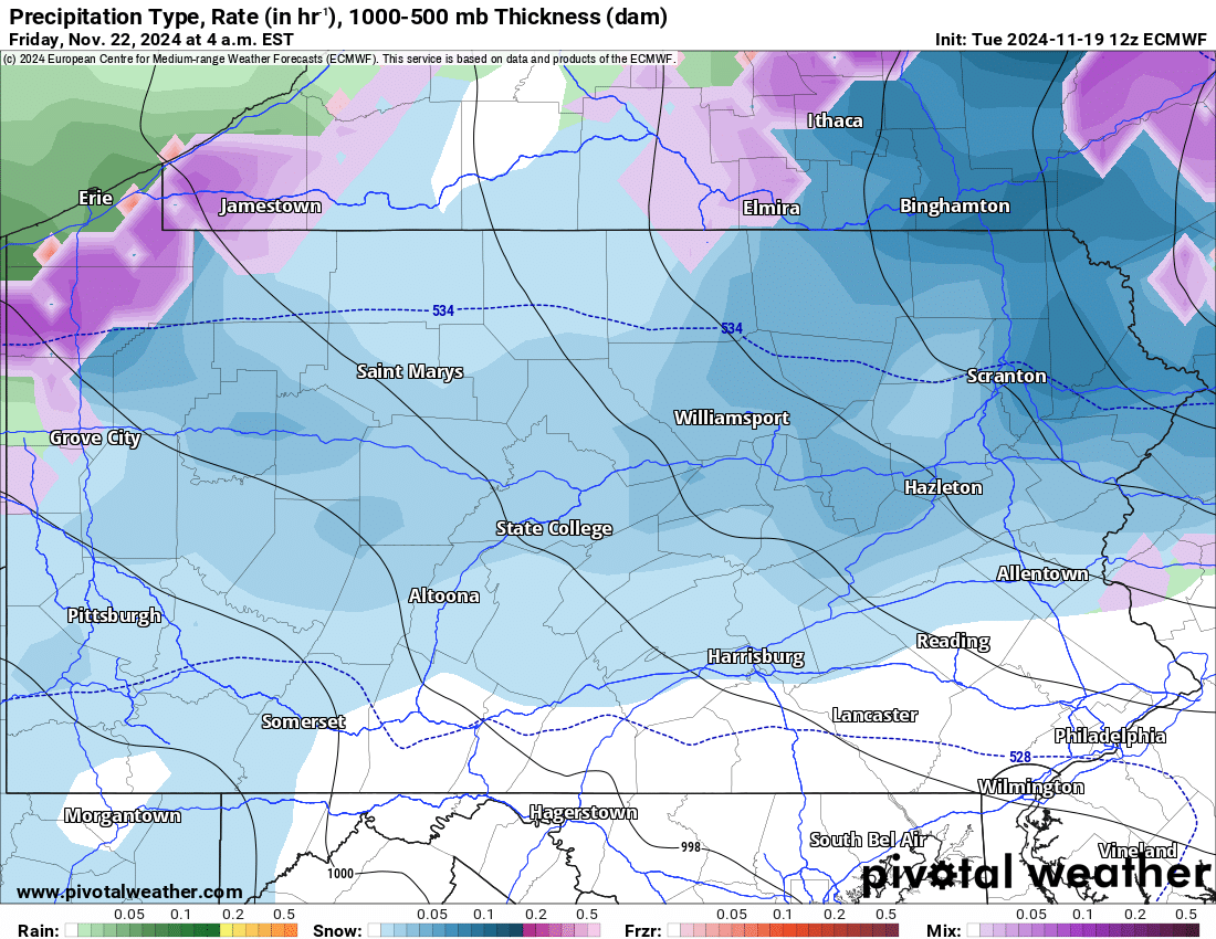
By around 2-5 AM Friday, rain should be changed over to snow down to the valley floor in the various valleys across the state within 50 miles of I-80. Temperatures are expected to be above freezing, around 33-34 in the valleys while snow is falling. Whereas in the mountains above 1500′ elevation, temperatures are likely to be below freezing, around 31-32.
With that said, if snow falls heavy enough, particularly in Northeast PA, snow may accumulation on paved surfaces even in the valleys, along with the mountains. Below is Euro model future radar for 4:00 AM Friday morning.
Snow is modeled to continue through Friday morning before switching to rain by the early afternoon Friday in most low elevations.
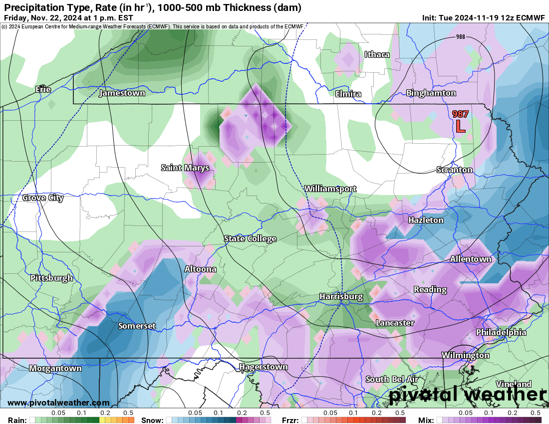
However, areas closest to the upper level low, like the Poconos and potentially Lehigh Valley, may continue to see snow around this time. The Laurel Highlands should also continue snowing around lunchtime Friday. Here is the Euro model future radar for 1:00 PM Friday.
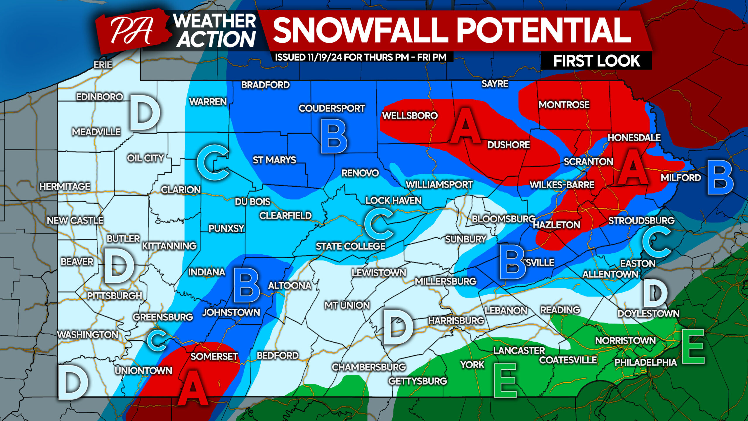
FIRST LOOK AT SNOWFALL POTENTIAL THURSDAY EVENING – FRIDAY AFTERNOON
Area A: Snowfall potential of 4 – 8″. Snow accumulation on roadways is likely.
Area B: Snowfall potential of 2 – 4″. Snow accumulation on untreated roadways is likely.
Area C: Snowfall potential of 1 – 2″. Snow accumulation on grass is likely, whereas it is unlikely on roadways.
Area D: Snowfall potential of up to 1″ on grass.
Area E: All rain expected from start to finish.
We will have another update on Wednesday evening, stay tuned!
Don’t forget to share this forecast with friends and family who may be impacted!


You must be logged in to post a comment.