
A heatwave is defined as 3 consecutive days or more with high temperatures at or over 90F. And it is already starting here in the Carolinas. We are starting a multi-day streak with highs in the 90s, and even upper 90s in SC. The center of the heat dome will be in the Northeast, but that also means that 90s will prevail on the bottom edge, which is where we are.
GEARING UP TO GET HOT
Many locations across NC and SC will see highs over 90 on Sunday, however some areas may not reach that high. The humidity is not yet super terrible, and it might not get bad until after the official start of Summer. That is June 21st.

MONDAY
Monday isn’t looking too shabby either, and another good pool day will be on tap. It looks like typical June heat in the South. Nothing unusual.

TUESDAY
Tuesday could be a copy and paste day of Monday, however a bit warmer. We will likely be at or over 90F. The beaches will be the coolest spots, wherever there is a seabreeze. If not, then it’ll be just as hot as inland, if not hotter.

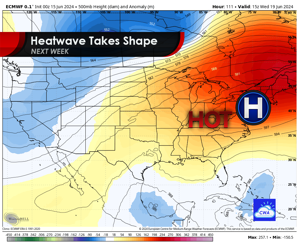
WEDNESDAY – FRIDAY
Next week looks like we will hover right around 90, with some folks going higher to perhaps 93. Most of the heat will be up in Virginia and the Northeast, where the center of the heat dome will be located. There will not be any excessive heat for the Carolinas during this timeframe, although it could feel like it.
SATURDAY
Now we start to see the true effects of a heatwave after the official start of Summer which is Friday. Below is the best guess for high temps on Saturday the 22nd, and it looks sweltering. Widespread mid 90s are possible.

SUNDAY
Sunday also looks just as miserable, with continued highs in the mid 90s. This could be signs of a hot summer, since a heatwave will already be in place as we begin official summer.

The issue is that 90s are expected beyond next week, which could make for an extended heatwave. This is concerning, since it’s only the beginning of Summer. If this pattern holds, then we could see a very hot summer. The only good thing from this is, ridges of high pressure keep hurricanes away, since hurricanes can not “penetrate” an upper-ridge, unless there are spots of weakness in the ridge pattern.
A/C units will be humming next week, and folks are encouraged to stay inside where there is A/C, and any outdoor work should be performed in the early mornings or late evenings, when it’s not the hottest part of the day.

You must be logged in to post a comment.