
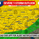
It has been several weeks since we’ve had a concern for severe thunderstorms, due to the streak of well below average temperatures. But with the new, more seasonable pattern, we expect to see more days with showers and storms. The NWS Storm Prediction Center has placed northeast PA under an Enhanced Risk, and much of the state elsewhere under a Slight Risk.
Damaging winds are the main threat, as a line of strong to severe storms is expected to sweep southeast Friday evening. The main concern for hail and isolated tornadoes are in discrete supercells that may pop up in the late afternoon and early evening. However short range model guidance suggests that threat will be northeast of us, mainly in eastern NY and southern New England.
STORM TIMING
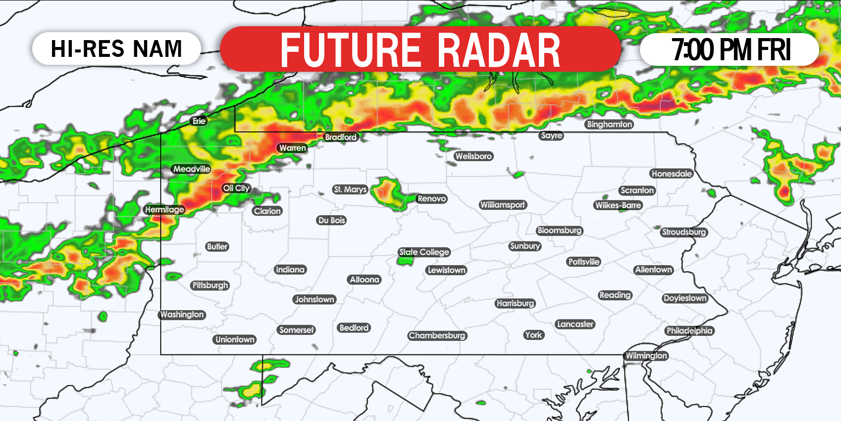
The latest Hi-Res NAM does not have much activity in PA besides the line of storms in the evening. There is still a chance for scattered, pop-up storms in the afternoon. Starting at 7:00 PM, the line of storms is modeled to be near the PA-NY border in central and eastern PA, and into northwest PA. Below is future radar for 7:00 PM Friday.
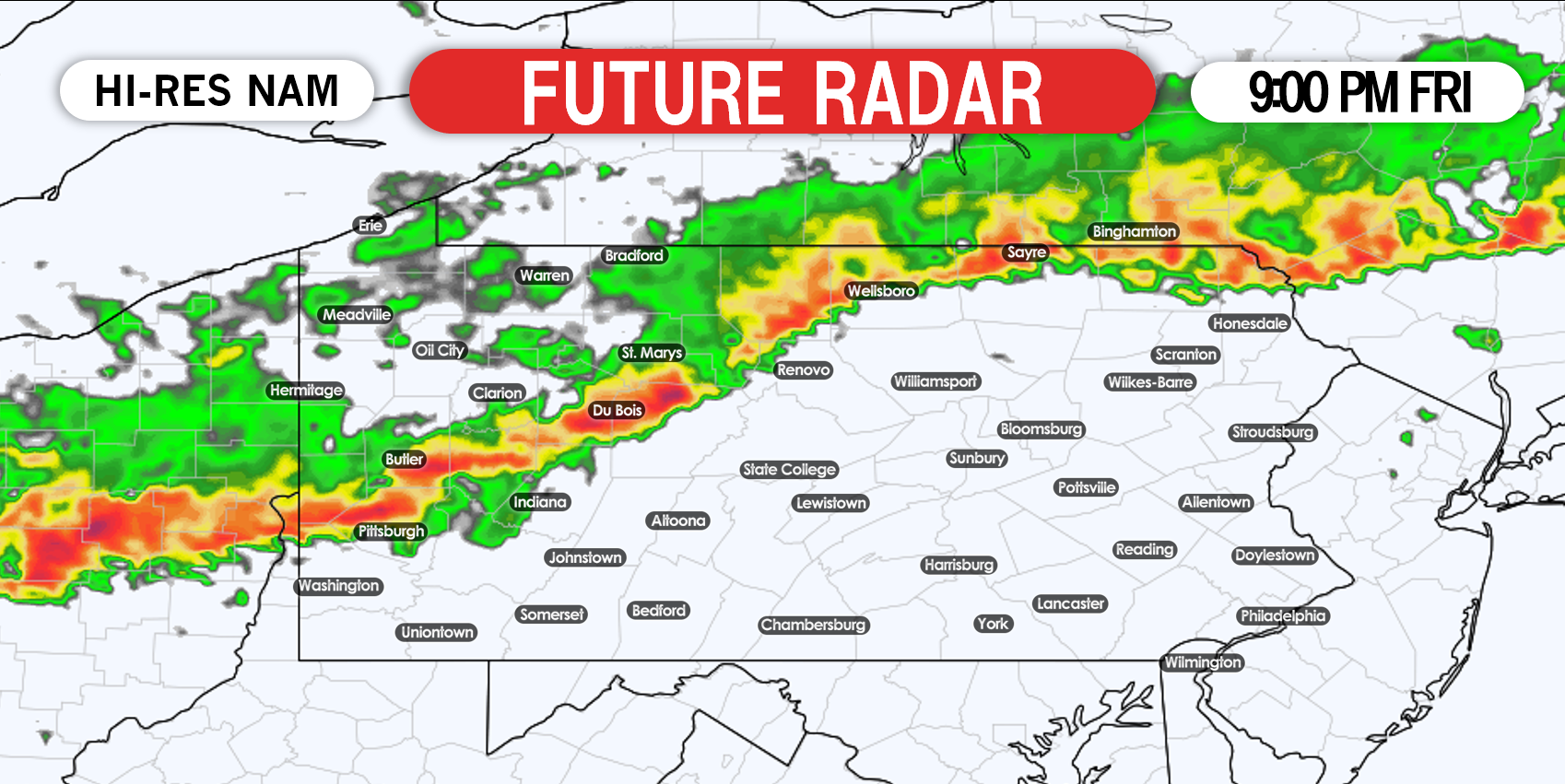
After this point in the evening is when we expect the line to really weaken, especially in central and eastern PA. It may be able to maintain similar strength near the Ohio border. Below is future radar for 11:00 PM Friday.
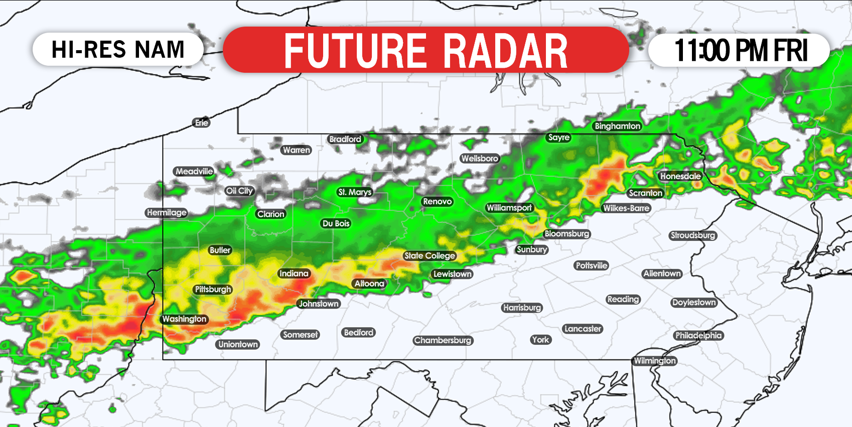
The line will likely turn into just a weakening area of moderate rain by early Saturday morning as it moves into southern PA, which explains the Marginal Risk near and south of Route 30.
SPC SEVERE THUNDERSTORM OUTLOOK FOR FRIDAY
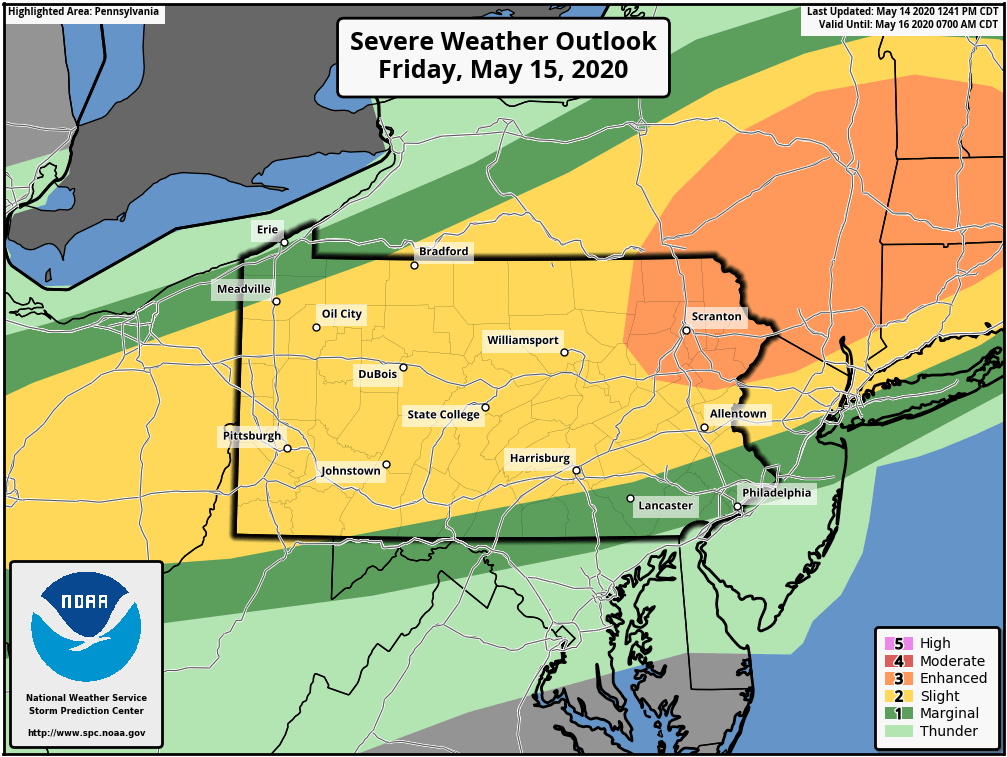
Northeast PA and into ENY and Southern New England have a greater chance of seeing more discrete supercells, as well as the line of strong to severe storms in the evening. The Slight Risk in most of PA is for pop-up storms in the afternoon. We don’t expect severe storm in most of southern PA south of Harrisburg.
We will have live radar on facebook Friday, and you can also stay updated through instant weather alert notifications and interactive radar on our app. Download it here >>> Weather Action App
Stay safe and stay tuned!
You must be logged in to post a comment.