
The Storm Prediction Center has upgraded most of PA south of i-80 to an enhanced risk for severe storms Thursday. However, the severity of the threat all depends on how long we see showers and cloudy skies hang around Thursday morning. The longer we stay cool and cloudy, the shorter of a window these storms will have to develop and strengthen.
TIMING FORECAST
UPDATED TIMING FORECAST POSTED HERE >>> THURSDAY MORNING TIMING UPDATE
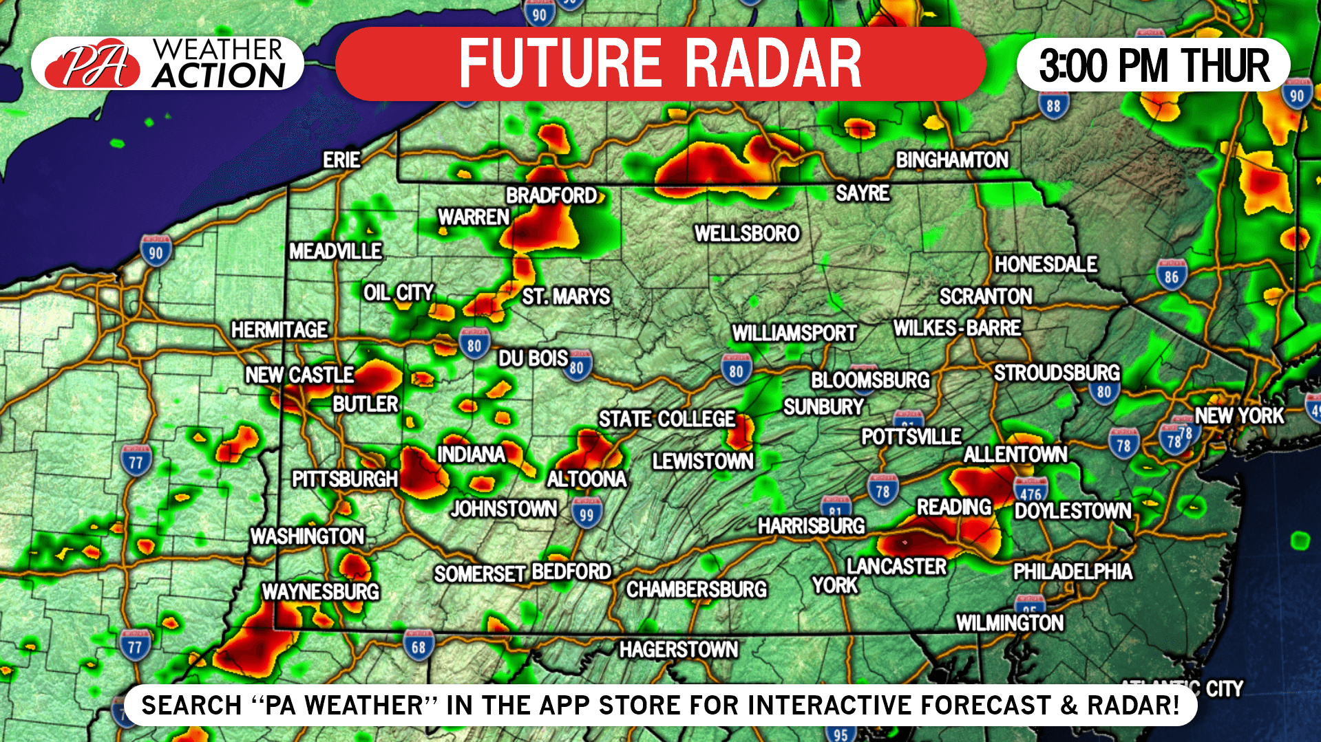
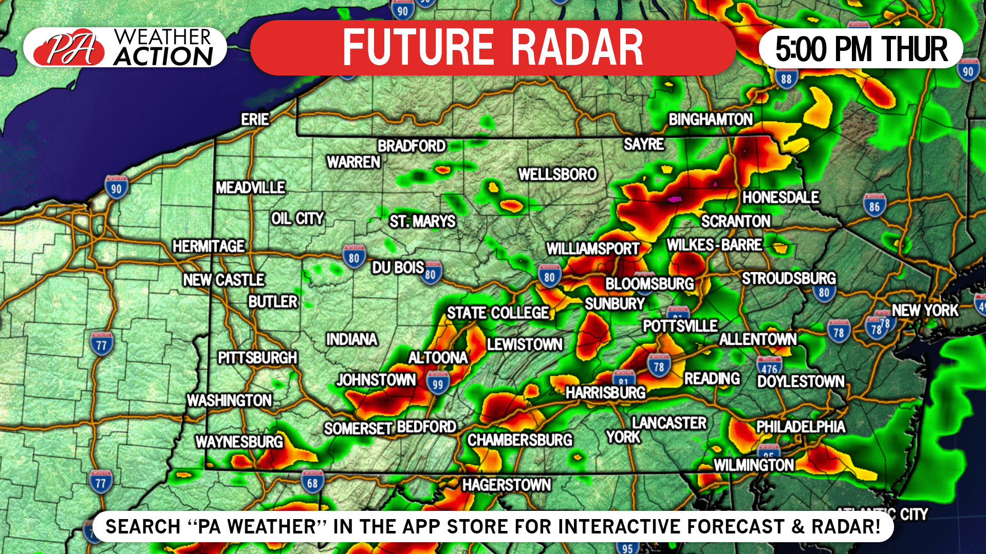
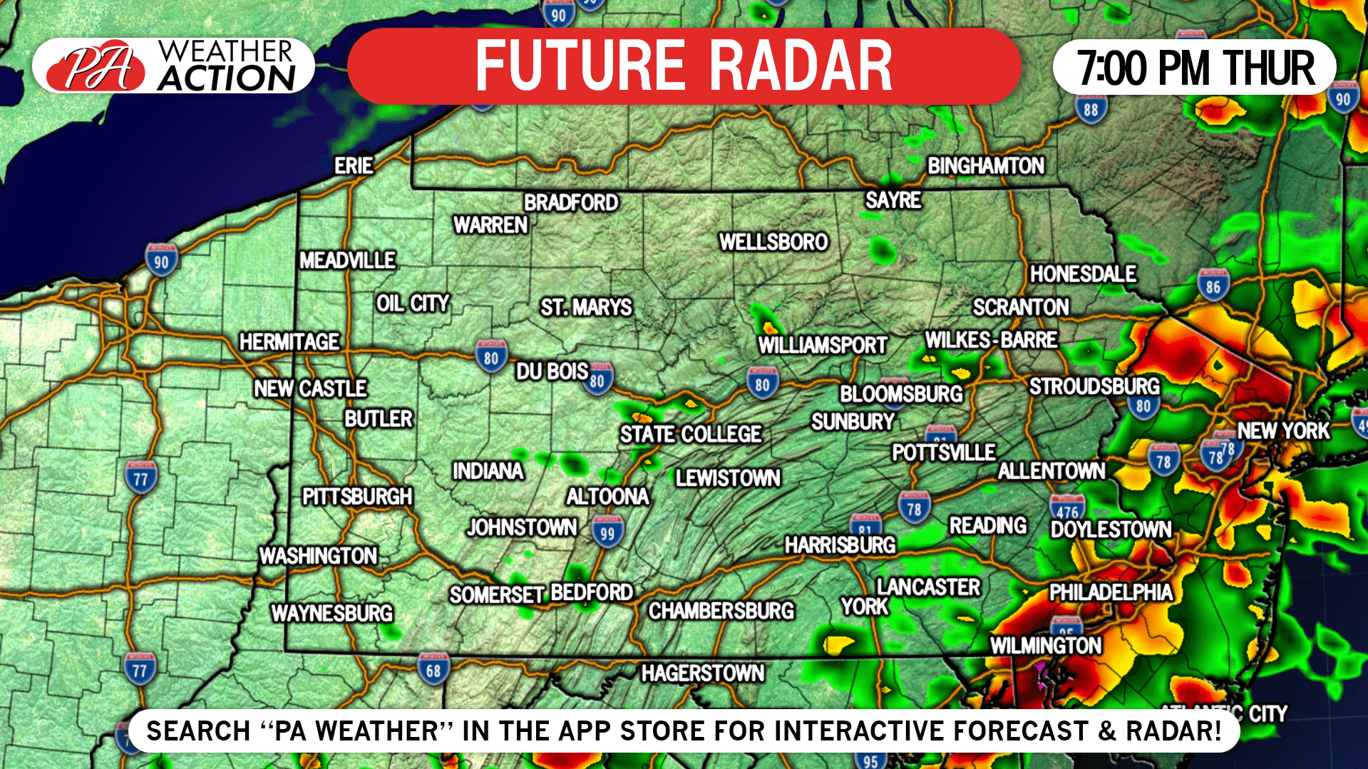
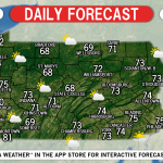
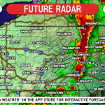
Thunderstorms will develop in the northern and western PA in the mid-afternoon. They will move southeast at around 50 MPH. This future radar assumes we will clear out earlier enough for storms to develop and strengthen.
3:00 PM Thursday: This is roughly when storms will pop-up and begin to strengthen in and around the Pittsburgh Area, as well as throughout the Appalachians in northern PA.
7:00 PM Thursday: By the evening, storms will make their way into southeast PA. We don’t expect them to lose much steam, as the storms will still benefit from a very unstable atmosphere and daytime heating. Though, the tornado threat will be lower in eastern PA compared to central parts of the state.
SPC SEVERE THUNDERSTORM OUTLOOK
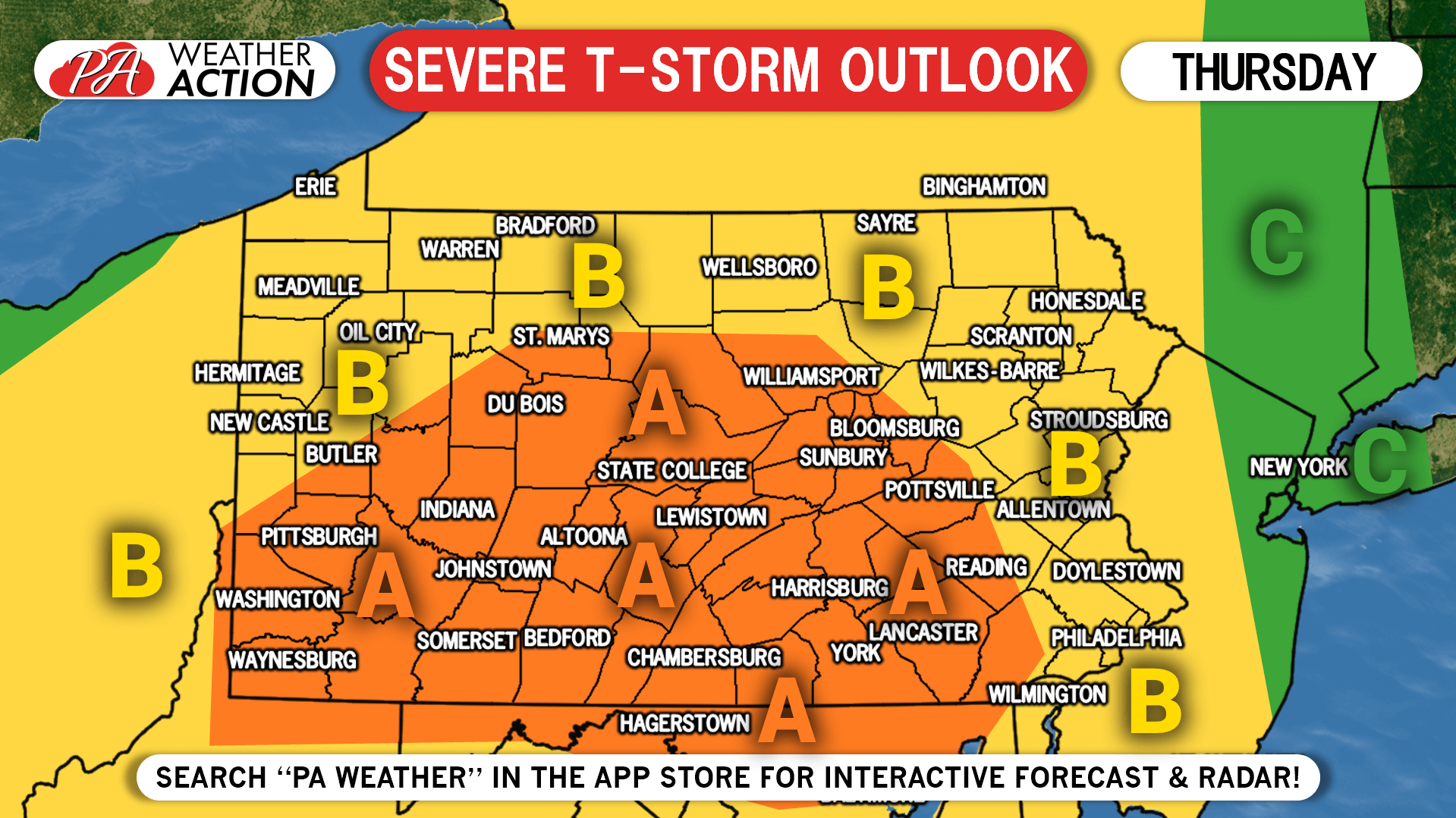
Area A: Numerous severe thunderstorms are possible in this area. Damaging winds, large hail, and isolated tornadoes are the main threats.
Area B: Scattered severe storms are possible, with damaging winds and hail being the main risks.
We will be live streaming the latest radar on our facebook page much of the day.
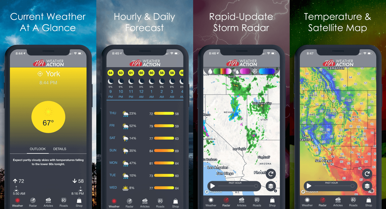
If you have not yet given our app a try, we would appreciate if you would! We have a brand new interactive radar, the latest alerts for your area, and much more. Just tap the banner below to download it from your phone’s app store!
You must be logged in to post a comment.