
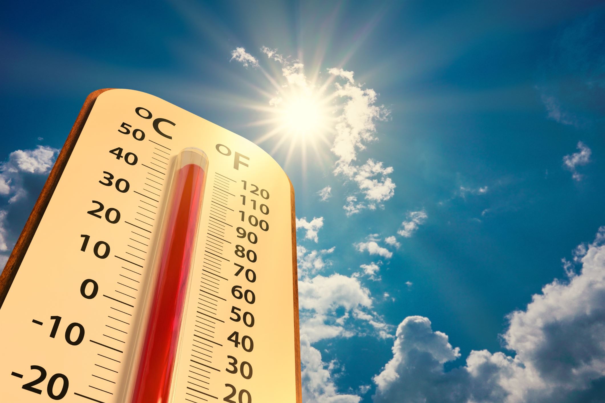
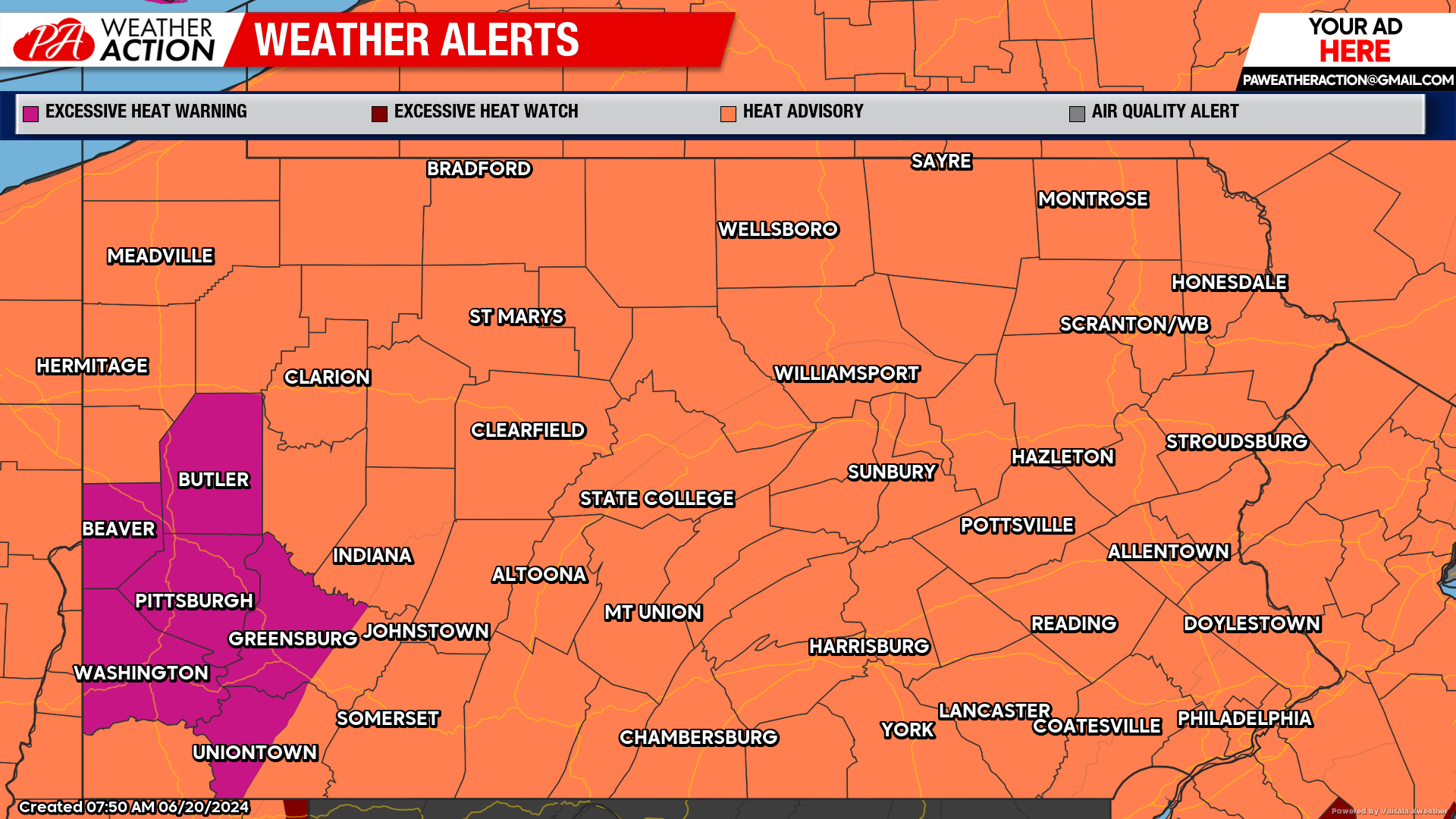
This dangerous heat wave will continue to impact the region the rest of this week and into the weekend. An Excessive Heat Warning is currently scheduled to remain in effect for the urban areas of Western PA through Saturday, with Heat Advisories continuing for the rest of the region. Air Quality Alerts are also in effect for urban areas. Slight chances for thunderstorms are possible with hazardous downburst being a possible concern.
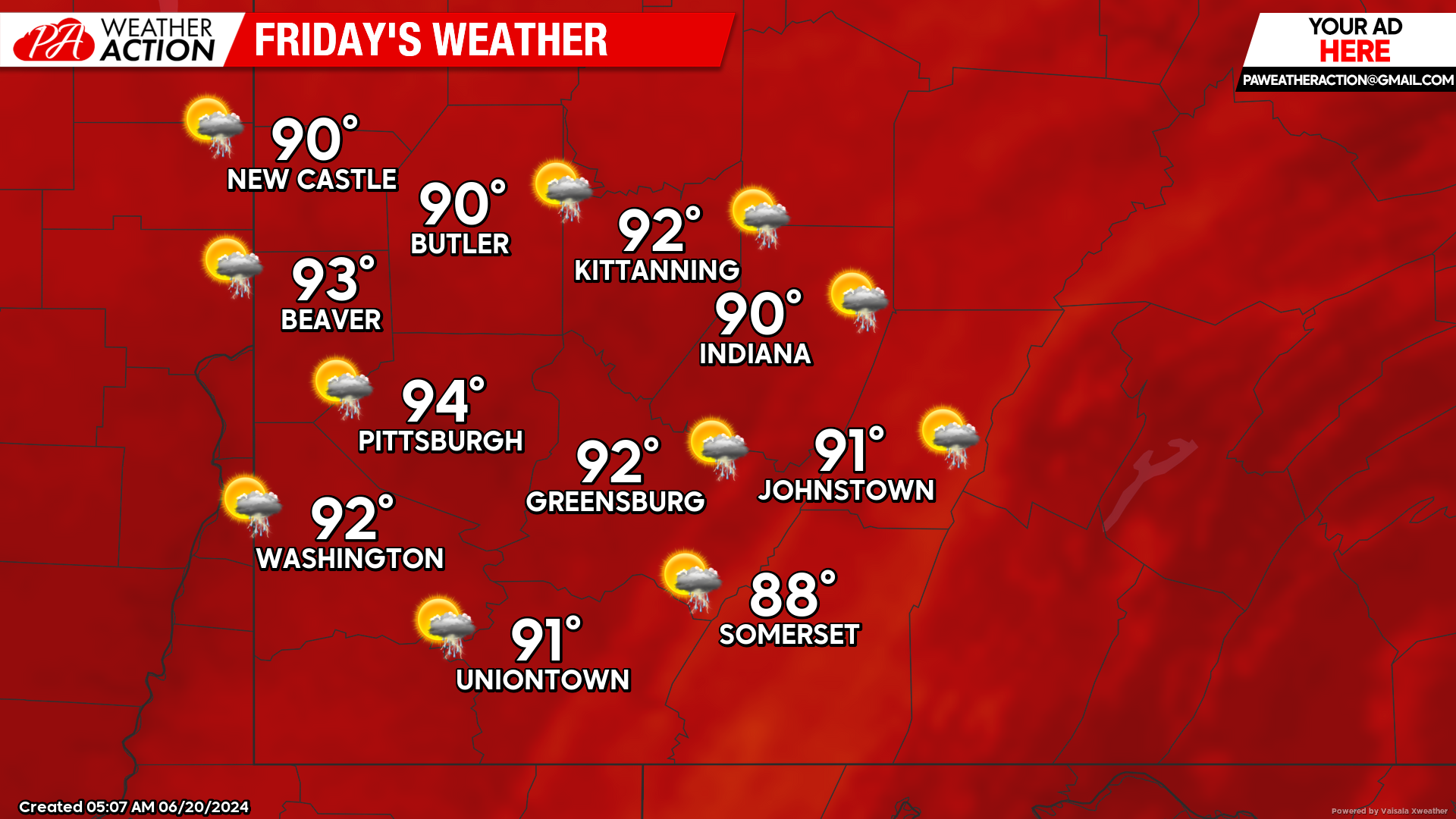
Friday
Mostly sunny and hot, a slight chance for a thunderstorm is possible throughout the day. Highs will be in the mid to low 90s, with the heat index approaching 100 degrees, lows will be in the low 70s to mid 60s.
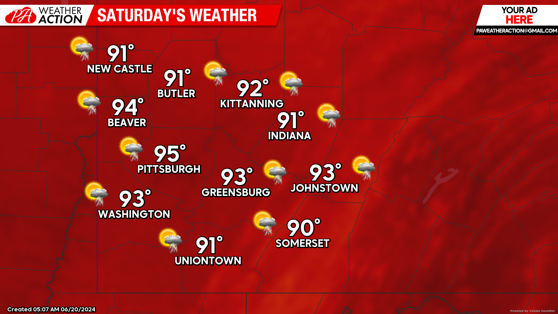
Saturday
Sunny and hot, with a slight chance for a thunderstorm in the morning and early afternoon hours. Highs will be mid to low 90s, lows will be in the mid to low 70s. Winds will be out of the West at 5 to 7 mph.
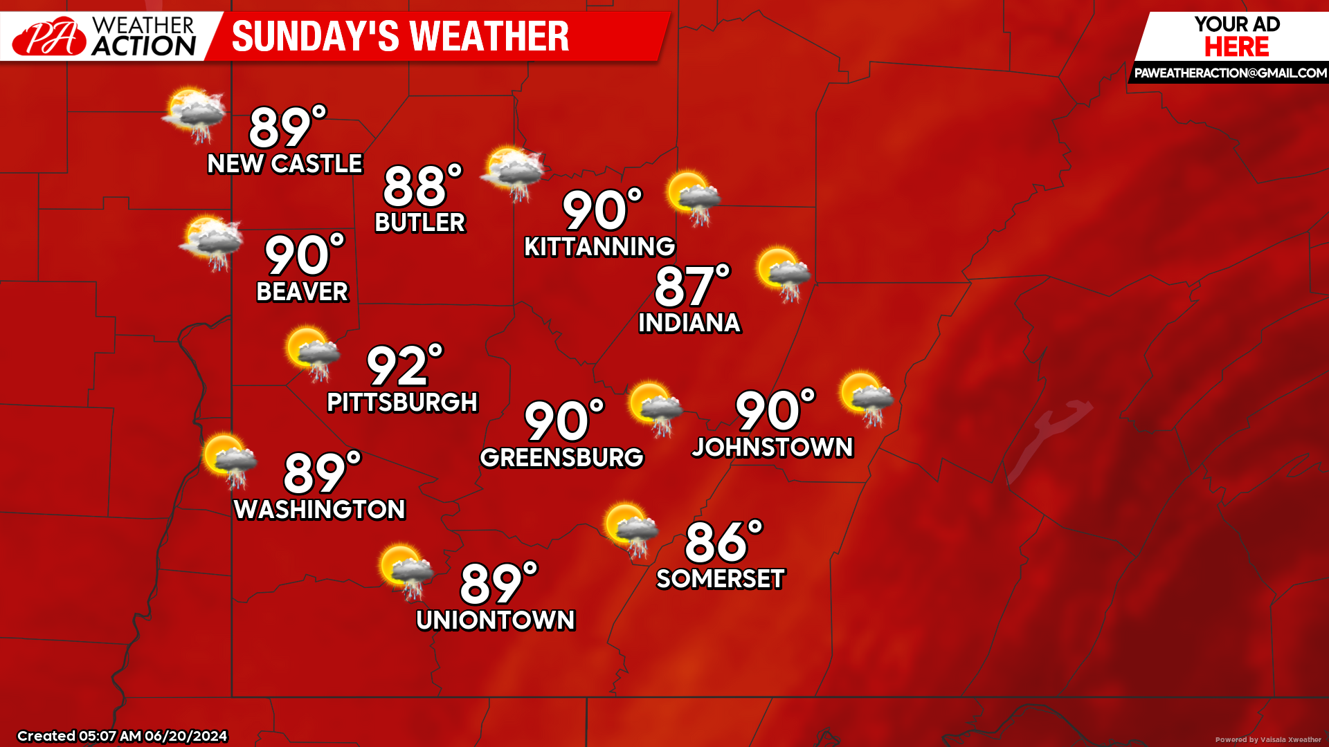
Sunday
Partly sunny and hot. Slight chance thunderstorm during the daytime hours but more likely in the evening and overnight hours. Highs will be in the low 90s to mid 80s, lows will be in the high to mid 60s.
Hot conditions are forecasted to continue with high temperatures ranging in the mid 80s to low 90s to start the week. Be weather aware and follow all suggestions to stay cool and to protect yourself from heat related illnesses. Follow PA Weather Action for more forecasts.


You must be logged in to post a comment.