
Our current system is developing over the Central part of the United States and will move into our region by tomorrow morning. The general theme for this system remains the same. Our biggest concern is not the snow totals as max snow totals will be in the 2 to 4 inch range, but for the freezing rain potential. While we are not expecting a lot of freezing rain, it only takes a little bit to cause significant issues.
Many counties across the state are under Winter Weather Advisories for tomorrow’s system. Below is the latest weather alerts maps from the National Weather Service: 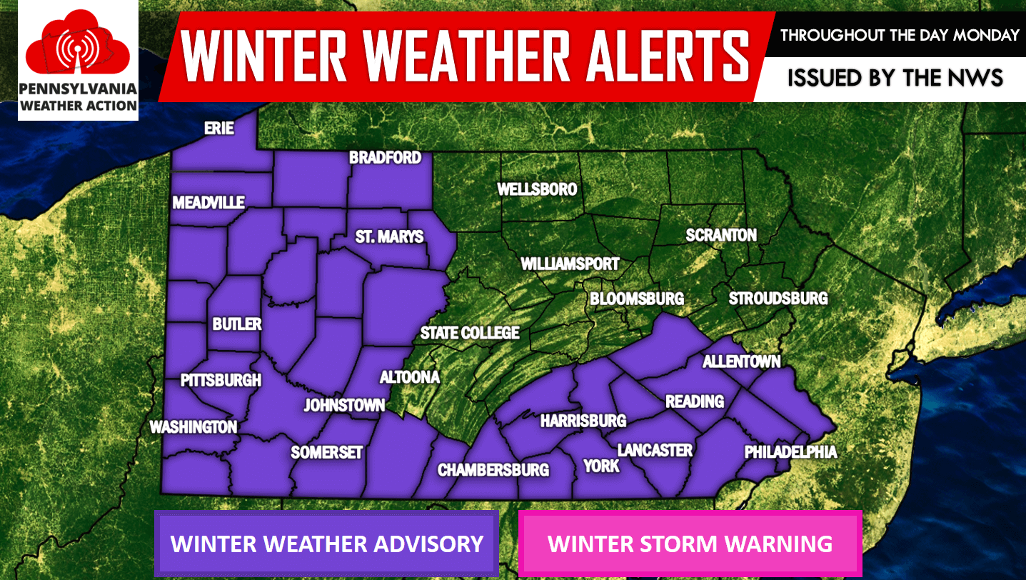
The time table for this system has moved up. We now expect the precipitation to arrive earlier than previously expected. Snow will begin to overspread Western Pennsylvania as early as 7:00 AM tomorrow morning: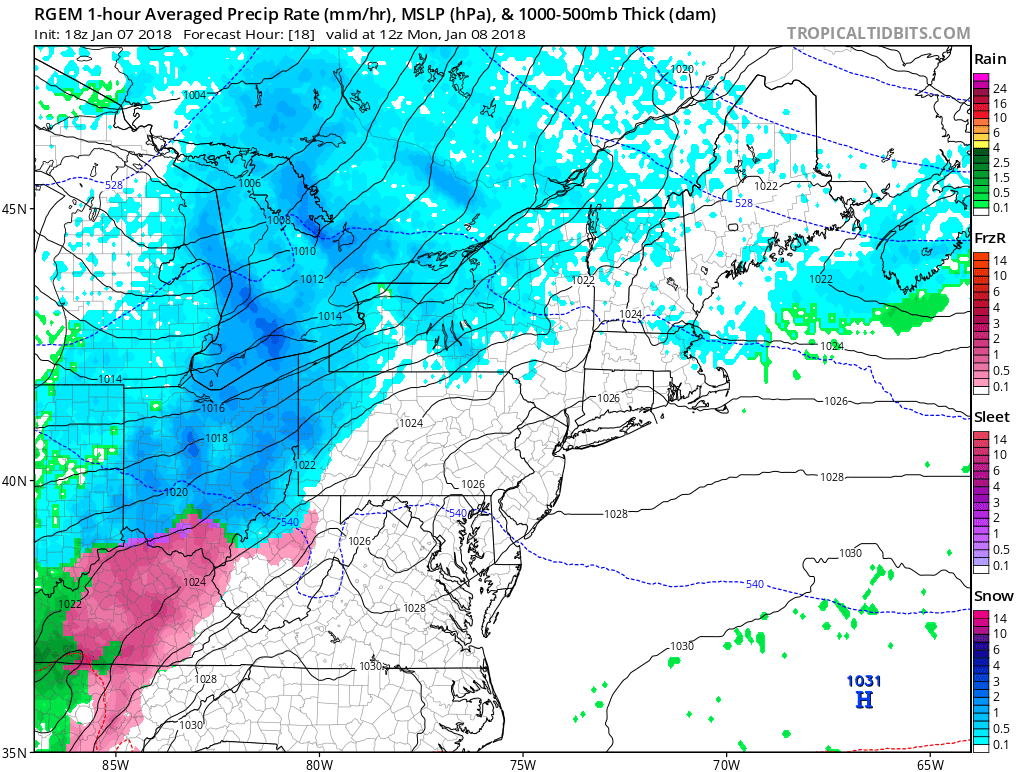
As the storm moves east, it will begin to weaken and is why we have our greatest snow totals for western areas. The snow and wintry mix will move into Central Pennsylvania by noon tomorrow. Eastern Pennsylvania will remain dry until tomorrow afternoon. Below is a look at the future radar for 12:00 PM: 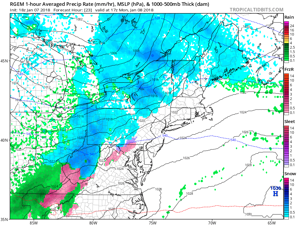
By noon, you can see the area of sleet and freezing rain beginning to develop over South Central Pennsylvania. This area of sleet and freezing rain will overspread most of Southeastern Pennsylvania by the mid-afternoon hours. Below is valid for 4:00 PM Monday afternoon: 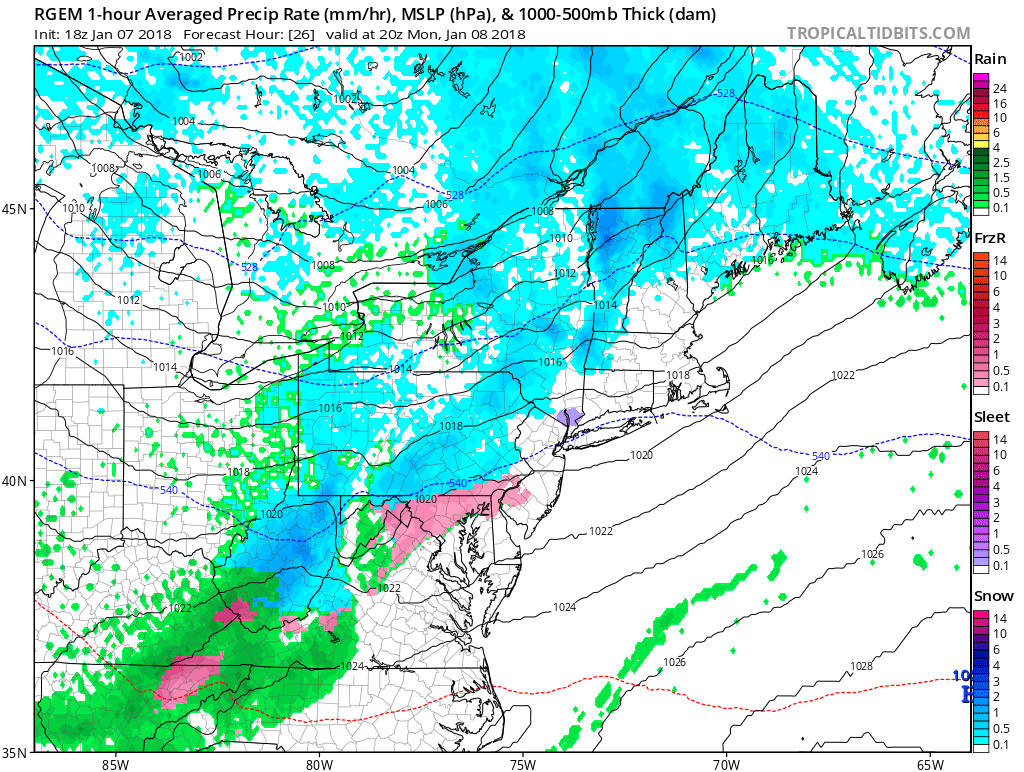
This particular model shows the freezing rain and sleet a bit farther south than we anticipate. But nevertheless, you can see the area of mixed precipitation expanding. The afternoon rush hour will be impacted significantly across South Central and Southeastern Pennsylvania tomorrow. Quite frankly, the arrival of the ice and sleet could not happen at a worse time.
The good news is, it is a quick hitter. By 7:00 PM Monday evening, most of the precipitation begins to move on east of our area: 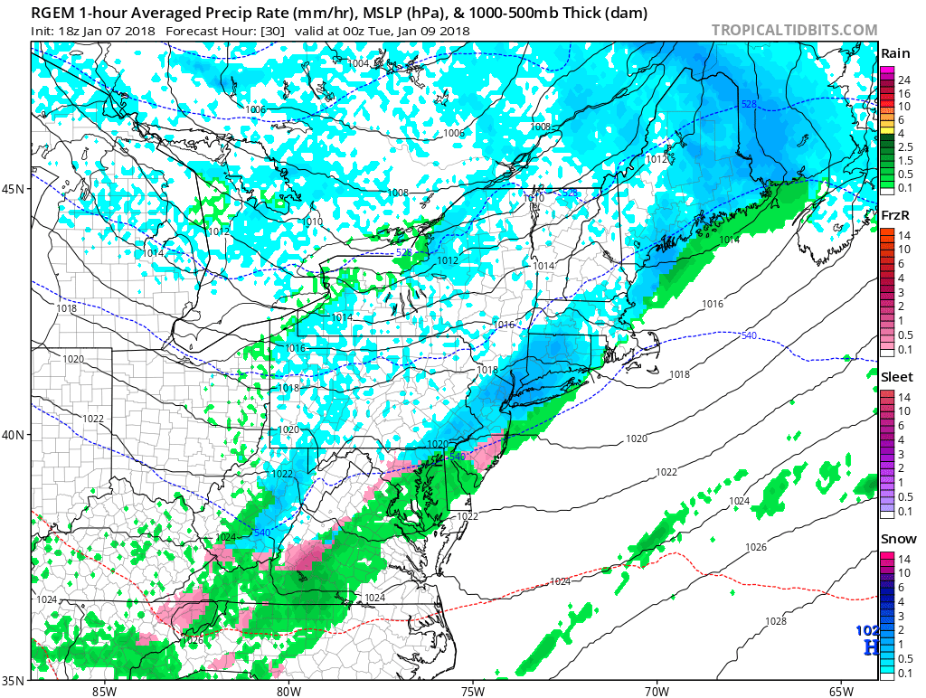
If you have travel plans tomorrow, expected delays in Western Pennsylvania during the morning and early afternoon hours. For Central Pennsylvania, expect delays during the mid-morning hours and through the afternoon rush hour. For Eastern Pennsylvania, expect delays by the early afternoon hours and lasting through Monday evening. Please be extra cautious while driving tomorrow, especially for areas dealing with sleet and freezing rain.
FINAL CALL FOR MONDAY’S WINTRY MIX:
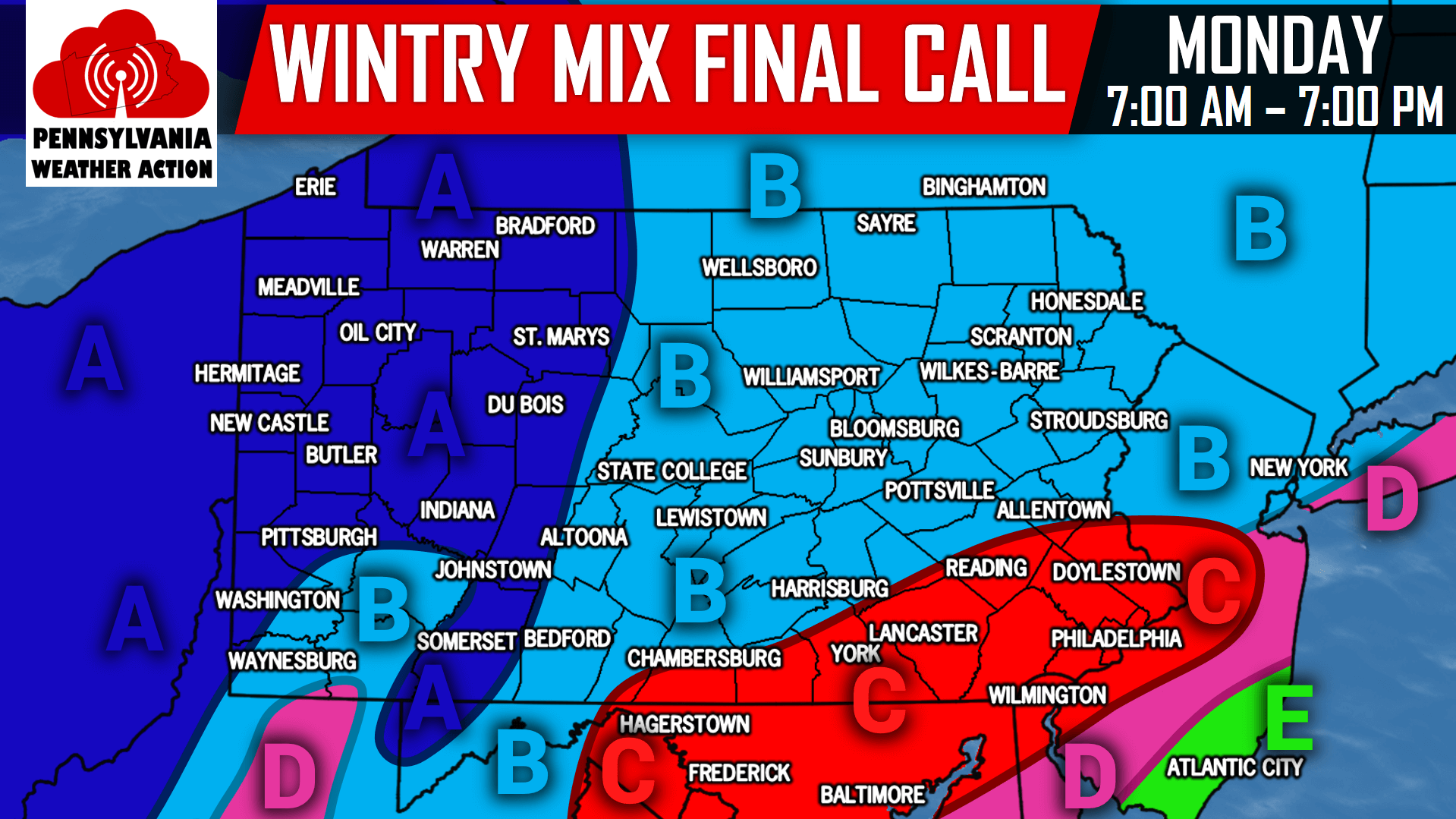
Timing: Precipitation will arrive by 7:00 AM for Western Pennsylvania and end by the early afternoon hours. For Central Pennsylvania, precipitation will begin between the mid-morning hours and noon. The precipitation will begin to diminish by the afternoon rush hour. Eastern Pennsylvania, the precipitation will arrive by the early afternoon hours and end by late Monday evening.
Area A: 2 to 4 inches of light to moderate snowfall with travel disruptions likely.
Area B: A coating to 2 inches of snowfall is possible. Most areas will be closer to the coating rather than the 2 inches.
Area C: This area remains our area of greatest concern. A coating to 1 inch of snow is possible, along with up to a tenth of an inch of ice. Hazardous travel can be expected, especially because of the precipitation falling in the afternoon hours through the rush hour.
Area D: A mix of snow and rain is expected. A coating to 1 inch of snow is likely.
Area E: Light rain is expected.
For more updates on this system and more, like our Facebook page, click here>>>Pennsylvania Weather Action’s Facebook Page
Share this article with your family and friends to warn them of the wintry mix expected tomorrow using our icon below, stay safe!
You must be logged in to post a comment.