
A mild and peaceful Christmas this year! But it really is the calm before the storm, with temperatures crashing this evening into early Friday morning. Central and Eastern Pennsylvania will wake up the temperatures in the teens and twenties Friday morning, just hours before the storm onset.
Over the last day, model trends have done further damage for those looking for snow. After a northward trend, which seems to occur when not benefiting PA, most of the commonwealth is looking at freezing rain and sleet. Southwest PA is still in the clear, with more of Eastern PA now expected to changeover. Only far NEPA looks to stay all snow.
This has cut into snow totals, as more sleet will occur in Eastern PA. I like to refer to sleet as the least harmful wintry precipitation type, as it’s not as slippery as freezing rain (ice) and doesn’t accumulate like snow.
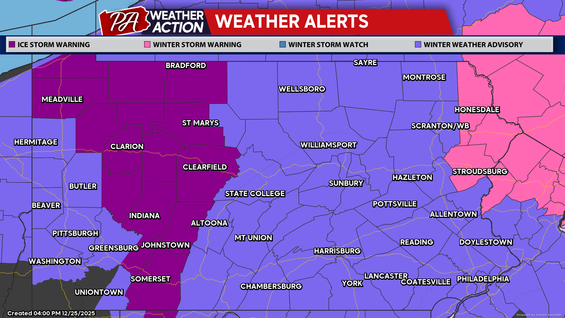
As a result, many areas were downgraded from a Winter Storm Watch to a Winter Weather Advisory due to lower impacts. Below is a look at the weather alert map.
WINTER STORM TIMING
Below is the latest storm start timing, with wintry precipitation likely to begin earlier than most weather apps show.
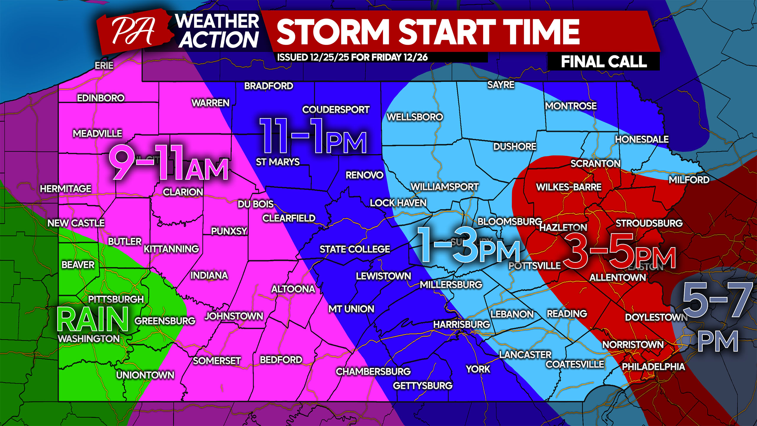
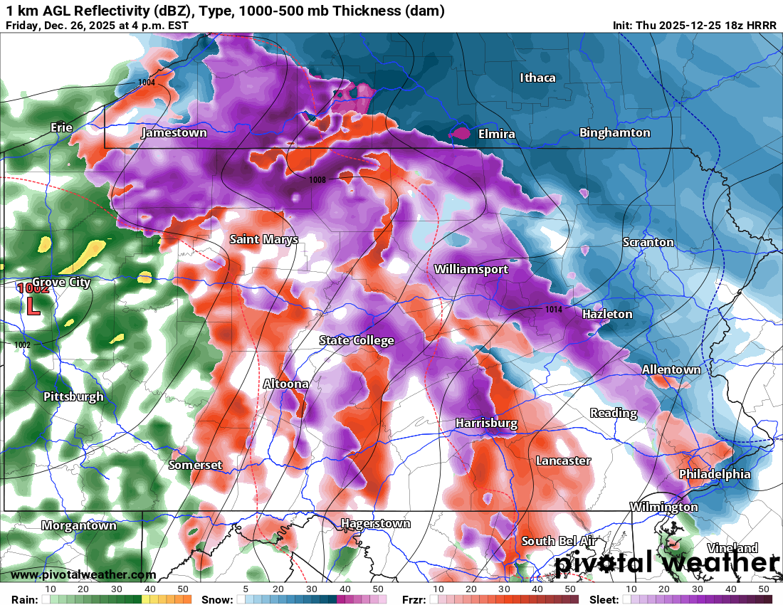
Starting late Friday morning, freezing rain will begin from “interior” Northwest PA, through the Allegheny Plateau and into South Central PA. There will likely be a gap in precipitation, with snow beginning in Northeast PA. Below is the latest HRRR model for noon Friday.
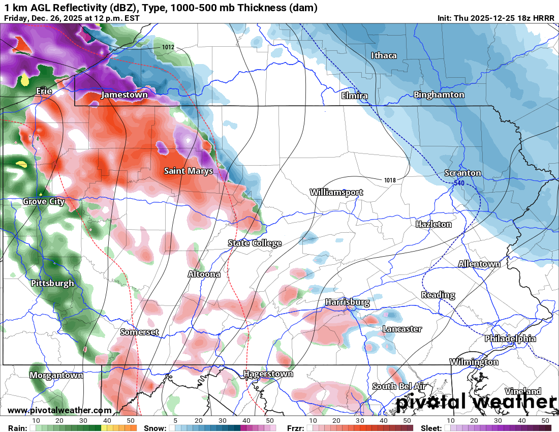
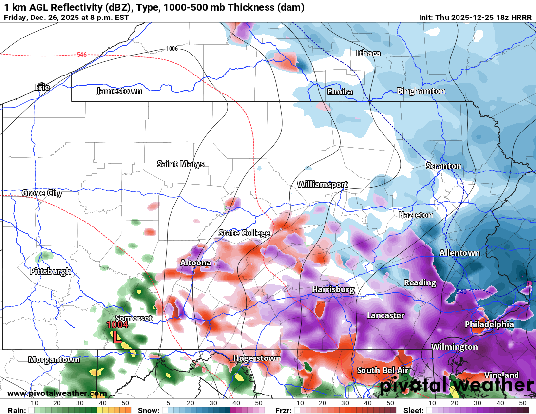
By late Friday afternoon, conditions will really go down hill with sleet and freezing rain stretching from near Erie all the way to west Philadelphia suburbs. In Central PA, ice will be building up on all surfaces. Be very careful when heading outside. Below is a look at future radar for 4:00 PM Friday.
This model cuts precipitation off pretty early, which makes sense given storms are often faster than modeled. Snow and sleet will continue in parts of Eastern PA into Friday evening, with sleet and freezing rain beginning to exit Central and especially Northwest PA.
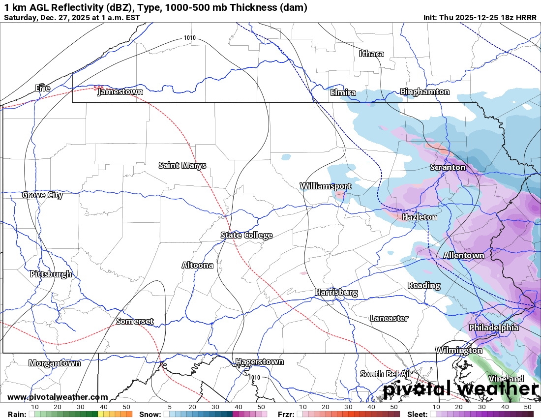
And already by only 1:00 AM Saturday, the storm will be wrapped by just about everywhere besides for some light wintry mix left in Eastern PA. Not a long duration event, but melting won’t occur until Saturday afternoon in Central PA and Sunday afternoon in Eastern PA.
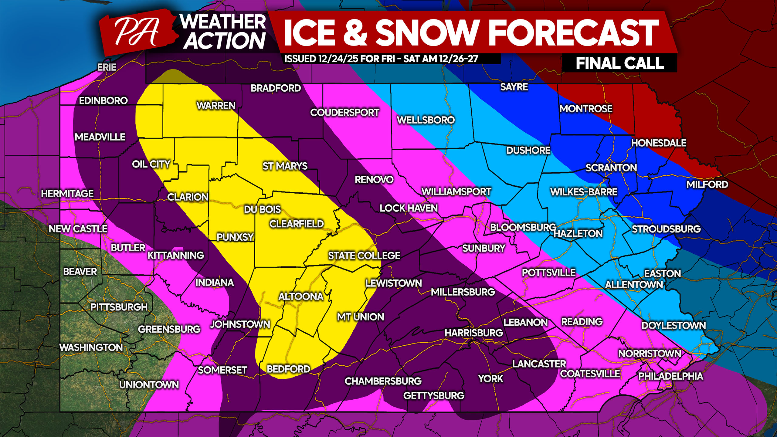
FINAL CALL SNOWFALL FORECAST FOR FRIDAY – EARLY SATURDAY AM
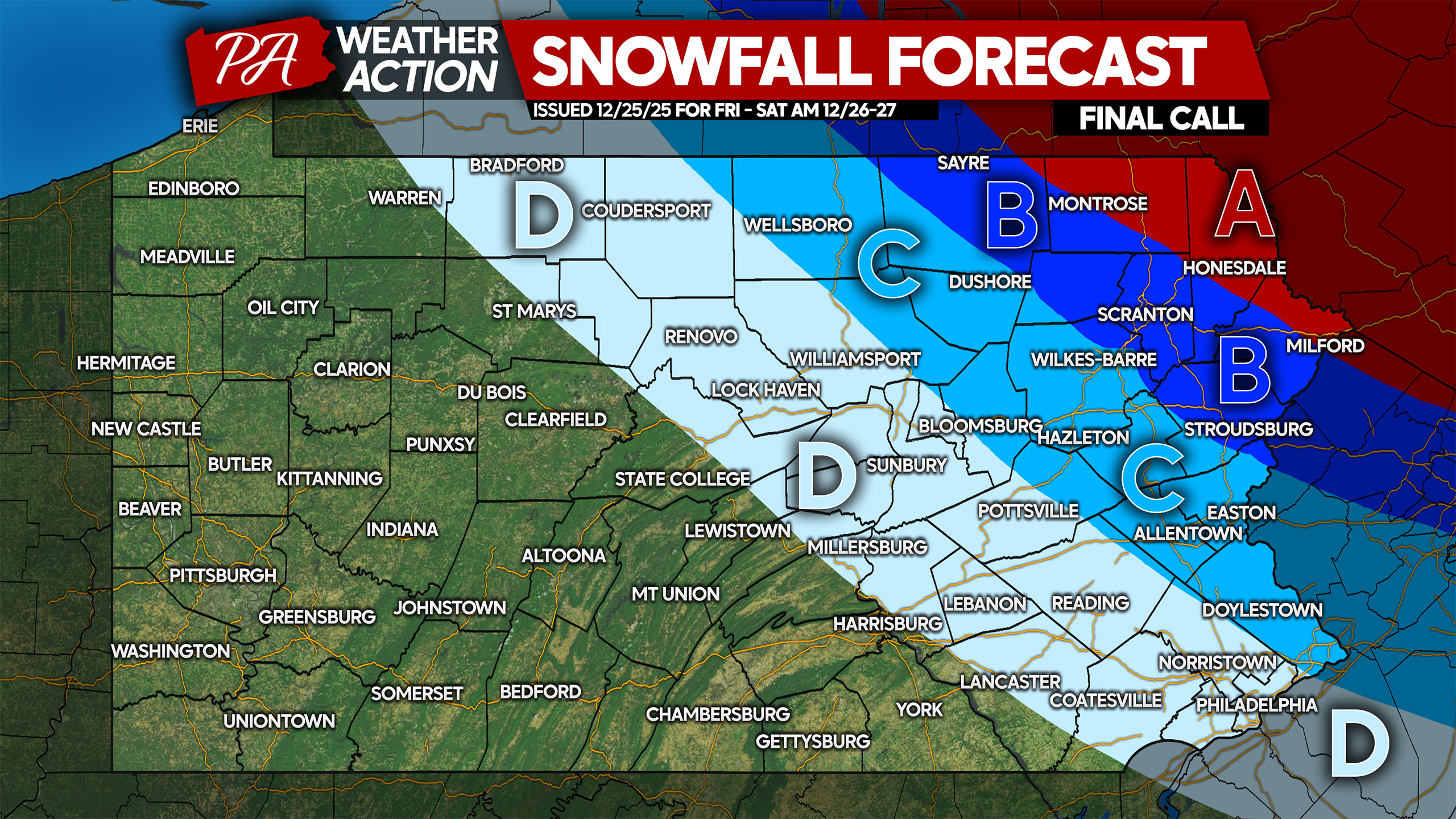
Area A: Snowfall accumulation of 6 – 10″ expected. Snow-covered roads will make travel very difficult and slippery. This area will see all snow.
Area B: Snowfall accumulation of 3 – 6″ anticipated. Snow-covered roads followed by sleet will make roads very treacherous. Avoid traveling during the storm.
Area C: Snow and sleet accumulation of 1 – 3″ expected. Roadways will be covered immediately with temperatures below freezing.
Area D: Sleet accumulation of up to 1″ expected, followed by freezing rain. Roads will be slushy and icy, avoid traveling.
FINAL CALL ICE FORECAST FOR FRIDAY – EARLY SATURDAY AM
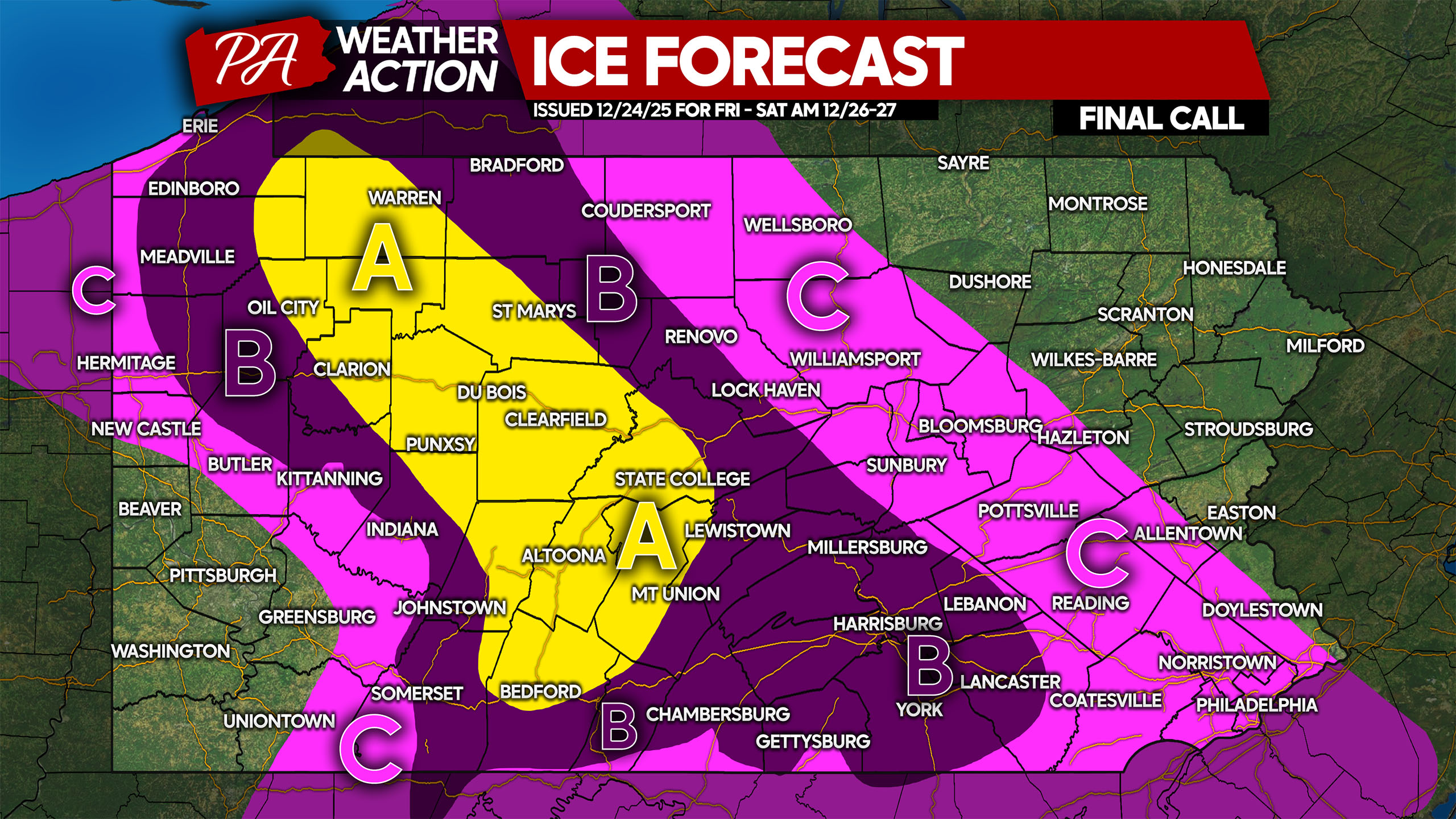
Area A: Ice accumulation of 0.25 – 0.35″ expected. Travel will be dangerous and should be avoided during and shortly after the storm. Walking outside should be done with caution to avoid falls. Isolated power outages are possible.
Area B: Ice accumulation of 0.10 – 0.25″ anticipated. Travel will be very slippery and should be avoided during and shortly after the storm. Be cautious when walking outside to avoid falls.
Area C: Ice accumulation of 0.05 – 0.10″ expected. Roads will be very slick and travel should be avoided while temperatures are under 32°.
While this may not be the poetic and beautiful snowy day after Christmas some were hoping for, it’ll still be very impactful. Please take it slow and steady while heading outside. Freezing rain is so slippery that you can hardly walk on smooth surfaces. We don’t need injuries heading into 2026!
Be sure to share this final forecast with friends and family! Stay safe!
You must be logged in to post a comment.