
Our attention has turned to a winter storm this weekend. You can find the details in the article linked below.
First Call Snow & Ice Forecast for Weekend Winter Storm Likely in Pennsylvania
We are entering what will be the most active February winter storm pattern since 2021. The first several days of February were pleasant after an exhaustingly cold January, but we’re about to be thrown for a loop in the coming weeks. On Thursday evening, the first call forecast for Saturday evening into Sunday morning’s storm will be posted.
And then on Sunday evening, we will have a first call forecast for a storm coming next Tuesday into Wednesday, if model guidance continues to show a storm. The moral of the story will be to just take it one storm at a time. With that said, let’s get into the details for this impending storm.
A Tier 4 travel ban has been issued by PennDOT on many state highways, starting late this evening or early Thursday morning. A Tier 4 ban prohibits travel for all vehicle types except cars, pickup trucks, and EMS vehicles. For more details, view the PennDOT website here.
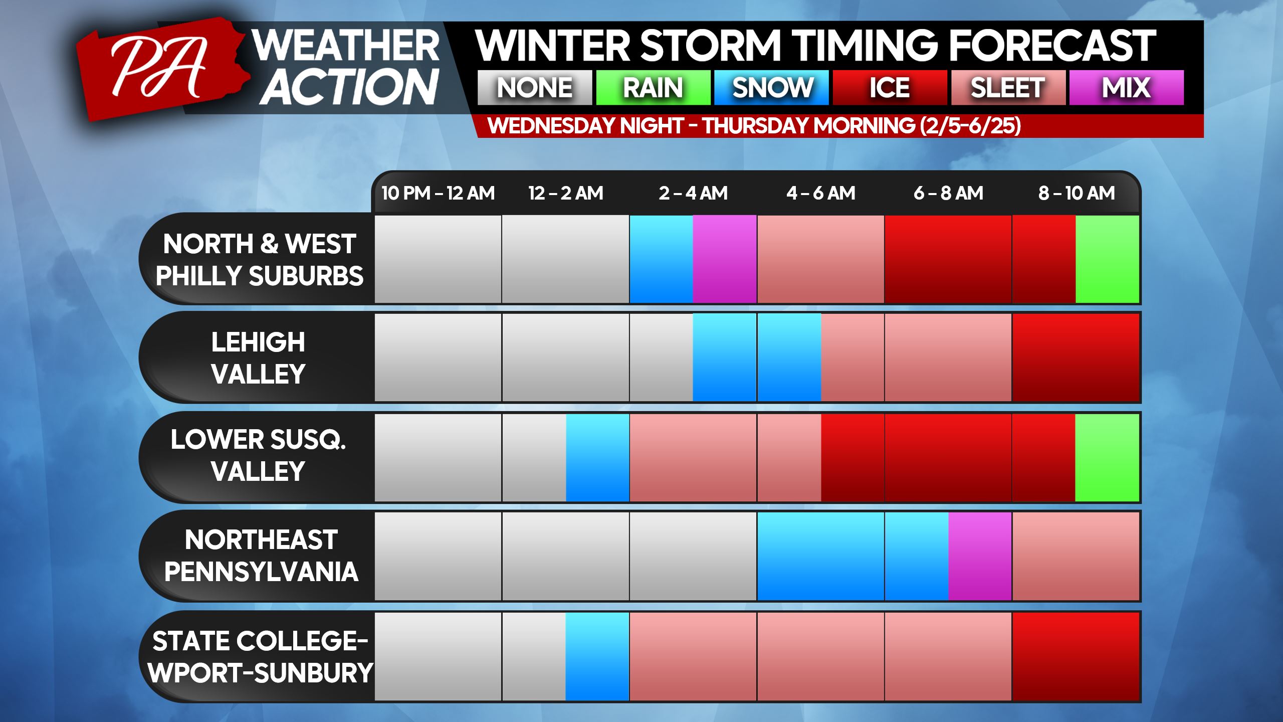
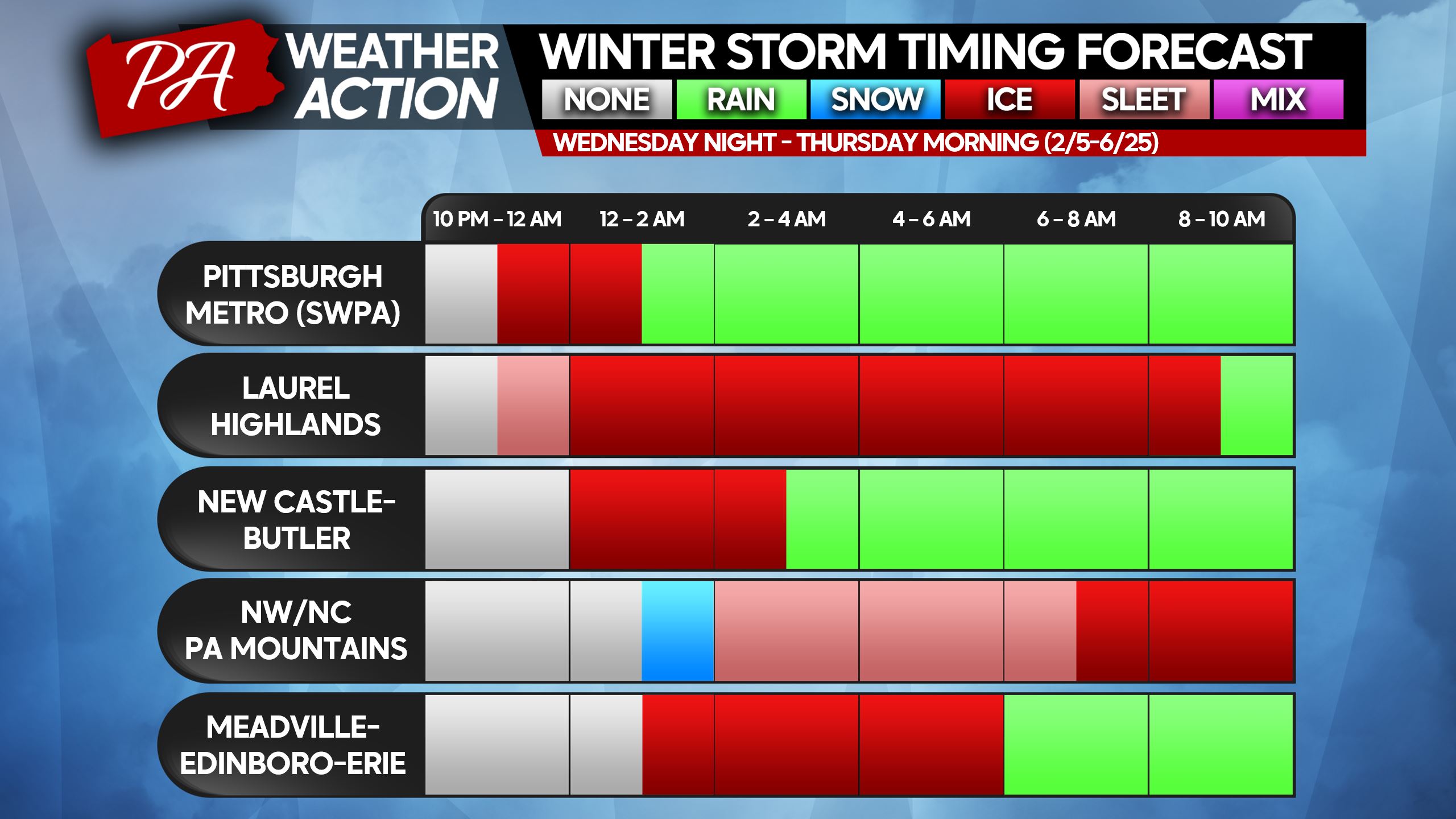
WINTER STORM TIMING
Wintry precipitation will begin on either side of midnight (Thursday morning), depending on location. Most places will begin as sleet, except in Northeast PA and the Lehigh Valley where a period of snow is likely at the onset.
As we approach sunrise Thursday, the worst of the storm will set in. A mix of sleet and freezing rain is expected at that point everywhere in the state east of the I-79 corridor (I-79 goes from Erie to Pittsburgh to Morgantown, WV).
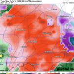
After sunrise Thursday, temperatures will begin to slowly warm. However, temperatures won’t hit above freezing in and east of the Appalachians until 8 AM in the Southern PA valleys to 11 AM in NEPA. Use the charts below to find when your area will rise above 32. When you see rain, that means temperatures will be above freezing.
After lunchtime is when those high temperatures near 40 will occur in Southern PA. All of the state will see temperatures above 32, which will cause melting. There isn’t a concern for refreezing.
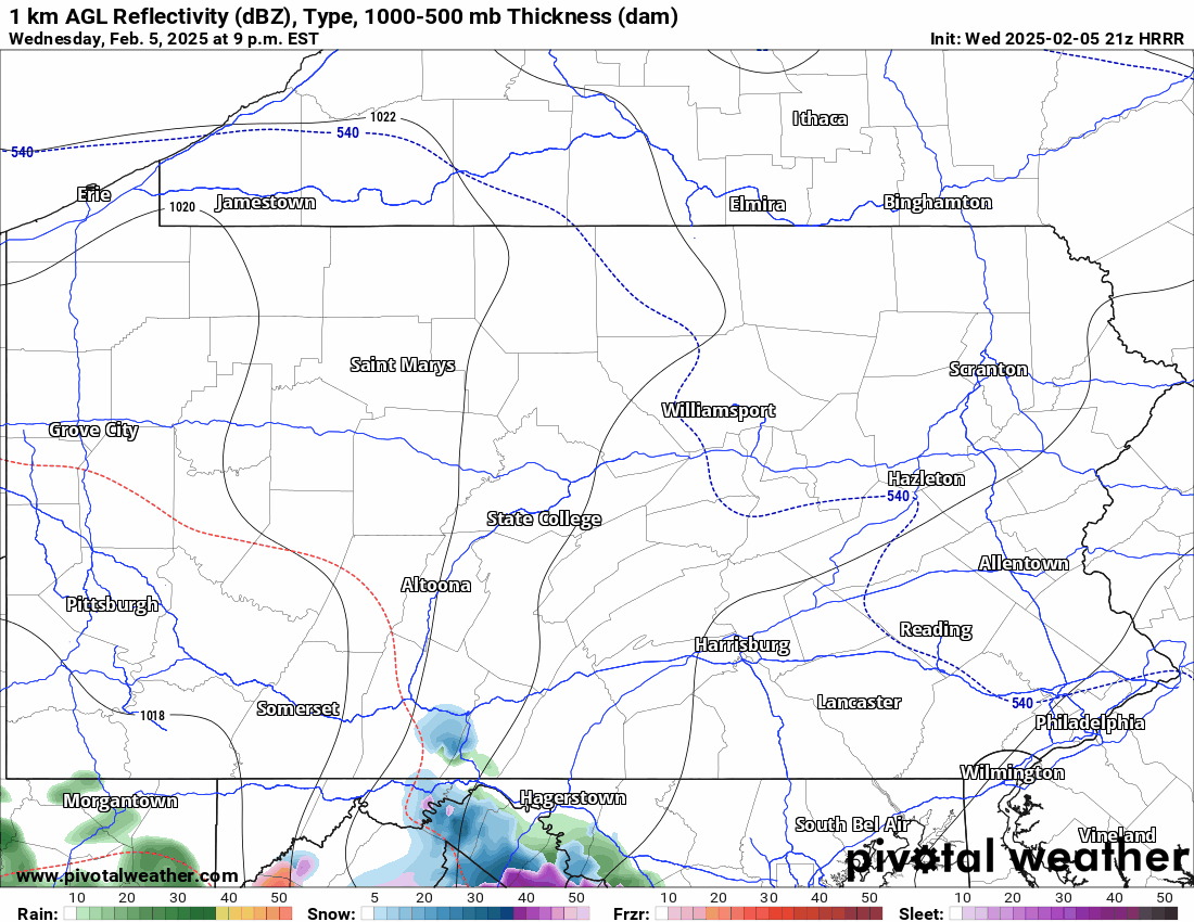
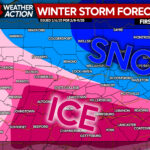
Future radar from the Hi-Res Rapid Refresh model for the duration of the storm is below.
FINAL CALL SNOW & SLEET FORECAST FOR THURSDAY AM
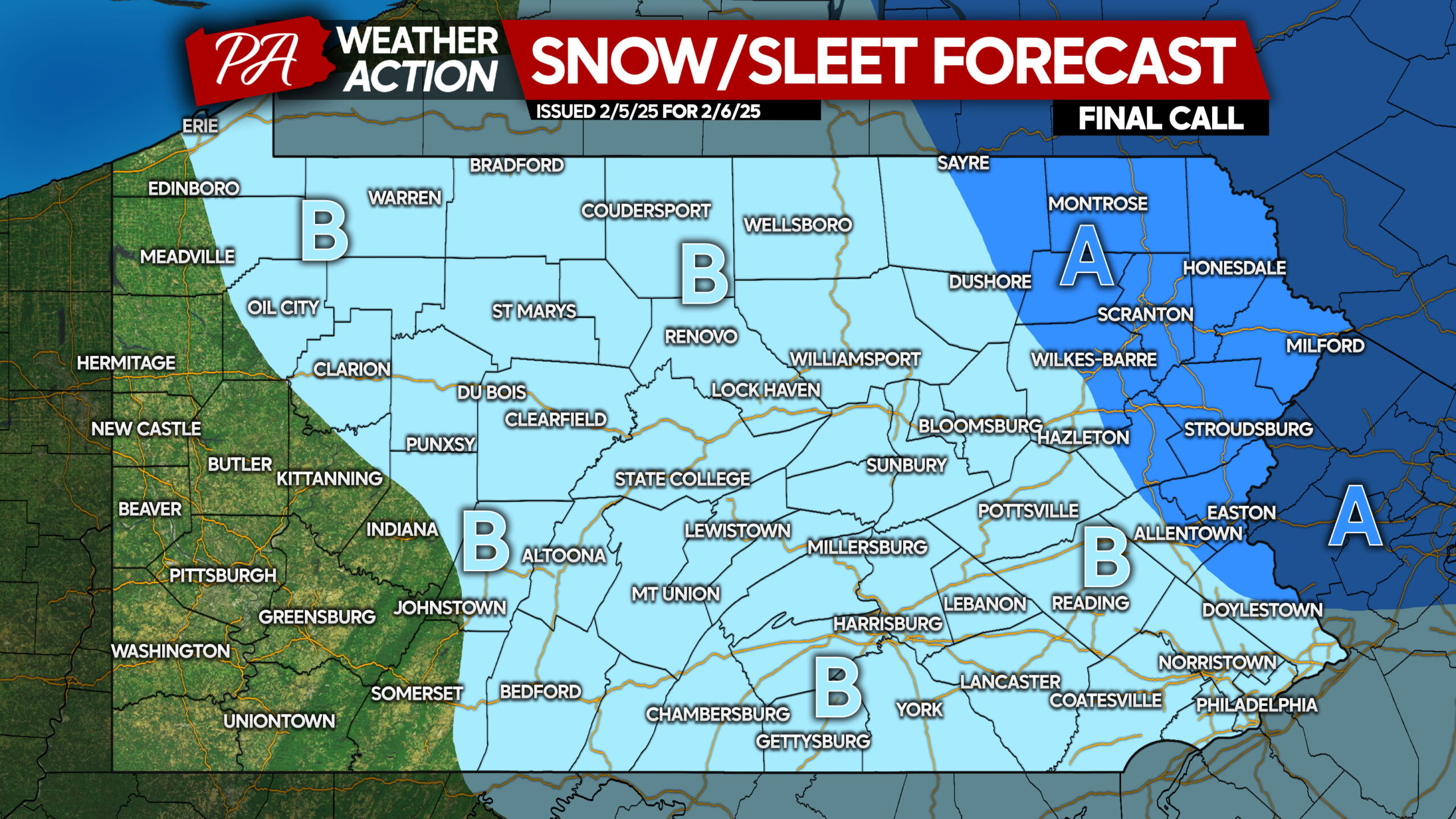
Area A: Snow and sleet accumulation of 1 – 3″.
Area B: Snow and sleet accumulation of less than 1″.
FINAL CALL ICE FORECAST FOR THURSDAY AM
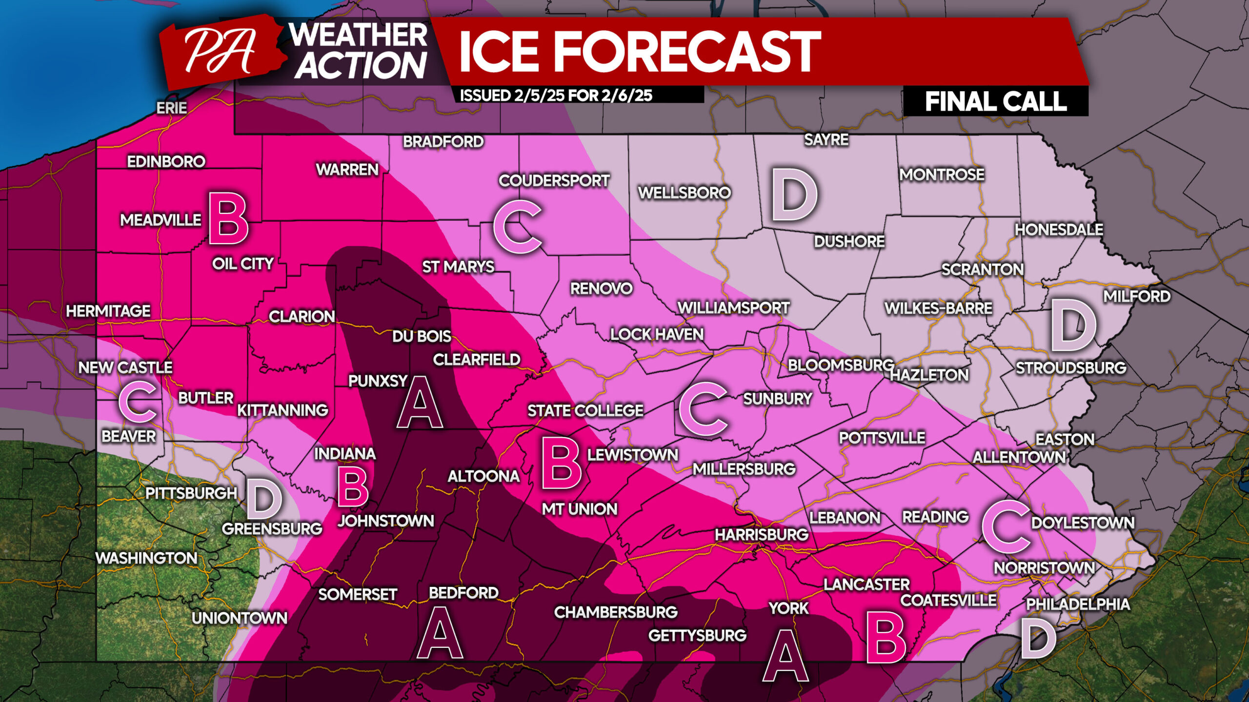
Avoid venturing outdoors until temperatures rise above freezing Thursday. School delays/closings are likely in Areas A, B, C, and D.
Area A: Ice accumulation between a quarter and a third of an inch expected. Roads will be extremely slippery, and travel will be nearly impossible.
Area B: Ice accumulation between a tenth to a quarter of an inch anticipated. Roads will be very slippery, and travel is highly discouraged.
Area C: Ice accumulation between a twentieth and a tenth of an inch expected. Avoid traveling until temperatures rise above freezing.
Area D: Ice accumulation of a hundredth to a twentieth of an inch anticipated. Untreated surfaces will be slippery.
You must be logged in to post a comment.