
This coastal storm has garnered impressive attention, with the media being quick to jump on it midweek, likely in part due to just how uneventful the weather has been recently. Unless you have property on the barrier islands of NC or NJ, it’s really not a concern.
This storm has been a mess on the models because this setup is very complex, with a coastal low and an upper level low over the Great Lakes interacting. But since the Great Lakes system is cutoff from the jet stream, it’s harder to forecast where it goes, which is correlated to the position and strength of the coastal.
If reading that paragraph gave you a headache, that’s just a hint of what forecasters have been dealing with. Fortunately, it’s rain, so we’re not talking about widespread significant impacts as we would be with snow.
But similar to the hurricane that was briefly projected to strike the Carolinas a few weeks ago, this shows how important it is to be patient for better forecast data to come out, typically about 48-60 hours before the potential storm.
FUTURE RADAR TIMING
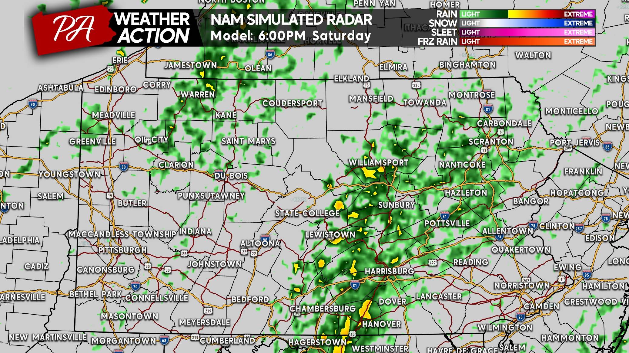
This is going to be a fairly long duration event, and it’s a case where I’d refer you to your local hourly forecast since we’re out of severe season. The upper level low will have some showers going across parts of Eastern and Central PA by this evening. We will be using Saturday morning’s High Resolution NAM model, with 6pm Sat shown below.
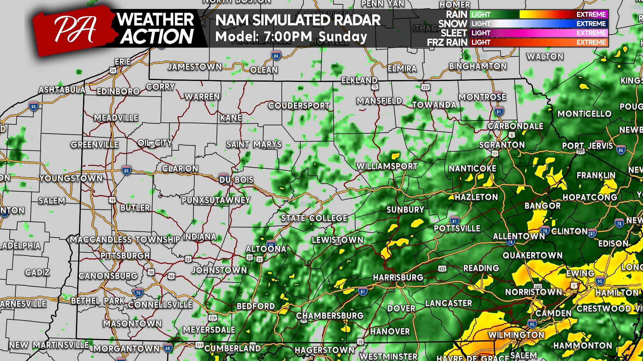
The coastal will get going late Sunday morning and into the PM hours. We aren’t looking at heavy rain from this, but light to moderate rain. Although it may feel heavy amidst the gusty winds. Here is a look at 7pm Sunday, showing Southeast PA under some moderate rain bands.
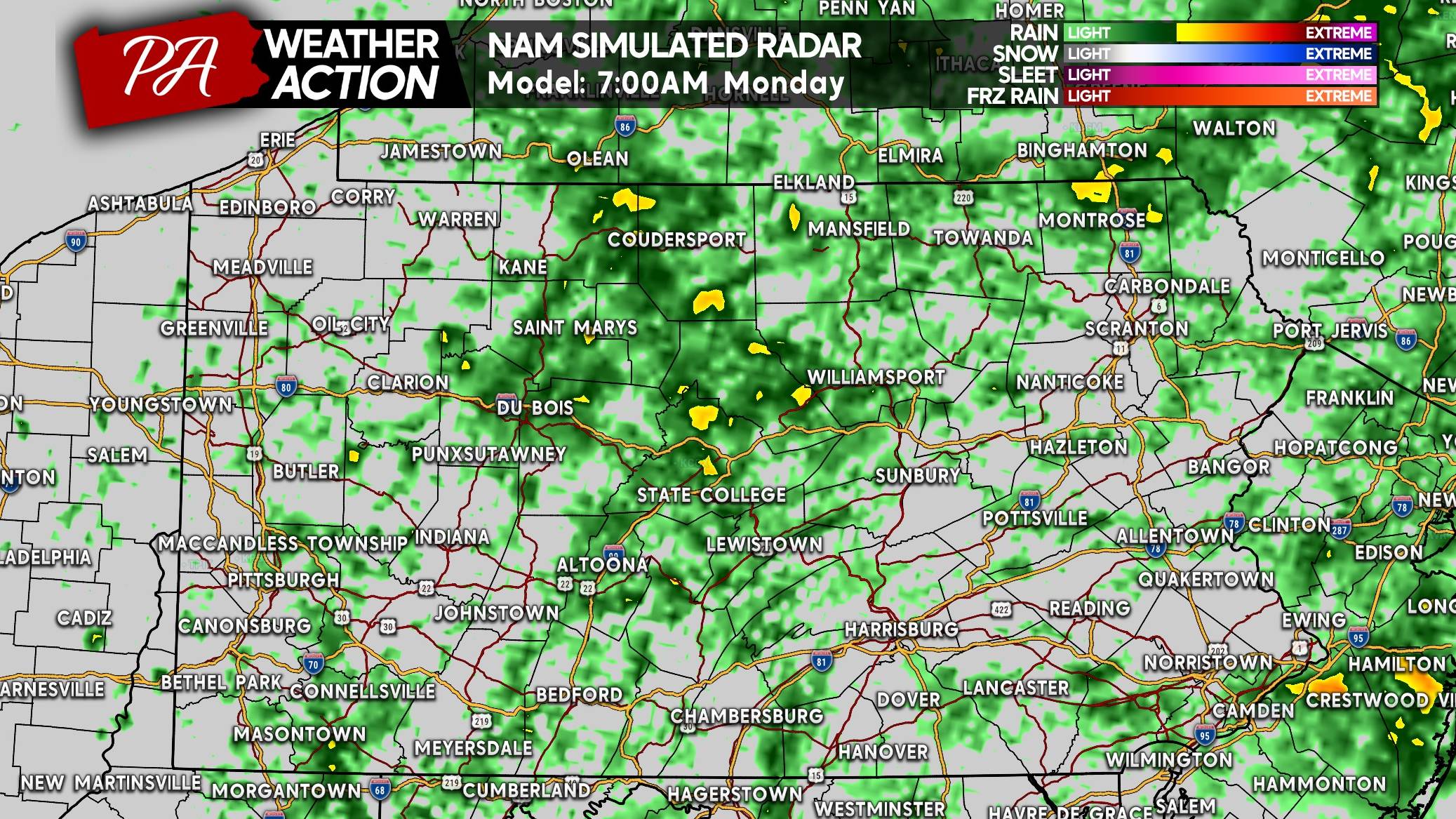
Light to moderate rain will continue overnight Sunday into Monday mainly in the eastern half of the state. Highest wind gusts will come late Sunday evening into Monday morning, maxing out at around 45 MPH in Southeast PA. The Jersey Shore will see gusts as high as 60 MPH, but fortunately we’re all well inland here.
As the sun comes up Monday morning, it’ll be masked by low clouds and showers nearly everywhere in Pennsylvania as the coastal sits and spins near Ocean City, MD. In reality, it’s nothing more than a dreary Monday. Nothing to be concerned about, and we’re all overdo for it. At least it’s on a Monday!
Expect showers to depart the later half of Monday as the coastal storm pulls away, leaving us with mostly sunny skies by Tuesday.
MAXIMUM WIND GUST FORECAST FOR SUN PM – MON AM
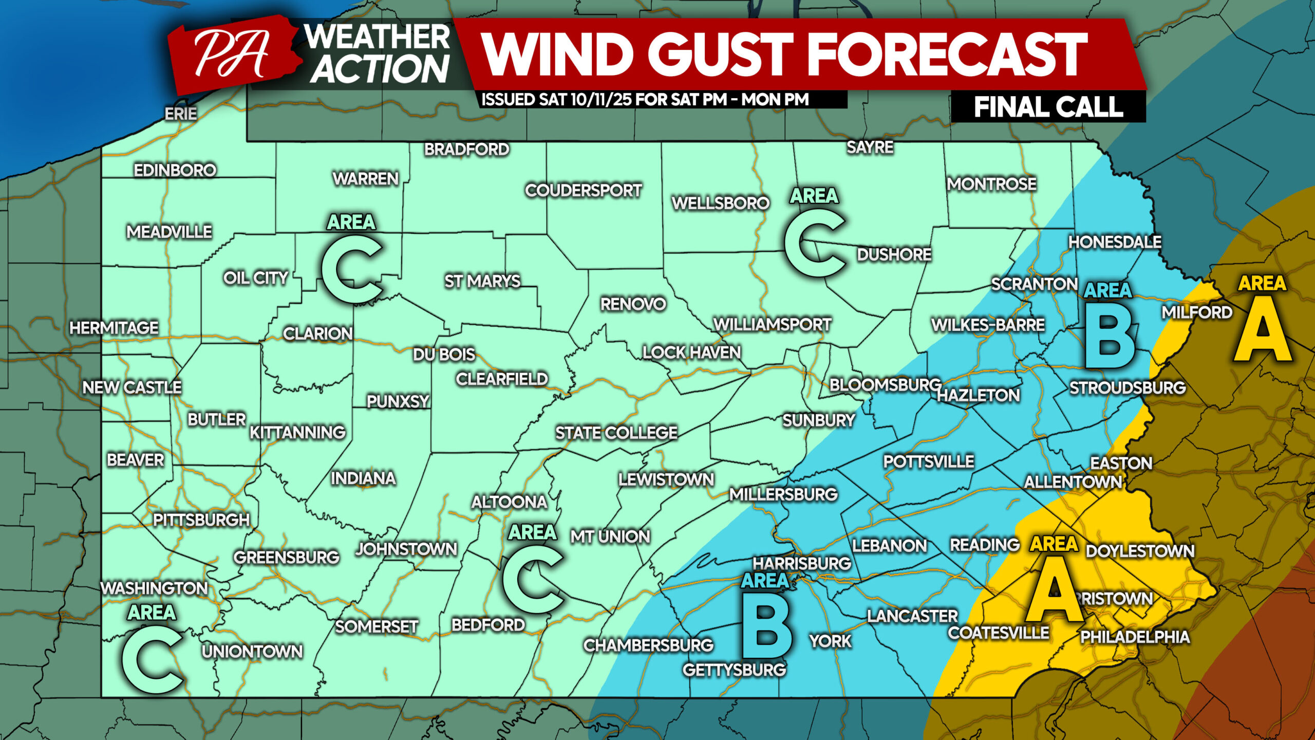
Area A: Maximum wind gusts of 35 – 45 MPH are expected Sunday evening into Monday morning. A few isolated power outages are possible.
Area B: Maximum wind gusts of 25 – 35 MPH are anticipated Sunday evening through Monday morning. Very isolated power outages are possible.
Area C: Maximum wind gusts of 15 – 25 MPH are likely. No power outage concern.
RAINFALL FORECAST THRU MONDAY PM IN PA
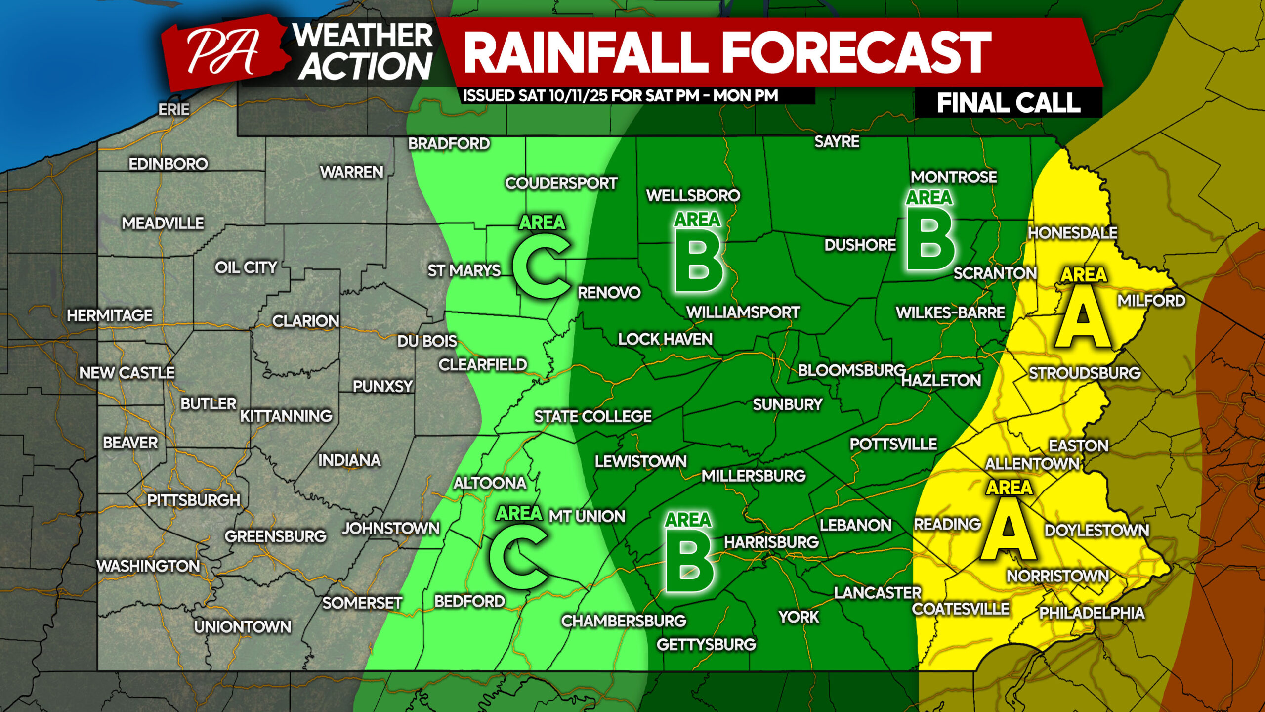
Area A: Total rainfall accumulation of 1.0 – 1.5″ expected, with highest amounts on mountain slopes. No flooding expected.
Area B: Total rainfall accumulation of 0.5 – 1.0″ anticipated, with highest amounts on mountain slopes. No flooding expected.
Area C: Area B: Total rainfall accumulation of 0.25 – 0.5″ expected.
Not the most dramatic storm by any means, but feel free to pass this forecast along with family and friends who may find the info useful!


You must be logged in to post a comment.