
Accumulating snow from the Grand Canyon to Newfoundland, all part of one massive storm is something we see just once or twice a decade. And here in Pennsylvania, it’s the first time in a long time that all 67 counties are under a Winter Storm Warning.
Snow Drifting & Refreezing Amidst Bitter Cold
The stretch of temperatures following this storm will be the coldest stretch we’ve seen in 11 years, with frequent subzero temperatures and highs not reaching the freezing point until at least February 5th, if not later.
The snow and sleet that falls will hardly melt, and anything that does melt will completely refreeze every night for weeks. Blowing and drifting will be an issue for weeks, especially in areas that don’t see sleet. In addition, we will remain primed for major storms in February.
The Storm Rundown
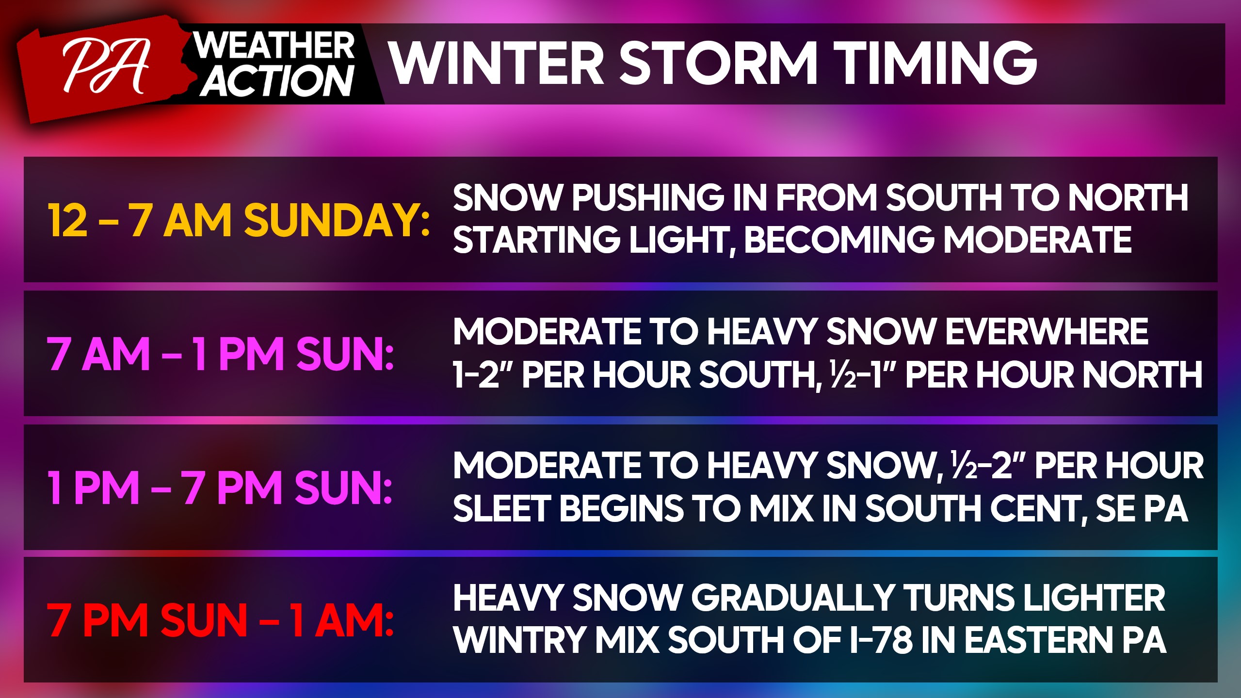
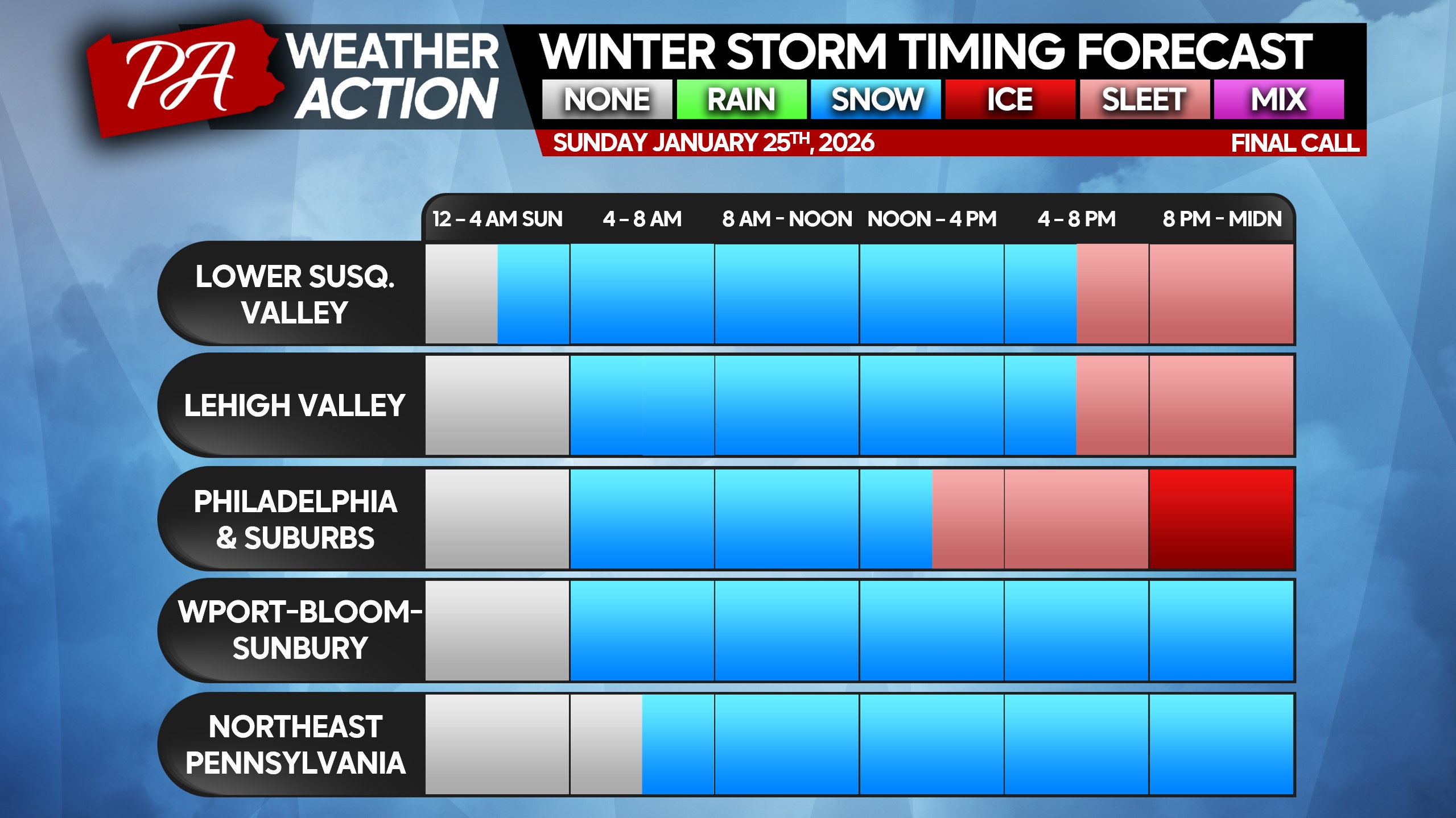
Snow will move in from south to north after midnight tonight, starting light but becoming moderate within a 2-3 hours of onset. After sunrise is when we expect the heaviest snow to get going south of I-80, moderate snow north. As the morning progresses, roads will become impassable in most cases.
Heading into Sunday afternoon, heavy snow will be dumping at 1″ to locally 2″ per hour in heaviest bands. We will begin to see the sleet line push north across the Southern PA border, especially in South Central and Southeast PA. That sleet line is expected to reach as far north as the PA Turnpike in Central PA and I-78 in Eastern PA.
Snow, sleet, and even freezing rain will gradually start to wind down late Sunday evening from south to north. By early Monday morning, the storm should be out of here with just some lingering light snow north of I-80.
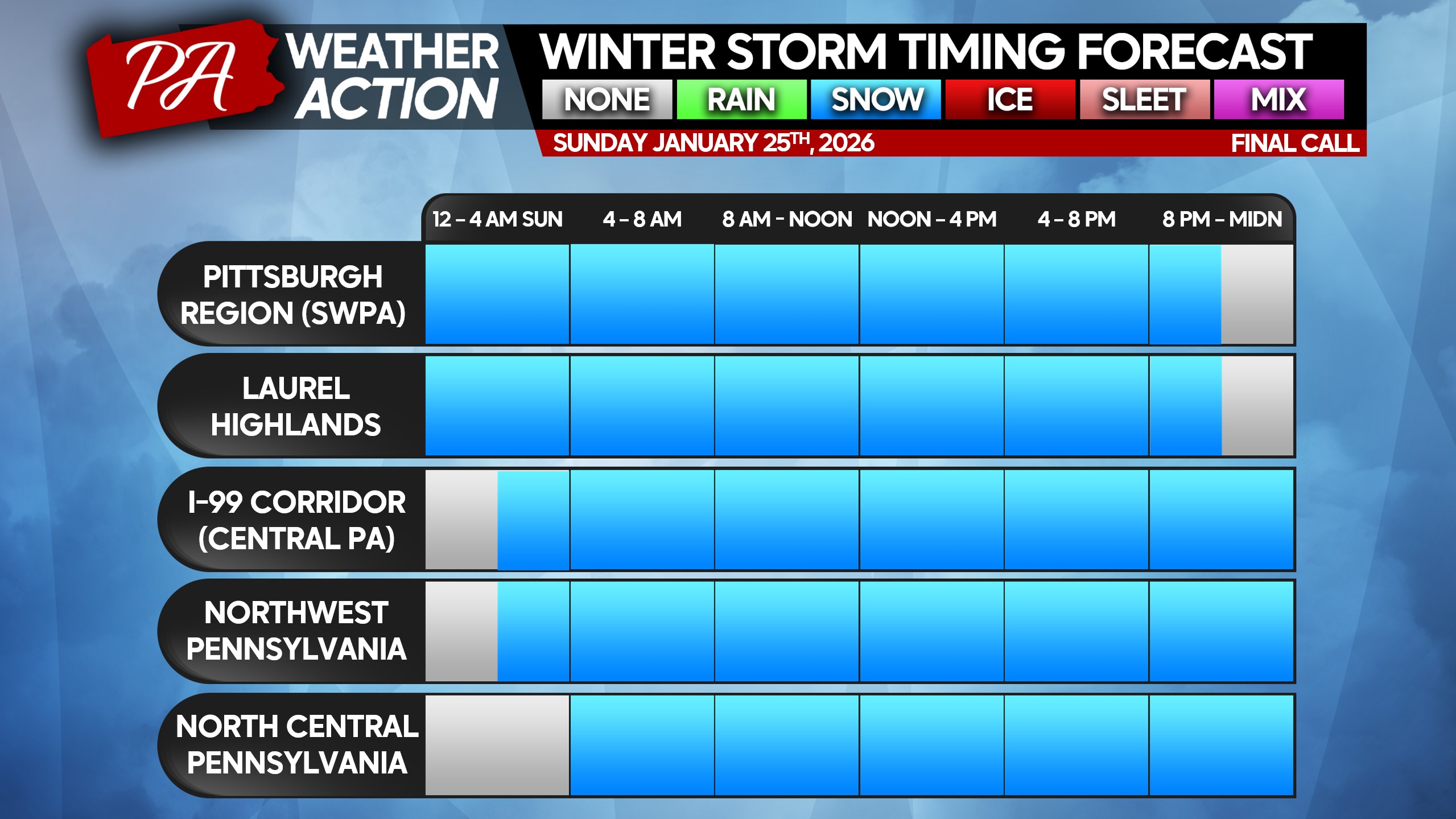
Local Winter Storm Timing Across PA
Below is a look at snow onset times around the state.
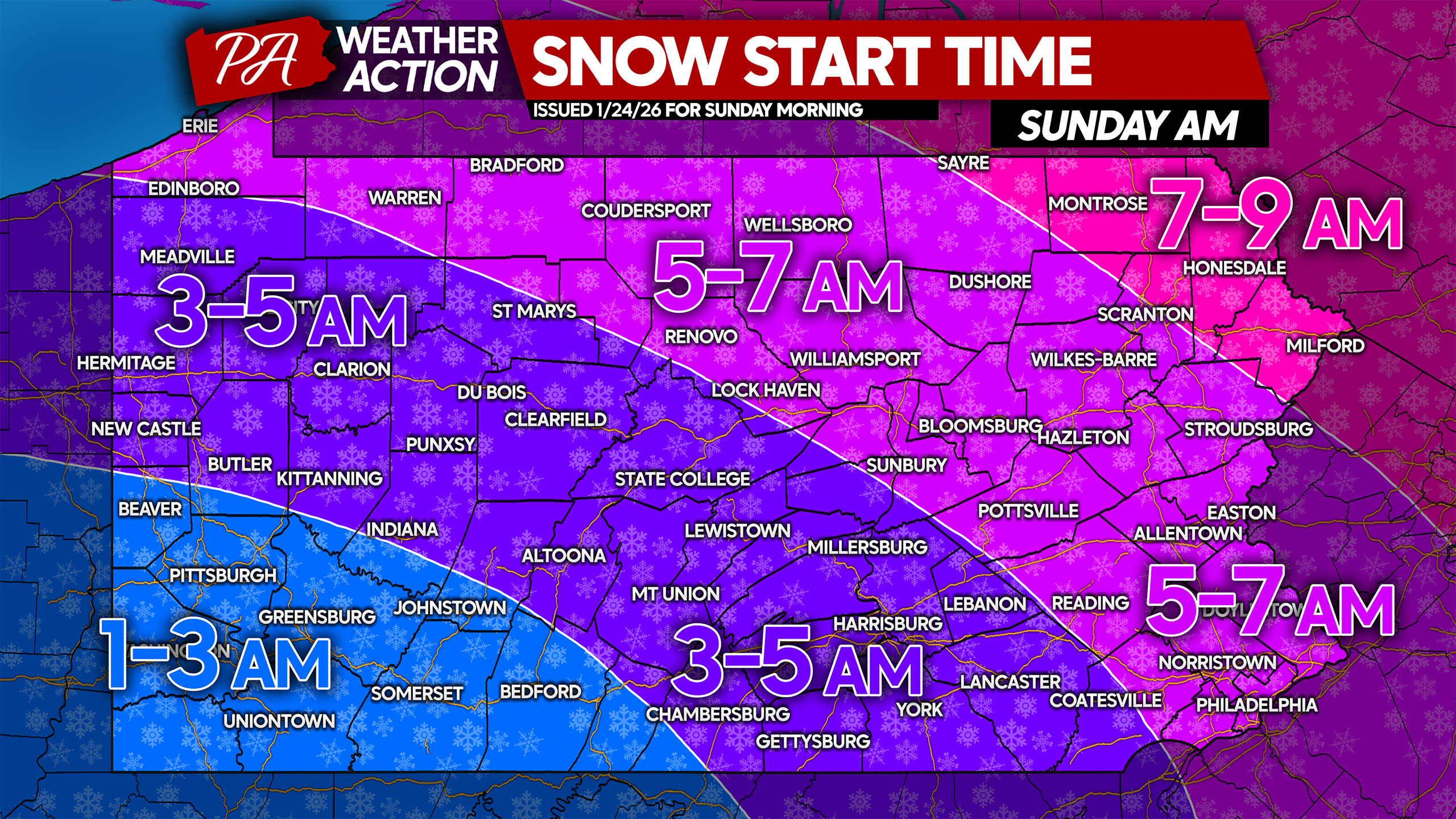
If you live in a smaller town or rural area, please find the nearest applicable region to you.
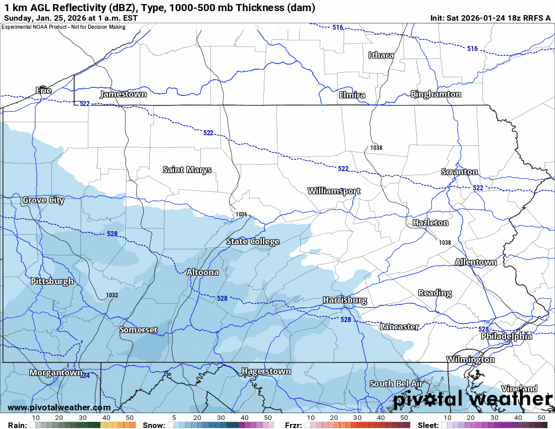
Below is a look at the latest RFRS short range model future radar for the duration of the system. The sleet line may briefly push as far north as the mid-Susquehanna Valley to the Southern Poconos, but will experience significantly pushback that far north.
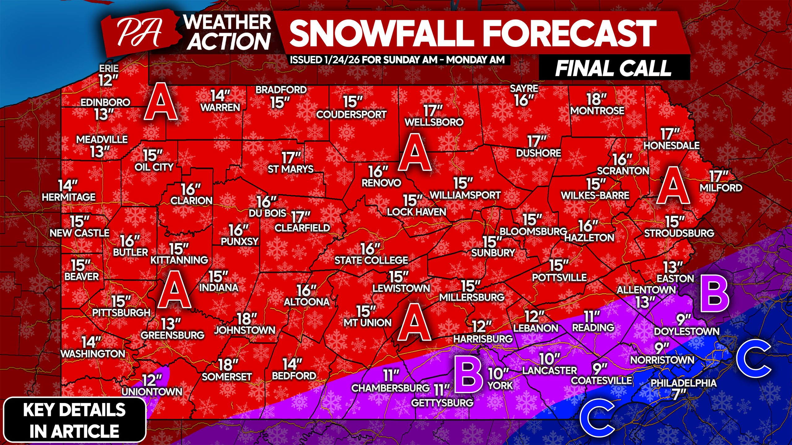
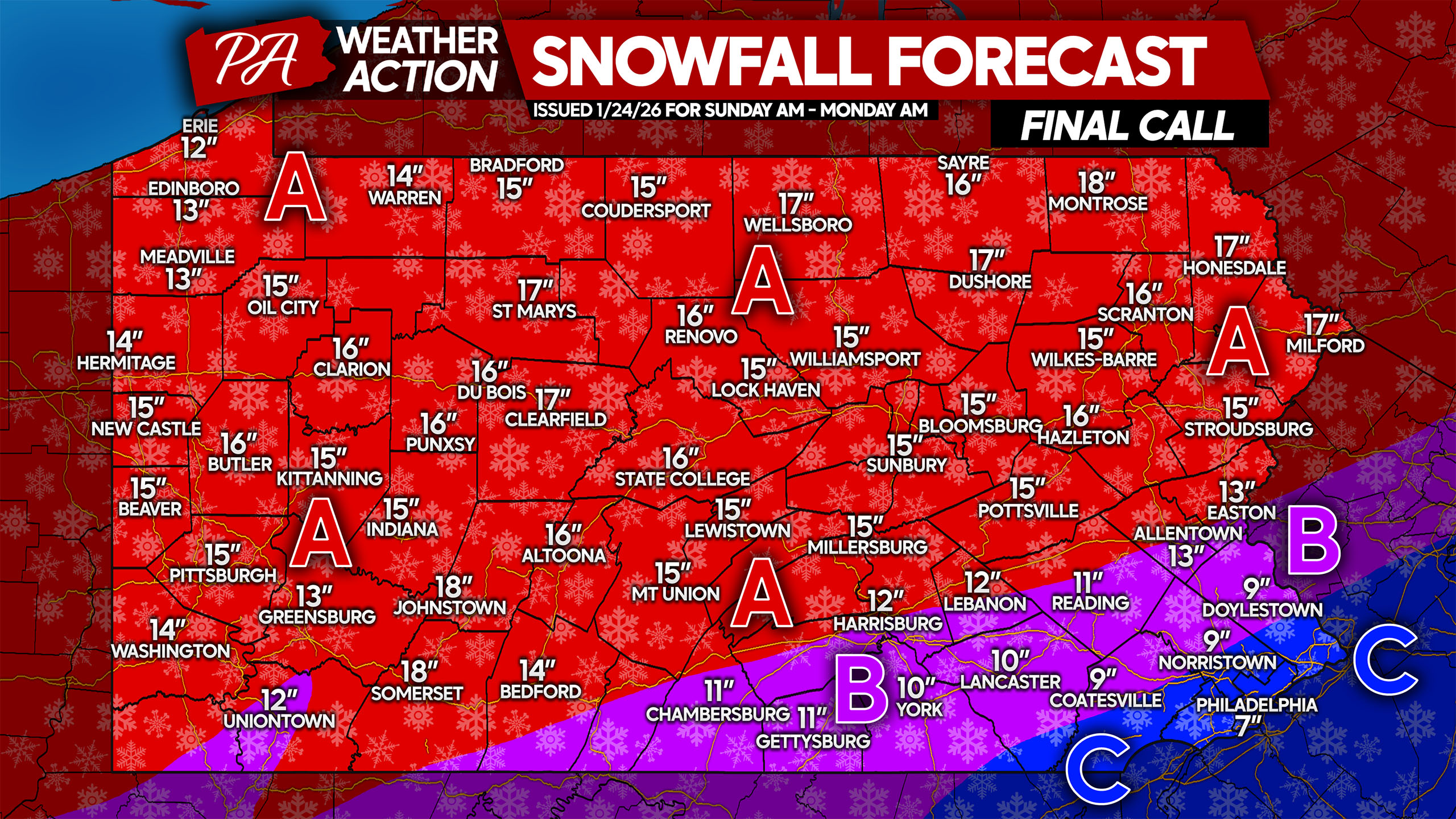
FINAL CALL SNOWFALL FORECAST FOR SUNDAY’S MAJOR STORM
Do not try to shovel too much at once, as exhaustion and/or injury may occur. Stay hydrated when shoveling, and take breaks! It’s a good idea to shovel midway through the storm.
Area A: Snowfall accumulation of 12 – 18″ expected, with all snow anticipated. Do not travel Sunday unless in an emergency, as you may be stranded. Schools and some businesses will likely be closed Monday and Tuesday.
Area B: Snowfall accumulation of 8 – 12″ expected, with a changeover to sleet Sunday afternoon. Do not travel Sunday unless absolutely necessary, as you may be stranded. Schools and some businesses will likely be closed Monday and Tuesday.
Area C: Snowfall accumulation of 6 – 8″ expected, with a changeover to sleet and eventually freezing rain likely. A tenth to a quarter-inch of ice is likely. Avoid traveling Sunday unless it’s 100% necessary. Schools will likely be closed Monday and Tuesday.
Be sure to share this important info with friends and family below!
You must be logged in to post a comment.