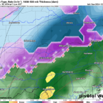
Snow in December has been hard to come by the last several years, and while this will not be a significant event, any snow in December is a welcome surprise for most people. What isn’t so welcome is ice – and freezing rain is now likely across a larger area on Sunday.
For the last few days, American weather models haven’t been enthused at all about Sunday’s wintry mix, but in classic fashion at the last second they are folding to foreign models like the Euro and Canadian. Our snowfall forecast from yesterday remains mostly unchanged.
The National Weather Service has issued Winter Weather Advisories for a large portion of the state, in part due to the potential for freezing rain. Below is the NWS alert map.
Winter Weather Timing
Precipitation will move in around lunchtime, starting as freezing rain in Northwest PA and the Laurel Highlands with temperatures just below freezing. Snow is expected at the onset east of the Allegheny Front in Central PA, with snowfall rates as much as 1″/hour, but mostly closer to 0.5″/hour. Below is the Hi-Res NAM for 1:00 PM Sunday.
Heading into late Sunday afternoon, snow will push northeast. This model wants to end the snow temporarily in South Central PA at this point, but we don’t think there will a lull.
You’ll see below that freezing rain continues through the afternoon on the Allegheny Plateau, which will make travel very slippery. Here is the Hi-Res NAM for 4:00 PM Sunday.
Light to moderate snow is anticipated to continue through dinnertime north of I-78 in Eastern PA and I-76 in Central PA. Freezing rain will be confined to the Allegheny Front on the east edge of the Laurel Highlands at this point, making for very rough travel between Blair and Cambria County. Below is the Hi-Res NAM for 7:00 PM Sunday.
And by very late Sunday evening, snow will be falling in northeast quarter of the state. The Poconos will be particularly treacherous at this point. Here is the Hi-Res NAM for 11:00 PM Sunday.
Snow will continue in Northeast PA until around 3 – 5 AM Monday morning before wrapping up.
FINAL CALL SNOWFALL FORECAST FOR SUNDAY – MONDAY AM
The shaded area outside Area D represents where a thin glaze of ice is possible Sunday afternoon.
Area A: Snowfall accumulation of 2 – 4″ expected. Roads will become snow-covered within a few hours of start time, making for treacherous travel for several hours.
Area B: Snowfall accumulation of 1 – 2″ anticipated. Untreated surfaces will become slushy a couple after start time, resulting in hazardous travel conditions much of Sunday PM.
Area C: Snowfall accumulation of less than 1″ expected. Slippery travel is briefly possible as snow falls, and the rain/snow line will likely be located in this region for a few hours before pushing north.
Area D: Ice accumulation of up to a quarter-inch anticipated, making for very slick walking and driving conditions. Sporadic power outages are possible.
Area E: Plain rain with temperatures above freezing is expected from start to finish.
Be sure to share this article with friends and family in affected areas!


You must be logged in to post a comment.