
Trends over the last 18 hours have benefited snow lovers across the eastern half of PA, while not taking anything away from those out west. For the first time in a long time, both Pittsburgh and Philadelphia are under Winter Storm Warnings for a storm.
We’re still looking at a clipper transferring energy to the coast. The reason for the snow gap in Central PA is the Alleghenies to the west rise up in elevation, forcing precipitation to fall heavier. By the time the clipper reaches Central PA, it’s moisture-starved and the coastal low pressure mainly benefits eastern areas.
Roads will be immediately impacted as snow begins to fall, except near Philadelphia where marginal temperatures and more pretreating will fend off roadway accumulations for the first few hours. So this evening still looks fine to travel around Philadelphia.
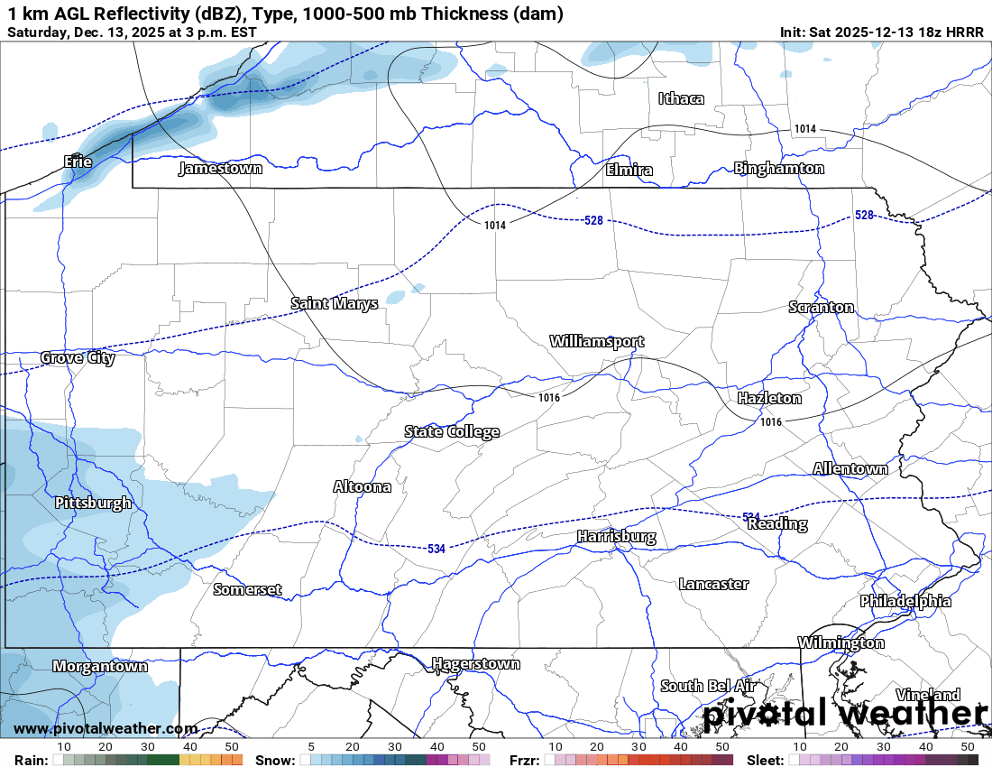
The rest of us will face deteriorating conditions this evening, especially in Western PA where snow is already starting as of the time this is being written. Below is the High Resolution Rapid Refresh (HRRR) model for the duration of this storm. The timestamp is in the top left.
It will take some time to dig out Sunday morning especially in Eastern PA where snow won’t wind down until either side of sunrise depending where you are. Plan on roads still being snow-covered through late Sunday morning or even afternoon.
This looks to be the final winter weather threat until around Christmas, with a brief reprieve from the frigid cold coming later next week.
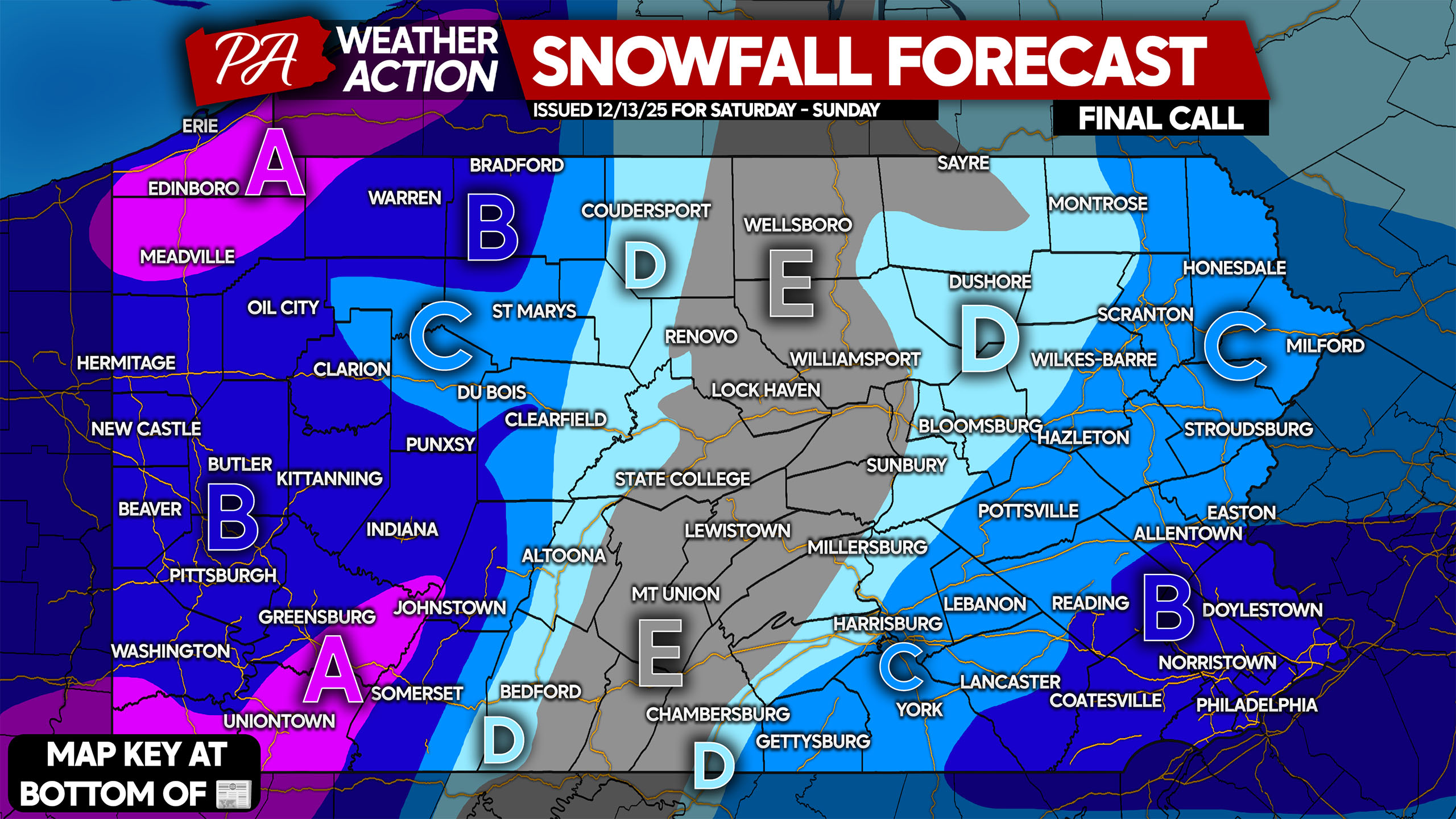
FINAL CALL SNOWFALL FORECAST THRU SUNDAY NIGHT
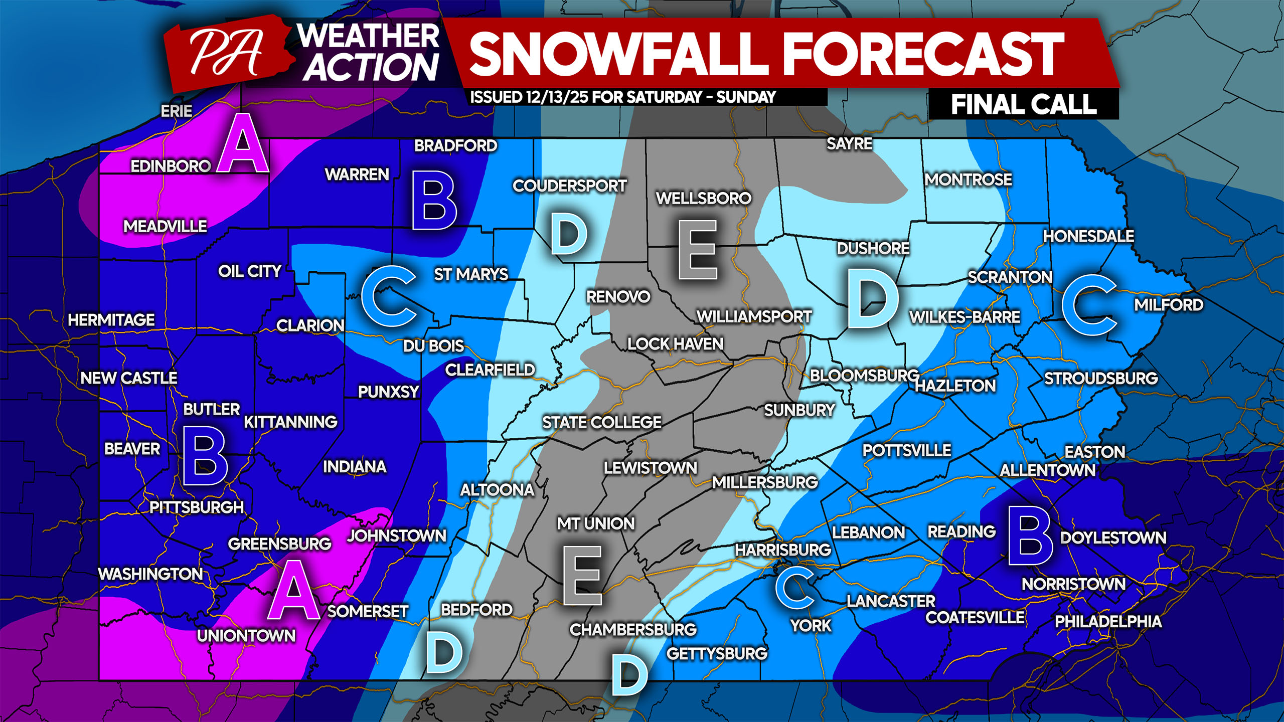
Area A: Snowfall accumulation of 6 – 8″ expected. Limit travel during and shortly after the storm to give crews space to clear the snow.
Area B: Snowfall accumulation of 4 – 6″ anticipated. Travel will be impacted this evening in Western PA and Sunday morning in Eastern PA.
Area C: Snowfall accumulation of 2 – 4″ expected. Plan on roads being snow-covered and hazardous.
Area D: Snowfall accumulation of 1 – 2″ anticipated. These areas may not pretreat, and roads will still be slick.
Area E: Less than 1″ of snow expected.
Share this forecast with family and friends!
You must be logged in to post a comment.