The first winter storm of 2025 will be threading the needle for snow lovers in Southern PA, with a sharp cutoff on the northern edge of this storm. Head to DC, a place that rarely sees 10″ of snow in an entire season, and they’re on tap for just that.
But as you push north into Northern Maryland, totals begin to drop off. This is still a tough call for southern tier counties of PA, where a 30 mile shift will make all the difference. Snow that falls with this storm will likely be on the ground for a long time. Potentially all the way through the end of January.
We will almost certainly have more opportunities for snow in January, but it’s important not to latch onto a model run 7 days in advance. You may hear about a chance for snow next weekend, but we have a long way to go and models haven’t shown any consistency.
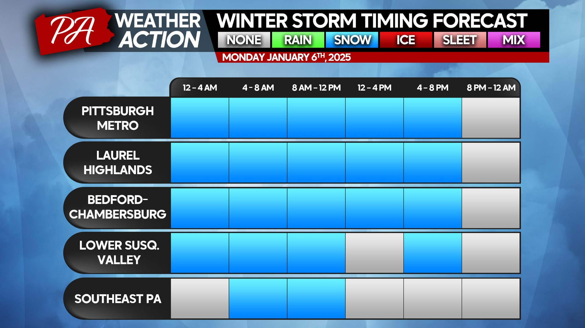
Monday’s Storm Timing
Snow will push into Southwest PA very shortly after midnight Monday morning, starting light but quickly becoming moderate nearest to the WV line. Snow will remain light north of Pittsburgh.
Snow will quickly move into the Laurel Highlands and South Central PA by around 2 – 4 AM Monday, falling between a half-inch and an inch per hour south of I-76 (PA Turnpike), and less than a half-inch per hour north.
And by the pre-dawn hours of Monday, light snow will push into Southeast PA. Moderate snow is likely south of Route 30.
Snow will then continue through Monday morning and become intermittent by the afternoon. Another wave of snow may move through the late afternoon into the early evening in Southwest PA South Central PA.
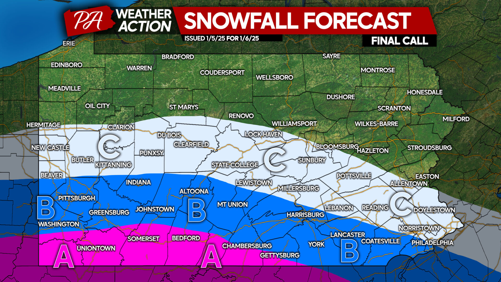
FINAL CALL SNOWFALL FORECAST FOR MONDAY
Area A: Snowfall accumulation of 5 – 8″ expected. Hazardous travel is likely to prompt school and business closings.
Area B: Snowfall accumulation of 3 – 6″ anticipated. School and business closings are likely in areas that average less seasonal snow, like valleys east of the mountains. Closings are possible in Western PA as well.
Area C: Snowfall accumulation of 1 – 3″ expected. Untreated roads will become snow-covered, leading to slippery conditions on roadways.
Thank you for reading, and stay safe out there!


You must be logged in to post a comment.