
The entirety of North America besides Alaska has seen a warmer than normal first half of January, with the core of the warmth over the Central US. Here in Pennsylvania, only slightly above average temperatures.
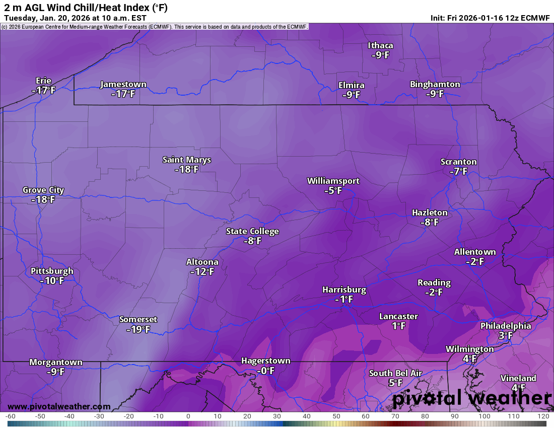
That will all be changing with Arctic cold coming in the following weeks. Most of the state will likely fall below 0 at some point with wind chills – well let’s not talk about that. Below is a preview of what it will feel like this coming Tuesday around 10 AM.
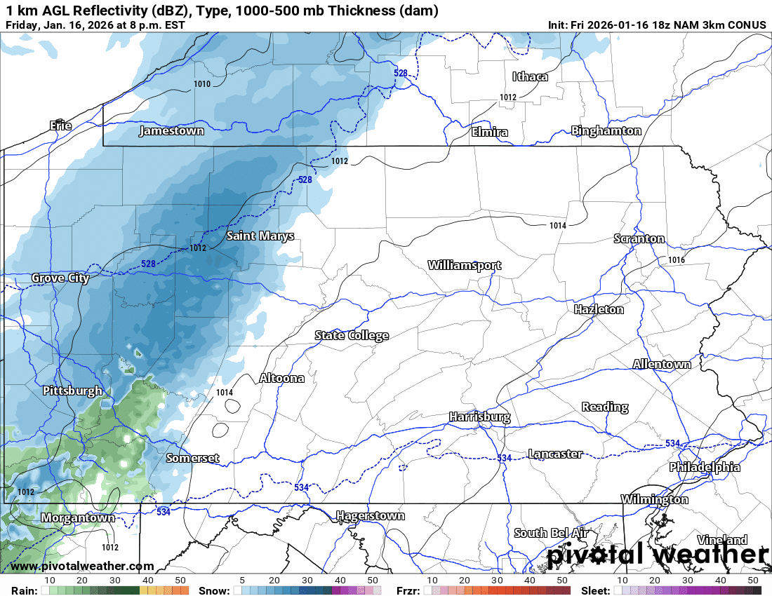
Light snow will begin in Western PA late tonight into early Saturday morning, with a burst of moderate snow likely to occur in the eastern half of the state beginning just after sunrise.
Road conditions will immediately be affected due to likely a lack of salting and temperatures below freezing. Moderate snow will gradually push east as the morning goes on, being exclusively along and east of I-476 by early Saturday afternoon before exiting.
Most persistent snows are expected to occur across the Poconos and Coal Region. Below is the Hi-Res NAM for the duration of this event, with the timestamp for each hour in the top left.
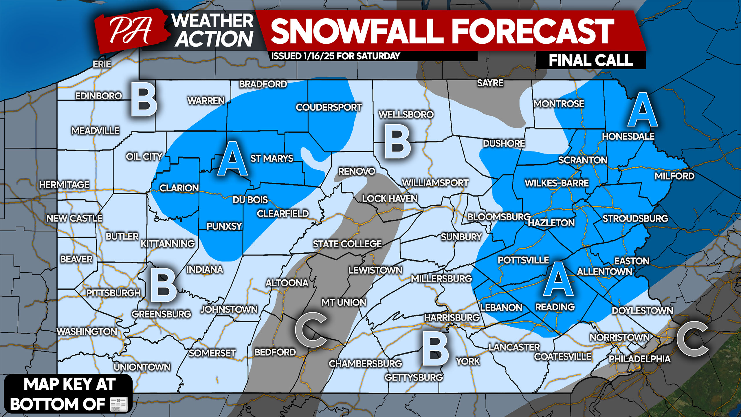
SATURDAY’S SNOWFALL FORECAST (FINAL CALL)
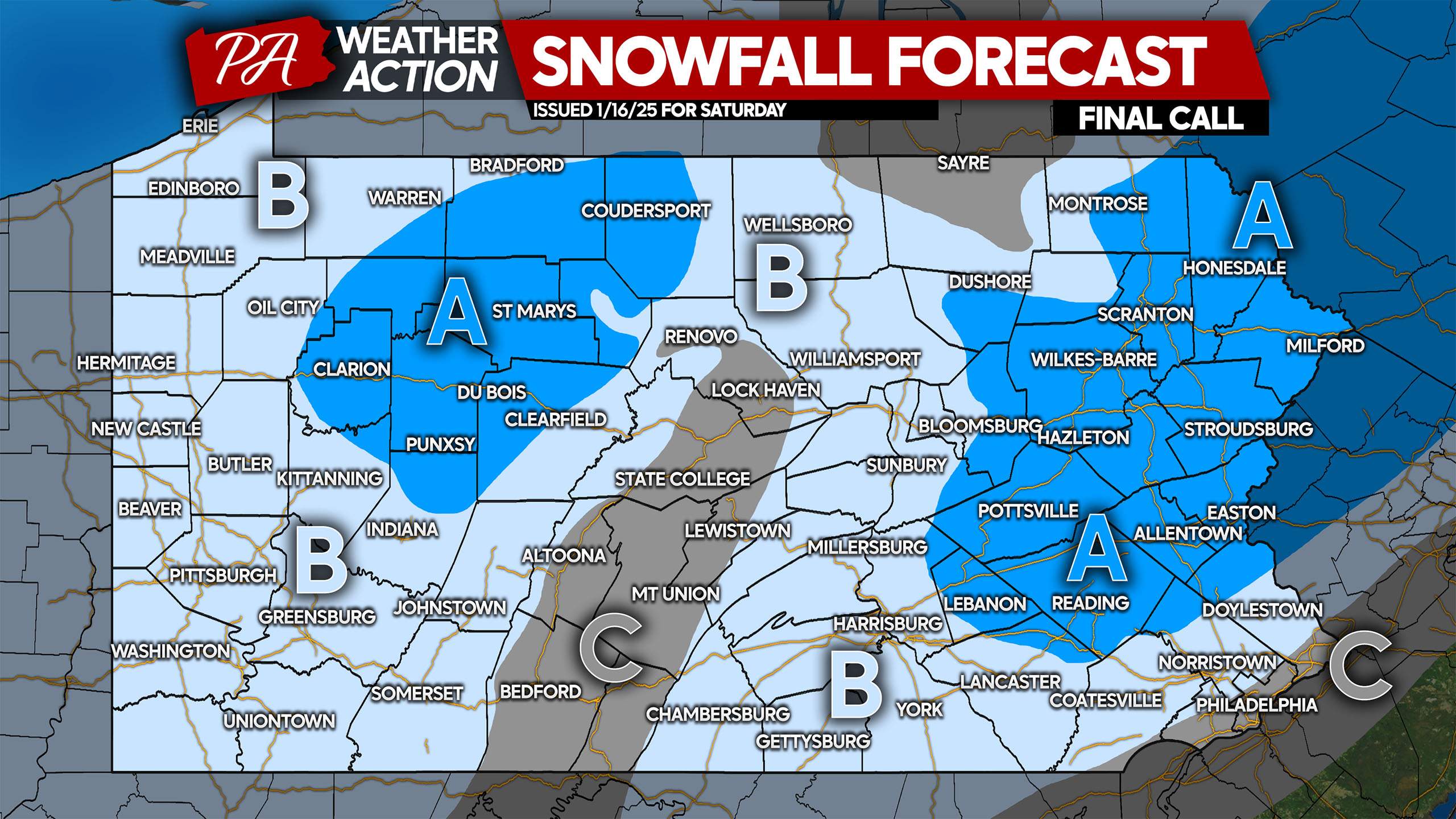
Area A: Snowfall accumulation of 2 – 3″ expected, with isolated localities in higher elevations of NEPA reaching 4″. Snow-covered roads are likely.
Area B: Snowfall accumulation of 1 – 2″ expected, with most areas closer to 1″. Higher elevations will be closer to the 2″ mark. Roads may be snow-covered.
Area C: Snowfall accumulation of less than 1″ expected. Road impacts unlikely.
Don’t forget to share this forecast with family and friends who may have Saturday morning plans!

You must be logged in to post a comment.