
It has been a roller coaster ride these past few days to say the least, and we are finally narrowing down on a solution just a day before the storm. This storm will bring drastically different impacts across Pennsylvania, with the focal point of concern on Eastern PA (areas near I-476).
There has been more emphasis on a fairly sharp cutoff in snow totals between Philadelphia and Lancaster, or Stroudsburg and Scranton. The core of the snow with this storm will be along I-95 and east, leaving us on the fringes.
Also, this will be an elevation-dependent storm in Central PA with the ridges seeing perhaps twice as much snow as adjacent valleys. This is without a doubt one of the most difficult forecasts in memory, especially when we cover the entire state.
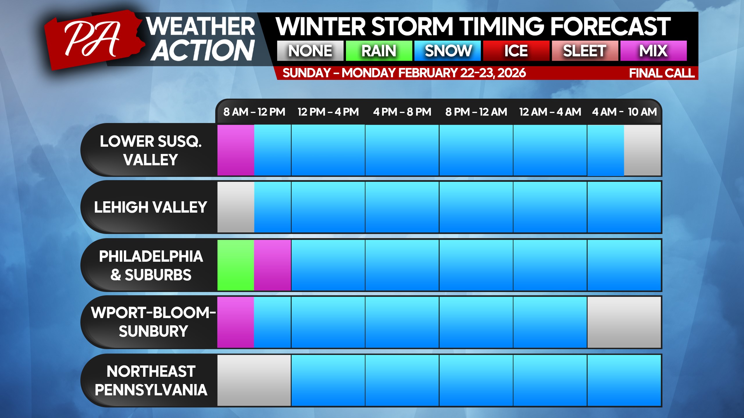
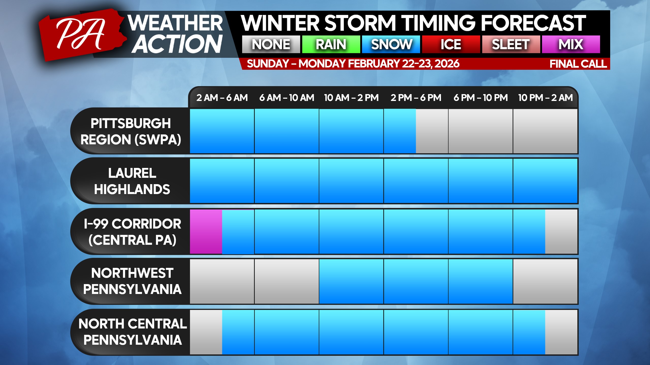
STORM TIMING
Light snow, mixing with rain in valleys to start, will move into Western and Central PA around sunrise Sunday or even a few hours beforehand. By lunchtime Sunday, were still just looking at light to moderate snow now extending into Eastern PA.
By late Sunday afternoon, the coastal low will really intensify and increase snowfall rates in Southeast PA to 1-2″/hour. Heavy snow will overspread all of Eastern PA Sunday evening into the overnight hours. This is where the sharp cutoff from the Delaware River, where snow will be heavy, to I-81, where snow will be light, will really come into play.
Heavy snow will continue in Southeast PA, the Lehigh Valley, and the Southern Poconos until mid-Monday morning before winding down. Below is a timing breakdown for regions across PA.
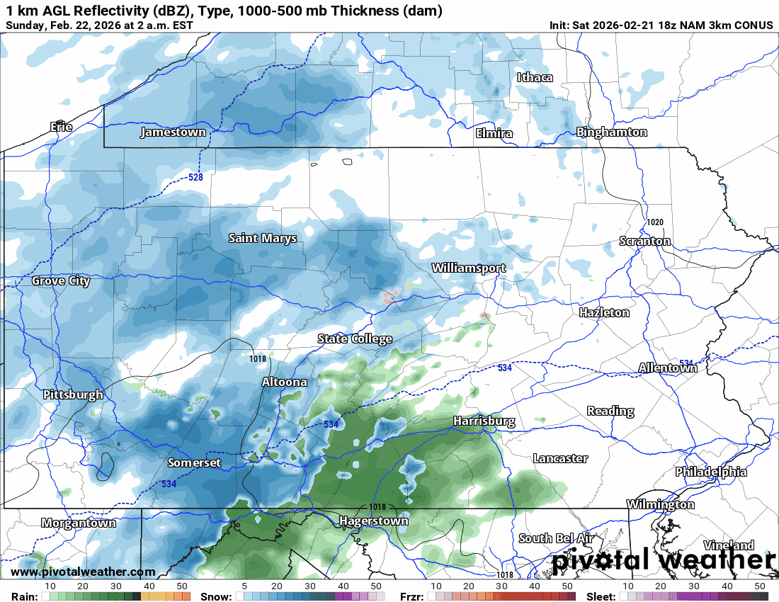
Models remain very split on where the cutoff for heavy snow is, which also affects timing and intensity. Below is the latest Hi-Res NAM model for this storm.
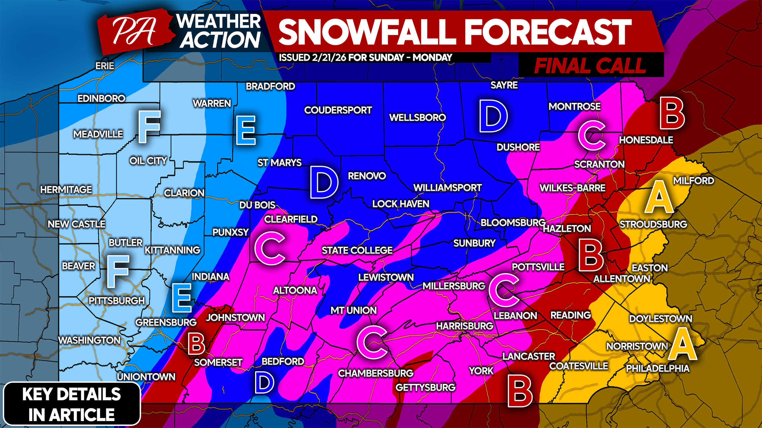
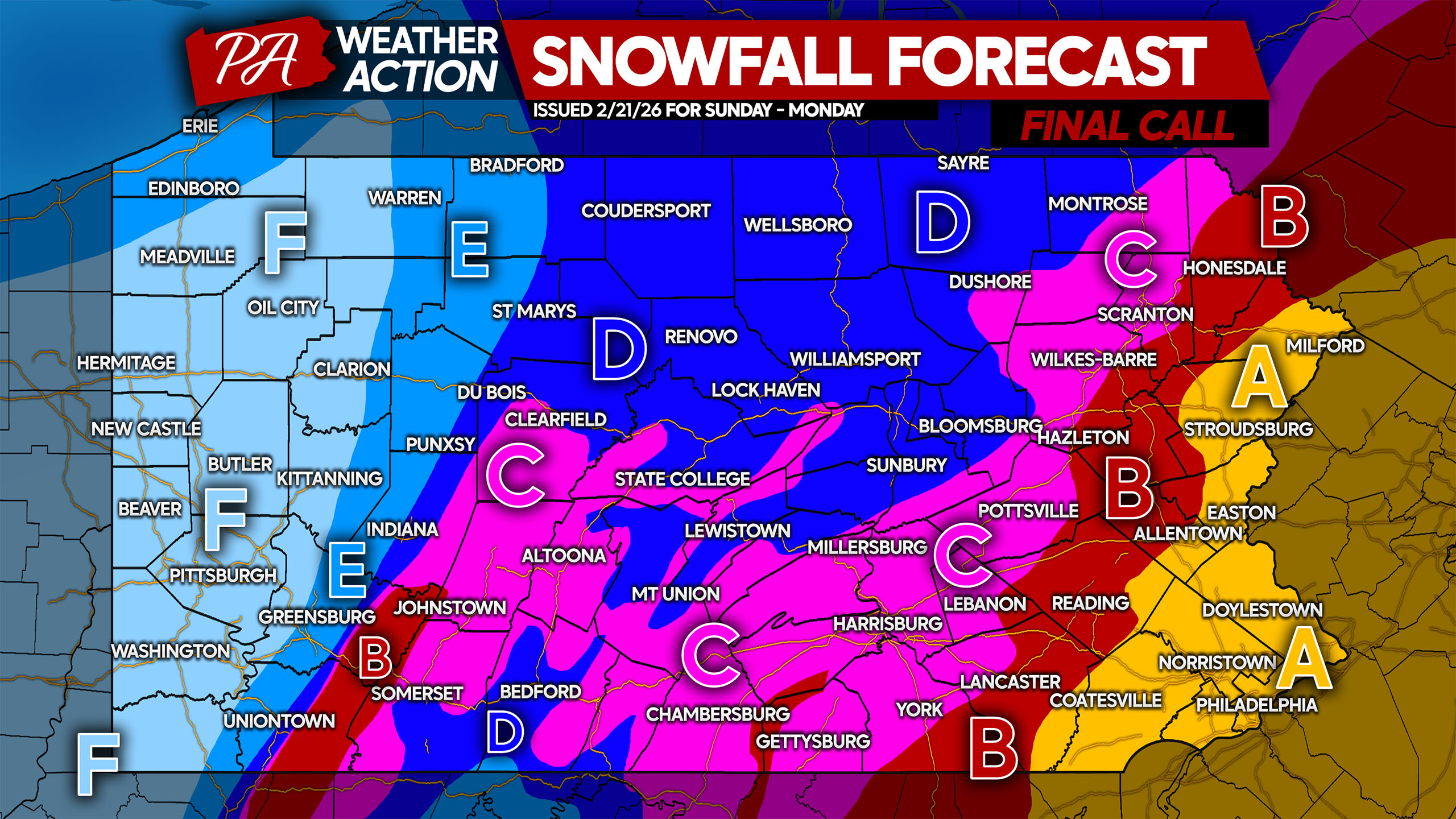
FINAL CALL SNOWFALL FORECAST FOR SUNDAY – MONDAY
Take breaks when shoveling and stay hydrated! Help out senior citizens, as they are at much higher risk of experiencing medical emergencies when shoveling this much snow.
Area A: Snowfall accumulation of 12 – 20″ expected. Do not travel in heavy snow unless in an emergency. Expect school closures through midweek.
Area B: Snowfall accumulation of 8 – 12″ expected. Do not travel in heavy snow unless in an emergency. Expect a few days of school closures.
Area C: Snowfall accumulation of 5 – 8″ expected. Avoid traveling during heavy snow unless you absolutely must! Expect school closures and delays for a few days.
Area D: Snowfall accumulation of 3 – 5″ expected. Expect school closures Monday.
Area E: Snowfall accumulation of 2 – 3″ expected.
Area F: Snowfall accumulation of 1 – 2″ expected.
Please share this important information with friends and family in affected areas below!
You must be logged in to post a comment.