As the coldest January in many years continues with frigid temperatures into next week and beyond, lakes are beginning to freeze over across the state. Before walking on frozen lakes, the ice must be at least 4″ thick, with proper measurement necessary. A thin blanket of snow is expected Friday night into Saturday morning, although in Eastern PA it’ll be more of a coating.
A large winter storm that brought a seasons’ worth of snow to parts of the South is pushing east, and weakening in the process. By the time it reaches us in a matter of hours depending on when you’re reading this, snow will be very light. However, very cold temperatures will allow anything that falls to stick to all untreated surfaces.
Because most of the state is not under a NWS Advisory, many roads may not be treated or plowed. Residual salt from the previous storm may help in areas like Southern PA.
Light Snow Timing
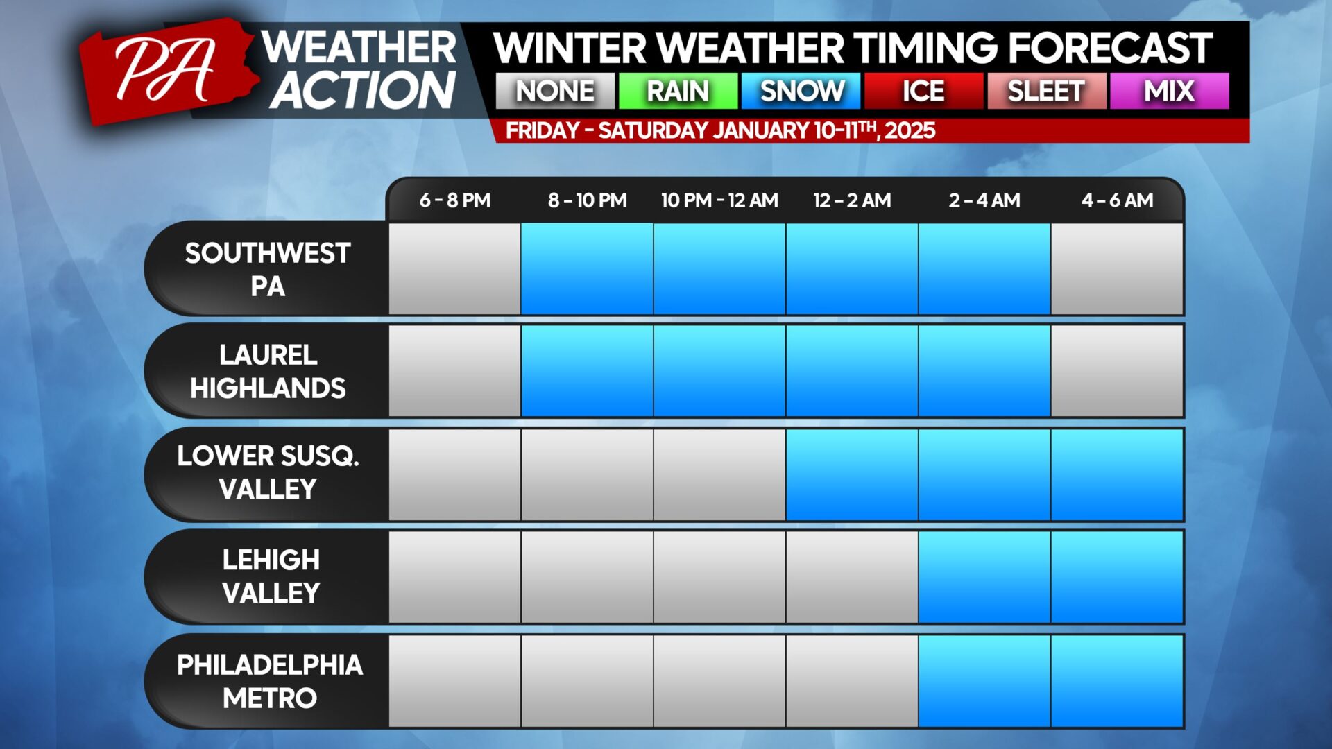
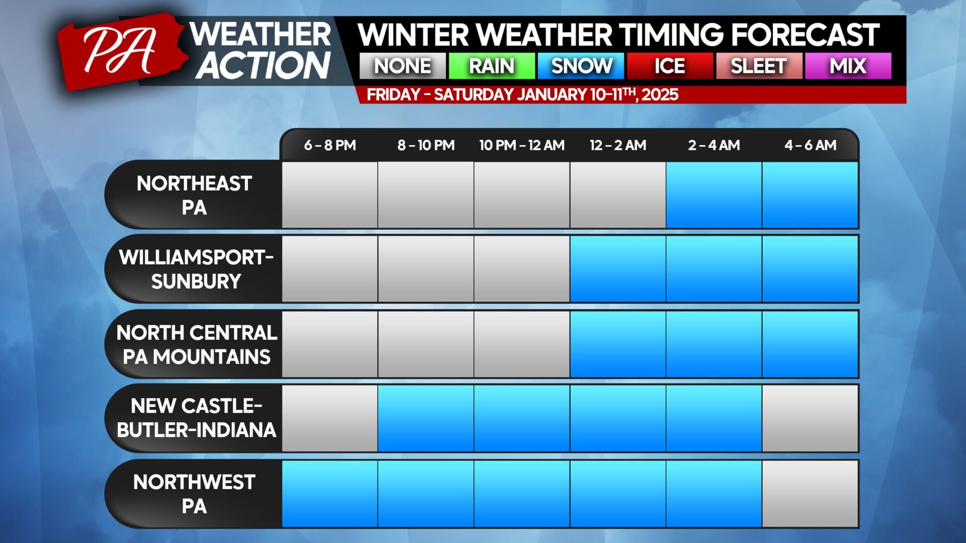
Light snow has already begun in Northwest PA, however they have separate banding that is headed to Western NY and Ontario. In the rest of Pennsylvania, snow is expected to move in late Friday evening from southwest to northwest.
Light snow will continue for 4 – 8 hours, depending on where you are, before exiting from southwest to northeast early to mid-Saturday morning. We do not expect lake effect snow to follow this event, which is great news for Erie!
Below are timing charts for various regions of the state. If your town is not listed, please use the closest town/area.
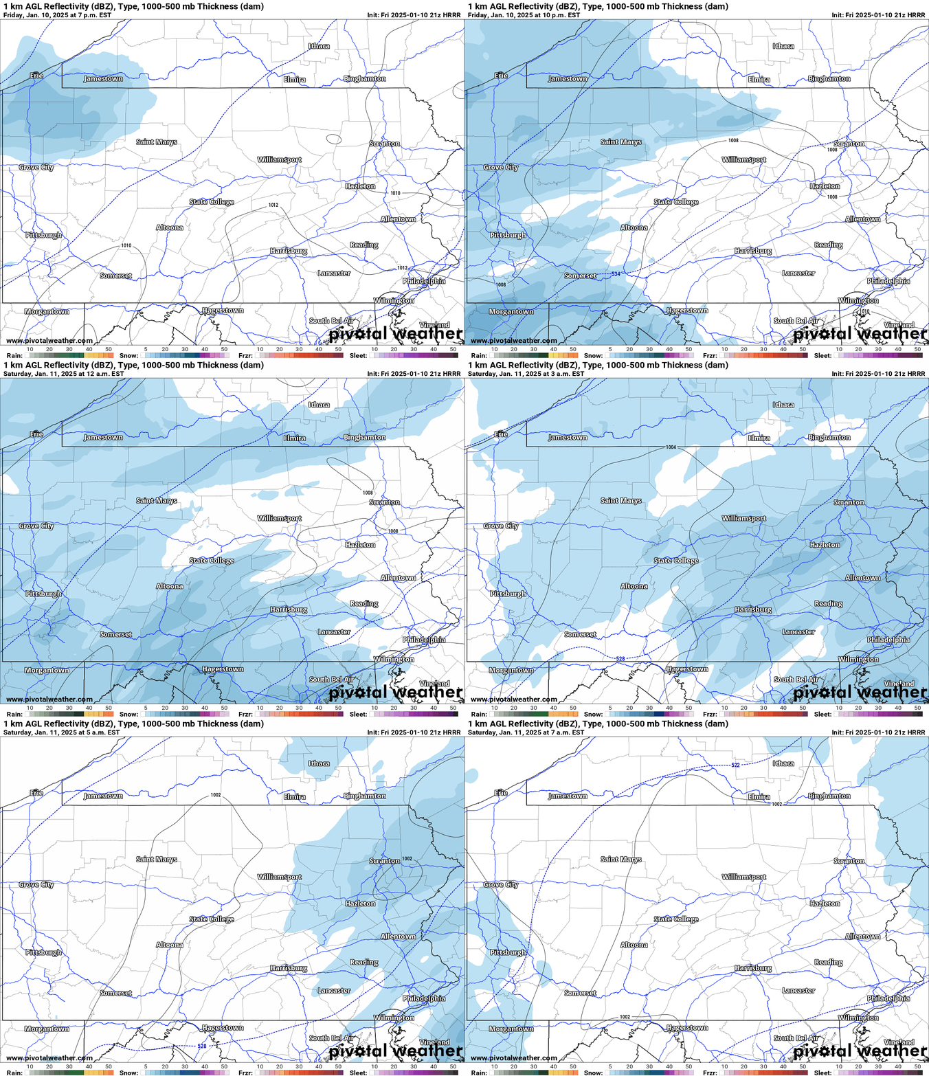
It’s nearly impossible to know where exact light snow bands will be, with each model placing them in slightly different areas each run. But we’re only talking the difference of less than an inch of snow.
Below is the HRRR (Hi-Res Rapid Refresh) Model for Friday evening into Saturday morning.
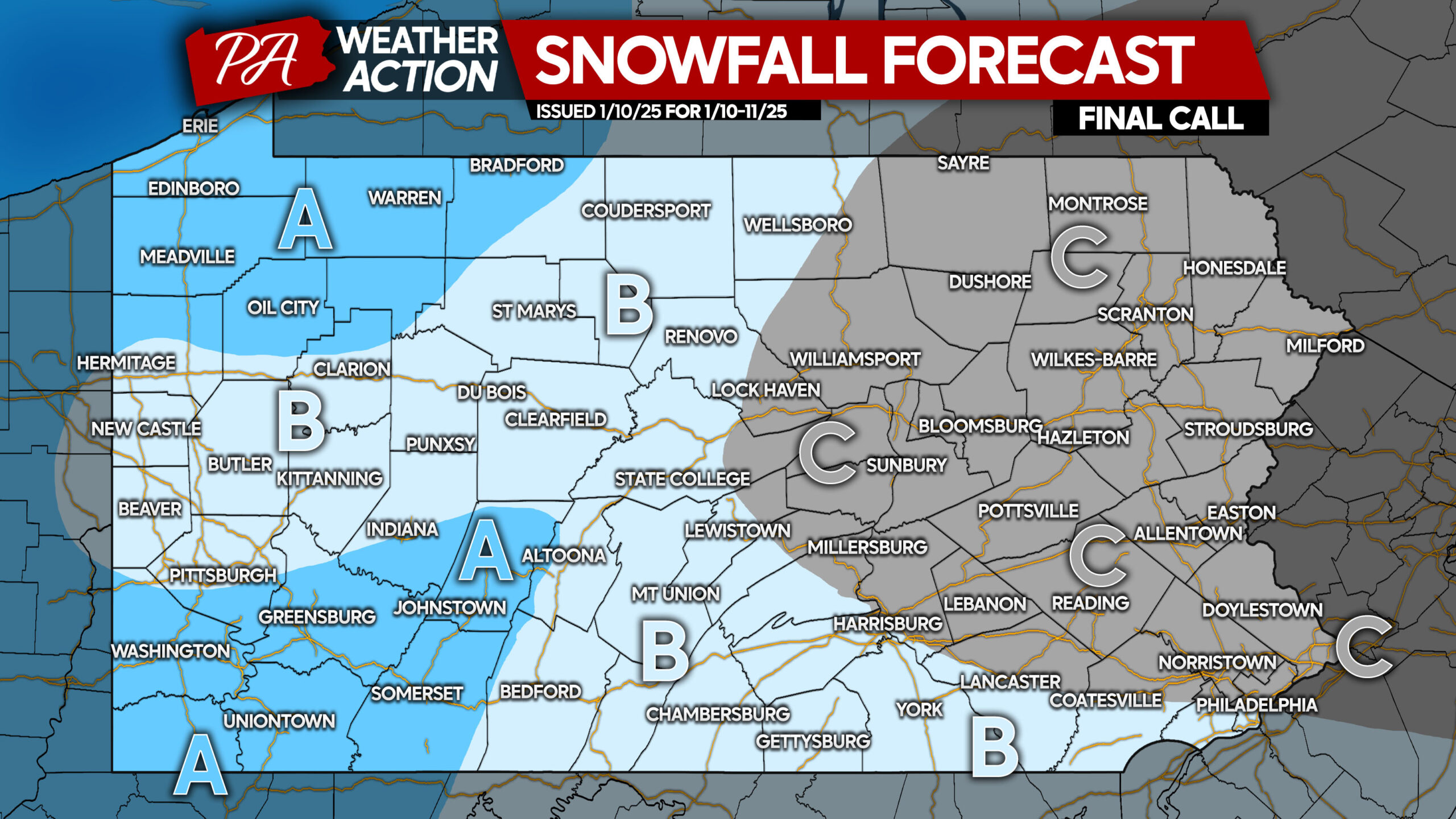
FINAL CALL SNOWFALL FORECAST FOR FRI NIGHT – SAT MORNING
Area A: Snowfall accumulation of 2 – 3″ anticipated. Up to 4″ possible in Northwest PA. Slick driving conditions are likely.
Area B: Snowfall accumulation of 1 – 2″ expected. Slick driving conditions are likely on untreated roadways.
Area C: Snowfall accumulation of less than 1″ anticipated. Untreated roads may become slick.



You must be logged in to post a comment.