
After many snowless weeks in much of the state, winter will finally make a return this weekend. Even if your area isn’t looking to get much out of this specific event, a very cold and stormy pattern is setting up, so the wait won’t be much longer. For now though, let’s get into the details around this storm.
While there has been a slight north trend in model guidance in regards to where heavier snowfall will occur, there has also been a push back from the confluence off to our northeast. As a result, a somewhat tighter gradient looks likely especially in Eastern PA. However some light to moderate snow is now anticipated south of the turnpike Sunday Morning, which before was expected to stay mainly south of the PA/MD border.
Since timing is important as many of you may have some weekend plans, we will get in-depth with it below.
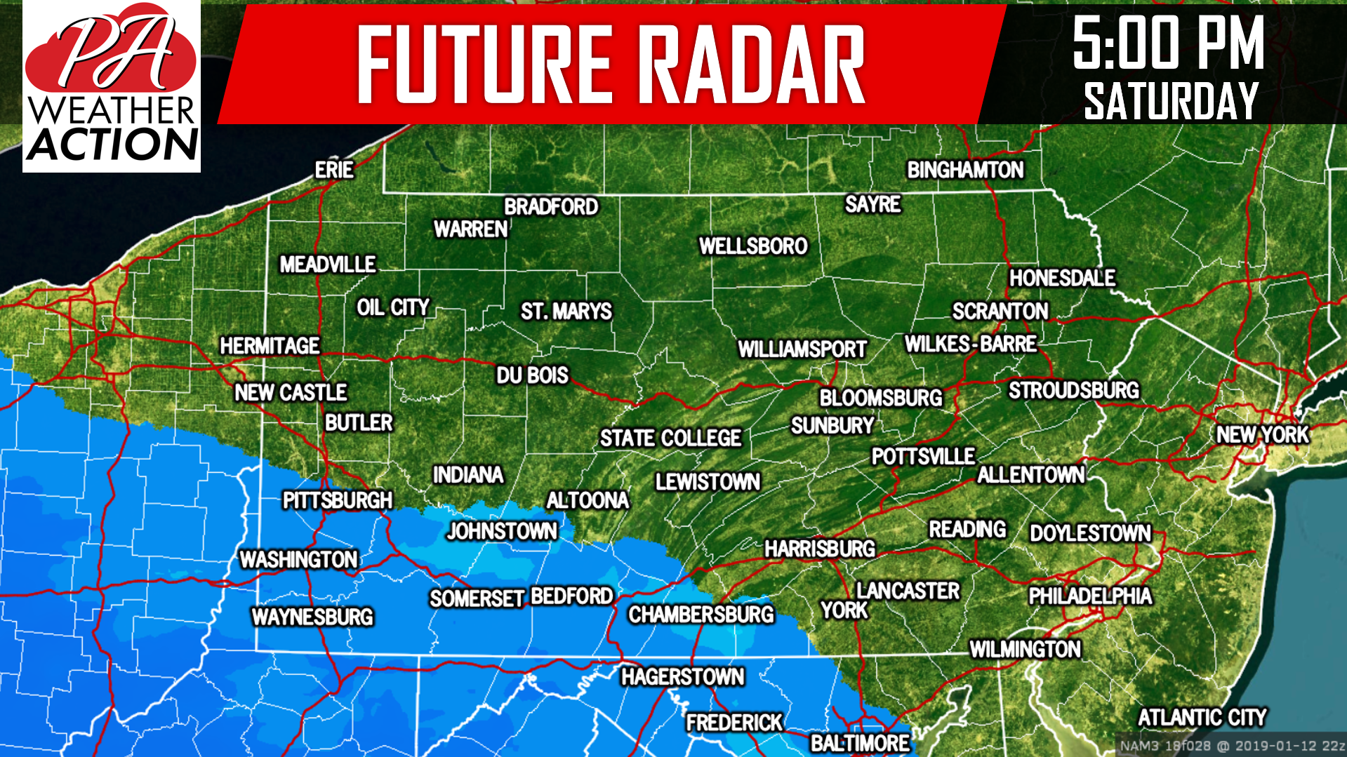
Light to moderate snow will begin to setup south of Pittsburgh, into the Laurel Highlands, and over as far east as Chambersburg by late Saturday Afternoon. Here is the Hi-Res NAM (American Short Range Model) for 5:00 PM Saturday:
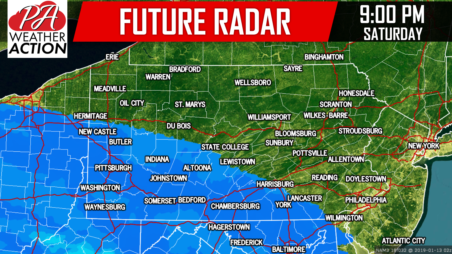
 Precipitation will have to overcome some dry air as it moves north and east Saturday Evening. Due to that, it may take several hours for snow to move north and east. By 9:00 PM Saturday, snow will expand as far north as the Butler-Altoona-York line. Below is future radar for 9 PM Saturday:
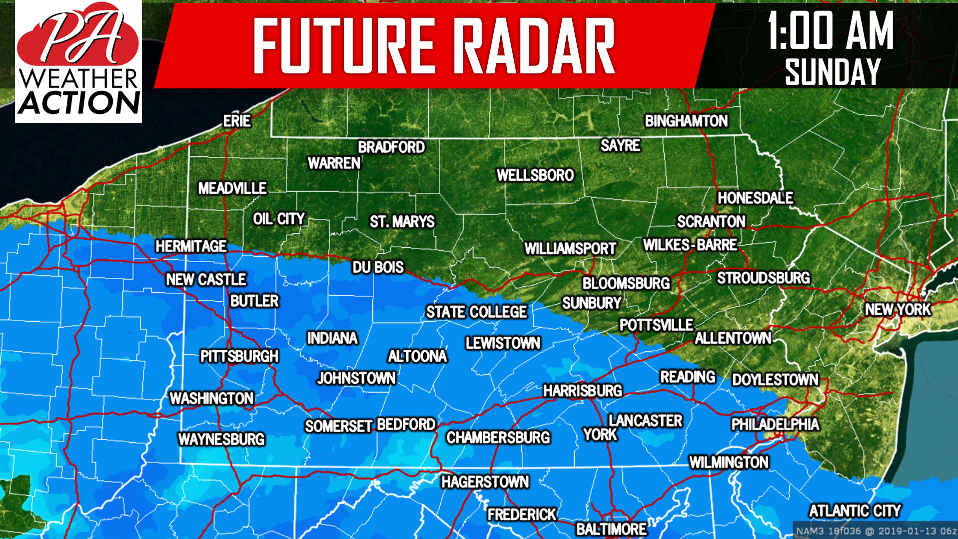
Snowfall rates of up to 1/2″ per hour are likely. Moving into early Sunday Morning, snow will only expand 20-30 miles. Here is a look at future radar for 1:00 AM Sunday:
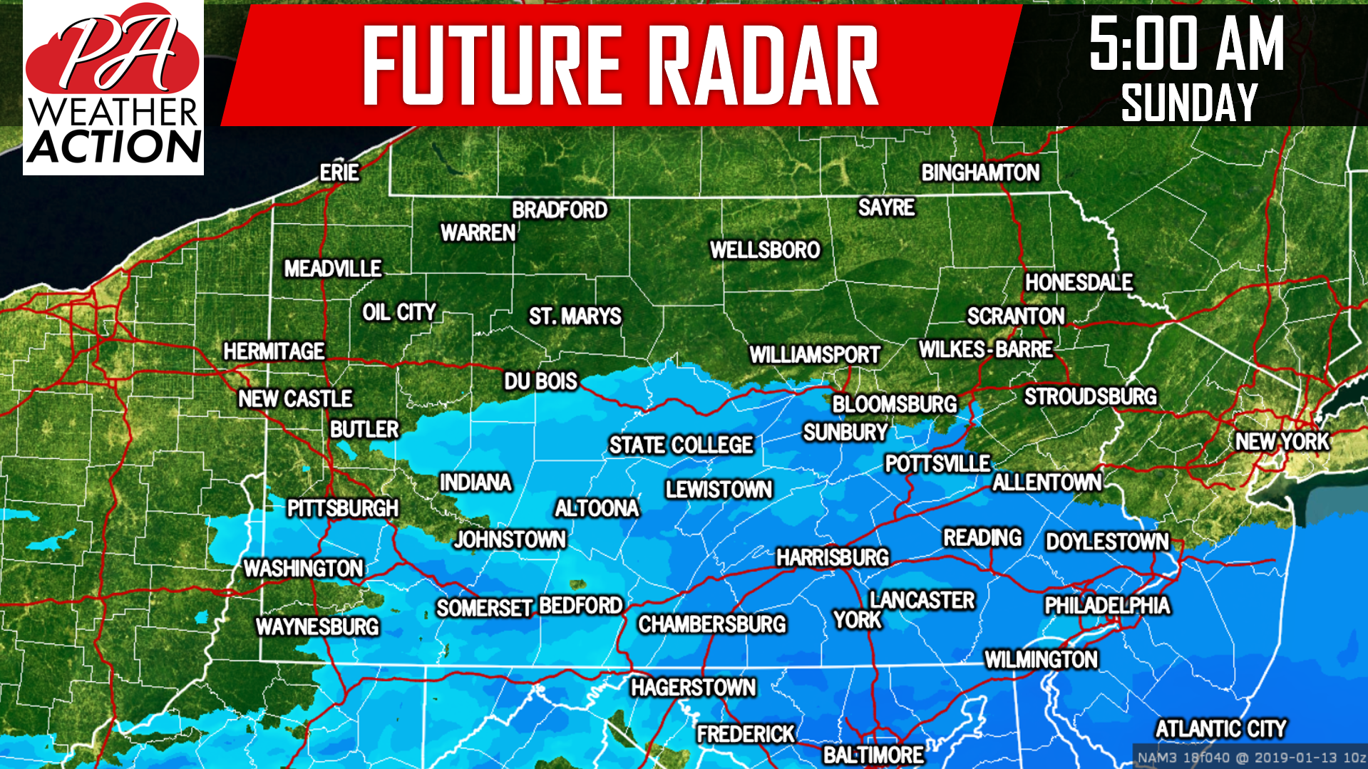
By just before sunrise Sunday, snow will begin to wrap up west of the Laurel Highlands, while light to moderate snow will likely still be falling in Southcentral and Southeast PA. Below is a view of future radar at 5:00 AM Sunday Morning:
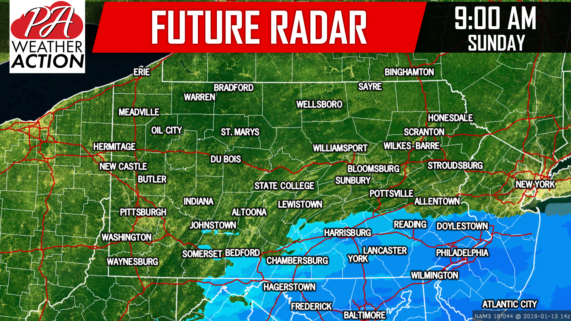
 Finally, all remaining light snow will come to a close mid to late Sunday Morning. As you can see below, only some light snow is left near the Southern PA border by 9:00 AM Sunday:
 This all will be a very fluffy snow, as temperatures will be in the mid 20s, generating ratios of 15:1. So what does all of this add up to?
FINAL CALL SNOWFALL FORECAST FOR WEEKEND STORM
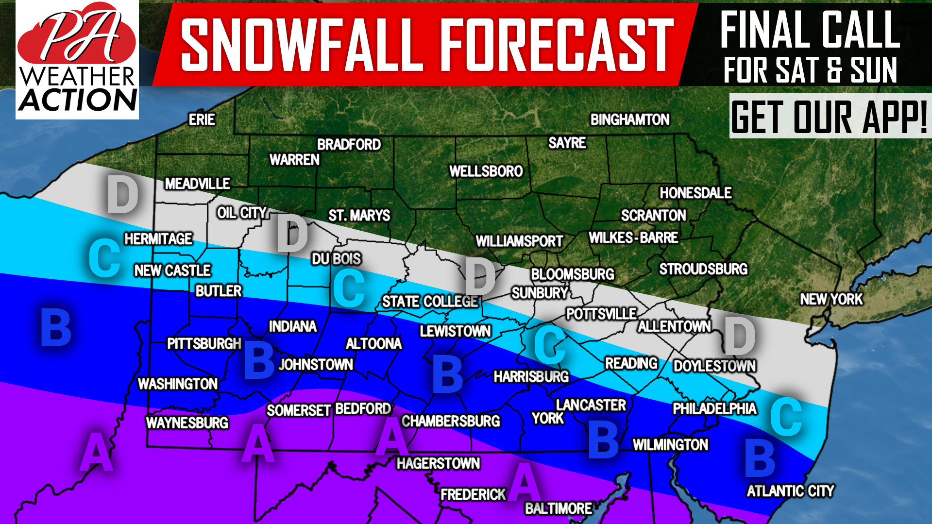 Area A: Snowfall accumulations of 4-6″ expected. Dangerous travel conditions expected Saturday Evening through mid Sunday Morning.
Area B: Snowfall accumulations of 2-4″ anticipated, with highest amounts near Area A, and lowest near Area C. Hazardous travel conditions expected late Saturday Evening through sunrise Sunday Morning.
Area C: Snowfall accumulations of 1-2″ expected. Untreated roadways will become slippery Saturday Night, reduce speed.
Area D: Snowfall accumulations of <1″ likely.
Download our app for an accurate hourly forecast for your area, and updates on future storms to come >>> PA Weather App Link
We will have updates throughout the storm on Facebook >>> PA Weather Action Facebook Link
Share the updated snowfall forecast with your friends and family using the button below!
You must be logged in to post a comment.