
While it may be spring, we are still seeing the same characteristics of this past “winter” with this storm as well. Timing with our coastal storm, that will be supplying the moisture, has been slowly pushed back in the past few days, from a predawn start to a 8 – 10 AM start. That makes a huge difference, as temperatures will be warmer later in the day and the sun angle will be higher.
Expectations for this storm in the northeast have remained about the same in the past few days, except here in Pennsylvania, where nearly the entire storm will now occur during the daytime. The will result in a mainly north of I-80 snow event, outside high elevations. We wanted to put our trust into what are statistically the most accurate models, the Ecmwf (Euro) and Ukmet, but it didn’t work out so much. That’s essentially the summary of this winter in one line, “it didn’t work out.” The good news is that this will more than likely be the last widespread snow event of the season here in PA, with above average temperatures coming afterwards.
STORM TIMING
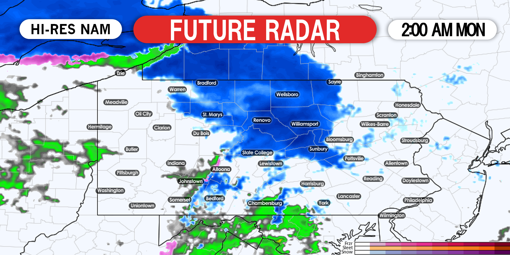
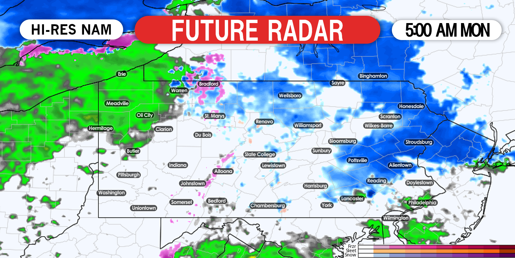
Snow from the weakening primary low pressure to our west will move into northern PA from west to east early Monday morning. Below is Hi-Res NAM future radar for 2:00 AM Monday.
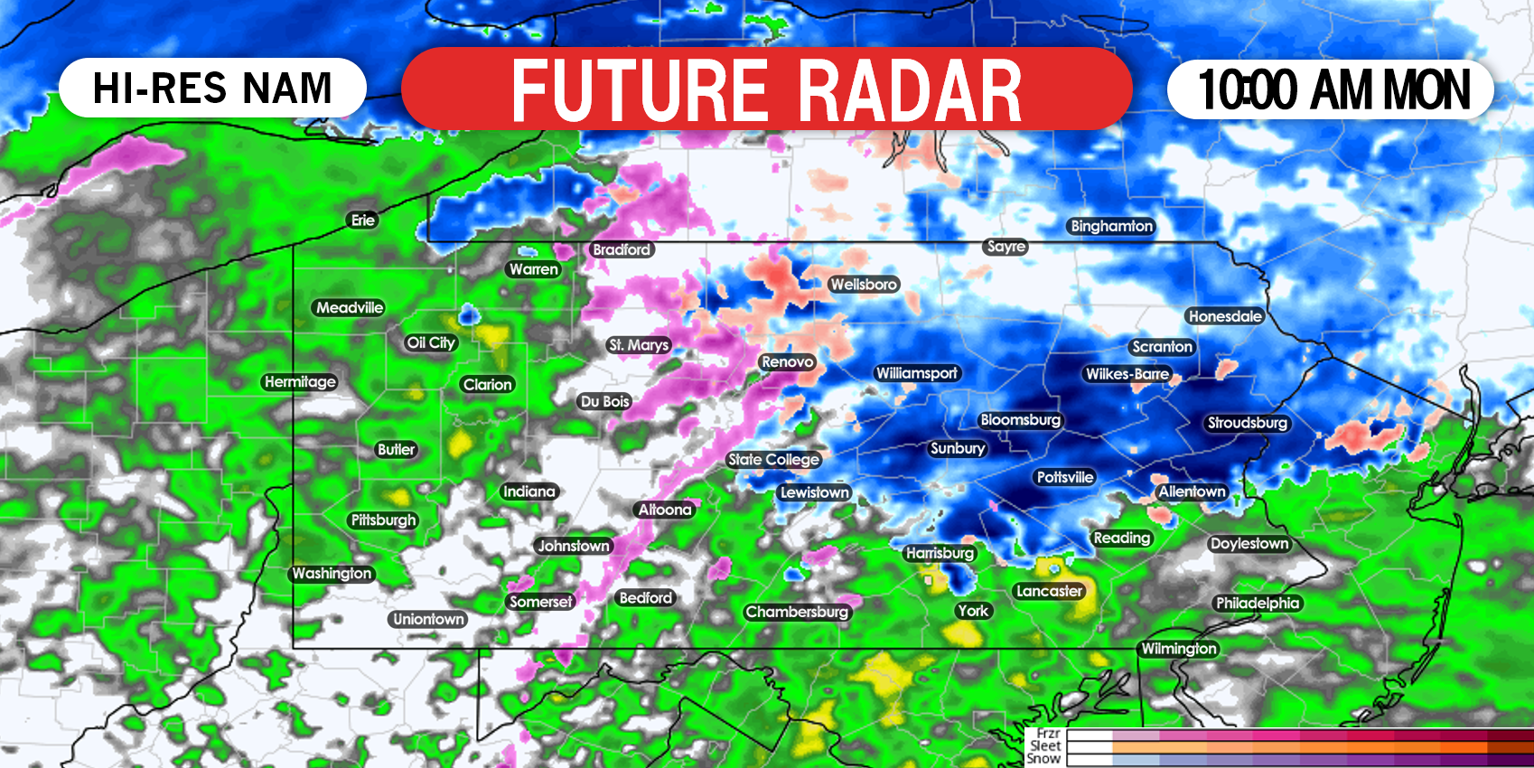
Precipitation will move into central and eastern PA by mid morning, initially in the form of rain south of I-78 and snow north of I-78. Below is future radar for 10:00 AM Monday.
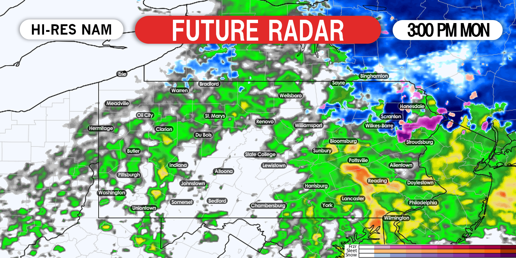
The rain/snow line will rapidly move north in the late morning and early afternoon Monday. Valleys north of I-78 will change over to rain a few hours before the mountains do. By 3:00 PM, only the northern Poconos are expected to hang onto the snow, while all other areas see rain, as shown here.
FINAL CALL SNOWFALL FORECAST FOR MONDAY
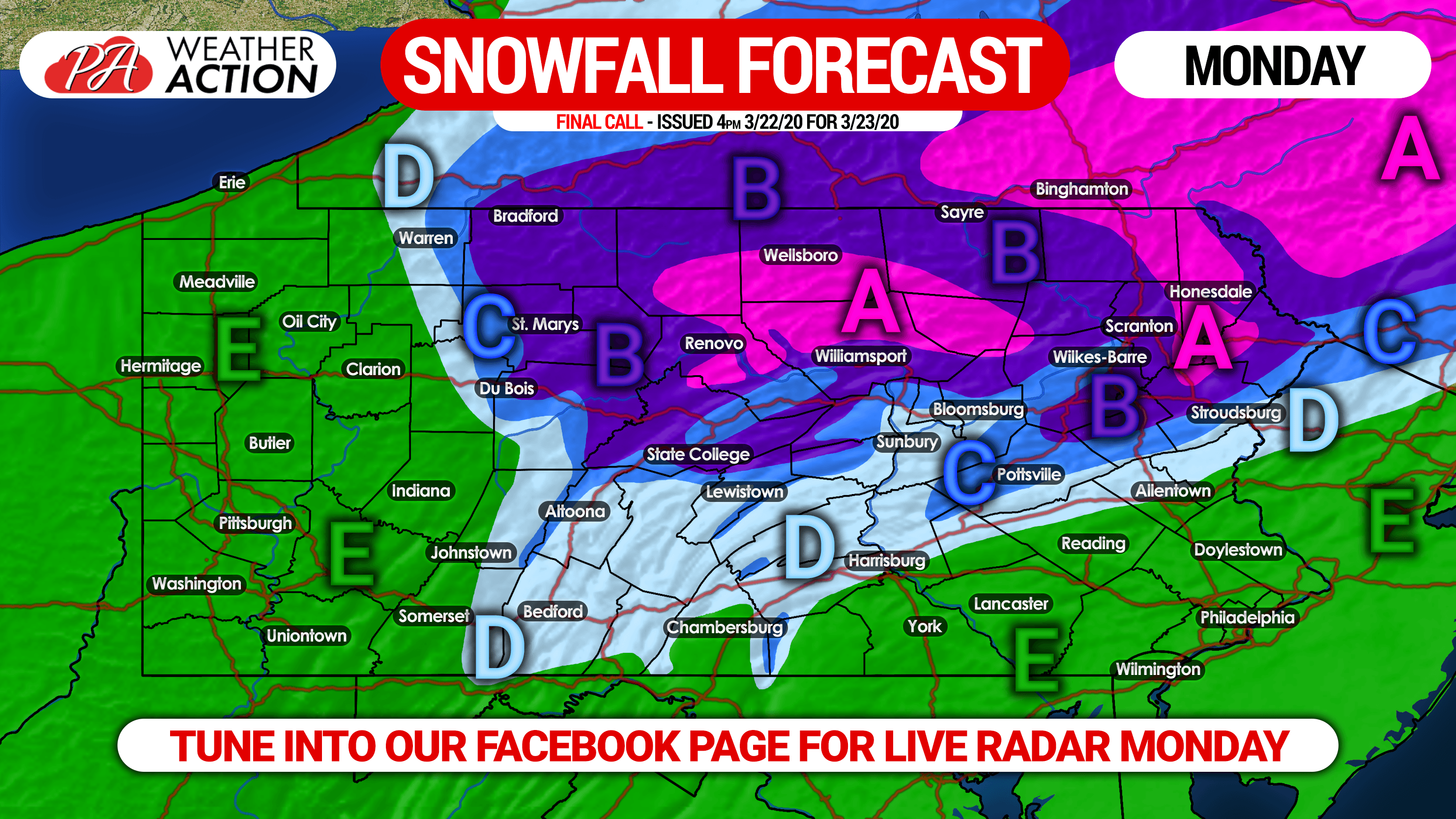
Area A: Snow accumulation of 3 – 5″ expected on grassy surfaces, and 1 – 2″ of snow on untreated paved surfaces.
Area B: Snow accumulation of 2 – 3″ expected on grassy surfaces, and a coating to 1″ of snow on untreated paved surfaces.
Area C: Snow accumulation of 1 – 2″ anticipated on grassy surfaces, with a slushy coating possible on untreated paved surfaces.
Area D: A coating to 1″ of snow accumulation on grassy surfaces, with no accumulations expected on paved surfaces.
Area E: Rain expected throughout the duration of the storm.
We will have live precipitation-type radar on our facebook page tomorrow, and you can always track your local weather with our app. Download it on iOS & Android here: Weather Action App Link
Thank you for sticking with us through this season, we’ll have severe weather coverage when the time comes. Stay safe everyone!

You must be logged in to post a comment.