
A strong storm system will deliver heavy snow, rain and even thunderstorms for parts of Pennsylvania tonight and into Thursday. Similar to previous winter storms this winter, the low pressure associated with this storm will track directly over our region tonight. This will allow for all areas to start off as rain. Localized areas near and south of i81 may even experience severe weather.
As the low pressure tracks northeast, rain will change to snow across much of western Pennsylvania and parts of central Pennsylvania. The bulk of the rain and snow will be over by Thursday mid-morning. Then our attention turns to lake effect snow that will impact western Pennsylvania, especially northwest Pennsylvania Thursday afternoon through Saturday morning.
TIMING:
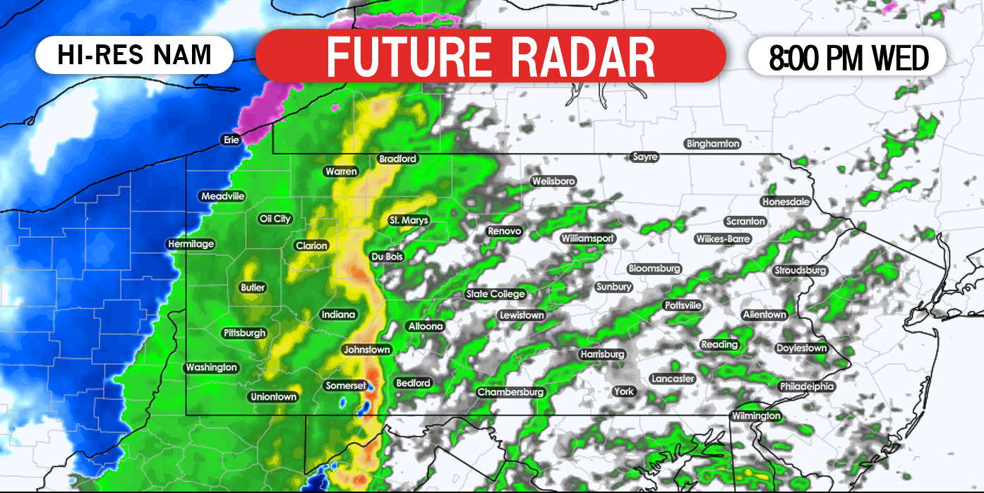
Rain has already entered western Pennsylvania as we are typing this article. The rain will continue to push eastward. Embedded severe thunderstorms are possible throughout the nighttime hours in central and eastern PA. Although this line likely won’t have much lightning, damaging winds of up to 50 – 60 MPH are still possible. Below is a look at the latest short range hi-res NAM model valid for 8:00 PM this evening.
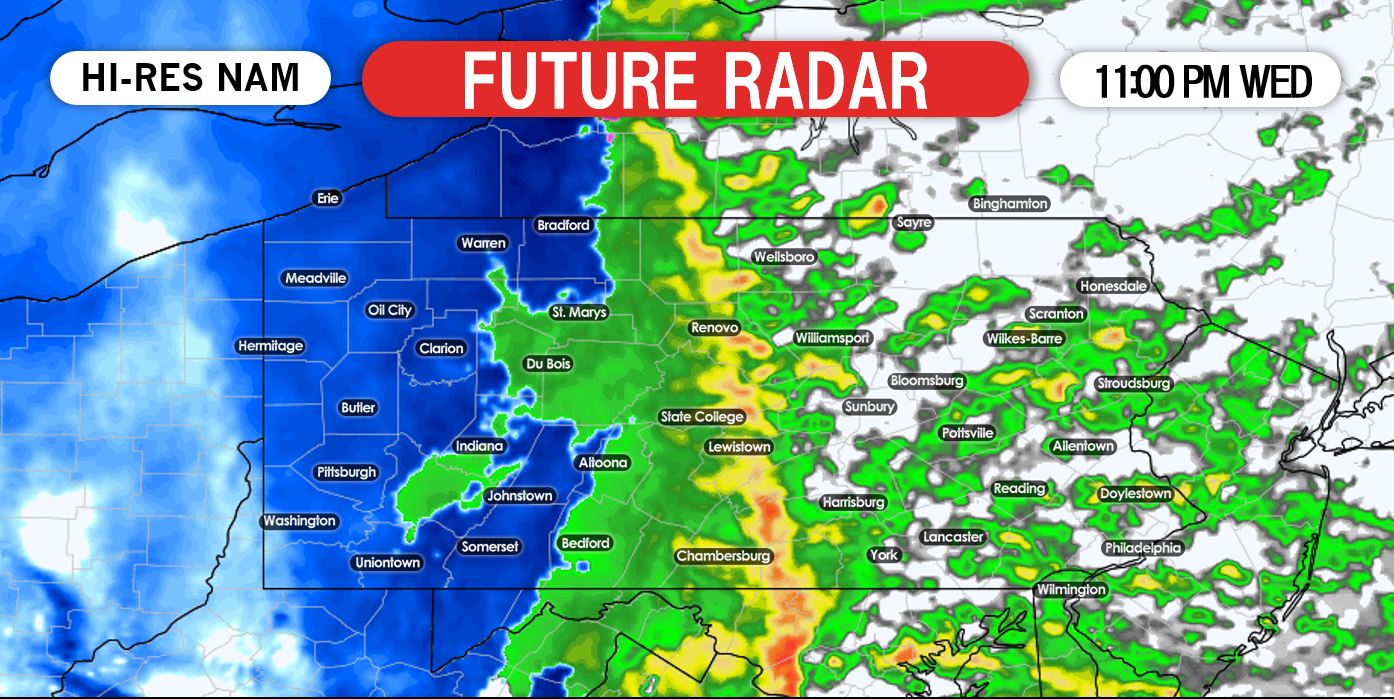
As we progress into the nighttime hours, rain will change to snow across western Pennsylvania. The snow will fall heavy at times. Temperatures will crash at a rapid rate allowing for accumulations to occur on all surfaces. Below is a look at 11:00 PM tonight:
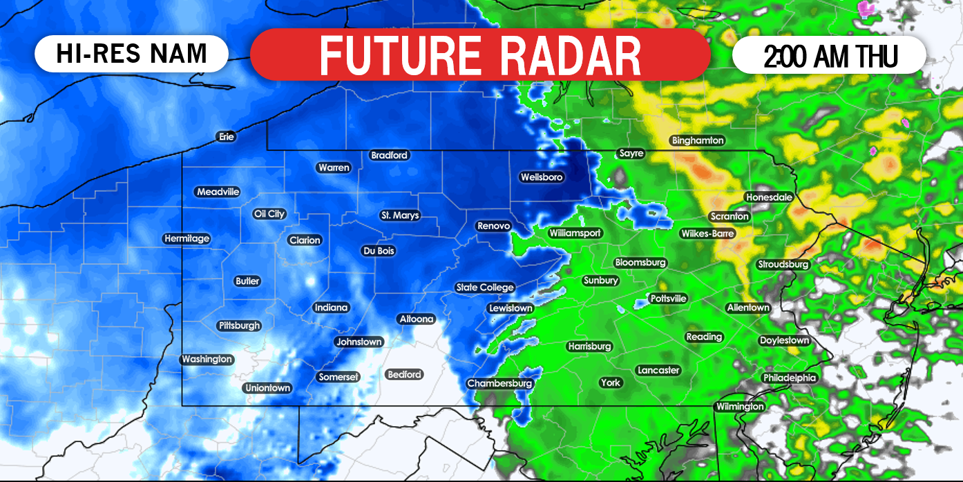
The good news is, the bulk of the rain and snow will fall while most of us are sleeping. Taking the hi-res NAM out to 2:00 AM Thursday morning, western Pennsylvania and parts of central Pennsylvania have changed over to snow. Once again, eastern Pennsylvania will escape the snowfall.
Snowfall rates may exceed 1″/+ per hour, especially across northwest Pennsylvania. Taking the hi-res NAM model out to 5:00 AM, the bulk of precipitation is over, with lingering snow showers across northern Pennsylvania.:

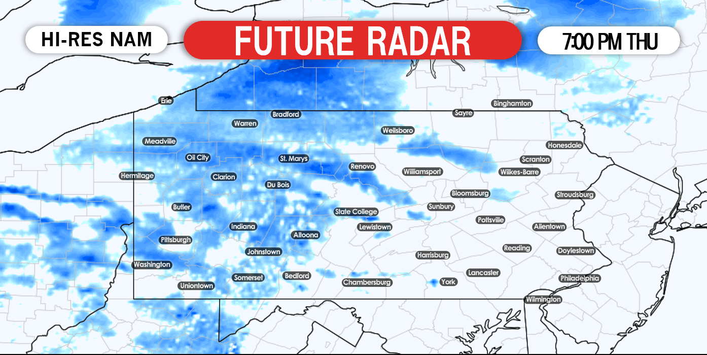
The storm system will pull away to our northeast by mid-morning Thursday. A lull in the action is likely Thursday afternoon. Then our attention turns to the lake effect snowfall that will impact western Pennsylvania Thursday evening through Saturday morning. Now this does not mean it will snow across these areas continuously. However, on and off lake effect snow showers are expected during this time period which will result in moderate to significant snowfall accumulations across northwest Pennsylvania. Lighter accumulations elsewhere across western Pennsylvania. Below is a look at 7:00 PM Thursday evening:
Taking the hi-res NAM all the way out to Friday night, lake effect snow showers are still occurring across parts of northwest Pennsylvania. It is expected these snow showers will completely shutoff by Saturday afternoon:

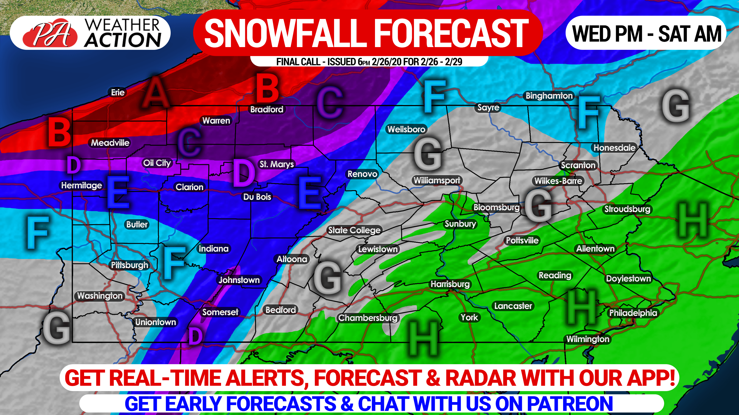
FINAL CALL SNOWFALL FORECAST THROUGH SATURDAY
You must be logged in to post a comment.