After the last three days I think we are deserving of a dry and warm day, and that’s exactly what is on tap today! We are starting the day with some clouds in parts of Eastern PA and valley fog, but that all will be on the way out this morning. Looking at satellite, you can see those clouds with the rest of the state being clear.
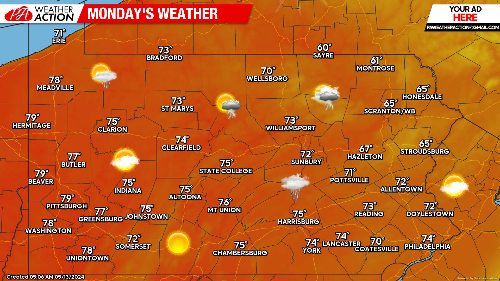
Today’s Forecast: 8/10 Weather Day
Aside from some clouds and a few showers in the northeast quarter of the state which may keep temperatures down there, the rest of us will see mostly sunny skies and very comfortable high temperatures in the 70s! Personally, I’d give a high of 75 and mostly sunny a 10/10 but since allergies are involved, there’s only so high we can go!
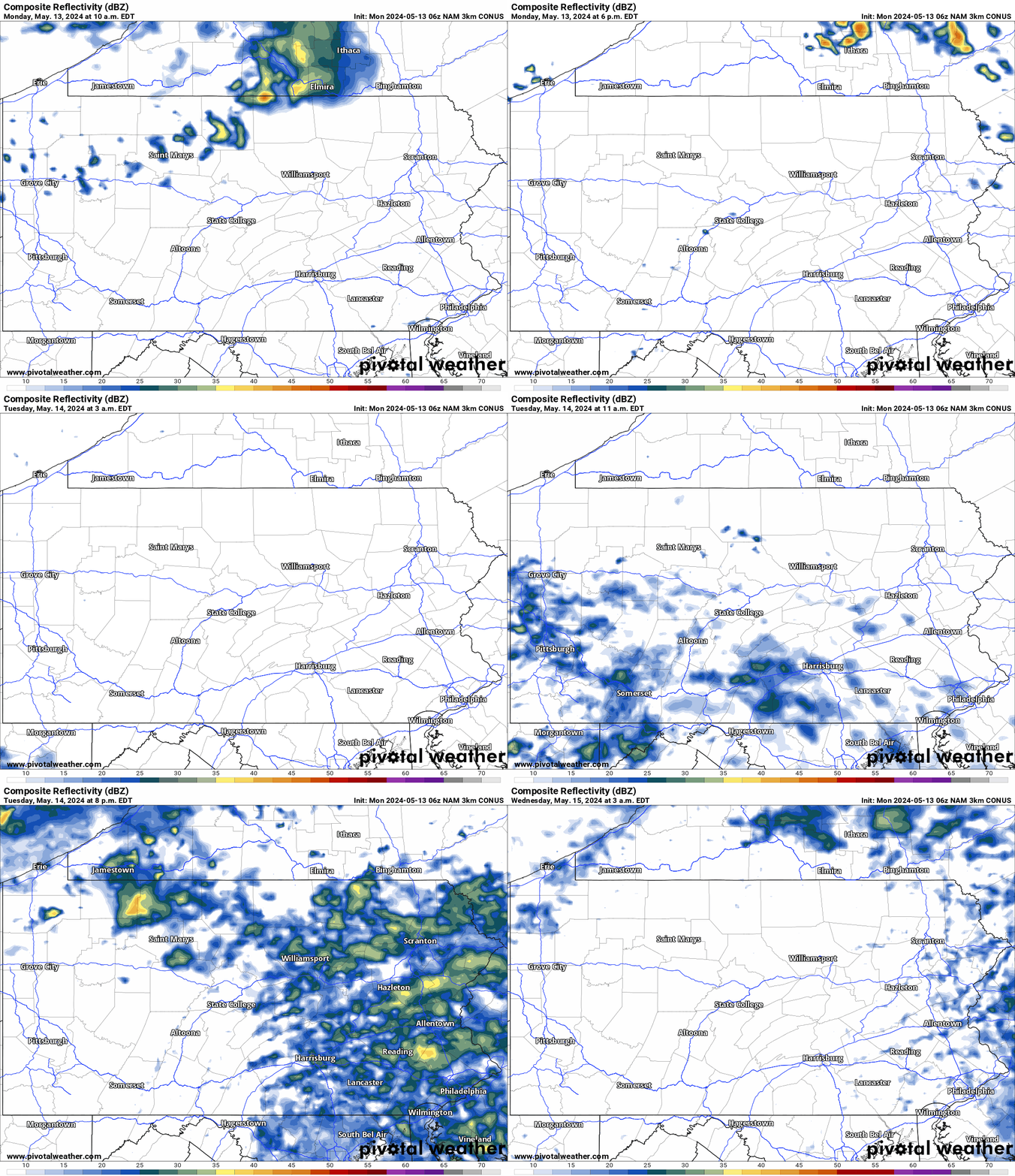
Hi-Res NAM Future Radar Monday AM – Wednesday AM
We won’t manage to avoid the rain for long, as another disturbance will bring widespread showers by lunchtime Tuesday, continuing but becoming scattered into the evening. Most persistent rainfall will be across Eastern PA, where a widespread half-inch to an inch of rain is likely. The hourly timestamp is in the top left of the animation below!
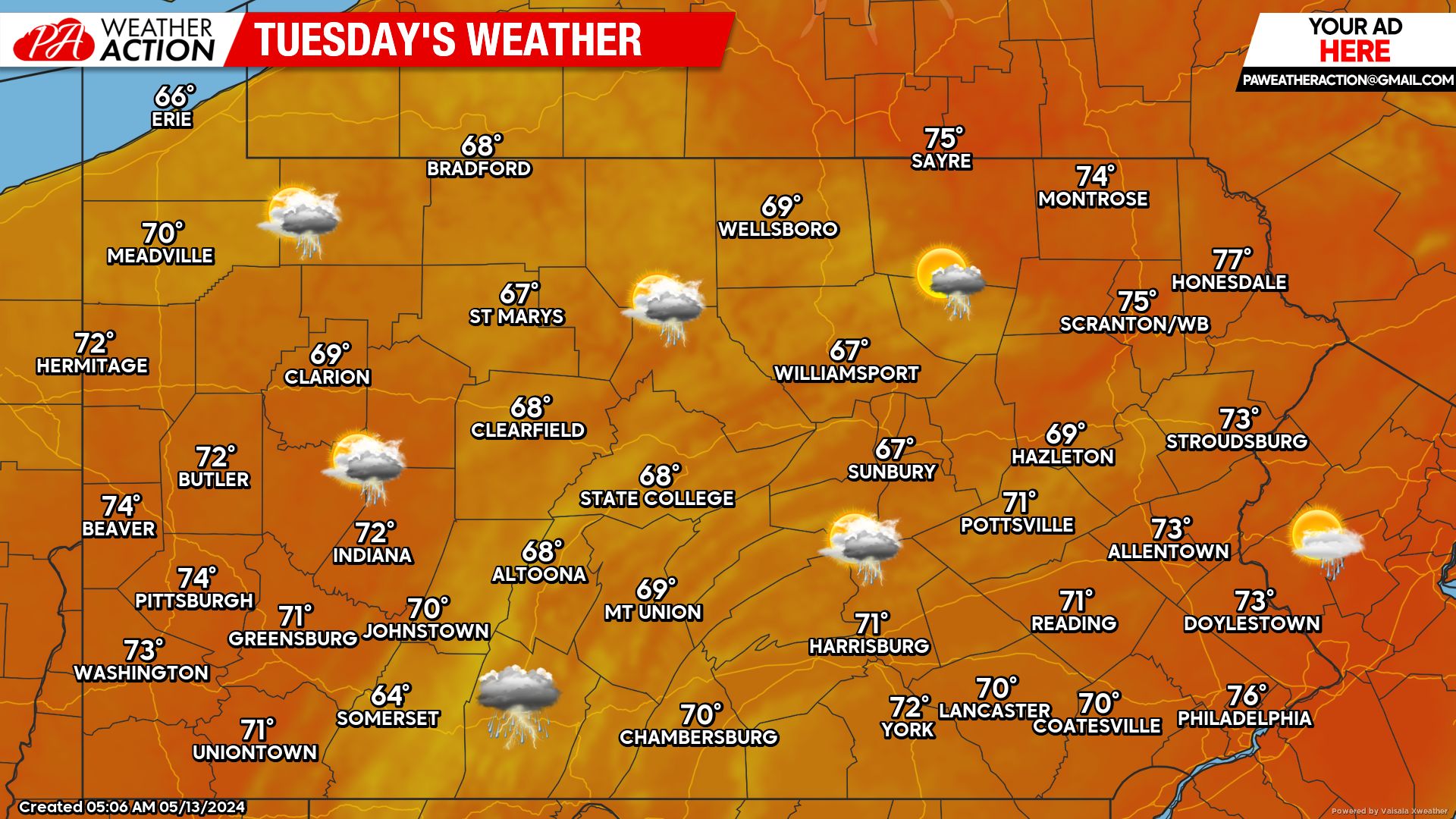
Tuesday’s Forecast: 5/10 Weather Day
Sunrise Tuesday may be mostly clear in much of the state, but clouds will quickly increase from south to north as showers begin to push in a bit before lunchtime. These won’t be heavy showers and thunder will be rare. Temperatures really won’t be too bad, especially when compared to last week. Highs in the 60s and 70s, and temps will cool off 3-6 degrees after rain begins.
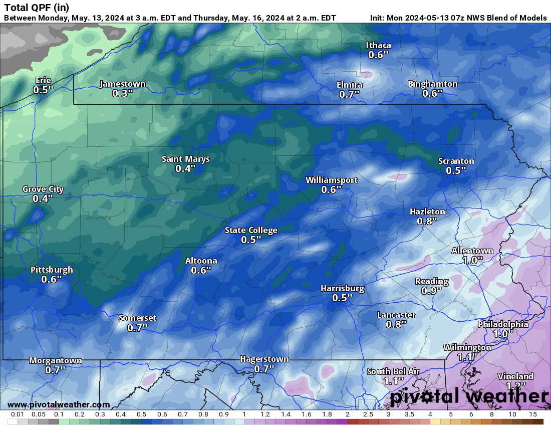
Total Rainfall Projection Through Wednesday
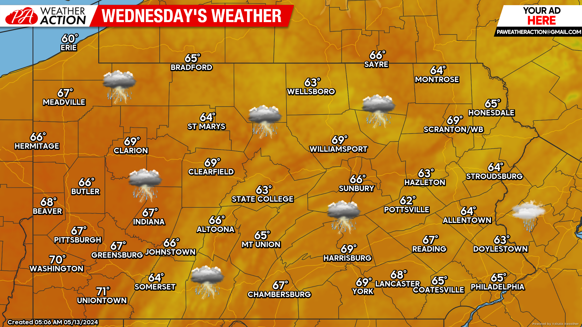
Models are still in disagreement whether Wednesday will be mainly dry or a near-washout, with most models having it pretty wet. It looks like most of us with the exception of Northwest PA are in line for about 0.5 – 1.0″ of rain, with Southeast PA and probably the Poconos nearing an inch. Those lawn mowers are definitely getting an early season workout!
Wednesday’s Forecast: 4/10 Weather Day
As mentioned, there are a few question marks surrounding Wednesday but we are leaning on the side of a washout. In the springtime, temperatures often stay lower than what models have on cloudy and rainy days like Wednesday will probably be. As a result, the high temperatures below may be a little too warm. Many areas may struggle to reach the mid 60s.
Another Wet Weekend Upcoming?
Safe to say I think 99% of us are done with these soggy weekends and would like a dry weekend after three straight rainy ones. While rain is likely Friday especially in the western half of the state, Saturday may be dry. The European model has the front drying up as it pushes east, but the GFS does not. Sunday looks like a lock in terms of a great dry and mostly sunny day! We will keep you posted.


You must be logged in to post a comment.