
Wednesday’s snow squall threat and timing forecast has been updated. Please follow the article linked below.
Final Call Forecast for Intense Snow Squalls Likely to Hit Parts of Pennsylvania Wednesday
Winter has loosened its grip the last few days, with snow starting to melt away in Southern PA. As we head into February, a more active pattern is expected. But with a warmer pattern will come more rain and wintry mix events, as opposed to all snow.
Multiple weak cold fronts will swing through the area this week, keeping temperatures down and introducing the chance for snow showers especially in Northern PA. After strong clipper system moves to our north on Wednesday, we are likely to see snow squalls.
These snow squalls will be accompanied by gusty winds up to 50 MPH, and low visibilities which will create temporary blizzard conditions. With temperatures dropping quickly during the squalls, snow will stick to all surfaces. This presents a significant concern for those traveling as squalls hit.
We will give you a good idea of timing below. Though like severe thunderstorms, it’s impossible to nail it down perfect and we highly encourage monitoring live radar during the highlighted periods.
TUESDAY’S SNOW SQUALLS
Tuesday’s snow squall threat is mainly in Northern Pennsylvania. Squalls will drop in from Upstate New York between 4 AM and 9 AM Tuesday, first in Erie and Bradford, then around 8 AM near I-80.
South of I-80, we anticipate the line of snow to weaken as it approaches the Pittsburgh Metro, along with State College and Stroudsburg. Below is Hi-Res NAM Future Radar for 4:00 – 10:00 AM Tuesday. The timestamp is in the top left.
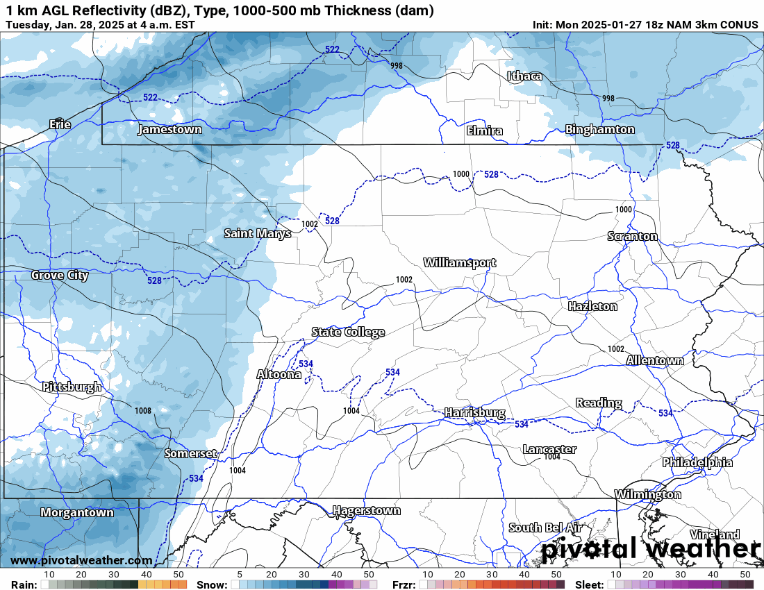
TUESDAY’S SNOW SQUALL THREAT MAP
Area A: Scattered snow squalls possible. Temporary blizzard conditions within squalls will result in reduced visibility and snow-covered roads.
WEDNESDAY’S SNOW SQUALLS
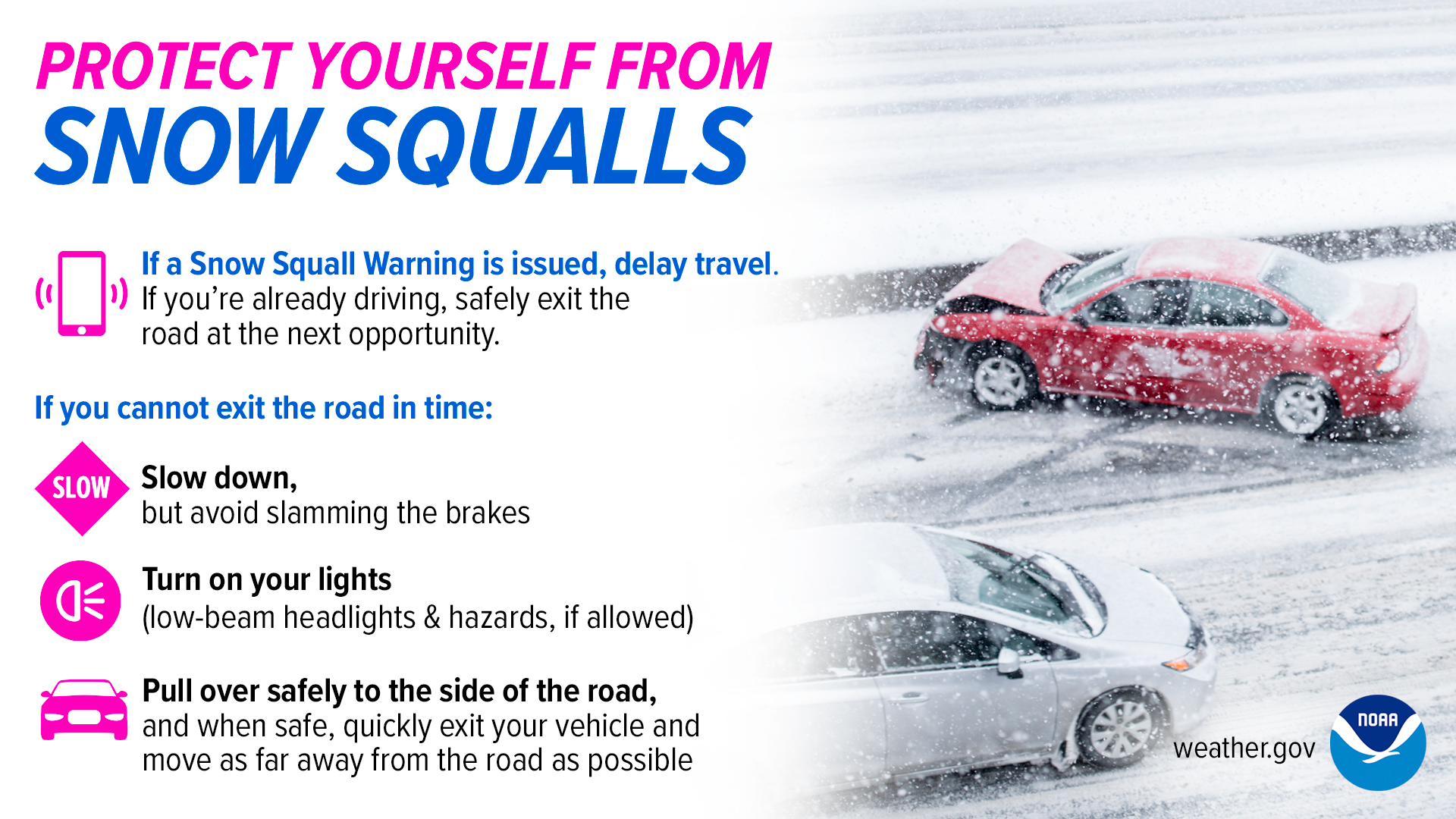
Wednesday brings greater concern for squalls due to a strong cold front moving through. Widespread snow squalls are likely in the northern two-thirds of the state. If you are driving on a highway when a snow squall hits, gradually reduce speeds to around half the speed limit or less, and activate hazard lights.
If visibility drops to the point you cannot see more than a quarter-mile in front of you, we advise to gradually reduce speed, activate hazards lights, and pull over on the side of the road as far away from moving vehicles as possible.
Below is a guide from the National Weather Service.
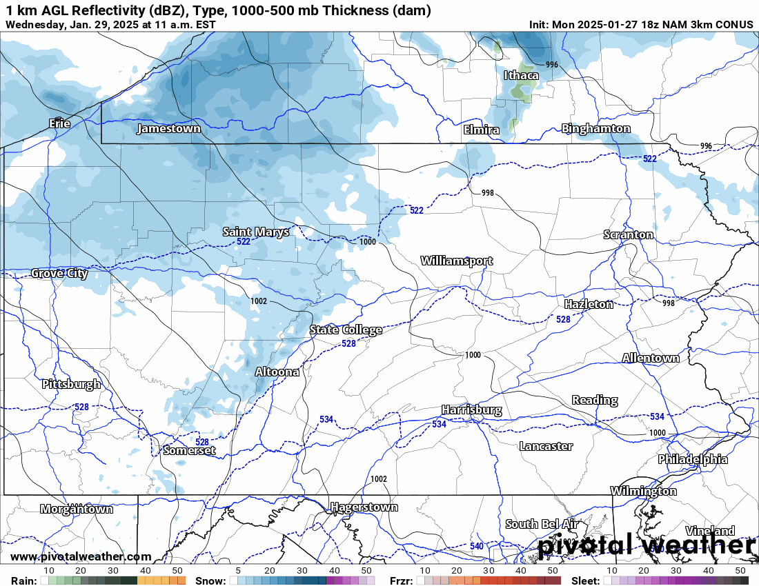
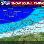
Timing for snow squalls looks to be early afternoon, between 12 – 3 PM Wednesday in Northern PA. And 3 – 6 PM in Southern PA. We will have a better idea of timing in Tuesday’s update. Below is Hi-Res NAM Future Radar for Wednesday’s squalls.
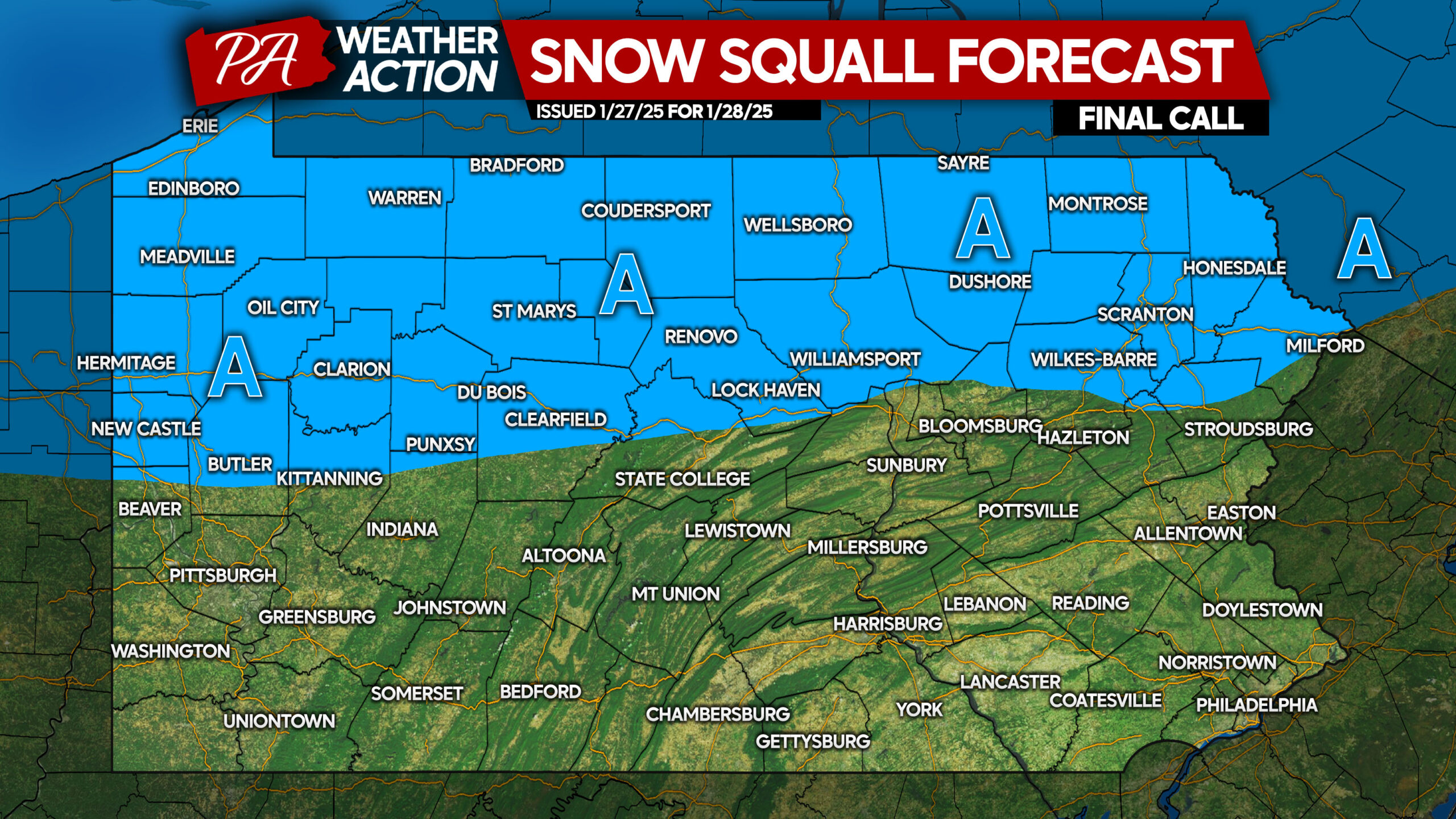
WEDNESDAY’S SNOW SQUALL THREAT MAP
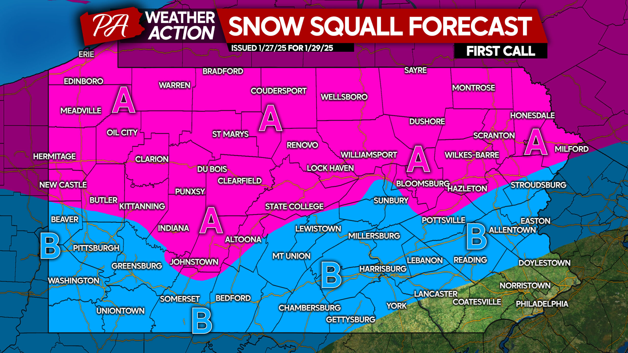
Area A: Widespread snow squalls are likely. Temporary blizzard conditions inside squalls will create very hazardous travel conditions including greatly reduced visibilities and rapidly snow-covered roadways.
Area B: Scattered snow squalls possible. Temporary blizzard conditions within squalls will result in reduced visibility and snow-covered roads.
We will have one more update on Wednesday’s squalls on Tuesday evening.
Don’t forget to share this forecast with family and friends!
You must be logged in to post a comment.