
December will start off with a bang, as a significant ice storm is likely to impact much of the state Sunday. This will be followed by a potential snowstorm in parts of Pennsylvania Sunday Night through Monday Evening. Hold on tight, we’ve got a lot to talk about!
STORM TIMING
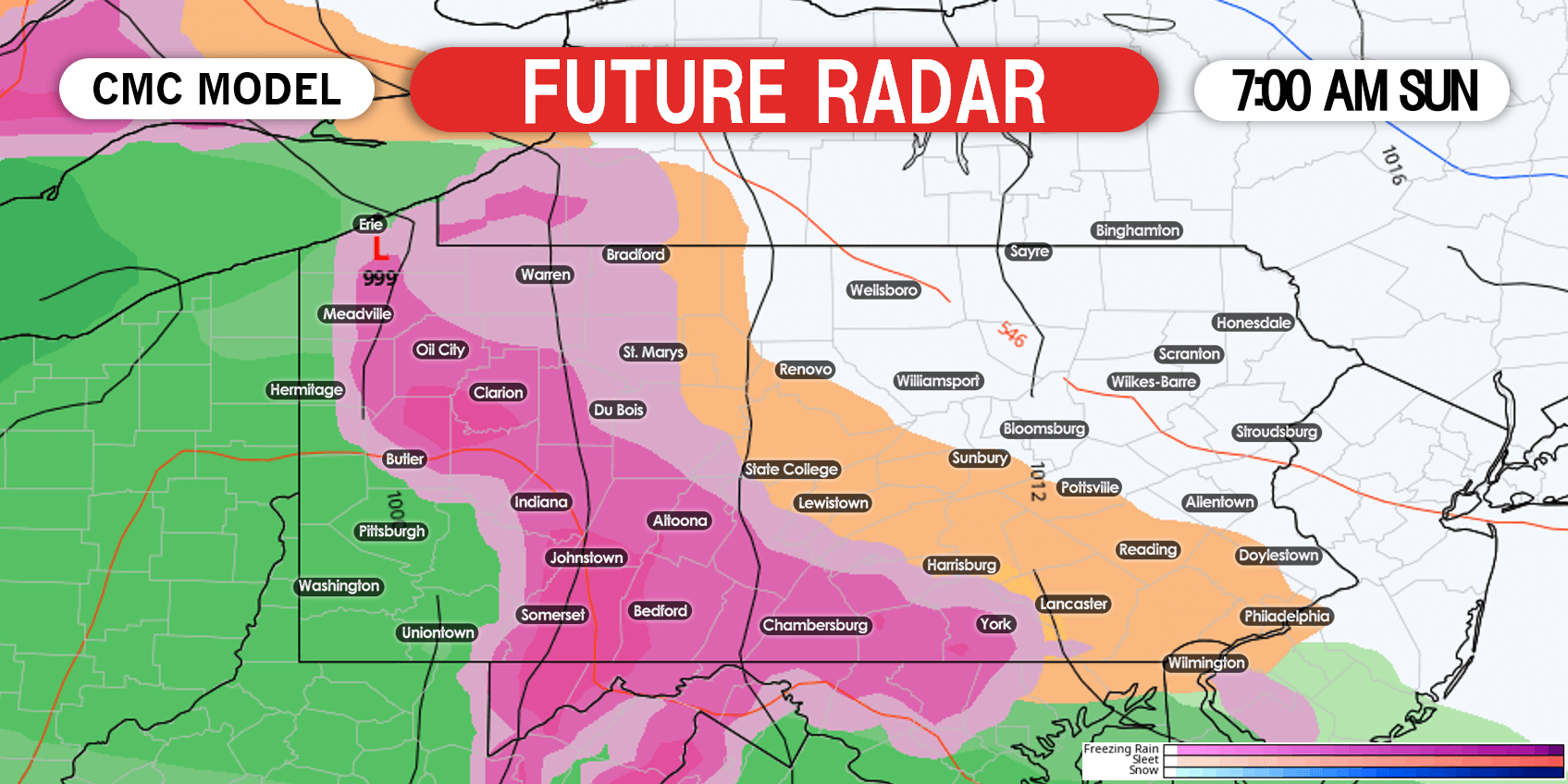
If you can avoid traveling on Sunday, we strongly advise doing so. Travel in most of the state will be treacherous. Freezing rain will move into much of southern and eastern Pennsylvania early Sunday morning. Southwest PA will likely just see plain rain, due to being west of the mountains with no cold air damming. By 7:00 AM Sunday, we expect freezing rain and sleet to overspread much of western and central Pennsylvania. We will use the Canadian model for today’s future radar, as it displays the middle ground between the GFS and ECMWF. Below is future radar for 7:00 AM Sunday.
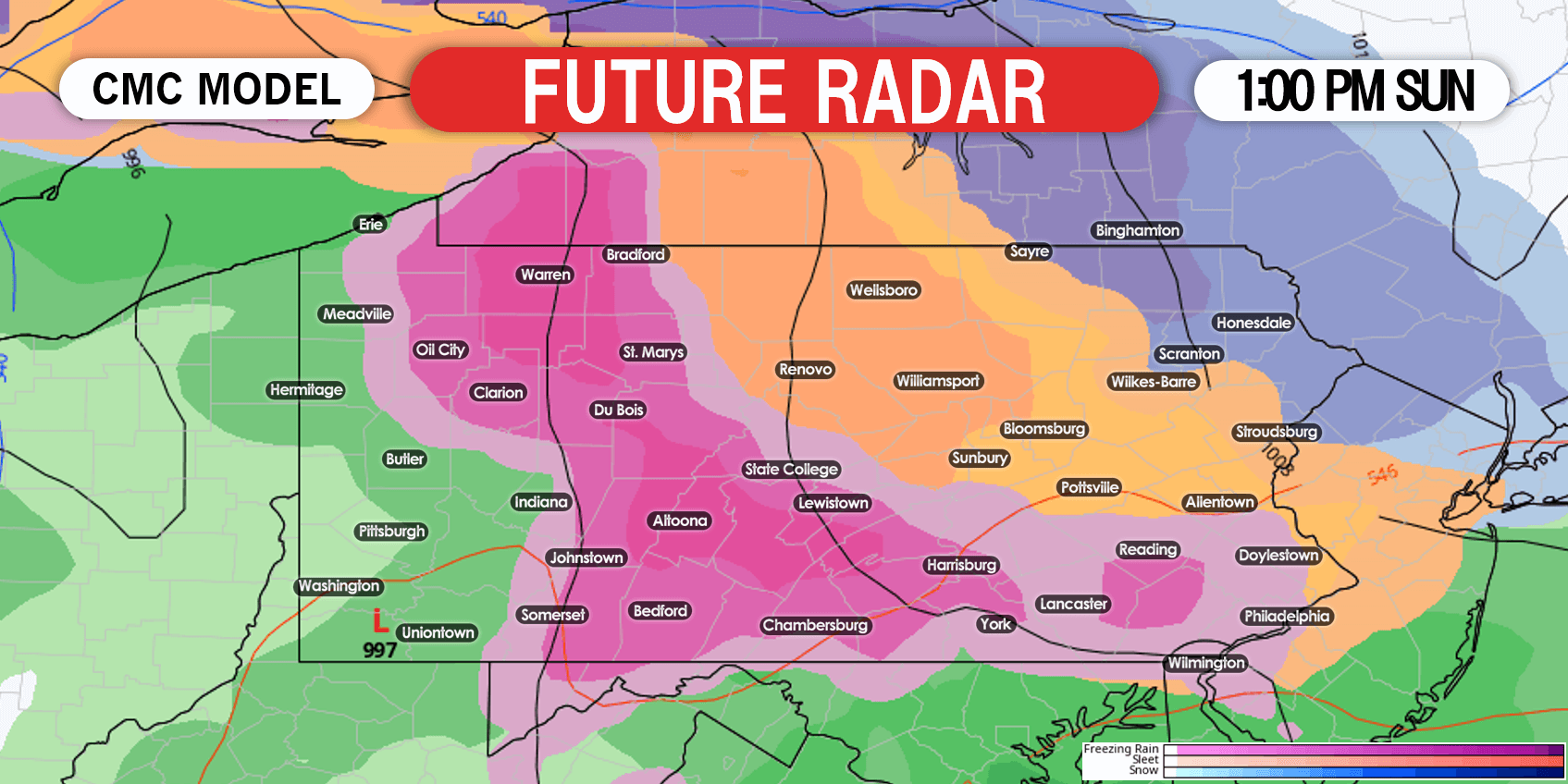 By dinnertime Sunday, temperatures should rise above 32° south of the PA turnpike, while areas north continue to see freezing rain. Northern PA will likely be seeing a mix of snow and sleet, with some areas near the NYS border potentially staying all snow. Future radar for 7:00 PM Sunday displayed below.
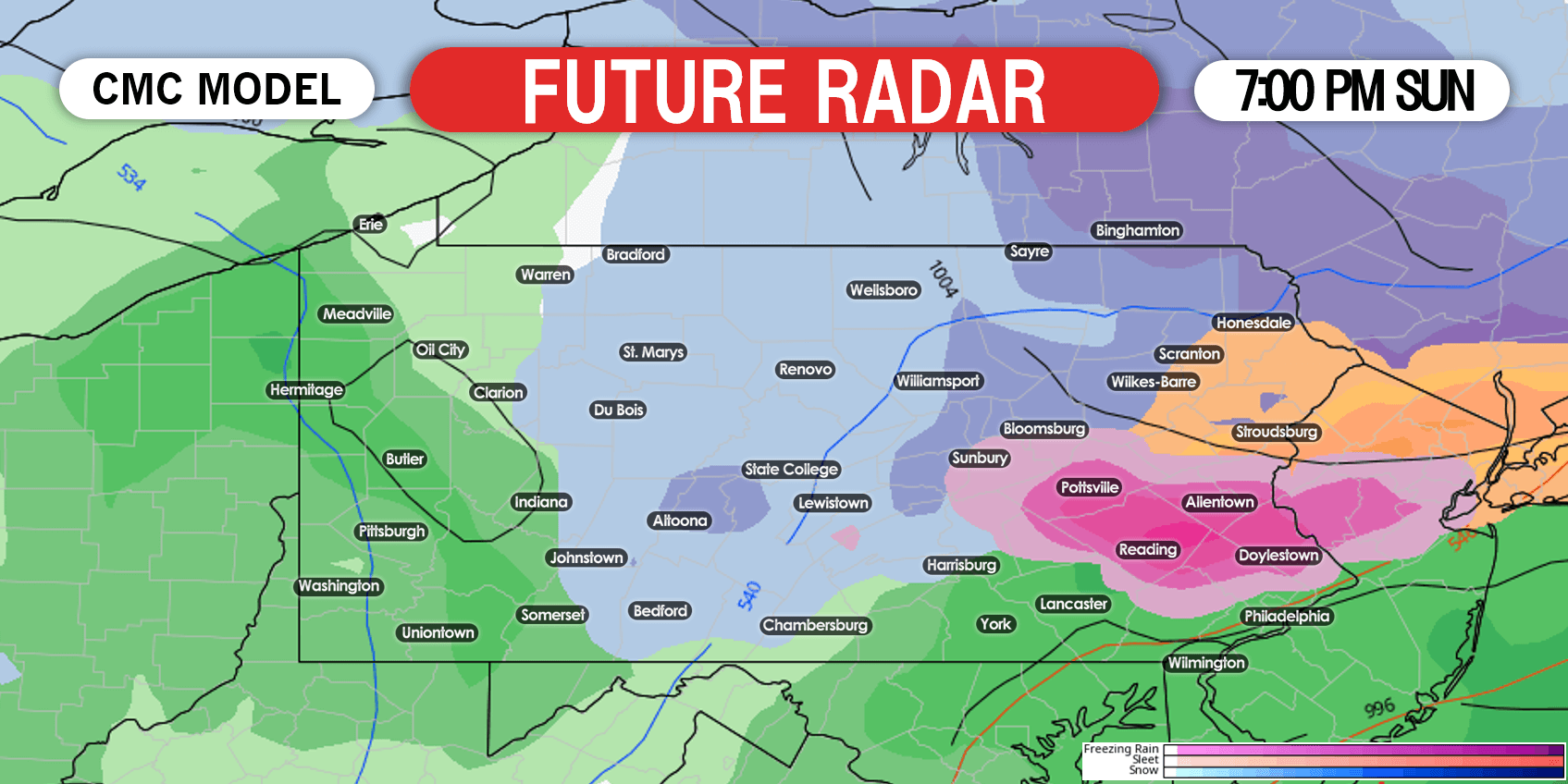 Now this is where things get complicated. Late Sunday evening will be the timeframe when the coastal low takes over. Where heaviest snow is falling by Monday morning is still up in the air. Northeast PA looks to be the area most likely to see snowfall Monday, as they will see snow regardless whether the northern or southern solution occurs. Below is future radar for 7:00 AM Monday.
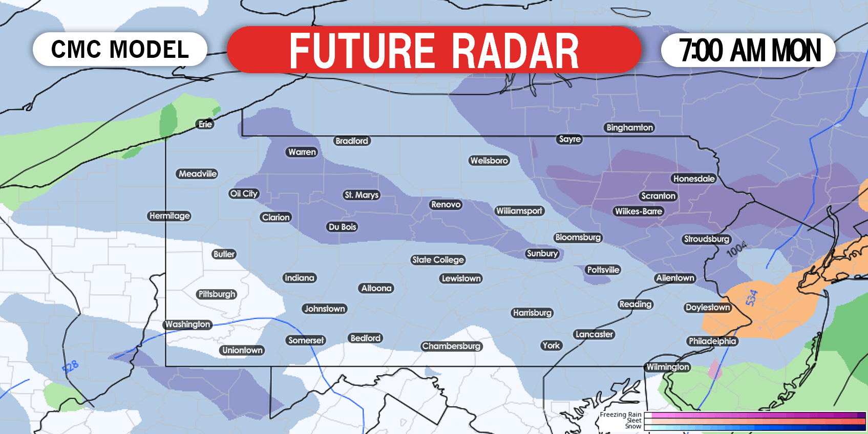 Heading into Monday afternoon, snow is likely in much of eastern PA, possibly with the exception of the Philadelphia area. All other parts of the state at this point are only expected to see scattered snow showers. However, that could change in the coming days.
FIRST CALL ICE FORECAST FOR SUNDAY
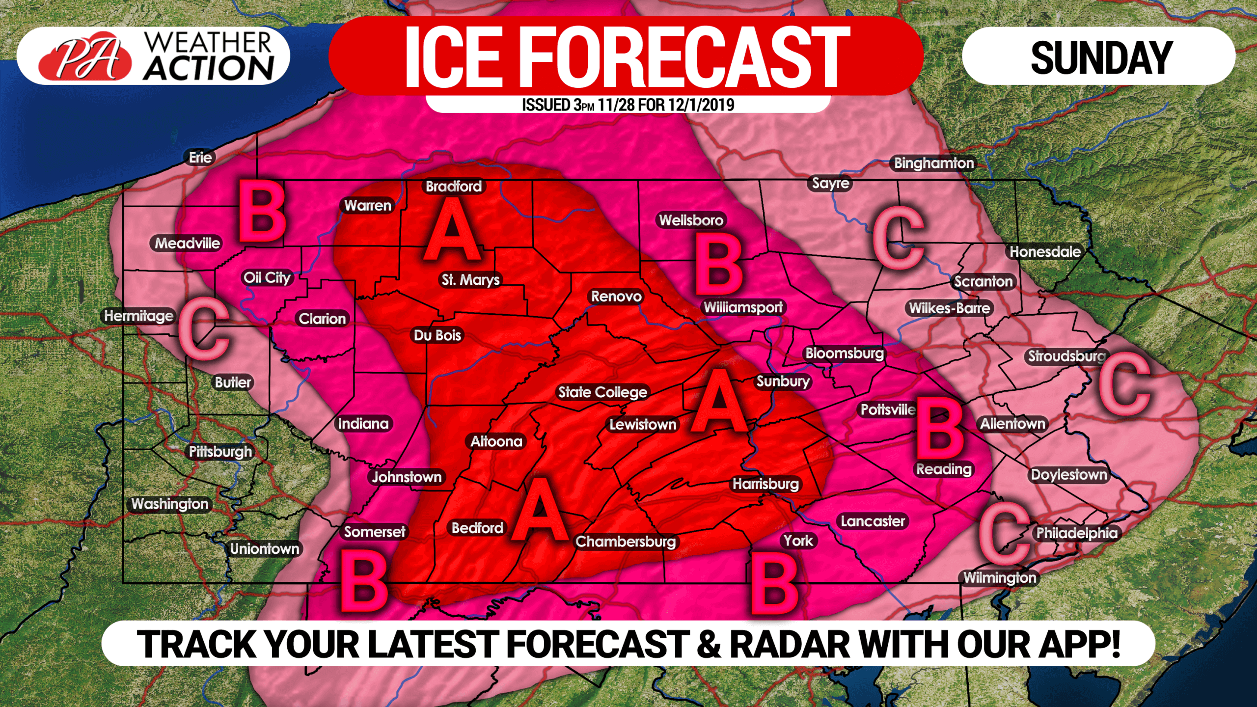
Area A: This area is likely to see freezing rain for a 12+ hour period, resulting in ice accumulation of .25 – .5″. Do not travel if you don’t have to Sunday. Scattered power outages possible.
Area B: Ice accumulation of .10 – .25″ expected. Travel highly discouraged Sunday. Isolated power outages possible.
Area C: Ice accumulation of .01 – .10″ anticipated. Travel may be difficult Sunday, especially closer to area b.
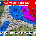
SCENARIO #1 FOR SNOWSTORM SUN NIGHT – MON EVE
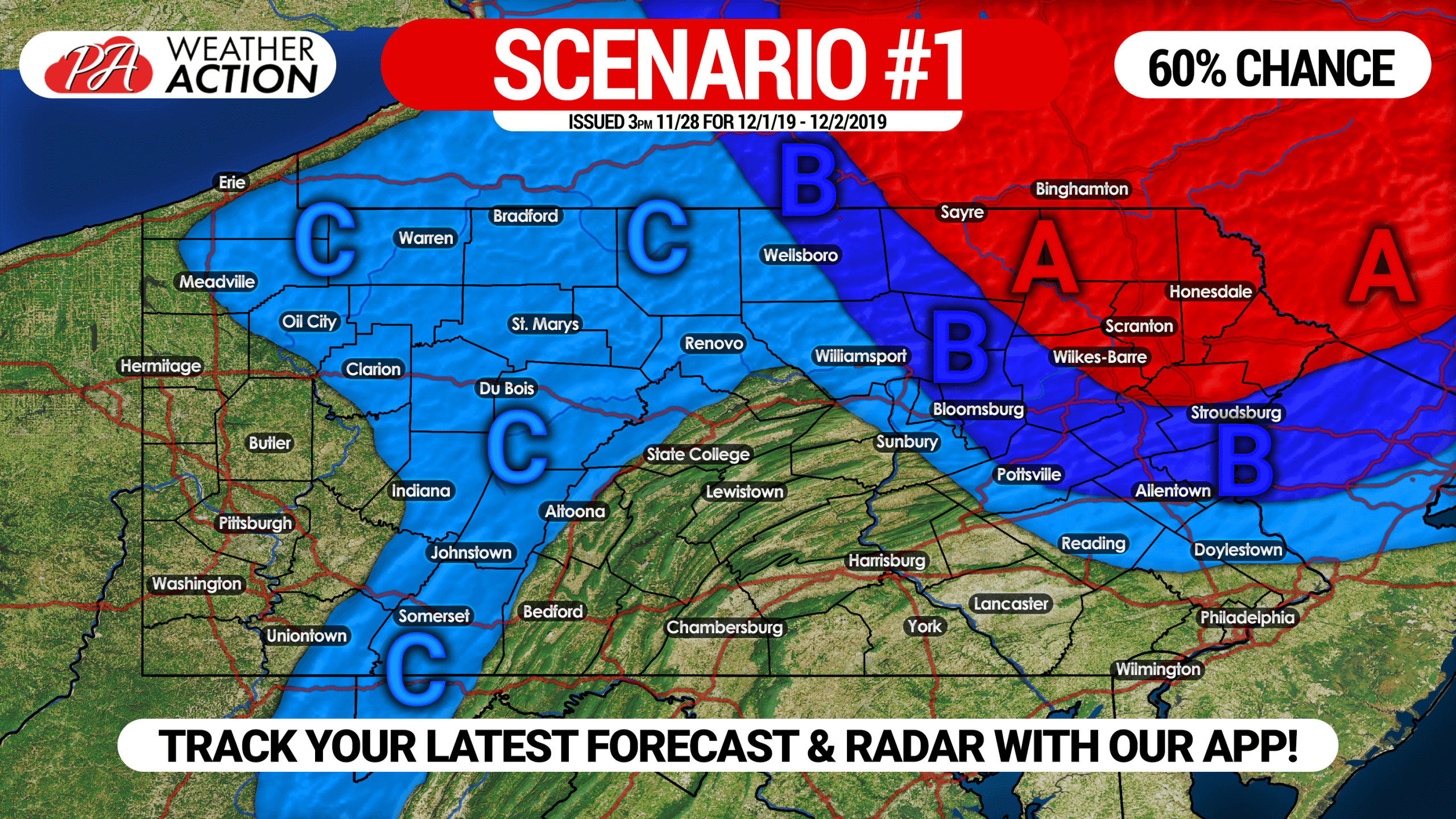
This is our northern solution, with the coastal low being farther north and the surface being a little warmer. This solution has been modeled for the past few days, but latest trends have been south.
Area A: Potential for 6″ or more of snow.
Area B: Potential for 3″ or more of snow.
Area C: Potential for 1″ or more of snow.
SCENARIO #2 FOR SNOWSTORM SUN NIGHT – MON EVE
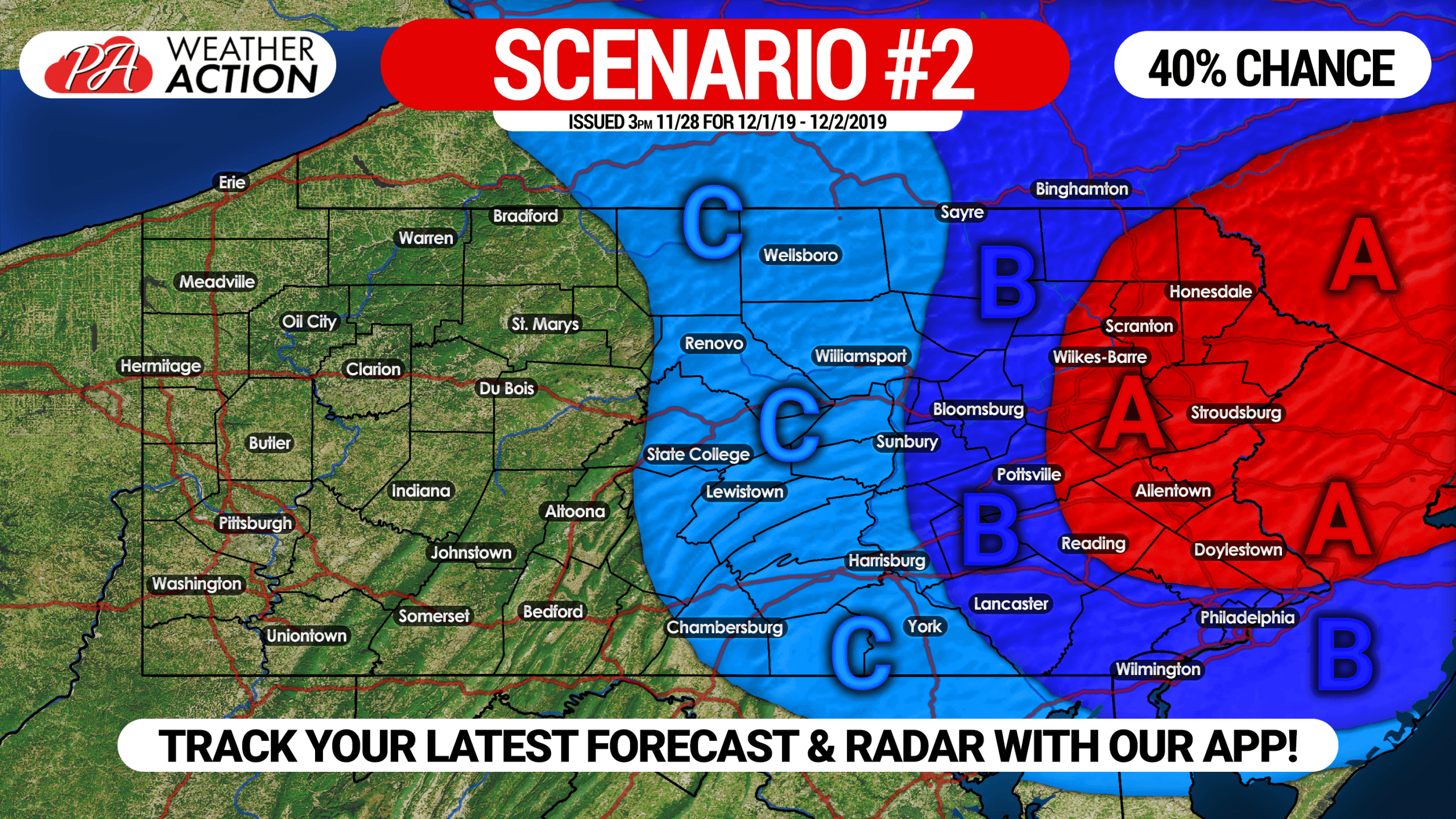
This is our southern solution, which would result in a significant heavy, wet snow for much of eastern PA. Latest model trends have been heading this direction, but being four days out they could easily do a 180.
Area A: Potential for 6″ or more of snow.
Area B: Potential for 3″ or more of snow.
Area C: Potential for 1″ or more of snow.
Updates to both the ice and snow forecast will be posted tomorrow (Friday)!
Be sure to share this important forecast with friends and family who may be traveling using the button below!
Get tomorrow’s update instantly, as well as your local forecast and radar with our free app >>> Weather Action App
Stay tuned everyone, winter is here!
You must be logged in to post a comment.