
While guidance trended less aggressive in terms of the snow side with this powerful nor’easter, there will still be a nice swath of accumulating snowfall from Central PA through Northern PA. We will all begin as rain late Sunday Night/Early Monday Morning, Central PA and Northern PA will begin to change from rain to a mix of sleet/rain to eventually wet snowfall that has the potential to lay down several inches, especially in the highest of elevations.
For the rest of us in South-central PA/Southeast PA/East-Central PA, we will be in for a cold soaking and heavy rainfall. Western PA will be spared the worst of the storm, where we expect only a little bit of rain to fall. For Eastern PA, wind is a concern. This will be a wind-whipped rainfall where gusts may surpass 40 and even 50mph at times. Isolated power outages cannot be ruled out.
While it may be disappointing that this will be a mainly rain event for most of us, it truly is a spectacular sight to see, such a massive storm system projected by model guidance. Below is the latest GFS valid Monday Afternoon:
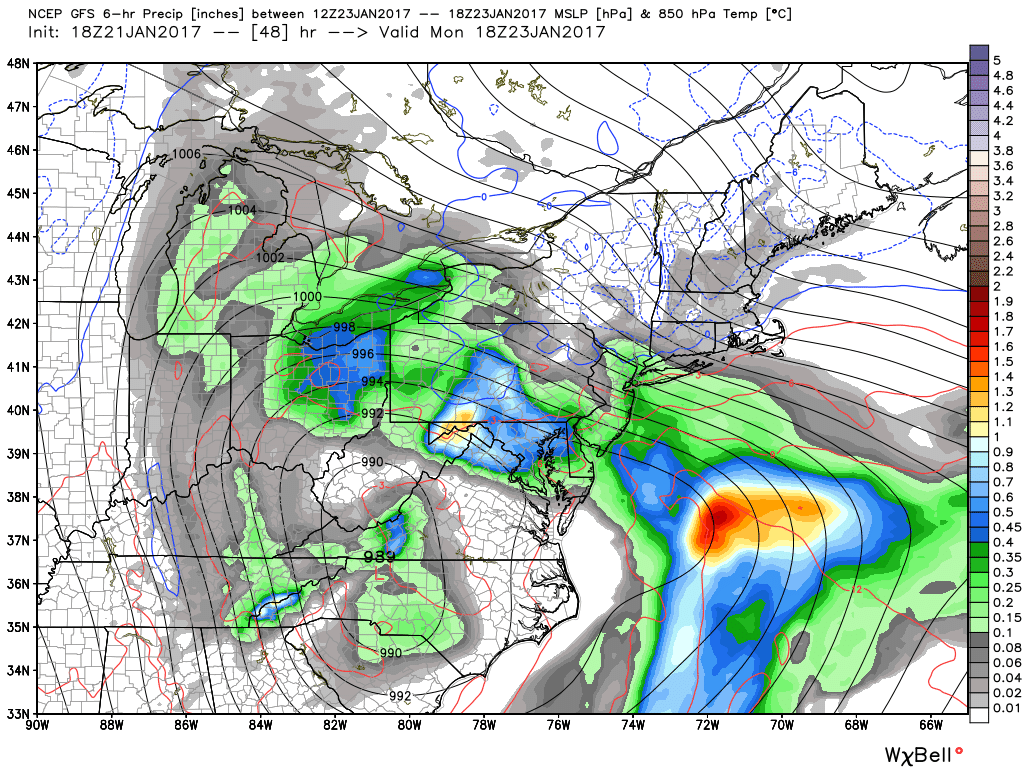
Notice how tight the isobars are over Eastern PA and into New Jersey. That is where your strongest winds are. This is expected to be an onshore flow, so beach erosion and coastal flooding is expected.
FIRST CALL FOR MONDAY’S NOR’EASTER
Timing: Light rain will overspread the state from south to north late Sunday Night. Brunt of the system will be on Monday. All activity should be over and done with by early Tuesday Morning.
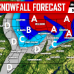
SNOWFALL FORECAST
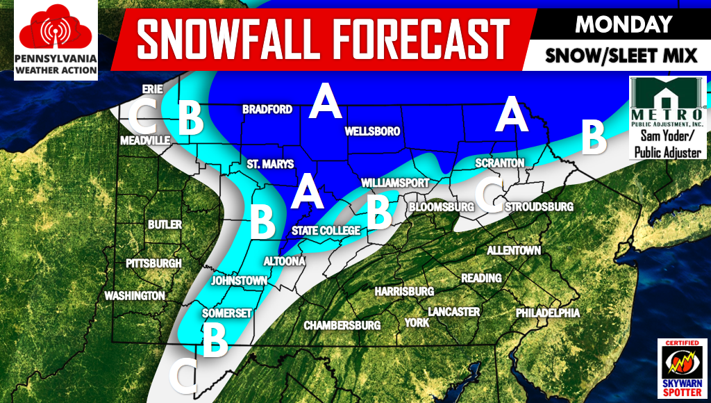
Area A – Snow/sleet accumulation of 2-4″.
Area B – Snow/sleet accumulation of 1-2″.
Area C – Snow/sleet accumulation of up to 1″.
RAINFALL FORECAST
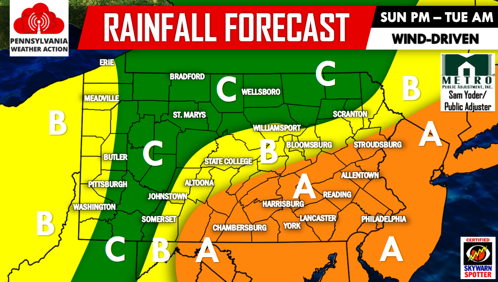
Area A – Rainfall amounts of 1.5-2+”.
Area B – Rainfall amounts of 1-1.5″.
Area C – Rainfall amounts of .5-1″.
Remember, the pattern change doesn’t arrive until late this week.
Be sure to have our Facebook page liked for the latest>>>PA Weather Action on Facebook! Don’t forget to share the forecast using the icons below! Stay safe!
You must be logged in to post a comment.