
After a hot and steamy week with it feeling in excess of 100° in many places, flooding rains are a possibility in Eastern PA Thursday. Very slow-moving thunderstorms and heavy rain will carry the likelihood of dropping several inches of rain in some areas.
Our most important tip is turn around, don’t drown. While cliche and basic, some people still fall victim to floodwaters after not following it. This especially applies to moving floodwaters. There are some situations where you’re caught in traffic and everyone is driving through floodwaters. In that case, take it slow and be considerate to not create a wave of water that may damage other people’s vehicles.
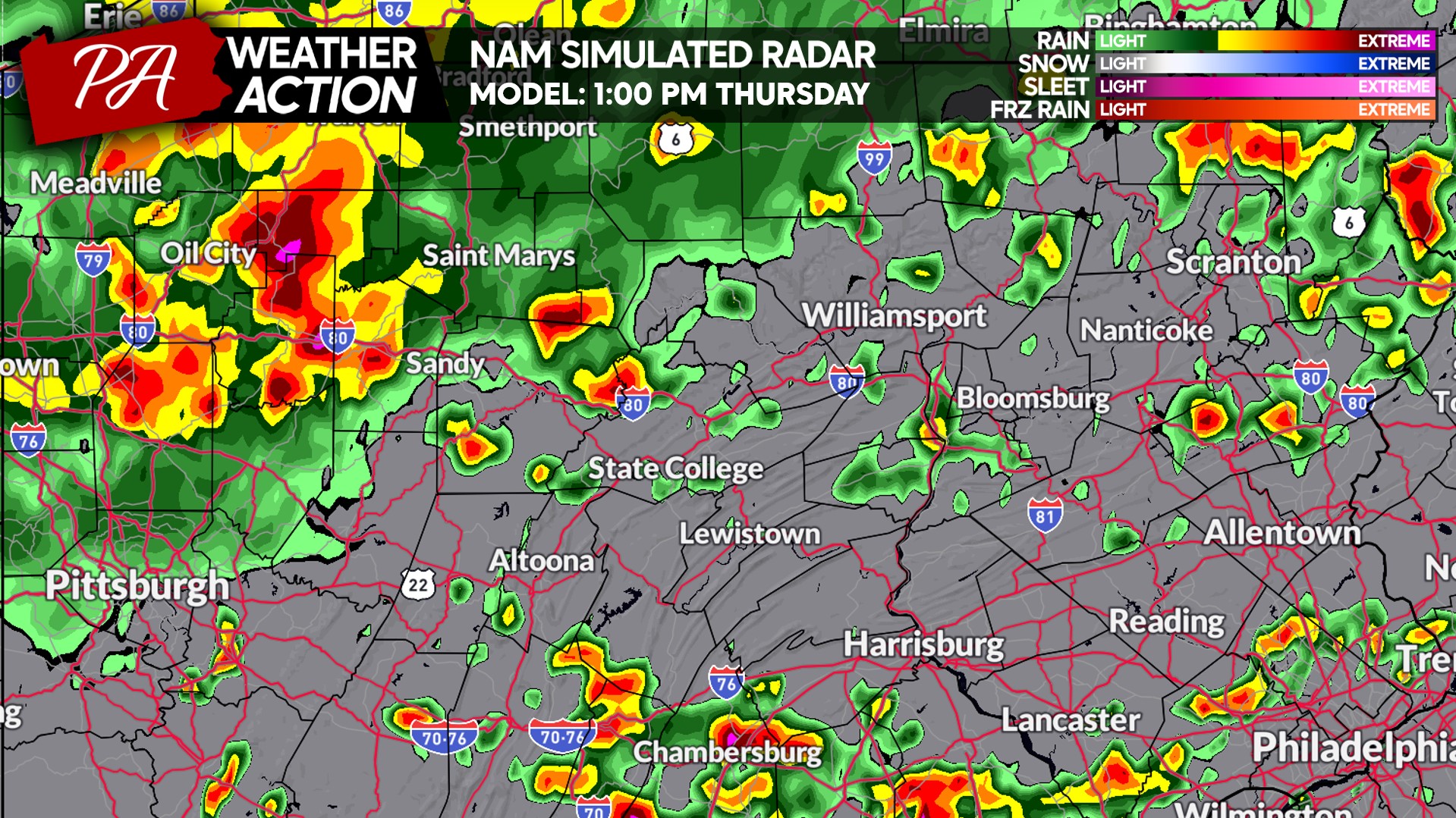
Looking at the Hi-Res NAM, we see a heavy batch of rain expected in Northwest PA early Thursday afternoon with some scattered thunderstorms elsewhere.
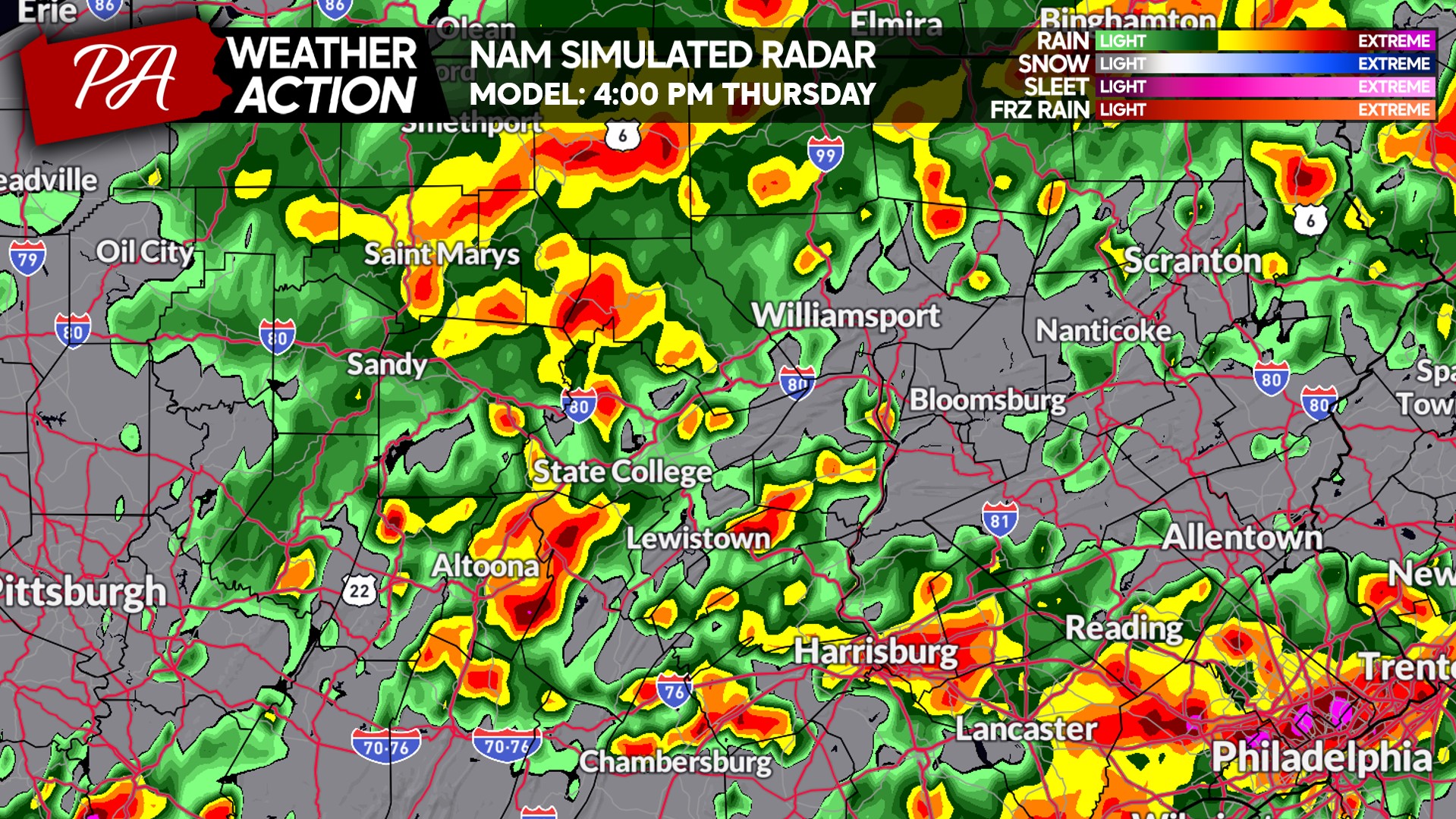
Very quickly, widespread strong thunderstorms with extremely heavy rain will develop over areas of South Central and Southeast PA by the beginning of Thursday’s afternoon rush. This is when the height of the flash flood concern will begin.
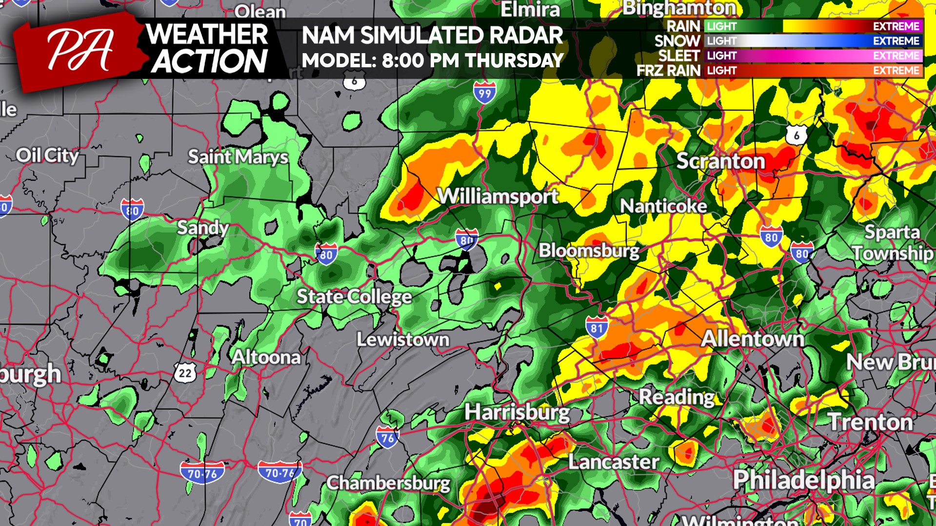
By around 8:00 PM, a swath of moderate to heavy rain will cover Northeast PA with scattered thunderstorms still draped across South Central and Southeast PA.
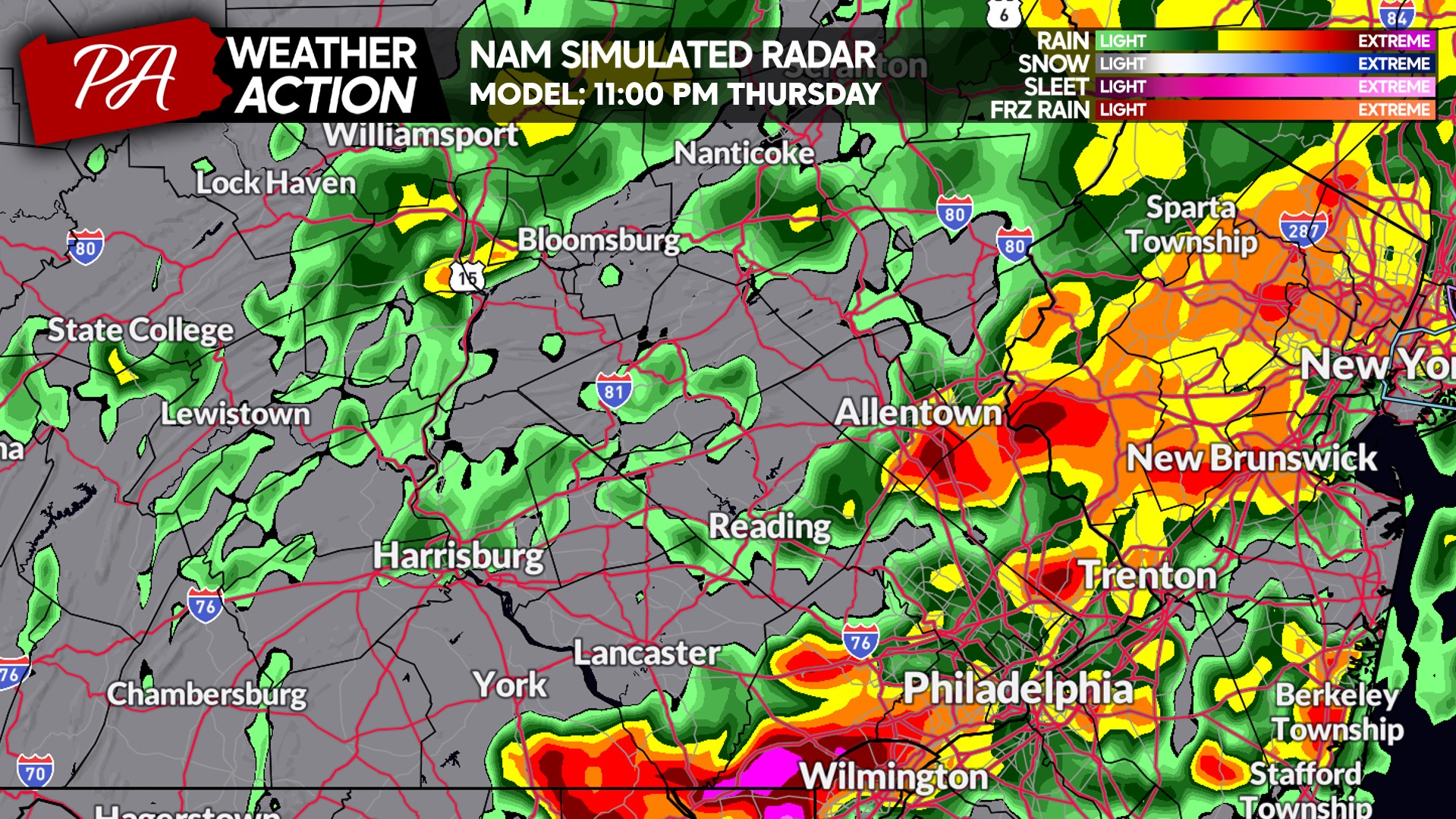
And by late Thursday evening, the flash flood risk will be focused on Southeast PA, where multiple inches of rain may have fallen. Urban flash flooding is a large concern around the Philadelphia Metro.
THURSDAY’S FLASH FLOODING RISK FORECAST
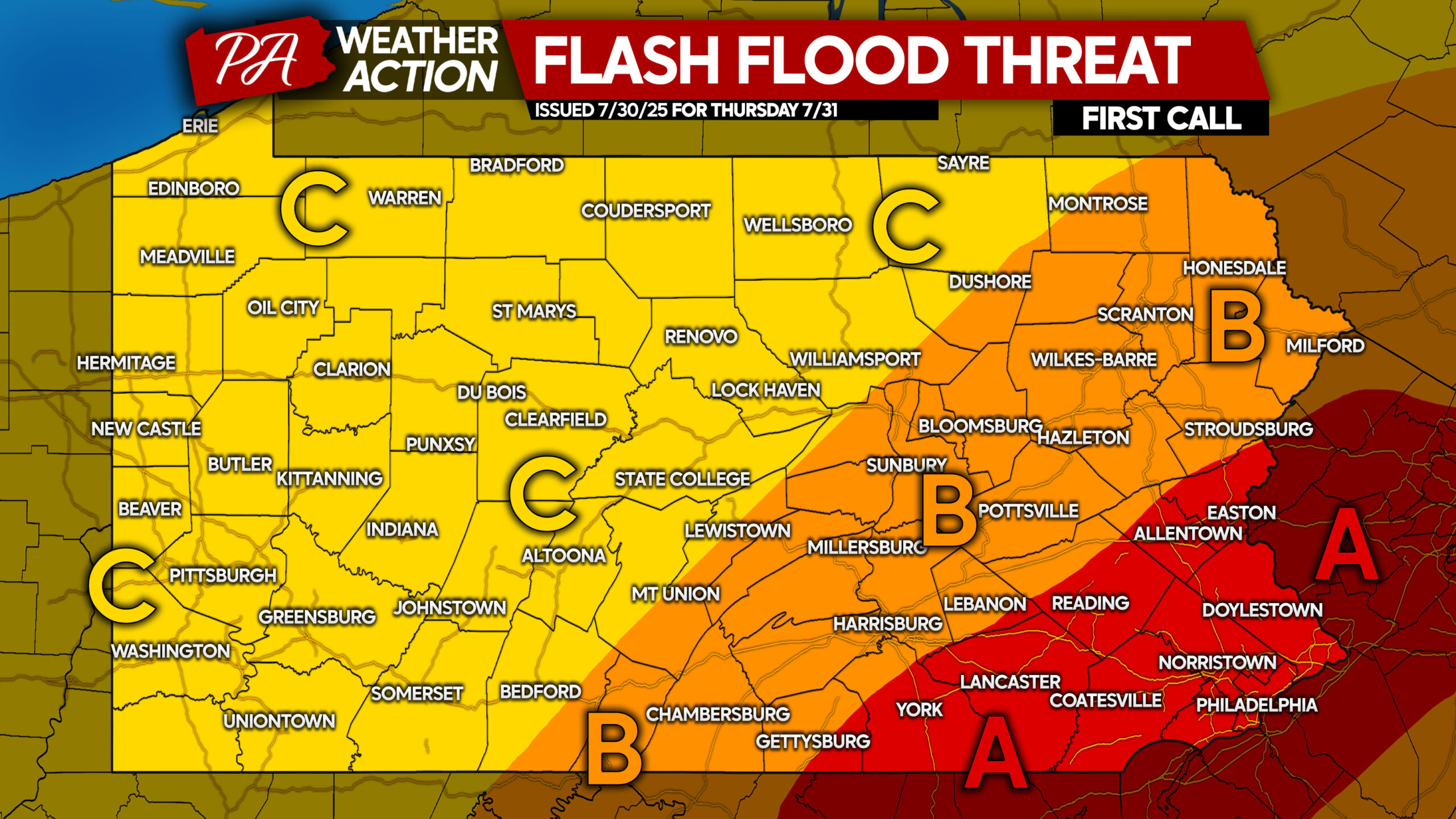
Area A: Significant flash flooding potential with 1.5 – 4.0″ of rainfall expected. Urban areas with poor drainage along with small creeks and streams will likely flood. Turn around, don’t drown when approaching flooded roadways. Your vehicle will float much easier than you think.
Area B: Moderate flash flooding potential with 0.5 – 2.0″ of rainfall anticipated. Typical areas susceptible to flooding will likely flood if rainfall amounts near the higher end of the range in a given location.
Area C: Slight flash flood potential with 0.3 – 1.2″ of rainfall expected. Spots that eclipse or exceed an inch of rain in an hour may see flooding in vulnerable locations.
Be sure to share this forecast article with family and friends! Stay safe!
You must be logged in to post a comment.