
The last few months have had the nicest weather in decades in Pennsylvania and really a lot of the US. We made it through September with no hurricane landfalls in the US for the first time since 2015. There have been zero tropical storms in the Gulf, which often come up our way soon after.
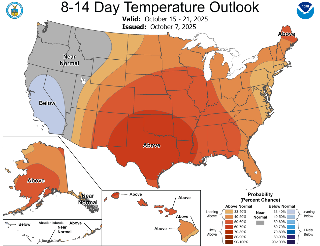
Truly, most of us will look back on this period as one we wish we could go back to, come January which is in less than 90 days. But it’s not over just yet, with above average temperatures continuing into mid-October.
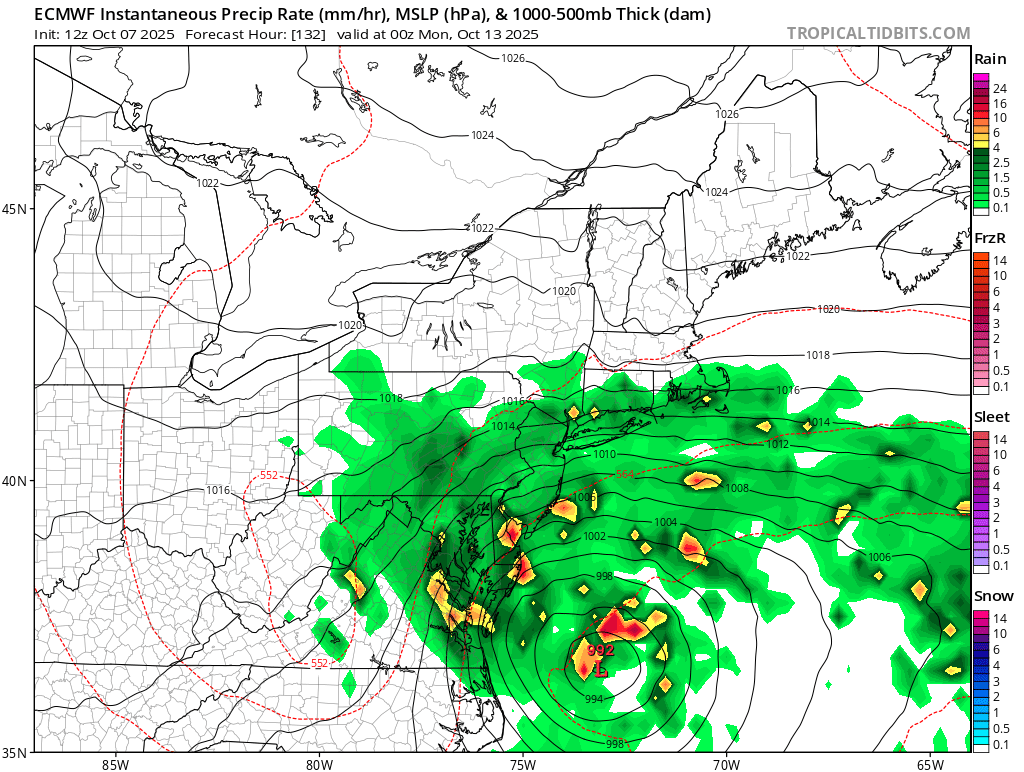
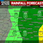
After this cold front pushes through, the next chance for rain comes Sunday and Monday especially in the eastern half of PA. A coastal storm almost like one we would see in winter time may affect the area, depending on the strength of the high pressure to our north.
Now for those who are looking for genuine Fall weather and not whatever we’ve been gifted the last week. After this cold front pushes through on Wednesday, high temperatures during the following week will be in the 60s most places with lows in the 30s and 40s!
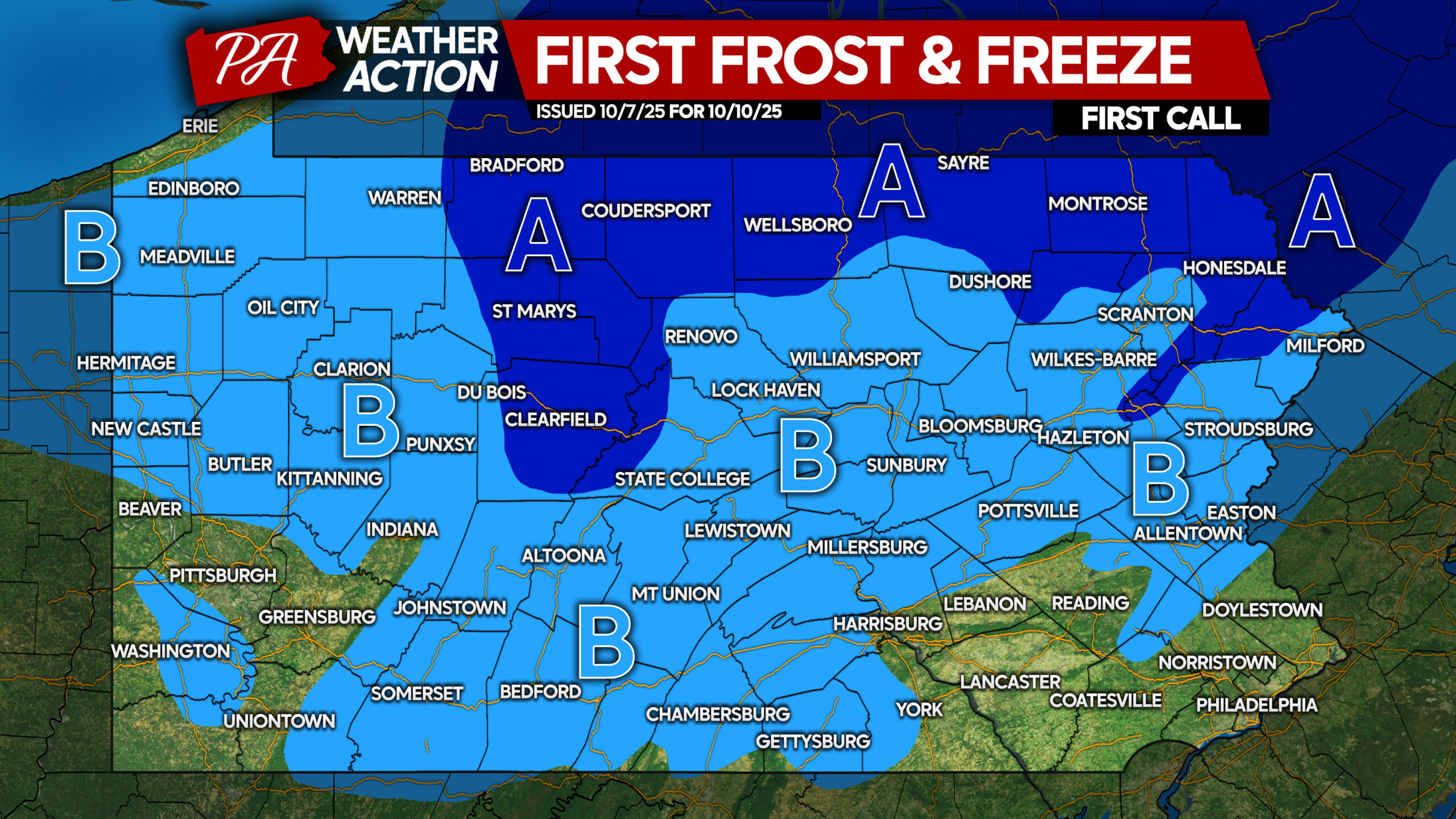
Friday morning will be particularly cold, with widespread first frosts and even freezes likely. This is already somewhat behind schedule in the mountains.
FIRST CALL FROST & FREEZE FORECAST FOR FRIDAY MORNING

Area A: The first widespread freeze of Fall 2025 is likely Friday morning, with temperatures falling into the upper 20s to low 30s. Frost and freeze conditions could kill crops, other sensitive vegetation and possibly damage unprotected outdoor plumbing.
Area B: Widespread frost conditions are expected Friday morning as temperatures dip into the low to mid 30s. Frost could harm sensitive outdoor vegetation. Sensitive outdoor plants may be killed if left uncovered.
Be sure to share this forecast with friends and family who would find this info useful!
You must be logged in to post a comment.