Winter has taken a strong grip on the East Coast with temperatures in the teens all the way to the Carolinas tonight. An Alberta Clipper (weak storm from Alberta Canada) will sweep across our area late Wednesday into Thursday, dropping light to moderate accumulations in parts of Pennsylvania.
A blustery Arctic chill will swiftly follow, with strong winds firing up the lake effect snow machine once again. This comes after Erie County received as much as nearly 5 feet of snow in the past week. But on the east side of the Appalachians, many of us are still searching for signs of winter in the form of snow.
Snow Timing
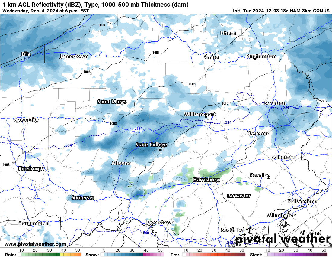
Scattered snow showers will begin Wednesday afternoon, and will immediately begin accumulating on all untreated surfaces as temperatures will be below freezing. Minimal travel impacts are expected for the Wednesday evening commute, with the exception of Erie County. Below is Hi-Res NAM future radar for 6:00 PM Wednesday.
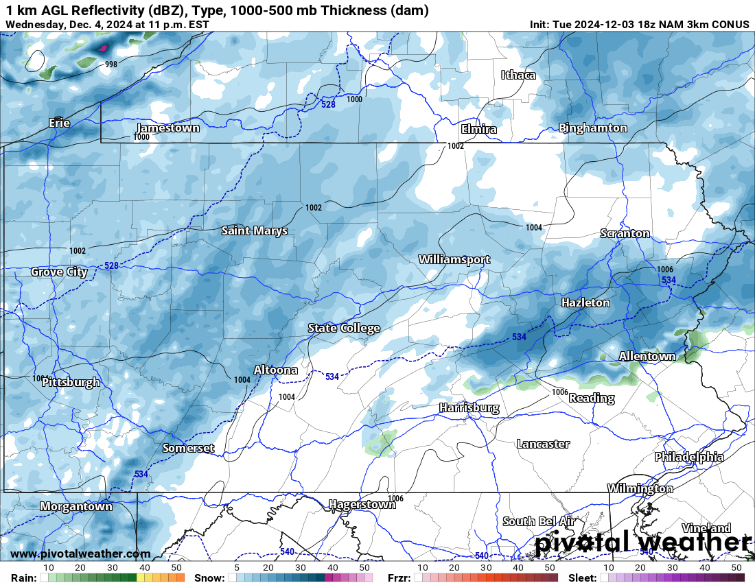
By late Wednesday evening, widespread light snow is expected to be falling except in South Central and SEPA, as usual. Road conditions will likely start to become slick by this time. Here is Hi-Res NAM future radar for 11:00 PM Wednesday.
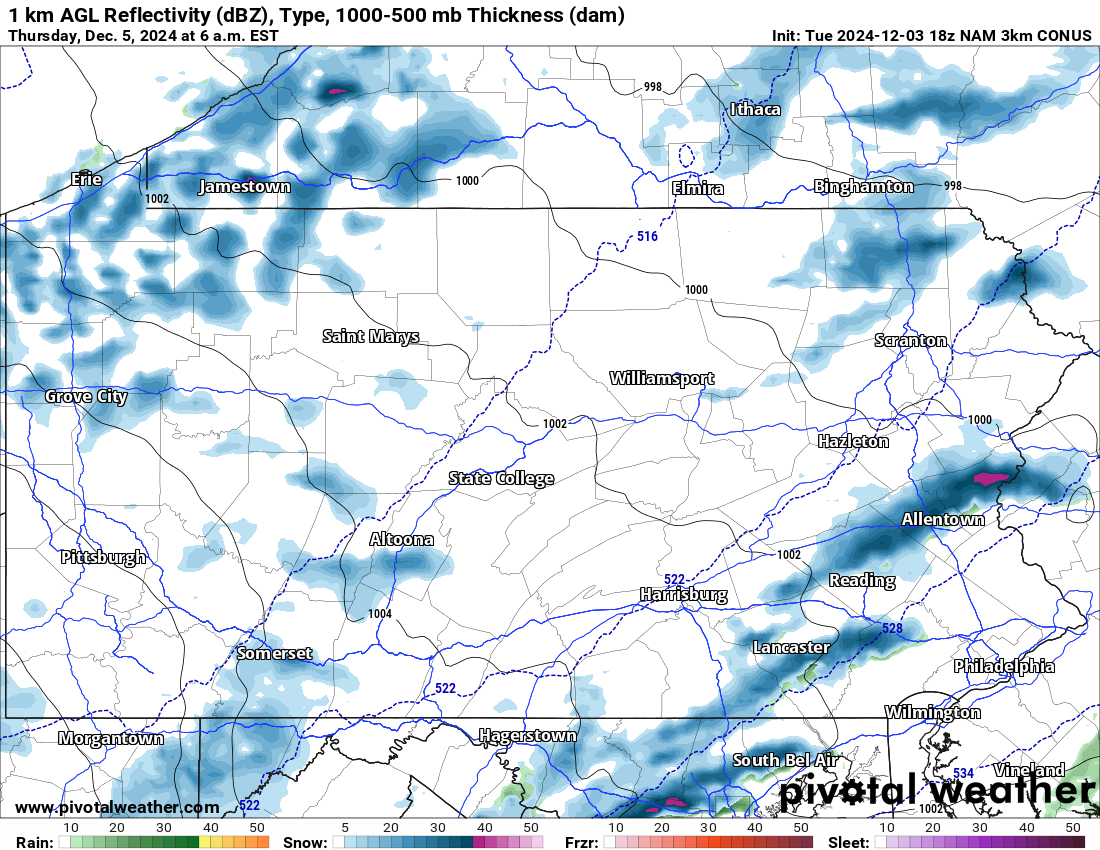
We are concerned about the potential of snow squalls pushing across much of the state Thursday morning. This includes Southern PA as well. The Thursday morning commute may be significantly impacted by these squalls.
We will have more info on precise timing in Wednesday afternoon’s update. Below is future radar for 6:00 AM Thursday showing those squalls.
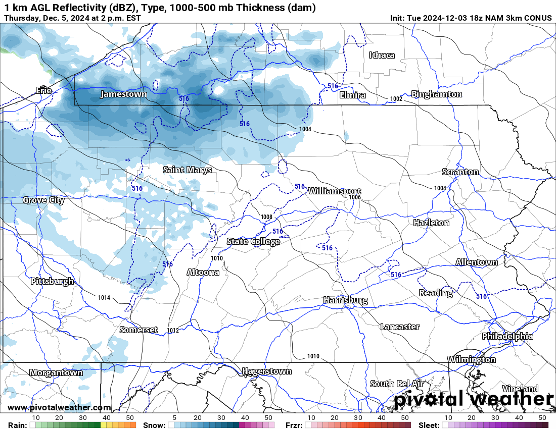
As we head into Thursday PM and even all the way into Friday morning, lake effect snow squalls are expected in Northwest PA. And this round will not be so focused on Erie, but rather across a wider area from the Ohio border to Wellsboro. Here is future radar for 2:00 PM Thursday.
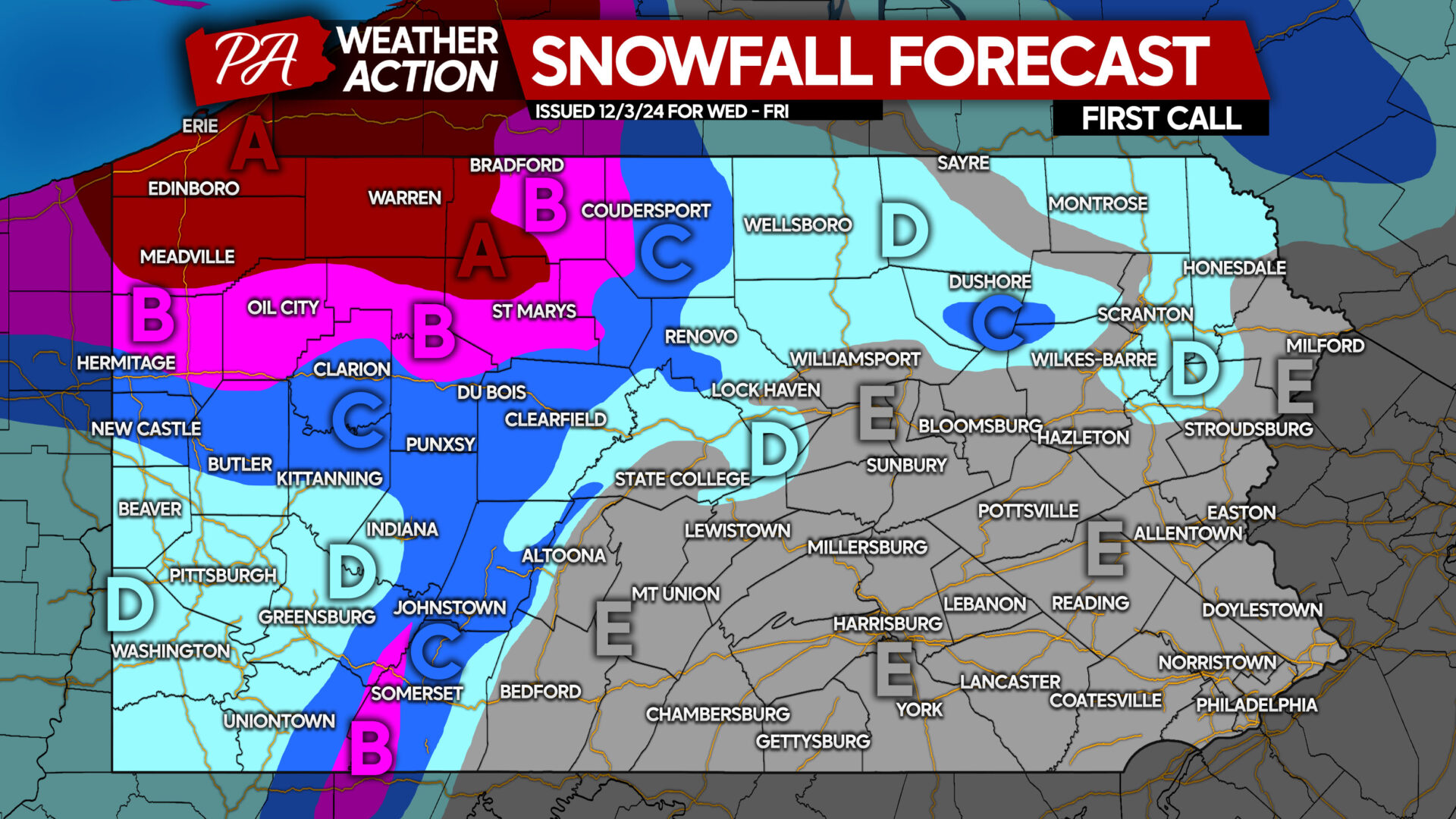
FIRST CALL SNOWFALL FORECAST FOR WEDNESDAY – FRIDAY
Area A: Snowfall accumulation of 8 – 14″ expected. Significant impacts to road conditions will occur during periods of snow squalls. Reduce speeds gradually during the onset of heavy snow, and avoid traveling on interstates during squalls.
Area B: Snowfall accumulation of 5 – 8″ anticipated. Travel conditions will be greatly deteriorated during times of heavy snow.
Area C: Snowfall accumulation of 3 – 5″ expected. Snow will stick to all untreated surfaces due to cold conditions, so leave extra time for driving while roads are slick.
Area D: Snowfall accumulation of 1 – 3″ anticipated. Untreated surfaces will become slick during times of snowfall.
Area E: Snowfall accumulation of less than 1″ possible. However, snow squalls are likely Thursday morning and will cause dangerous travel in affected areas.
Don’t forget to share this forecast with friends and family! Many people are unaware of this event.


You must be logged in to post a comment.