
It has become all too common in the 2020s to have the ingredients for a major snowstorm on the table but miss our opportunity. That will more than likely be the case once again this weekend, with the storm heading out to sea and weaker.
In addition, weather model performance has been abysmal lately with less data points being available for models to use. This is precisely why less than three days out, the American model continues to drop feet of snow on us while other models aren’t remotely close. We would rather disregard the American model (GFS) until we get burned than to buy into an incorrect solution more often than not.
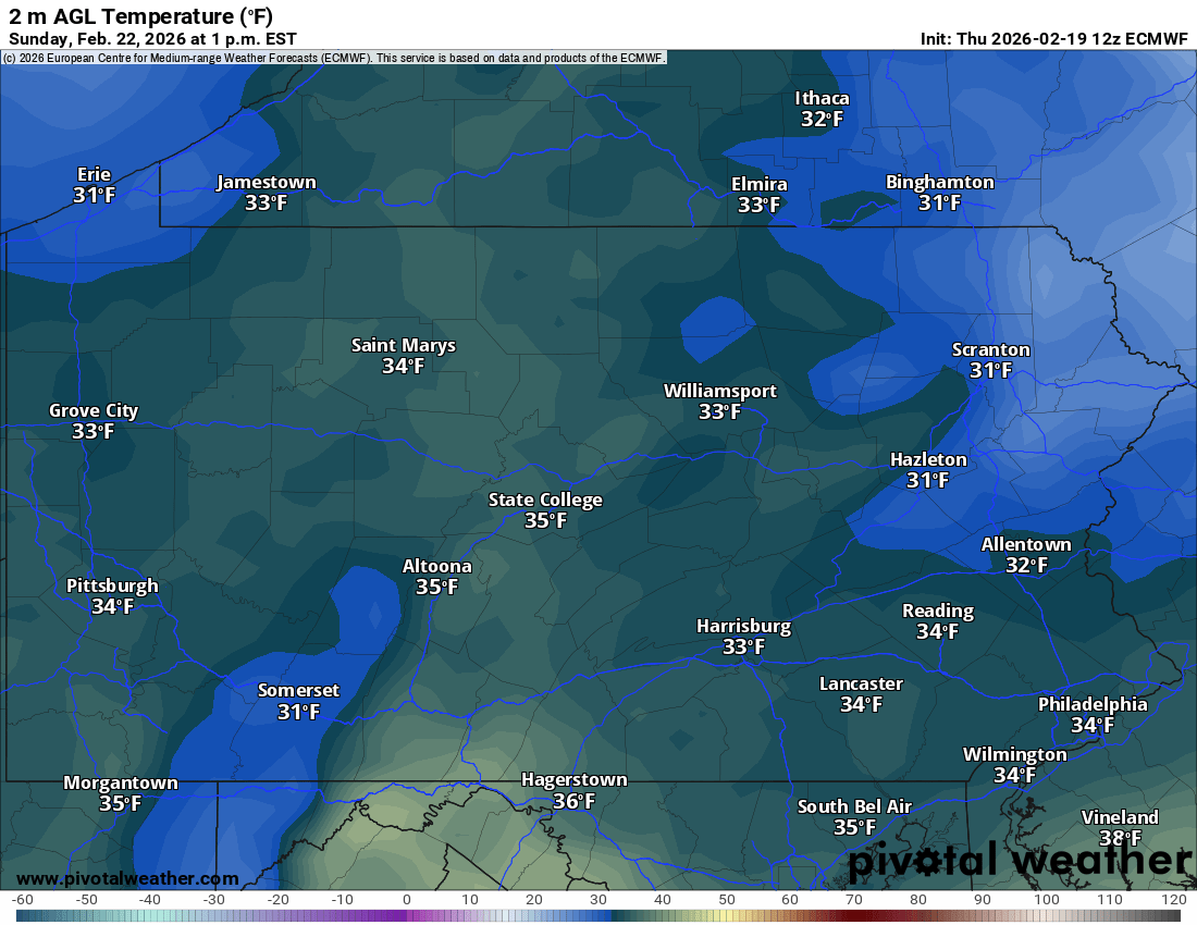
With all that said, here in Pennsylvania we’re still looking at a light to perhaps moderate snow event. The biggest things to keep in mind will be that since precipitation will be on the lighter side, very marginal temperatures and a late February sun angle now equivalent to October 20th, will make accumulation on roads difficult. With marginal temperatures and a higher sun angle, you need moderate to heavy precipitation. Below is a look at temperatures midday Sunday.
SNOW TIMING
Timing is still fuzzy given the uncertain around the evolution of this system.
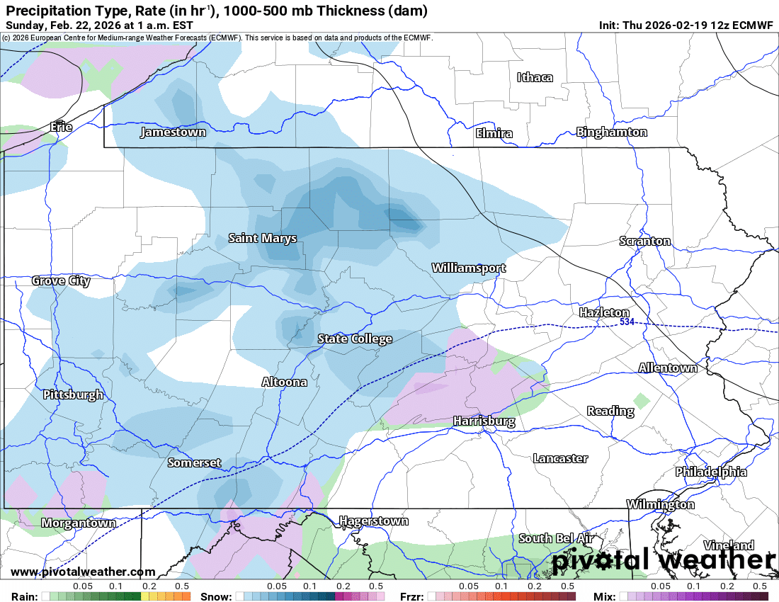
Scattered snow showers are possible early Sunday morning in the western half of the state. Below is the European model for 1:00 AM Sunday.
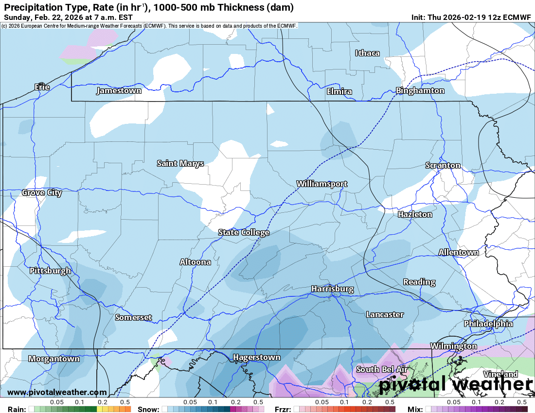
By sunrise Sunday, we could be looking at widespread light snow with some moderate snow areas in Southern PA. Roadway accumulation will still be probable until about 9-10 AM Sunday. Below is a look at 7 AM Sun.
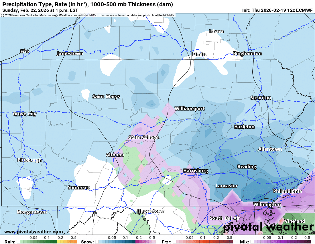
As we head through the late morning and into lunchtime, moderate snow may shift more into Eastern PA with light snow showers elsewhere. As you can see, there are spotty breaks in the precipitation as well. Here’s a look at 1 PM Sunday on the Euro.
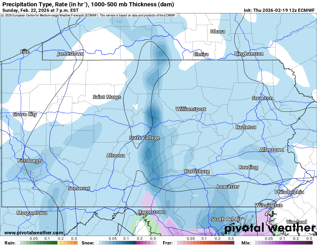
As Sunday afternoon goes on and turns to evening, models are suggesting a trend west in the moderate snow across Central PA as a norlun trough sets up over the Chesapeake Bay and into parts of Pennsylvania. This will be localized and relatively difficult to predict. The euro shows about a 20 mile wide band of heavy snow, which gives you an idea.
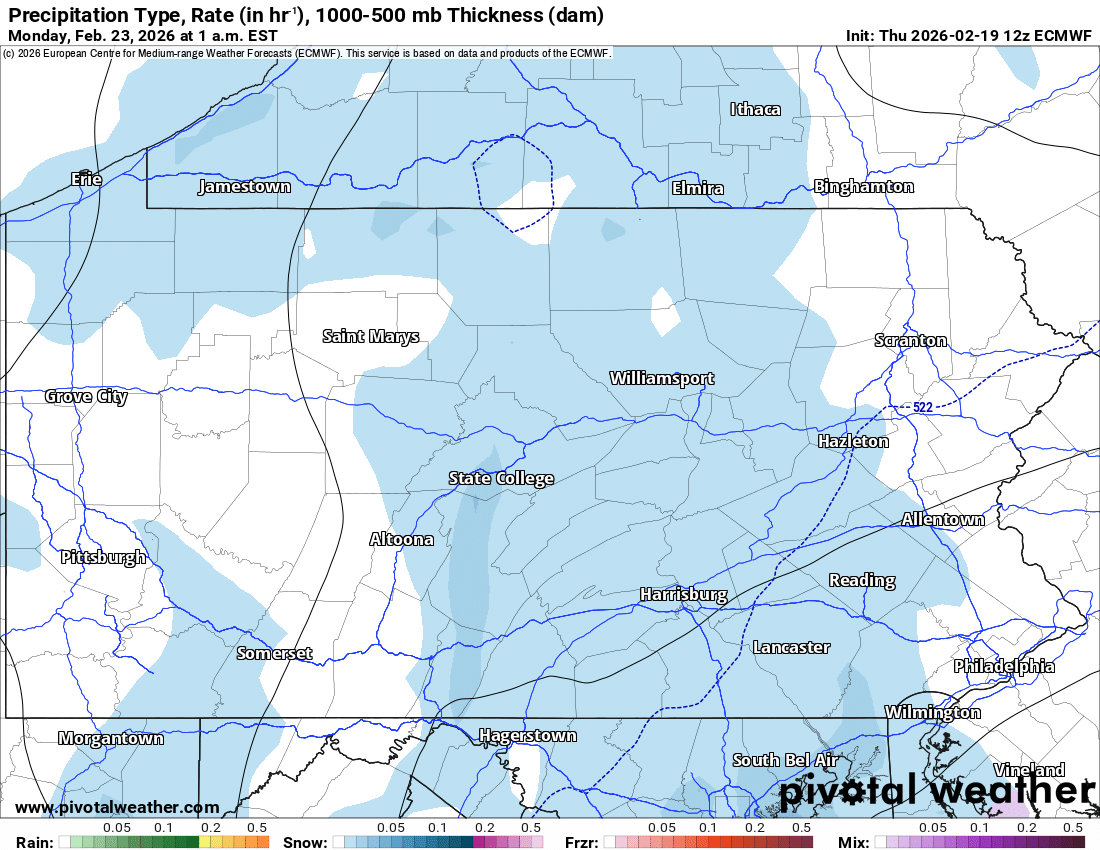
And finally by early Monday morning, snow should wind down across Central PA.
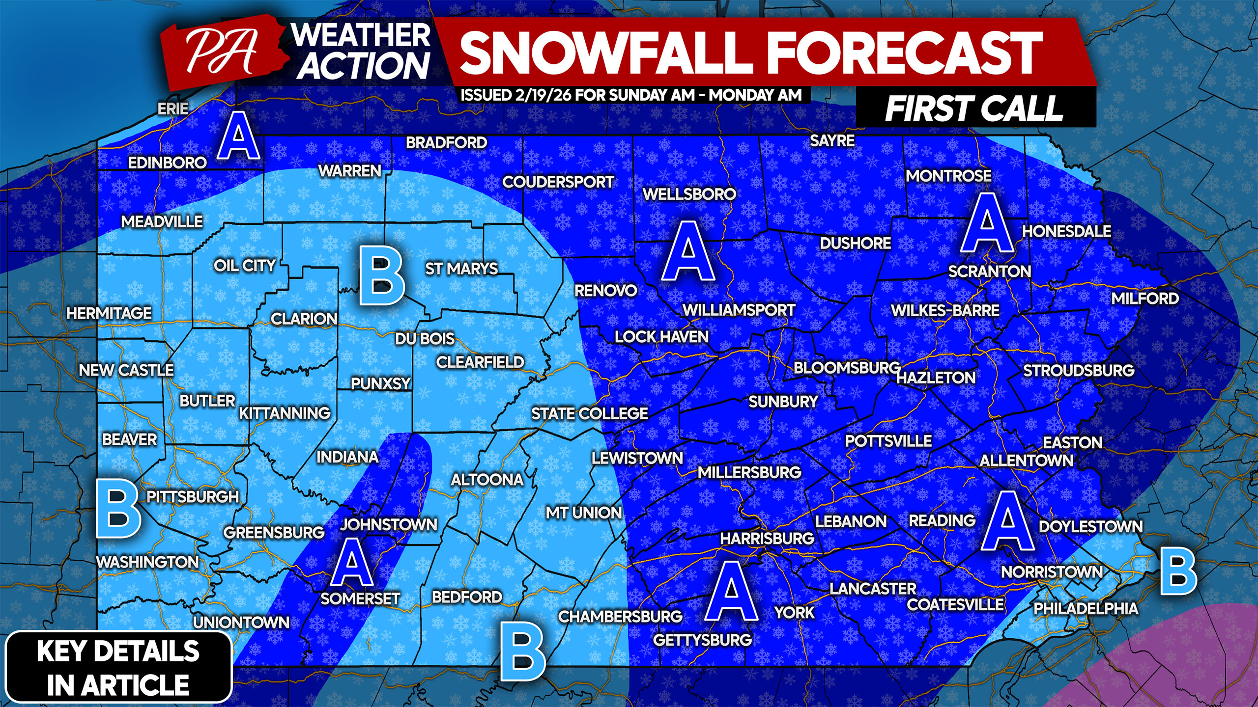
FIRST CALL SNOWFALL FORECAST FOR SUNDAY AM – MONDAY AM IN PENNSYLVANIA
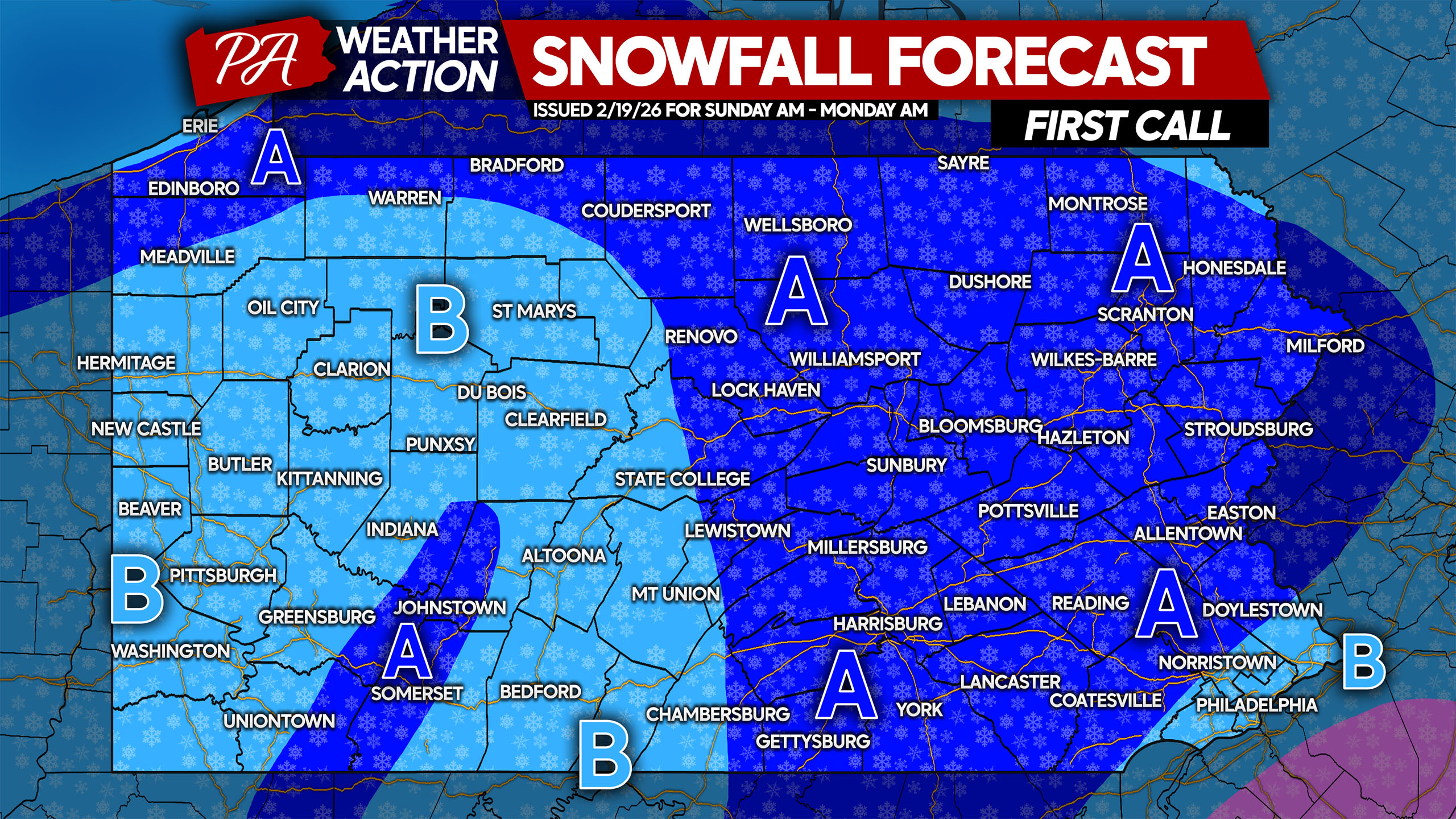
Area A: Snowfall accumulation of 2 – 5″ of wet snow, primarily on grassy and elevated surfaces. An inch or two of slush may accumulate on paved surfaces, especially during times of moderate snow.
Area B: Snowfall accumulation of 1 – 2″ of wet snow on grassy and elevated surfaces, with a coating to an inch of slush possible on paved surfaces.
It’s a tough call for those with weekend plans, but I’d expect interstates to be mainly clear. Local roads will likely be slushy especially in Area A, so take it slow!
Be sure to share this forecast with family and friends below!

You must be logged in to post a comment.