
OUR FINAL CALL FORECAST HAS BEEN POSTED:
This time of year is always shocking in that things change so quickly. From 60s and sun in October with 6:30pm sunsets to 40s and 4:45pm sunsets in November is probably the fastest transition at any point in the year. Without sports and the holidays, I think we would all be in shambles.
A cold snap will reach Pennsylvania on Monday, plunging temperatures by 20-25°. Along with that descent will come gusty winds, making Tuesday at best feel like the teens and twenties. It’s not going to be pretty, and the rest of the week while not as cold, has trended downwards as well.
A weak system will move over us on Sunday bringing light snows to our north. Some models even now suggest Western New York will get in on that snow. Our snow here in PA will come on the backside primarily as lake effect.
FUTURE RADAR TIMING
This will be a long-duration, on and off event, with most hours being off. Areas closest to Lake Erie will see the most consistent lake effect snow banding as usual, with it becoming more dispersed farther away. Starting late Sunday evening or very early Monday morning, snow is expected in Northwest PA.
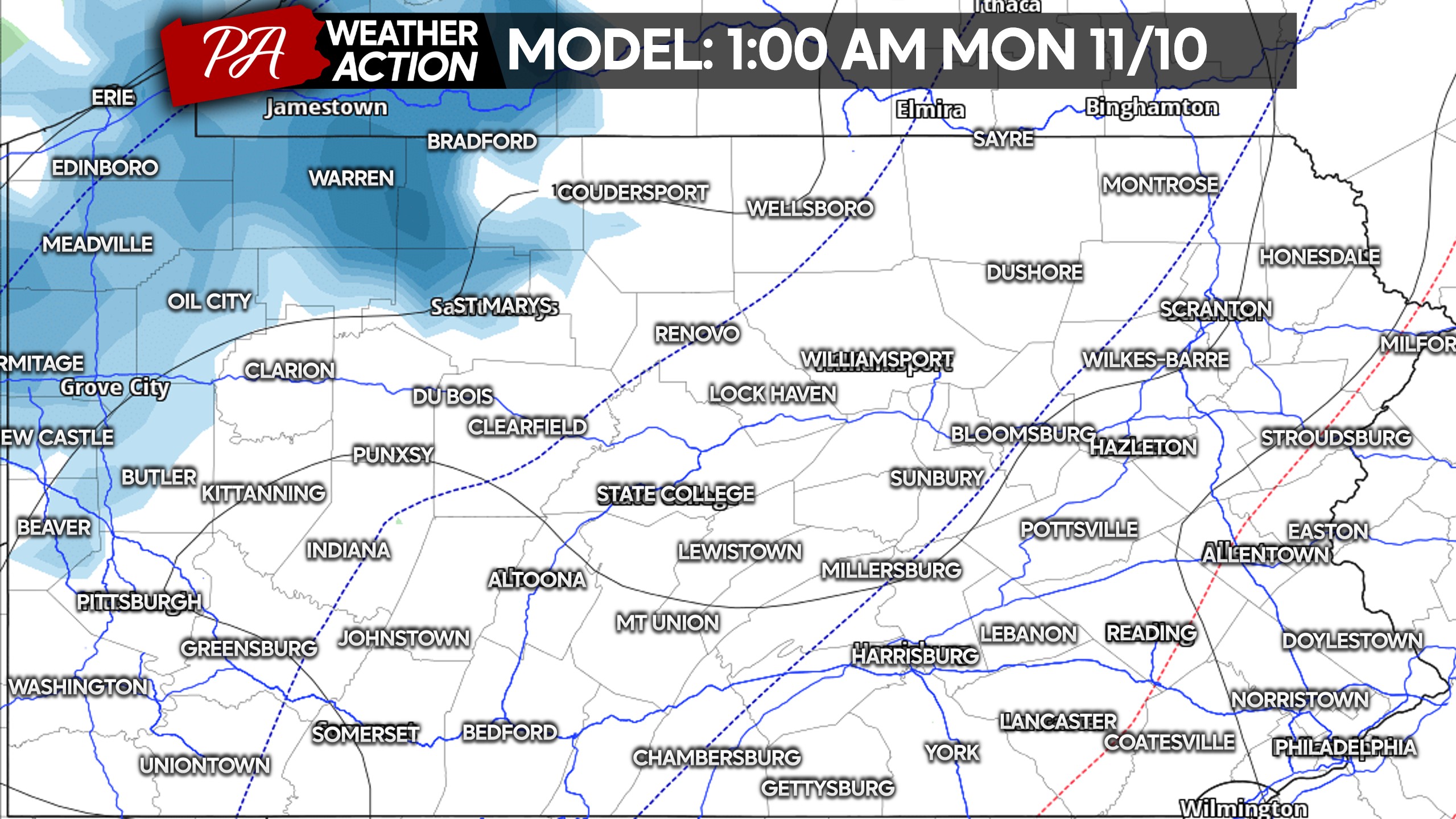
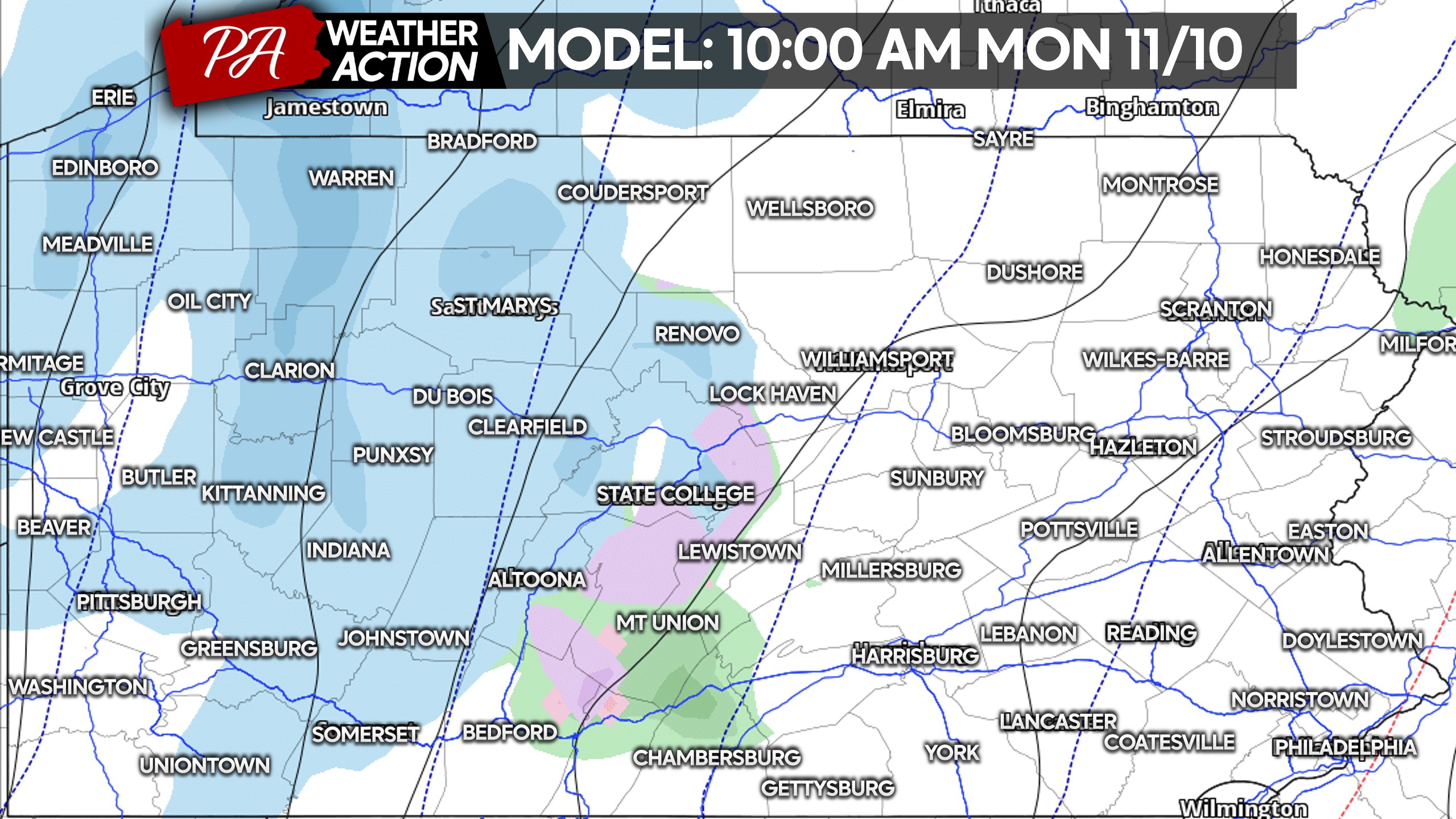
Scattered snow showers will continue through the morning Monday, but none of this should cause slippery travel except in Northwest PA. Below is future radar for 10:00 AM Monday.
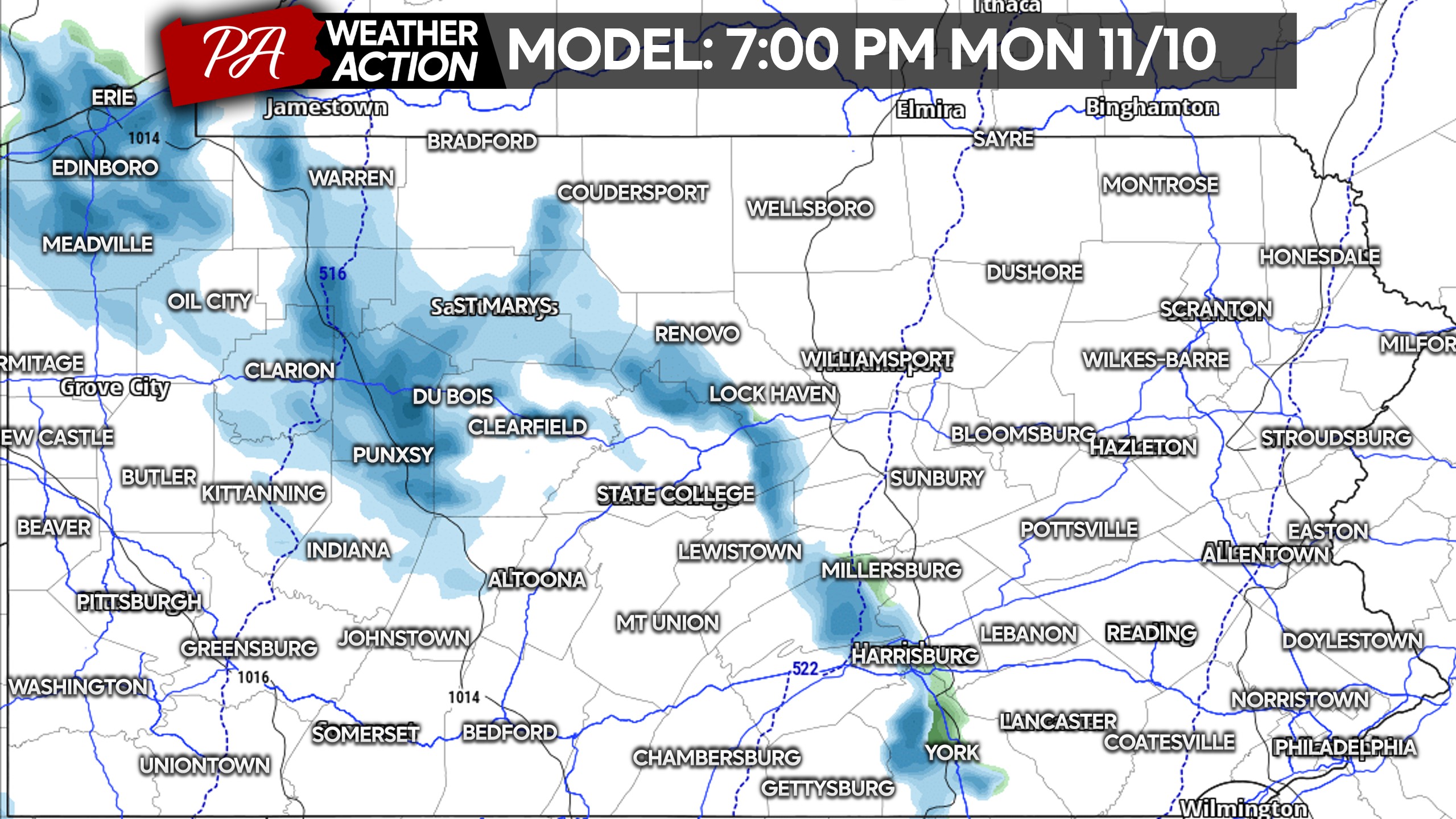
Monday afternoon should bring a lull in the action before lake effect begins to ramp up around dinnertime. The NAM model is bringing a strong snow band through Northwest PA, reaching all the way into the Susquehanna Valley by 7:00 PM Monday.
These fine details like banding placement are harder to nail down, with places east of the mountains less likely to see much.
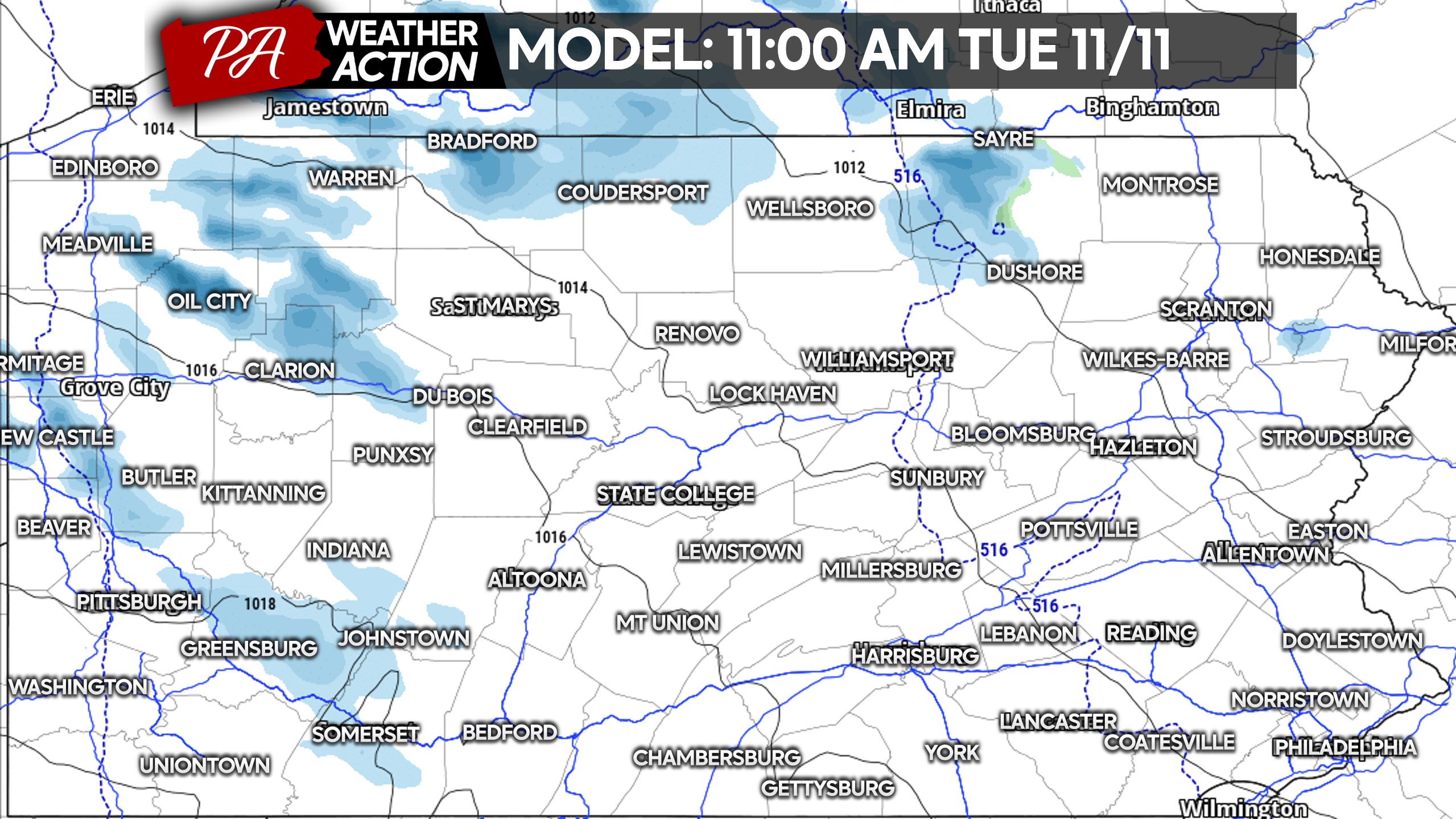
Lake effect snow showers will persist into Tuesday morning before slowly wrapping up Tuesday afternoon. Intermittent snow showers are possible in Western and Northern PA during that time. Brief slippery travel is possible in heavy snow bands.
FIRST CALL SNOWFALL FORECAST FOR MON-TUE
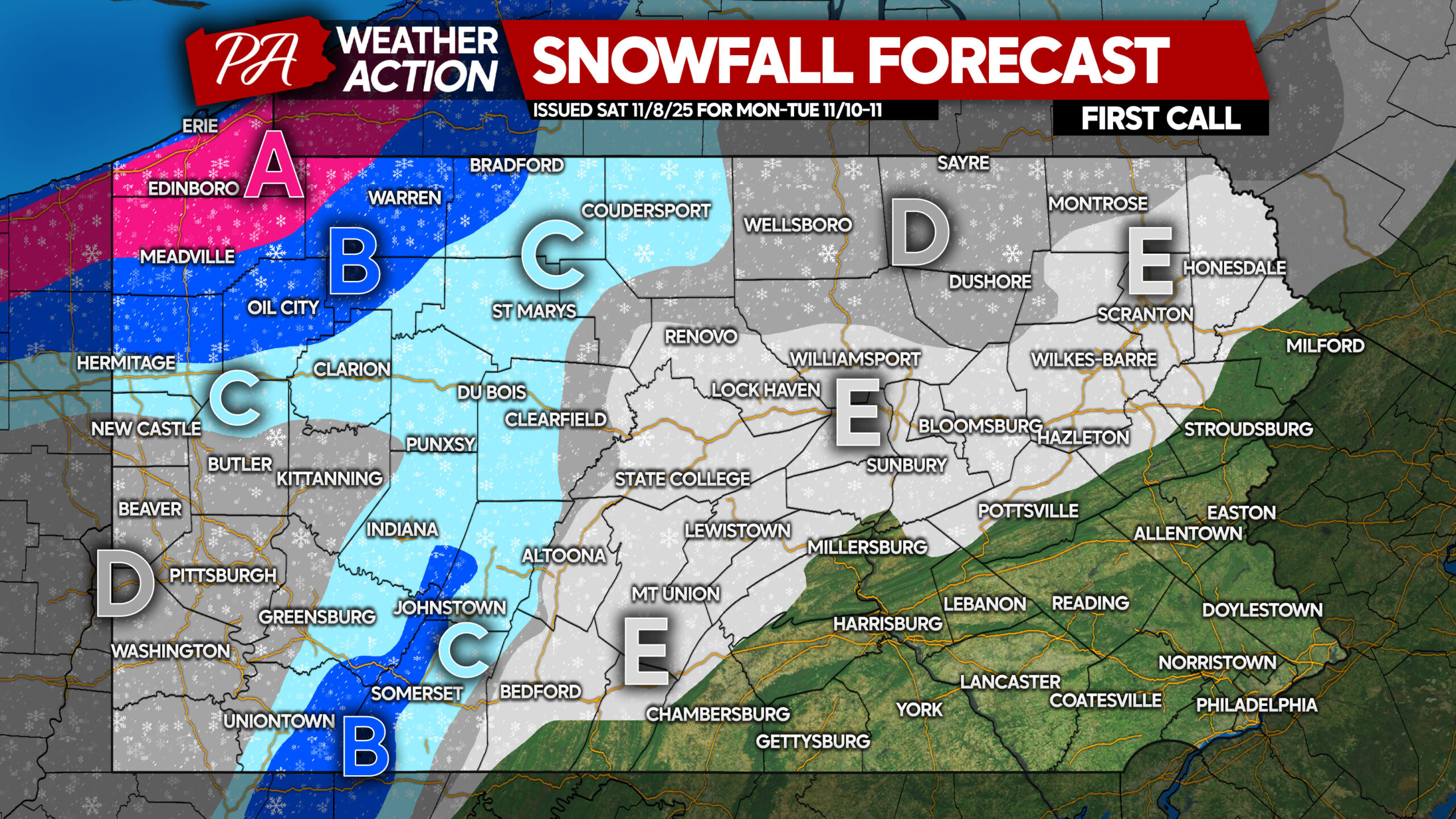
Area A: Snowfall accumulation of 5 – 8″ expected. Road conditions will be deteriorated during and shortly after times of heavy snow.
Area B: Snowfall accumulation of 2 – 5″ anticipated. Road conditions will be slippery during and just after snow squalls.
Area C: Snowfall accumulation of 1 – 2″ expected. Roads may briefly be slippery as snow falls, especially Monday night and Tuesday.
Area D: Snowfall accumulation of less than 1″ anticipated. Very isolated slippery road conditions possible if a heavier snow band moves through.
Area E: First snowflakes of the season are likely, but no accumulation is expected!
Be sure to share this important info with friends and family!
You must be logged in to post a comment.